
close
3D
Trail Conditions
- Unknown
- Snow Groomed
- Snow Packed
- Snow Covered
- Snow Cover Partial
- Freeze/thaw Cycle
- Icy
- Prevalent Mud
- Wet
- Variable
- Ideal
- Dry
- Very Dry
Trail Flow (Ridden Direction)
Trailforks scans users activity logs to determine the most popular direction each trail is ridden. A good flowing trail network will have most trails flowing in a single direction according to their intension.
The colour categories are based on what percentage of users are riding a trail in its intended direction.
The colour categories are based on what percentage of users are riding a trail in its intended direction.
- > 96%
- > 90%
- > 80%
- > 70%
- > 50%
- < 50%
- bi-directional trail
- no data
Trail Last Used
Trailforks scans activity logs to determine the last time a trail was ridden.
- < 2 days
- < 1 week
- < 2 weeks
- < 1 month
- < 6 months
- > 6 months
Trail Ridden Direction
The intended direction a trail should be ridden.
- Downhill Only
- Downhill Primary
- Both Directions
- Uphill Primary
- Uphill Only
- One Direction
Contribute Details
Colors indicate trail is missing specified detail.
- Description
- Photos
- Description & Photos
- Videos
Trail Popularity ?
Trailforks scans activity logs to determine which trails are ridden the most in the last 9 months.
Trails are compared with nearby trails in the same city region with a possible 25 colour shades.
Think of this as a heatmap, more activities = more kinetic energy = warmer colors.
- most popular
- popular
- less popular
- not popular
ATV/ORV/OHV Filter
Max Vehicle Width
inches
US Cell Coverage
Legend

Radar Time
Activity Recordings
Trailforks uses anonymized public activity data.
?
Activity Recordings
Trailforks uses anonymized public activity data.
?
Winter Trails
Warning
A routing network for winter maps does not exist. Selecting trails using the winter trails layer has been disabled.
Missing Trails
Most Popular
Least Popular
Trails are colored based on popularity. The more popular a trail is, the more red. Less popular trails trend towards green.
Jump Magnitude Heatmap
Heatmap of where users jump on trails. Zoom in to see individual jumps, click circles to view jump details.
BC Backroad Status
![map legend]()
Service Road Atlas is a free to use, community-driven service for viewing and creating reports on the numerous back-country service roads around B.C. and Alberta.

Slope Aspect
Direction the slope faces
Trails Deemphasized
Trails are shown in grey.
Only show trails with no bike usage.
Suggested Layers
Based on selected activity type
Save the current map location and zoom level as your default home location whenever this page is loaded.
SaveOsiglia trails and routes are listed on Trailforks with interactive trail maps, difficulty ratings, photos, and user-reported trail conditions. Supported activity types include Mountain Biking, E-Biking, Hiking, Trail Running, Adaptive Biking and Winter Fat Biking. Scenery includes creeks. Common trail features include jumps and bridges.
This is an auto-generated description of Osiglia.
Login or register to submit a custom description.
This region uses the Uk/Euro style trail grading system.
Trail info last updated
Activities Click to view
- Mountain Bike
12 trails
- E-Bike
12 trails
- Adaptive Bike
5 trails
- Winter Fat Bike
2 trails
- Hike
6 trails
- Trail Running
6 trails
Region Details
- 5
- 1
- 6
Region Status
Open as of Oct 31, 2026Stats
- Avg Trail Rating
- Trails (view details)
- 12
- Trails Mountain Bike
- 12
- Trails E-Bike
- 12
- Trails Gravel Bike
- 5
- Trails Adaptive Bike
- 5
- Trails Winter Fat Bike
- 2
- Trails Hike
- 6
- Trails Trail Running
- 6
- Total Distance
- 14 miles
- Total Descent Distance
- 8 miles
- Total Descent
- 4,556 ft
- Total Vertical
- 1,527 ft
- Highest Trailhead
- 3,360 ft
- Reports
- 426
- Photos
- 39
- Completed Counter
- 6,712
Popular Osiglia Mountain Biking Trails
• 100 ★ 4.2 • 2,310 ft • 0 ft • 1,149 •
Sentiero che permette di proseguire una volta terminato il Baltera DH verso il paese di Osiglia. Al momento il sentiero termina a pochi metri dalla strada provinciale.
• 85 ★ 4.7 • 1 mile • 0 ft • 972 •
Highly rated popular blue difficulty singletrack. This mountain bike primary trail and has a moderate overall physical rating. It features roller coaster. On average it takes 9 minutes to complete this trail.
• 95 ★ 3.7 • 2,612 ft • 33 ft • 549 •
Popular blue difficulty singletrack. This mountain bike primary trail and has a moderate overall physical rating. On average it takes 6 minutes to complete this trail.
• 70 ★ 4.7 • 1 mile • 6 ft • 489 •
facile e veloce...alcuni salti tutti copiabili o evitabili...impegnativo fisicamente per i molti rilanci da fare...molto divertente tutto su terra
• 35 ★ 5.0 • 1 mile • 0 ft • 474 •
Trail Flow molto ben realizzato tutto su terra tanti salti tutti evitabili, tantissime curve e compressioni. Trail Flow very well done many jumps all avoidable, many curves and compressions.
• 20 ★ 3.0 • 3 miles • 115 ft • 28 •
questo sentiero antico è stato risistemato lo scorso anno dal Gal , permette dall' alta via dei monti liguri di scendere a Bormida lungo il rio pisciarella , e può essere il seguito del trail colonnello Din il primo tratto passa...
Photos of Osiglia Mountain Bike
Videos of Osiglia Mountain Bike


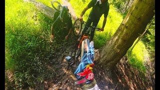
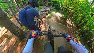
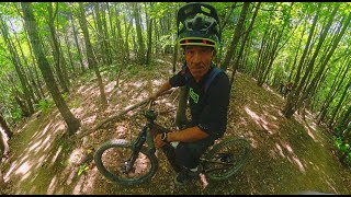


Recent Trail Reports
| status | trail | date | condition | info | user |
|---|---|---|---|---|---|
| Risalita Baltera DH | Oct 31, 2026 @ 2:42pm (Europe/Rome) Oct 31, 2026 | Unknown | RenReich | ||
| River | Oct 29, 2026 @ 9:37am (Europe/Monaco) Oct 29, 2026 | Ideal | majatravels | ||
| Accesso per Osiglia dh | Oct 29, 2026 @ 9:37am (Europe/Monaco) Oct 29, 2026 | Ideal | majatravels | ||
| simona | Oct 19, 2026 @ 2:09pm (Europe/Rome) Oct 19, 2026 | Ideal | Arzi71 | ||
| North Shore | Oct 17, 2026 @ 8:20am (Europe/Monaco) Oct 16, 2026 | Ideal | abrondi | ||
| Grollon 3pt | Oct 17, 2026 @ 8:20am (Europe/Monaco) Oct 16, 2026 | Ideal | abrondi | ||
| Grollon | Oct 17, 2026 @ 8:20am (Europe/Monaco) Oct 16, 2026 | Ideal | abrondi | ||
| Baltera DH | Oct 17, 2026 @ 8:20am (Europe/Monaco) Oct 16, 2026 | Variable | abrondi | ||
| accesso alla baltera dh | Oct 17, 2026 @ 8:20am (Europe/Monaco) Oct 16, 2026 | Ideal | abrondi | ||
| risalita baltera | Oct 17, 2026 @ 8:20am (Europe/Monaco) Oct 16, 2026 | Variable | abrondi |
Activity Feed
| username | action | type | title | date |
|---|---|---|---|---|
| aurelsodouda | ridden | trail | activity #107927140 and 1 more | Nov 17, 2026 @ 2:04am 1 day |
| Renekon01M | ridden | trail | activity #107772687 and 1 more | Nov 14, 2026 @ 9:48am Nov 14, 2026 |
| SlickeKQHna | wishlist | trail | activity #107200146 | Nov 4, 2026 @ 1:10pm Nov 4, 2026 |
| RenReich | add | report | activity #106920517 | Oct 31, 2026 @ 6:42am Oct 31, 2026 |
| majatravels | add | report | activity #106815415 and 1 more | Oct 29, 2026 @ 10:48am Oct 29, 2026 |
Recent Comments
| username | type | title | comment | date |
|---|---|---|---|---|
| trail | Unrideable trail, lots of rocks and trees on... | Jul 31, 2026 @ 12:20pm Jul 31, 2026 | ||
| trail | Einfacher Trail mit Kids ab 6 Jahren gut farbar. | Apr 19, 2026 @ 10:06pm Apr 19, 2026 | ||
| trail | Einziger Family Trail der Spass... | Apr 19, 2026 @ 10:03pm Apr 19, 2026 | ||
| trail | Ciao, vedi questa traccia su... | Sep 14, 2025 @ 11:42am Sep 14, 2025 | ||
| report | Come già segnalato percorrere di seguito... | Jun 24, 2025 @ 1:59pm Jun 24, 2025 |
Local Badges
-

Epic Mountain Bike Climb 2k3 awarded -

Climbing 10k Badge0 awarded -

Mountain Biking 100k Badge0 awarded -

Epic Ride Descent 2k3 awarded -

Descent 10k Badge0 awarded -

Descent 100k Badge0 awarded
Activity Type Stats
| activitytype | trails | distance | descent | descent distance | total vertical | rating | global rank | state rank | photos | reports | routes | activity logs |
|---|---|---|---|---|---|---|---|---|---|---|---|---|
| Mountain Bike | 12 | 14 miles | 4,557 ft | 8 miles | 1,529 ft | #4,297 | #272 | 28 | 426 | 1,100 | ||
| E-Bike | 12 | 14 miles | 4,557 ft | 8 miles | 1,529 ft | #2,637 | #271 | 11 | 418 | 542 | ||
| Gravel Bike | 4 | 6 miles | 371 ft | 1 mile | 1,447 ft | #3,694 | #242 | 2 | 10 | |||
| Adaptive Bike | 5 | 5 miles | 335 ft | 4,925 ft | 1,204 ft | #4,464 | #342 | 133 | ||||
| Winter Fat Bike | 2 | 2 miles | 148 ft | 2,638 ft | 397 ft | #3,008 | #279 | 49 | ||||
| Hike | 6 | 8 miles | 3,219 ft | 5 miles | 1,398 ft | #10,338 | #709 | 372 | 23 | |||
| Trail Running | 6 | 6 miles | 1,056 ft | 2 miles | 1,158 ft | #10,623 | #780 | 357 | 8 |
Frequently Asked Questions
▼
What are the highest rated mountain biking trails in Osiglia?
The highest rated mountain biking trails in Osiglia are:
- North Shore (4.6/5)
- River (4.5/5)
- simona (4.4/5)
- Grollon (4.1/5)
- Baltera DH (3.8/5)
▼
Where can I park to ride in Osiglia?
Check the Osiglia trail map for trailhead and parking information. Community members regularly update access and parking details for trails in the area.
▼
What is the longest trail in Osiglia?
The longest trail in Osiglia is pisciarella at 2.7 miles. View all trails sorted by distance.
▼
How many trails are in Osiglia?
Osiglia has a total of 12 trails. Browse top mountain biking trails in Osiglia to find detailed information including difficulty ratings, distances, and trail conditions.
▼
Which trail has the most elevation gain in Osiglia?
The trail with the most elevation gain in Osiglia is pisciarella with 115 ft of elevation gain. View all trails sorted by elevation gain.
▼
Which trail has the most elevation descent in Osiglia?
The trail with the most elevation descent in Osiglia is pisciarella with 1,503 ft of elevation descent. View all trails sorted by elevation descent.
▼
What activities are most popular in Osiglia?
Osiglia supports the following activities: Mountain Biking, E-Biking, Adaptive Biking, Winter Fat Biking, Hiking, Trail Running.
▼
What trails have the biggest jumps in Osiglia?
The trails with the biggest jumps in Osiglia are: Browse all mountain bike trails to find trails with jumps and technical features.
▼
Are the trails open in Osiglia?
The overall region status for Osiglia is Clear / Green. Out of 12 trails:
- Clear / Green: 11
- Significant Issue / Amber: 1
▼
Can I ride an ebike in Osiglia?
Yes, Osiglia supports e-bike riding. There are 12 trails in Osiglia that allow e-bikes. Check the e-bike trails listing for specific trail access details and any local regulations.
▼
What is the highest summit in Osiglia?
The highest summit in Osiglia is Rocca Colma at 4,409 ft elevation.
▼
What are the most popular Strava Segments in Osiglia?
The most popular Strava segments in Osiglia are:
- BKD - River seconda parte (1,941 athletes)
- River 2021 Muscolare (1,929 athletes)
- River end (1,850 athletes)
▼
Are there accessible or adaptive trails in Osiglia?
Yes, there are 5 accessible/adaptive trails in Osiglia. View all adaptive trails in Osiglia for specific accessibility information.
▼
What are the most popular mountain biking trails in Osiglia?
The most popular mountain biking trails in Osiglia are: View all mountain biking trails sorted by popularity.
▼
What are the best beginner ride trails in Osiglia?
The best beginner mountain biking trails in Osiglia are:
- simona (4.7/5)
Activities
Trails
Points of Interest
- By Torettoride & contributors
- Admins: denitopia, denitopia
- #38391 - 5,046 views
- osiglia activity log | embed map of Osiglia mountain bike trails |
Downloading of trail gps tracks in kml & gpx formats is enabled for Osiglia.
You must login to download files.
