close
-
Layers w
- Weather Layers
- Pro
- Pro
- Pro
- Pro
- Pro
- Pro
- More Layers
- Pro
- Pro
- Pro
- Pro
-
Upgrade to

3D
Trail Conditions
- Unknown
- Snow Groomed
- Snow Packed
- Snow Covered
- Snow Cover Partial
- Freeze/thaw Cycle
- Icy
- Prevalent Mud
- Wet
- Variable
- Ideal
- Dry
- Very Dry
Trail Flow (Ridden Direction)
Trailforks scans users ridelogs to determine the most popular direction each trail is ridden. A good flowing trail network will have most trails flowing in a single direction according to their intension.
The colour categories are based on what percentage of riders are riding a trail in its intended direction.
The colour categories are based on what percentage of riders are riding a trail in its intended direction.
- > 96%
- > 90%
- > 80%
- > 70%
- > 50%
- < 50%
- bi-directional trail
- no data
Trail Last Ridden
Trailforks scans ridelogs to determine the last time a trail was ridden.
- < 2 days
- < 1 week
- < 2 weeks
- < 1 month
- < 6 months
- > 6 months
Trail Ridden Direction
The intended direction a trail should be ridden.
- Downhill Only
- Downhill Primary
- Both Directions
- Uphill Primary
- Uphill Only
- One Direction
Contribute Details
Colors indicate trail is missing specified detail.
- Description
- Photos
- Description & Photos
- Videos
Trail Popularity ?
Trailforks scans ridelogs to determine which trails are ridden the most in the last 9 months.
Trails are compared with nearby trails in the same city region with a possible 25 colour shades.
Think of this as a heatmap, more rides = more kinetic energy = warmer colors.
- most popular
- popular
- less popular
- not popular
ATV/ORV/OHV Filter
Max Vehicle Width
inches
US Cell Coverage
Legend

Radar Time
Activity Recordings
Trailforks uses anonymized public activity data.
?
Activity Recordings
Trailforks uses anonymized public activity data.
?
Personal Heatmap
▶
Activity Types
all
/
none
▶
Options
2
Date range
month
–
Winter Trails
Warning
A routing network for winter maps does not exist. Selecting trails using the winter trails layer has been disabled.
Missing Trails
Most Popular
Least Popular
Trails are colored based on popularity. The more popular a trail is, the more red. Less popular trails trend towards green.
Jump Magnitude Heatmap
Heatmap of where riders jump on trails. Zoom in to see individual jumps, click circles to view jump details.
BC Backroad Status
![map legend]()
Service Road Atlas is a free to use, community-driven service for viewing and creating reports on the numerous back-country service roads around B.C. and Alberta.

Slope Aspect
Direction the slope faces
Trails Deemphasized
Trails are shown in grey.
Only show trails with no bike usage.
Suggested Layers
Based on selected activity type
Save the current map location and zoom level as your default home location whenever this page is loaded.
Save
No description for Pcim has been added yet!
Login or register to submit one.
This region uses the Uk/Euro style trail grading system.
Activities Click to view
- Mountain Bike
23 trails
- E-Bike
4 trails
- Adaptive Bike
0 trails
- Winter Fat Bike
0 trails
- Horse
0 trails
- Hike
18 trails
- Trail Running
18 trails
- Observed Trials
0 trails
- Snowshoe
0 trails
- Downhill Ski
0 trails
- Backcountry Ski
0 trails
- Nordic Ski
0 trails
Region Details
- 4
- 7
- 2
- 1
- 1
Region Status
Caution as of May 22, 2026Stats
- Avg Trail Rating
- Trails (view details)
- 15
- Trails Mountain Bike
- 23
- Trails E-Bike
- 4
- Trails Hike
- 18
- Trails Trail Running
- 18
- Total Distance
- 24 miles
- Total Descent
- 8,045 ft
- Total Vertical
- 1,910 ft
- Highest Trailhead
- 2,943 ft
- Reports
- 118
- Photos
- 59
- Ridden Counter
- 703
Popular Pcim Mountain Biking Trails
• 85 ★ 5.0 • 661 ft • 0 ft • 98 •
Trasa zaczyna się koło "Diabelskiego Kamienia" na górze Kotoń. Nieopodal żółtego szlaku, prowadzącego z Pcimia----->Zawadki.
• 60 ★ 3.5 • 5 miles • 546 ft • 85 • • hike
Moderately popular blue difficulty wilderness trail. This hike primary trail can be used both directions and has a moderate overall physical rating with a 546 ft blue climb. On average it takes 37 minutes to complete this trail.
• 80 ★ 5.0 • 3,888 ft • 0 ft • 77 •
Popular red difficulty singletrack. This mountain bike primary trail can be used downhill only. It features drop, jump, gap jump and rock face. On average it takes 5 minutes to complete this trail.
• 45 ★ 5.0 • 2,162 ft • 0 ft • 56 •
Na razie jest ścieżka, przyjemna do jazdy. Będą pojawiać się modyfikacje.
• 5 ★ 4.0 • 4 miles • 612 ft • 24 • • hike
Less popular blue difficulty wilderness trail. This hike primary trail can be used downhill primary. On average it takes 58 minutes to complete this trail.
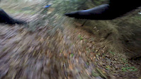
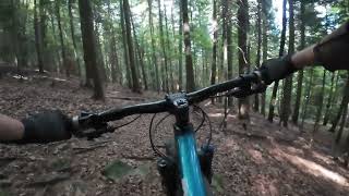
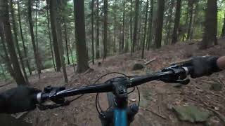
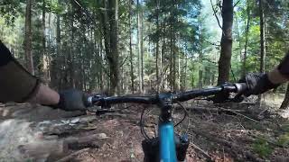
Photos of Pcim Mountain Bike
Videos of Pcim Mountain Bike
trail: Lubomir
3:36 |
311 |
Nov 20, 2016
trail: Pitok
9:05 |
25 |
Oct 27, 2025 , Pcim
trail: Majtki
9:14 |
28 |
Oct 26, 2025 , Pcim
trail: Rajtki
9:13 |
35 |
Oct 23, 2025 , Pcim
trail: Remi
6:40 |
61 |
Sep 14, 2025 , Pcim
trail: Crux
6:24 |
77 |
Sep 5, 2025 , Pcim
trail: Crux
8:13 |
85 |
Dec 9, 2024 , Pcim
trail: Crux
0:23 |
74 |
Dec 3, 2024 , Pcim
Recent Trail Reports
| status | trail | date | condition | info | user |
|---|---|---|---|---|---|
| Majtki | May 22, 2026 @ 10:13am (Europe/Warsaw) May 22, 2026 | Variable | ukaszUL4Dy0 | ||
| Trzy Kopce | Apr 17, 2026 @ 2:18pm (Europe/Budapest) Apr 17, 2026 | Ideal | maciejp | ||
| Shinkansen | Jan 6, 2026 @ 11:00am (Europe/Warsaw) Jan 6, 2026 | Snow Covered | xjaco88x | ||
| Remi | Nov 10, 2025 @ 4:10pm (Europe/Warsaw) Nov 10, 2025 | Unknown | amun AT | ||
| Crux | Sep 5, 2025 @ 11:16pm Sep 5, 2025 | Very Dry | sebasg3r | ||
| Rajtki | Aug 30, 2025 @ 9:56am Aug 30, 2025 | Ideal | majatravels | ||
| Diabełrock | Jun 15, 2025 @ 11:14am Jun 15, 2025 | Ideal | marcingabrys | ||
| Pitok | Jun 15, 2025 @ 11:14am Jun 15, 2025 | Ideal | marcingabrys | ||
| Majtki Access | May 2, 2025 @ 10:11am May 2, 2025 | Ideal | marcingabrys | ||
| Kotoński | Apr 16, 2025 @ 3:20pm Apr 16, 2025 | Variable | sebasg3r |
Activity Feed
| username | action | type | title | date |
|---|---|---|---|---|
| tomaszpadlo | wishlist | trail | activity #96253726 and 1 more | Jun 4, 2026 @ 2:54pm Jun 4, 2026 |
| ukaszUL4Dy0 | add | report | activity #95227764 | May 22, 2026 @ 1:13am May 22, 2026 |
| ukaszUL4Dy0 | add | photo | activity #95175412 | May 21, 2026 @ 7:57am May 21, 2026 |
| F4NSqr | wishlist | region | activity #95166480 | May 21, 2026 @ 4:37am May 21, 2026 |
| xaoo | add | skillpark | activity #94797829 | May 16, 2026 @ 2:59am May 16, 2026 |
Recent Comments
| username | type | title | comment | date |
|---|---|---|---|---|
| trail | trasa skończona | Sep 4, 2025 @ 11:02am Sep 4, 2025 | ||
| trail | Ta trasa i Pitok są trochę żle zaznaczone.... | Aug 30, 2025 @ 9:56am Aug 30, 2025 | ||
| trail | Ta trasa i Rajtki są trochę żle zaznaczone.... | Aug 30, 2025 @ 9:55am Aug 30, 2025 | ||
| trail | trasa mocno zmieniona i przebieg nie aktualny,... | Jan 31, 2025 @ 1:12am Jan 31, 2025 | ||
| trail | Zwykła leśna droga, ta sama, którą... | Jul 28, 2024 @ 5:02am Jul 28, 2024 |
Local Badges
-

Epic Mountain Bike Climb 2k0 awarded -

Climbing 10k Badge0 awarded -

Mountain Biking 100k Badge0 awarded -

Epic Ride Descent 2k0 awarded -

Descent 10k Badge0 awarded -

Descent 100k Badge0 awarded
Bike & Skill Parks
| name | type | city | rating |
|---|---|---|---|
| Pumptrack Stróża | skill park | Pcim |
Activity Type Stats
| activitytype | trails | distance | descent | descent distance | total vertical | rating | global rank | state rank | photos | reports | routes | ridelogs |
|---|---|---|---|---|---|---|---|---|---|---|---|---|
| Mountain Bike | 23 | 24 miles | 8,045 ft | 14 miles | 1,909 ft | #3,750 | #78 | 59 | 118 | 449 | ||
| E-Bike | 4 | 10 miles | 1,368 ft | 3 miles | 1,312 ft | #4,682 | #357 | 89 | 158 | |||
| Hike | 18 | 24 miles | 7,838 ft | 13 miles | 1,909 ft | #5,588 | #102 | 110 | 109 | |||
| Trail Running | 18 | 24 miles | 7,838 ft | 13 miles | 1,909 ft | #5,216 | #98 | 110 | 1 |
Frequently Asked Questions About Pcim
▼
What are the highest rated mountain biking trails in Pcim?
The highest rated mountain biking trails in Pcim are:
- Majtki (4.5/5)
- Pitok (4.4/5)
- Diabełrock (4.1/5)
- Rajtki (4.1/5)
- Pękalówka Trawers (4.1/5)
▼
What is the best time of the year to ride in Pcim?
Based on ride log data, the most popular months to ride in Pcim are:
- July (15 activities)
- May (5 activities)
- April (4 activities)
▼
Where can I park to ride in Pcim?
There are 1 parking locations listed in Pcim. The most popular parking spots are:
▼
What is the longest trail in Pcim?
The longest trail in Pcim is Lubomir at 4.6 miles. View all trails sorted by distance.
- By patrykdh
 & contributors
 - Admins: apply
- #36971 - 3,404 views
- pcim activity log | embed map of Pcim mountain bike trails | pcim mountain biking points of interest
Downloading of trail gps tracks in kml & gpx formats is enabled for Pcim.
You must login to download files.