close
-
Layers w
- Weather Layers
- Pro
- Pro
- Pro
- Pro
- Pro
- Pro
- More Layers
- Pro
- Pro
- Pro
- Pro
-
Upgrade to

3D
Trail Conditions
- Unknown
- Snow Groomed
- Snow Packed
- Snow Covered
- Snow Cover Partial
- Freeze/thaw Cycle
- Icy
- Prevalent Mud
- Wet
- Variable
- Ideal
- Dry
- Very Dry
Trail Flow (Ridden Direction)
Trailforks scans users ridelogs to determine the most popular direction each trail is ridden. A good flowing trail network will have most trails flowing in a single direction according to their intension.
The colour categories are based on what percentage of riders are riding a trail in its intended direction.
The colour categories are based on what percentage of riders are riding a trail in its intended direction.
- > 96%
- > 90%
- > 80%
- > 70%
- > 50%
- < 50%
- bi-directional trail
- no data
Trail Last Ridden
Trailforks scans ridelogs to determine the last time a trail was ridden.
- < 2 days
- < 1 week
- < 2 weeks
- < 1 month
- < 6 months
- > 6 months
Trail Ridden Direction
The intended direction a trail should be ridden.
- Downhill Only
- Downhill Primary
- Both Directions
- Uphill Primary
- Uphill Only
- One Direction
Contribute Details
Colors indicate trail is missing specified detail.
- Description
- Photos
- Description & Photos
- Videos
Trail Popularity ?
Trailforks scans ridelogs to determine which trails are ridden the most in the last 9 months.
Trails are compared with nearby trails in the same city region with a possible 25 colour shades.
Think of this as a heatmap, more rides = more kinetic energy = warmer colors.
- most popular
- popular
- less popular
- not popular
ATV/ORV/OHV Filter
Max Vehicle Width
inches
US Cell Coverage
Legend

Radar Time
Activity Recordings
Trailforks uses anonymized public activity data.
?
Activity Recordings
Trailforks uses anonymized public activity data.
?
Personal Heatmap
▶
Activity Types
all
/
none
▶
Options
2
Date range
month
–
Winter Trails
Warning
A routing network for winter maps does not exist. Selecting trails using the winter trails layer has been disabled.
Missing Trails
Most Popular
Least Popular
Trails are colored based on popularity. The more popular a trail is, the more red. Less popular trails trend towards green.
Jump Magnitude Heatmap
Heatmap of where riders jump on trails. Zoom in to see individual jumps, click circles to view jump details.
BC Backroad Status
![map legend]()
Service Road Atlas is a free to use, community-driven service for viewing and creating reports on the numerous back-country service roads around B.C. and Alberta.

Slope Aspect
Direction the slope faces
Trails Deemphasized
Trails are shown in grey.
Only show trails with no bike usage.
Suggested Layers
Based on selected activity type
Save the current map location and zoom level as your default home location whenever this page is loaded.
Save
No description for Poreč has been added yet!
Login or register to submit one.
This region uses the Uk/Euro style trail grading system.
Activities Click to view
- Mountain Bike
25 trails
- E-Bike
15 trails
- Gravel Bike
0 trails
- Adaptive Bike
0 trails
- Winter Fat Bike
0 trails
- Hike
15 trails
- Trail Running
15 trails
Region Details
- 3
- 1
- 10
- 6
- 1
- 1
Region Status
Open as of Apr 24, 2026Stats
- Avg Trail Rating
- Trails (view details)
- 22
- Trails Mountain Bike
- 25
- Trails E-Bike
- 15
- Trails Hike
- 15
- Trails Trail Running
- 15
- Total Distance
- 32 miles
- Total Descent
- 3,258 ft
- Total Vertical
- 881 ft
- Highest Trailhead
- 882 ft
- Reports
- 134
- Photos
- 77
- Ridden Counter
- 986
Sub Regions
-
San Servolo trails
- 4
- 4
- 1
Popular Poreč Mountain Biking Trails
• 95 ★ 5.0 • 1,332 ft • 0 ft • 91 •
made by the local club Cyclist club Poreč Few jumps and berms. Careful there is a bigger drop after a left turn, if you go straight that's chicken way :)
• 95 ★ 4.4 • 577 ft • 0 ft • 81 •
Singletrack S3 (based on Single Track Scale) with some little drops and 90° berms
• 90 ★ 4.0 • 1,142 ft • 0 ft • 80 •
, easy to follow, there is a intersection, either way is all right, they reconnect t the trail...
• 100 ★ 4.7 • 3,392 ft • 154 ft • 65 •
Singletrack S0 (based on single track scale) to climb San Servolo Trails Area. at every crossroad there is a label saying where to go to the top in order to avoid starting climb a trail used only to descend. I suggest to the builders to...
• 65 ★ 4.0 • 2 miles • 114 ft • 64 •
Singletrack S0 (based on singletrack scale) with an easy climb at the beginning and after a quiet fast and flow section
• 35 ★ 3.0 • 13 miles • 897 ft • 54 •
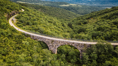
A part of one of the most known cycle path in Europe: , from the city of Trieste to the tourist location of Poreč
• 70 ★ 4.0 • 1,280 ft • 0 ft • 44 •
Natural Singletrack S2 (based on Single Track Scale) with many switchback with no berm so it requires nosepress to ride it fast. I suggest to the mainteners to add them in here in order to receive donations via Trailforks.
Poreč Mountain Bike Routes
★ 4.0 • 20 miles • 1,073 ft • 0 •
A very nice XC trail/course. Part of the course was used (until 2017) for the international MTB Parenazan...
★ 5.0 • 37 miles • 1,930 ft • 0 • Loop •
Nice and relaxing MTB/gravel bike route, starts in Poreč and takes insland to the small medieval town of...
31 miles • 1,683 ft • 0 • Loop •
Lovreč captains trail, marked with number 146. You can ride it without gps just following the sings....
15 miles • 878 ft • 0 •
This MTB tour connects parts of few different bike trails passing through Kaštelir-Labinci, into a...
31 miles • 1,683 ft • 0 • Loop •
Nice XC route connecting the town of Poreč with the interior. After the town of Sv. Lovreč (Saint...
30 miles • 1,703 ft • 0 • Loop •
Easy MTB gravel route, starts in Vižinada goes to Baderna and then comes back to Vižinada. YOu can ride...
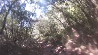
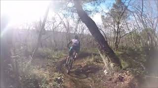
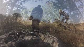
Photos of Poreč Mountain Bike
Videos of Poreč Mountain Bike

trail: Fuškulinka trail
2:39 |
15 |
Mar 8, 2026 , Poreč
trail: Kontija trail
0:40 |
307 |
Dec 1, 2020 , Poreč
trail: XC St.Bečić 1st part
3:45 |
736 |
Apr 18, 2020 , Poreč
trail: XC St.Bečić 1st part
2:57 |
729 |
Apr 18, 2020 , Poreč

trail: XC St.Bečić 1st part
2:42 |
456 |
Apr 18, 2020 , Poreč
Recent Trail Reports
| status | trail | date | condition | info | user |
|---|---|---|---|---|---|
| Gradole trail | Apr 24, 2026 @ 11:06am (Europe/Ljubljana) Apr 24, 2026 | Ideal | Marinmm | ||
| Mukla trail | Apr 24, 2026 @ 4:54pm (Europe/Zagreb) Apr 24, 2026 | Ideal | Marinmm | ||
| Shanshar trail | Dec 7, 2025 @ 2:28pm (Europe/Zagreb) Dec 7, 2025 | Ideal | NejcUQyHp7 | ||
| The Hidden Lake Trail | Mar 5, 2025 @ 7:24am Mar 5, 2025 | Ideal | micheletraversi SGREBENZONE | ||
| Spider Trail | Mar 3, 2025 @ 8:08am Mar 3, 2025 | Ideal | micheletraversi SGREBENZONE | ||
| Naturalis Trail | Mar 3, 2025 @ 8:07am Mar 3, 2025 | Ideal | micheletraversi SGREBENZONE | ||
| XC St.Bečić 1st part | Mar 2, 2025 @ 6:16am Mar 2, 2025 | Ideal | micheletraversi SGREBENZONE | ||
| XC St.Bečić 2nd part | Mar 2, 2025 @ 6:15am Mar 2, 2025 | Ideal | micheletraversi SGREBENZONE | ||
| To The Top | Mar 2, 2025 @ 6:15am Mar 2, 2025 | Ideal | micheletraversi SGREBENZONE | ||
| Montixel Trail | Mar 2, 2025 @ 6:15am Mar 2, 2025 | Ideal | micheletraversi SGREBENZONE |
National Scenic Trails & Official Routes
-
Parenzana
- Mountain Bike
- E-Bike
Activity Feed
| username | action | type | title | date |
|---|---|---|---|---|
| Patdi83 | ridden | trail | activity #94811695 and 4 more | May 16, 2026 @ 7:07am May 16, 2026 |
| SigiB7 | ridden | trail | activity #93511162 | Apr 27, 2026 @ 5:35am Apr 27, 2026 |
| Marinmm | add | report | activity #93280921 and 1 more | Apr 24, 2026 @ 7:54am Apr 24, 2026 |
| Matijabs2hJb | wishlist | trail | activity #92596812 | Apr 14, 2026 @ 7:45am Apr 14, 2026 |
| Teek-1 | ridden | trail | activity #92418028 | Apr 11, 2026 @ 12:25pm Apr 11, 2026 |
Recent Comments
| username | type | title | comment | date |
|---|---|---|---|---|
| trail | Nice technical Trail.Some steep parts but good... | Jun 23, 2025 @ 3:15am Jun 23, 2025 | ||
| trail | First part/access roads is completely... | May 29, 2025 @ 11:20pm May 29, 2025 | ||
| trail | Awesome, technical trail. Unfortunately, some... | May 29, 2025 @ 12:54pm May 29, 2025 | ||
| trail | This mapping doesn't make a lot of sense, it's... | Mar 5, 2025 @ 7:25am Mar 5, 2025 | ||
| trail | As noted in description it's not a MTB trail,... | May 16, 2024 @ 1:25pm May 16, 2024 |
Local Badges
-

Epic Mountain Bike Climb 2k76 awarded -

Climbing 10k Badge21 awarded -

Mountain Biking 100k Badge3 awarded -

Epic Ride Descent 2k76 awarded -

Descent 10k Badge21 awarded -

Descent 100k Badge3 awarded
Bike & Skill Parks
| name | type | city | rating |
|---|---|---|---|
| Poreč Pumptrack | skill park | Poreč |
Activity Type Stats
| activitytype | trails | distance | descent | descent distance | total vertical | rating | global rank | state rank | photos | reports | routes | ridelogs |
|---|---|---|---|---|---|---|---|---|---|---|---|---|
| Mountain Bike | 25 | 32 miles | 3,258 ft | 9 miles | 879 ft | #1,717 | #10 | 77 | 134 | 7 | 5,662 | |
| E-Bike | 15 | 26 miles | 853 ft | 5 miles | 879 ft | #1,245 | #7 | 105 | 5 | 862 | ||
| Hike | 15 | 26 miles | 1,686 ft | 6 miles | 879 ft | #2,078 | #16 | 97 | 3 | 87 | ||
| Trail Running | 15 | 26 miles | 1,686 ft | 6 miles | 879 ft | #1,595 | #15 | 97 | 3 | 9 |
Frequently Asked Questions About Poreč
▼
What are the best places to ride in Poreč?
Poreč has 1 areas to explore for mountain biking. The top rated areas are:
▼
What are the highest rated mountain biking trails in Poreč?
The highest rated mountain biking trails in Poreč are:
- Mukla trail (4.5/5)
- Shanshar trail (4.4/5)
- To The Top (4.2/5)
- Pissing of hunters trail (4.1/5)
- Kosti Koža (4.1/5)
▼
What is the best time of the year to ride in Poreč?
Based on ride log data, the most popular months to ride in Poreč are:
- June (9 activities)
- August (9 activities)
- October (8 activities)
▼
Where can I park to ride in Poreč?
Check the Poreč trail map for trailhead and parking information. Community members regularly update access and parking details for trails in the area.
Activities
- By VjekoslavKrsanac
 TRAILFORKS & contributors
 - Admins: VjekoslavKrsanac
- #16740 - 8,621 views
- poreč activity log | embed map of Poreč mountain bike trails | poreč mountain biking points of interest
Downloading of trail gps tracks in kml & gpx formats is enabled for Poreč.
You must login to download files.