close
-
Layers w
- Weather Layers
- Pro
- Pro
- Pro
- Pro
- Pro
- Pro
- More Layers
- Pro
- Pro
- Pro
- Pro
-
Upgrade to

3D
Trail Conditions
- Unknown
- Snow Groomed
- Snow Packed
- Snow Covered
- Snow Cover Partial
- Freeze/thaw Cycle
- Icy
- Prevalent Mud
- Wet
- Variable
- Ideal
- Dry
- Very Dry
Trail Flow (Ridden Direction)
Trailforks scans users ridelogs to determine the most popular direction each trail is ridden. A good flowing trail network will have most trails flowing in a single direction according to their intension.
The colour categories are based on what percentage of riders are riding a trail in its intended direction.
The colour categories are based on what percentage of riders are riding a trail in its intended direction.
- > 96%
- > 90%
- > 80%
- > 70%
- > 50%
- < 50%
- bi-directional trail
- no data
Trail Last Ridden
Trailforks scans ridelogs to determine the last time a trail was ridden.
- < 2 days
- < 1 week
- < 2 weeks
- < 1 month
- < 6 months
- > 6 months
Trail Ridden Direction
The intended direction a trail should be ridden.
- Downhill Only
- Downhill Primary
- Both Directions
- Uphill Primary
- Uphill Only
- One Direction
Contribute Details
Colors indicate trail is missing specified detail.
- Description
- Photos
- Description & Photos
- Videos
Trail Popularity ?
Trailforks scans ridelogs to determine which trails are ridden the most in the last 9 months.
Trails are compared with nearby trails in the same city region with a possible 25 colour shades.
Think of this as a heatmap, more rides = more kinetic energy = warmer colors.
- most popular
- popular
- less popular
- not popular
ATV/ORV/OHV Filter
Max Vehicle Width
inches
US Cell Coverage
Legend

Radar Time
Activity Recordings
Trailforks uses anonymized public activity data.
?
Activity Recordings
Trailforks uses anonymized public activity data.
?
Personal Heatmap
▶
Activity Types
all
/
none
▶
Options
2
Date range
month
–
Winter Trails
Warning
A routing network for winter maps does not exist. Selecting trails using the winter trails layer has been disabled.
Missing Trails
Most Popular
Least Popular
Trails are colored based on popularity. The more popular a trail is, the more red. Less popular trails trend towards green.
Jump Magnitude Heatmap
Heatmap of where riders jump on trails. Zoom in to see individual jumps, click circles to view jump details.
BC Backroad Status
![map legend]()
Service Road Atlas is a free to use, community-driven service for viewing and creating reports on the numerous back-country service roads around B.C. and Alberta.

Slope Aspect
Direction the slope faces
Trails Deemphasized
Trails are shown in grey.
Only show trails with no bike usage.
Suggested Layers
Based on selected activity type
Save the current map location and zoom level as your default home location whenever this page is loaded.
Save
No description for Prades has been added yet!
Login or register to submit one.
This region uses the Uk/Euro style trail grading system.
Activities Click to view
- Mountain Bike
395 trails
- E-Bike
394 trails
- Adaptive Bike
9 trails
- Horse
46 trails
- Hike
392 trails
- Trail Running
384 trails
Region Details
- 102
- 3
- 83
- 87
- 40
- 13
Region Status
Open as of Jun 8, 2026Stats
- Avg Trail Rating
- Trails (view details)
- 328
- Trails Mountain Bike
- 396
- Trails E-Bike
- 394
- Trails Gravel Bike
- 28
- Trails Adaptive Bike
- 9
- Trails Horse
- 46
- Trails Hike
- 392
- Trails Trail Running
- 384
- Trails Dirtbike/Moto
- 2
- Total Distance
- 187 miles
- Total Descent Distance
- 89 miles
- Total Descent
- 38,282 ft
- Total Vertical
- 2,434 ft
- Highest Trailhead
- 3,898 ft
- Reports
- 583
- Photos
- 186
- Ridden Counter
- 7,921
Sub Regions
-
Muntanyes de Prades
- 43
- 65
- 28
- 13
Popular Prades Mountain Biking Trails
• 100 ★ 3.0 • 997 ft • 0 ft • 127 •
Popular red difficulty singletrack. This multi-use trail can be used downhill primary and has a moderate overall physical rating with a 0 ft double black diamond climb. Trail visibility is always easy to follow. On average it takes minutes to complete this trail.
• 90 ★ 5.0 • 3,596 ft • 0 ft • 85 •
Senderó des dels plans d'en pagès a la pista forestal entre la casa forestal de i la del Tillar.
• 90 ★ 5.0 • 2,710 ft • 0 ft • 81 •
Continuació del senderó dels 3 pals, de la pista forestal de Castellfollit fins la mateixa casa forestal de Castellfollit.
• 100 ★ 4.7 • 1 mile • 47 ft • 72 •
Senderó del . Connecta el barranc del Tillar fins els plans d'en pagès ( ). Es pot fer tant de pujada com de baixada.
• 80 ★ 4.5 • 2 miles • 199 ft • 66 • • hike
Highly rated popular blue difficulty singletrack. This hike primary trail can be used both directions and has a hard overall physical rating with a 199 ft black diamond climb. Trail visibility is always easy to follow. On average it takes 29 minutes to complete this trail.
• 95 ★ 4.7 • 3,123 ft • 6 ft • 62 •
Highly rated popular red difficulty singletrack. This multi-use trail can be used downhill only. Trail visibility is always easy to follow. On average it takes 5 minutes to complete this trail.
Prades Mountain Bike Routes
16 miles • 3,393 ft • 9 • Loop •
Ruta sencilla y divertida donde conoceremos algunas de las bajadas de Arbolí.
10 miles • 2,224 ft • 12 • Loop •
Vuelta por Montañas de Prades con buenas bajadas Rojas
13 miles • 2,291 ft • 14 • Loop •
Salida unando bajadas por senderos azules y rojos en los alrededores de Prades
22 miles • 2,544 ft • 8 • Loop •
Ruta circular passant per corriols que voregen la Pobla de Cèrvoles.
27 miles • 3,434 ft • 0 •
Ruta Circular amb sortida i arribada a la Pobla de Cérvoles. -Forn de Vidre -Camí Ral -Sta Magdalena...
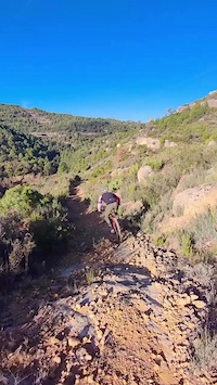
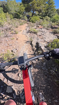
Photos of Prades Mountain Bike
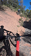
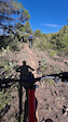
Videos of Prades Mountain Bike
trail: El Forcat - Toll dels Pops
0:52 |
4 |
Apr 23, 2026
trail: Els Esmolets
0:29 |
4 |
Apr 21, 2026
trail: Canal del Llengües
0:17 |
4 |
Apr 21, 2026
trail: Pla la Mola - Sant Joan
0:14 |
3 |
Apr 21, 2026
trail: Pla el Punton
0:18 |
4 |
Apr 17, 2026

trail: Pla el Punton
0:25 |
6 |
Apr 17, 2026

trail: La Llisera
0:50 |
14 |
Nov 3, 2025
trail: Ponç-Palau
0:03 |
13 |
Jun 14, 2024
Recent Trail Reports
| status | trail | date | condition | info | user |
|---|---|---|---|---|---|
| Cartoixans (part 2) | Jun 8, 2026 @ 6:20pm (Europe/Madrid) Jun 8, 2026 | Dry | elcuquito | ||
| La Llisera | Jun 3, 2026 @ 9:30pm (Europe/Madrid) Jun 3, 2026 | Dry | elcuquito | ||
| Pirons - Cementiri | Jun 3, 2026 @ 9:24pm (Europe/Madrid) Jun 3, 2026 | Dry | elcuquito | ||
| Torres Ulldemolins | Jun 3, 2026 @ 9:24pm (Europe/Madrid) Jun 3, 2026 | Dry | elcuquito | ||
| Conexió Torres | Jun 3, 2026 @ 9:23pm (Europe/Madrid) Jun 3, 2026 | Dry | elcuquito | ||
| Los Plans | Jun 3, 2026 @ 9:21pm (Europe/Madrid) Jun 3, 2026 | Dry | elcuquito | ||
| Bosc d'en Lluc | Jun 3, 2026 @ 9:20pm (Europe/Madrid) Jun 3, 2026 | Dry | elcuquito | ||
| La Colomina | May 31, 2026 @ 4:47pm (Europe/Madrid) May 31, 2026 | Dry | elcuquito | ||
| Albarca | May 31, 2026 @ 4:47pm (Europe/Madrid) May 31, 2026 | Dry | elcuquito | ||
| Coll d'Albarca - Pista Ulldemolins | May 31, 2026 @ 4:47pm (Europe/Madrid) May 31, 2026 | Dry | elcuquito |
Activity Feed
| username | action | type | title | date |
|---|---|---|---|---|
| elcuquito | add | report | activity #96544489 | Jun 8, 2026 @ 9:20am Jun 8, 2026 |
| elcuquito | ridden | trail | activity #96173567 and 1 more | Jun 3, 2026 @ 12:21pm Jun 3, 2026 |
| elcuquito | add | report | activity #96173539 and 5 more | Jun 3, 2026 @ 12:20pm Jun 3, 2026 |
| elcuquito | ridden | trail | activity #95939286 | May 31, 2026 @ 7:45am May 31, 2026 |
| elcuquito | add | report | activity #95939254 and 11 more | May 31, 2026 @ 7:45am May 31, 2026 |
Recent Comments
| username | type | title | comment | date |
|---|---|---|---|---|
| trail | Muy buena rápida. Al principio tiene una... | May 18, 2026 @ 4:43am May 18, 2026 | ||
| trail | Corriol que es pot dividir amb tres parts, la... | Apr 15, 2026 @ 12:56am Apr 15, 2026 | ||
| trail | Sender tècnic molt divertit amb una part... | Apr 13, 2026 @ 9:10pm Apr 13, 2026 | ||
| trail | Entrada part superior tècnica i es converteix... | Apr 10, 2026 @ 2:51am Apr 10, 2026 | ||
| trail | Rock roll del guapo. Com mola | Apr 5, 2026 @ 6:47am Apr 5, 2026 |
Local Badges
-

Completionist0 awarded
Activity Type Stats
| activitytype | trails | distance | descent | descent distance | total vertical | rating | global rank | state rank | photos | reports | routes | ridelogs |
|---|---|---|---|---|---|---|---|---|---|---|---|---|
| Mountain Bike | 395 | 187 miles | 38,284 ft | 89 miles | 2,434 ft | #836 | #93 | 184 | 584 | 6 | 2,633 | |
| E-Bike | 394 | 187 miles | 38,284 ft | 89 miles | 2,434 ft | #200 | #88 | 2 | 584 | 4 | 382 | |
| Gravel Bike | 28 | 21 | 23 | |||||||||
| Adaptive Bike | 9 | #488 | #179 | 17 | ||||||||
| Horse | 46 | 7 miles | 863 ft | 3 miles | 1,270 ft | #1,796 | #148 | 17 | ||||
| Hike | 392 | 186 miles | 38,232 ft | 88 miles | 2,434 ft | #759 | #108 | 583 | 330 | |||
| Trail Running | 384 | 186 miles | 38,232 ft | 88 miles | 2,434 ft | #536 | #102 | 583 | 243 | |||
| Dirtbike/Moto | 2 | 771 ft | 7 ft | 607 ft | 7 ft | 8 |
Frequently Asked Questions About Prades
▼
What are the best places to ride in Prades?
Prades has 1 areas to explore for mountain biking. The top rated areas are:
▼
What are the highest rated mountain biking trails in Prades?
The highest rated mountain biking trails in Prades are:
- Ramader (part 2) (4.4/5)
- Mas d'en Pagès (4.3/5)
- Fondo del Bosc (Tillar) (4.3/5)
- Coll Caldereta - Castellfollit (4.3/5)
- Jabalinera (4.3/5)
▼
What is the best time of the year to ride in Prades?
Based on ride log data, the most popular months to ride in Prades are:
- September (16 activities)
- December (16 activities)
- August (13 activities)
▼
Where can I park to ride in Prades?
There are 2 parking locations listed in Prades. The most popular parking spots are:
Activities
Trails
- By emmp & contributors
- Admins: snaker4, kai-bcn, kardi13, endumora
- #33549 - 1,882 views
- prades activity log | embed map of Prades mountain bike trails | prades mountain biking points of interest
Downloading of trail gps tracks in kml & gpx formats is enabled for Prades.
You must login to download files.