close
-
Layers w
- Weather Layers
- Pro
- Pro
- Pro
- Pro
- Pro
- Pro
- More Layers
- Pro
- Pro
- Pro
- Pro
-
Upgrade to

3D
Trail Conditions
- Unknown
- Snow Groomed
- Snow Packed
- Snow Covered
- Snow Cover Partial
- Freeze/thaw Cycle
- Icy
- Prevalent Mud
- Wet
- Variable
- Ideal
- Dry
- Very Dry
Trail Flow (Ridden Direction)
Trailforks scans users ridelogs to determine the most popular direction each trail is ridden. A good flowing trail network will have most trails flowing in a single direction according to their intension.
The colour categories are based on what percentage of riders are riding a trail in its intended direction.
The colour categories are based on what percentage of riders are riding a trail in its intended direction.
- > 96%
- > 90%
- > 80%
- > 70%
- > 50%
- < 50%
- bi-directional trail
- no data
Trail Last Ridden
Trailforks scans ridelogs to determine the last time a trail was ridden.
- < 2 days
- < 1 week
- < 2 weeks
- < 1 month
- < 6 months
- > 6 months
Trail Ridden Direction
The intended direction a trail should be ridden.
- Downhill Only
- Downhill Primary
- Both Directions
- Uphill Primary
- Uphill Only
- One Direction
Contribute Details
Colors indicate trail is missing specified detail.
- Description
- Photos
- Description & Photos
- Videos
Trail Popularity ?
Trailforks scans ridelogs to determine which trails are ridden the most in the last 9 months.
Trails are compared with nearby trails in the same city region with a possible 25 colour shades.
Think of this as a heatmap, more rides = more kinetic energy = warmer colors.
- most popular
- popular
- less popular
- not popular
ATV/ORV/OHV Filter
Max Vehicle Width
inches
US Cell Coverage
Legend

Radar Time
Activity Recordings
Trailforks uses anonymized public activity data.
?
Activity Recordings
Trailforks uses anonymized public activity data.
?
Personal Heatmap
▶
Activity Types
all
/
none
▶
Options
2
Date range
month
–
Winter Trails
Warning
A routing network for winter maps does not exist. Selecting trails using the winter trails layer has been disabled.
Missing Trails
Most Popular
Least Popular
Trails are colored based on popularity. The more popular a trail is, the more red. Less popular trails trend towards green.
Jump Magnitude Heatmap
Heatmap of where riders jump on trails. Zoom in to see individual jumps, click circles to view jump details.
BC Backroad Status
![map legend]()
Service Road Atlas is a free to use, community-driven service for viewing and creating reports on the numerous back-country service roads around B.C. and Alberta.

Slope Aspect
Direction the slope faces
Trails Deemphasized
Trails are shown in grey.
Only show trails with no bike usage.
Suggested Layers
Based on selected activity type
Save the current map location and zoom level as your default home location whenever this page is loaded.
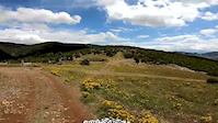
SavePërrenjasi is a settlement in the south-east of Albania. Geographical location, relief configuration, absolute altitude above sea level and distance from the Adriatic Sea have enabled the continental nature of the climate which appears in the cold and wet winter and in the cold, hot and dry weather.
Activities Click to view
- Mountain Bike
5 trails
- E-Bike
5 trails
- Horse
4 trails
- Hike
6 trails
- Trail Running
6 trails
- ATV/ORV/OHV
3 trails
Region Details
- 1
- 1
- 1
- 2
Region Status
Open as of Jun 27, 2023Stats
- Avg Trail Rating
- Trails (view details)
- 6
- Trails Mountain Bike
- 5
- Trails E-Bike
- 5
- Trails Horse
- 4
- Trails Hike
- 6
- Trails Trail Running
- 6
- Trails Dirtbike/Moto
- 2
- Trails Observed Trials
- 1
- Trails ATV/ORV/OHV
- 3
- Total Distance
- 6 miles
- Total Descent Distance
- 5 miles
- Total Descent
- 3,949 ft
- Total Vertical
- 1,444 ft
- Highest Trailhead
- 3,497 ft
- Reports
- 2
- Photos
- 37
- Ridden Counter
- 2
Popular Prrenjas Mountain Biking Trails
• 5 ★ 0.0 • 1 mile • 11 ft • 1 •
Less popular blue difficulty alpine mixed. This multi-use trail can be used both directions and has a moderate overall physical rating with a 11 ft black diamond climb. It features berm, rock face and rock garden. Trail visibility is always easy to follow. On average it takes 1 hour5 minutes to complete this trail. A license is required to use this trail.
• 5 ★ 4.0 • 2 miles • 58 ft • 1 •
Less popular blue difficulty alpine primitive. This mountain bike primary trail can be used downhill only and has a moderate overall physical rating. It features berm. Trail visibility is sometimes hard to follow.
• 5 ★ 0.0 • 449 ft • 4 ft •
Less popular white difficulty primitive. This multi-use trail can be used both directions and has a moderate overall physical rating with a 4 ft black diamond climb. It features berm and rock face. Trail visibility is always easy to follow.
• 5 ★ 0.0 • 2 miles • 3 ft •
Less popular green difficulty mixed. This multi-use trail can be used both directions and has a moderate overall physical rating with a 3 ft black diamond climb. It features berm, rock face, rock garden and other. Trail visibility is always easy to follow.
Photos of Prrenjas Mountain Bike
Videos of Prrenjas Mountain Bike

trail: Via Egnatia Trail 1
0:52 |
17 |
Nov 2, 2020
trail: Duka Trail
0:47 |
3 |
Jun 25, 2020
Recent Trail Reports
| status | trail | date | condition | info | user |
|---|---|---|---|---|---|
| Via Egnatia Trail 2 | Jun 23, 2023 @ 4:20am Jun 23, 2023 | Dry | vichivano |
Activity Feed
| username | action | type | title | date |
|---|---|---|---|---|
| vichivano | add | report | activity #41304036 and 1 more | Jun 27, 2023 @ 6:39am Jun 27, 2023 |
| andiqyqja | add | photo | activity #22341202 and 29 more | Aug 21, 2021 @ 5:18am Aug 21, 2021 |
| andiqyqja | add | trail | activity #22304470 | Aug 19, 2021 @ 10:32pm Aug 19, 2021 |
| andiqyqja | add | trail | activity #22282633 and 1 more | Aug 19, 2021 @ 7:19am Aug 19, 2021 |
| andiqyqja | update | trail | activity #22282507 and 2 more | Aug 19, 2021 @ 7:13am Aug 19, 2021 |
Activity Type Stats
| activitytype | trails | distance | descent | descent distance | total vertical | rating | global rank | state rank | photos | reports | routes | ridelogs |
|---|---|---|---|---|---|---|---|---|---|---|---|---|
| Mountain Bike | 5 | 5 miles | 3,219 ft | 5 miles | 1,335 ft | #3,017 | #14 | 37 | 2 | 88 | ||
| E-Bike | 5 | 5 miles | 3,219 ft | 5 miles | 1,335 ft | #1,766 | #23 | 2 | 2 | |||
| Horse | 4 | 5 miles | 3,196 ft | 5 miles | 1,335 ft | #566 | #20 | |||||
| Hike | 6 | 6 miles | 3,950 ft | 5 miles | 1,444 ft | #2,744 | #23 | 2 | 13 | |||
| Trail Running | 6 | 6 miles | 3,950 ft | 5 miles | 1,444 ft | #2,268 | #23 | 2 | 1 | |||
| Dirtbike/Moto | 2 | 3 miles | 2,031 ft | 3 miles | 1,178 ft | |||||||
| Observed Trials | 1 | 1,299 ft | 33 ft | 161 ft | ||||||||
| ATV/ORV/OHV | 3 | 4 miles | 2,031 ft | 3 miles | 1,335 ft | #299 | #21 |
Frequently Asked Questions About Prrenjas
▼
What are the highest rated mountain biking trails in Prrenjas?
The highest rated mountain biking trails in Prrenjas are:
- Via Egnatia Trail 1 (4/5)
- Kostrican (Via Egnatia Trail ) (0/5)
- Via Egnatia Trail 3 (0/5)
- Via Egnatia Trail 2 (0/5)
▼
Where can I park to ride in Prrenjas?
Check the Prrenjas trail map for trailhead and parking information. Community members regularly update access and parking details for trails in the area.
▼
What is the longest trail in Prrenjas?
The longest trail in Prrenjas is Via Egnatia Trail 3 at 1.9 miles. View all trails sorted by distance.
▼
What are the best & highest rated hiking trails in Prrenjas?
The best hiking trails in Prrenjas are: View all hiking trails sorted by popularity score.
Activities
Trails
Points of Interest
- By andiqyqja
 TRAILFORKS & contributors
 - Admins: andiqyqja
- #38831 - 1,595 views
- prrenjas activity log | embed map of Prrenjas mountain bike trails | prrenjas mountain biking points of interest
Downloading of trail gps tracks in kml & gpx formats is enabled for Prrenjas.
You must login to download files.