close
-
Layers w
- Weather Layers
- Pro
- Pro
- Pro
- Pro
- Pro
- Pro
- More Layers
- Pro
- Pro
- Pro
- Pro
-
Upgrade to

3D
Trail Conditions
- Unknown
- Snow Groomed
- Snow Packed
- Snow Covered
- Snow Cover Partial
- Freeze/thaw Cycle
- Icy
- Prevalent Mud
- Wet
- Variable
- Ideal
- Dry
- Very Dry
Trail Flow (Ridden Direction)
Trailforks scans users ridelogs to determine the most popular direction each trail is ridden. A good flowing trail network will have most trails flowing in a single direction according to their intension.
The colour categories are based on what percentage of riders are riding a trail in its intended direction.
The colour categories are based on what percentage of riders are riding a trail in its intended direction.
- > 96%
- > 90%
- > 80%
- > 70%
- > 50%
- < 50%
- bi-directional trail
- no data
Trail Last Ridden
Trailforks scans ridelogs to determine the last time a trail was ridden.
- < 2 days
- < 1 week
- < 2 weeks
- < 1 month
- < 6 months
- > 6 months
Trail Ridden Direction
The intended direction a trail should be ridden.
- Downhill Only
- Downhill Primary
- Both Directions
- Uphill Primary
- Uphill Only
- One Direction
Contribute Details
Colors indicate trail is missing specified detail.
- Description
- Photos
- Description & Photos
- Videos
Trail Popularity ?
Trailforks scans ridelogs to determine which trails are ridden the most in the last 9 months.
Trails are compared with nearby trails in the same city region with a possible 25 colour shades.
Think of this as a heatmap, more rides = more kinetic energy = warmer colors.
- most popular
- popular
- less popular
- not popular
ATV/ORV/OHV Filter
Max Vehicle Width
inches
US Cell Coverage
Legend

Radar Time
Activity Recordings
Trailforks uses anonymized public activity data.
?
Activity Recordings
Trailforks uses anonymized public activity data.
?
Personal Heatmap
▶
Activity Types
all
/
none
▶
Options
2
Date range
month
–
Winter Trails
Warning
A routing network for winter maps does not exist. Selecting trails using the winter trails layer has been disabled.
Missing Trails
Most Popular
Least Popular
Trails are colored based on popularity. The more popular a trail is, the more red. Less popular trails trend towards green.
Jump Magnitude Heatmap
Heatmap of where riders jump on trails. Zoom in to see individual jumps, click circles to view jump details.
BC Backroad Status
![map legend]()
Service Road Atlas is a free to use, community-driven service for viewing and creating reports on the numerous back-country service roads around B.C. and Alberta.

Slope Aspect
Direction the slope faces
Trails Deemphasized
Trails are shown in grey.
Only show trails with no bike usage.
Suggested Layers
Based on selected activity type
Save the current map location and zoom level as your default home location whenever this page is loaded.
Save
No description for Ptuj has been added yet!
Login or register to submit one.
This region uses the Uk/Euro style trail grading system.
Activities Click to view
- Mountain Bike
7 trails
- E-Bike
4 trails
Region Details
- 1
- 3
- 3
Region Status
Open as of Jun 12, 2026Stats
- Avg Trail Rating
- Trails (view details)
- 7
- Trails Mountain Bike
- 7
- Trails E-Bike
- 4
- Total Distance
- 2 miles
- Total Descent Distance
- 2 miles
- Total Descent
- 1,164 ft
- Total Vertical
- 412 ft
- Highest Trailhead
- 1,512 ft
- Reports
- 13
- Photos
- 3
- Ridden Counter
- 33
Sub Regions
-
Vurberk
- 1
- 3
- 3
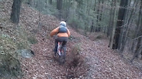
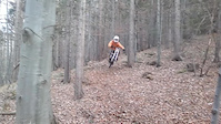
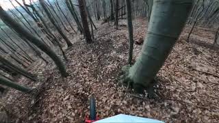
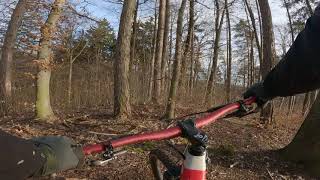
Popular Ptuj Mountain Biking Trails
• 5 ★ 5.0 • 1,929 ft • 0 ft • 9 •
Vurko is a dh "mini" park...with various flow trails...techy sections....jump lines and drops. It's easy to pedal up. Build and maintained by: Mtb_Abuhi
• 5 ★ 0.0 • 2,195 ft • 0 ft • 5 •
It's a fun ridding..different sections...step hills..trail. Made by: Mtb_Abuhi
• 5 ★ 0.0 • 1,266 ft • 0 ft • 4 •
Less popular red difficulty singletrack. This mountain bike primary trail can be used downhill only. It features bridge, drop, jump and ladder bridge. On average it takes 12 minutes to complete this trail.
• 5 ★ 0.0 • 1,263 ft • 6 ft • 1 •
Less popular green difficulty singletrack. This mountain bike primary trail can be used both directions.
Recent Trail Reports
| status | trail | date | condition | info | user |
|---|---|---|---|---|---|
| Vurko | Mar 7, 2021 @ 1:34am Mar 7, 2021 | Ideal | Vrecl AED Maribor | ||
| Grmada | Mar 7, 2021 @ 1:34am Mar 7, 2021 | Ideal | Vrecl AED Maribor | ||
| 2. Grof | Mar 7, 2021 @ 1:34am Mar 7, 2021 | Ideal | Vrecl AED Maribor |
Activity Feed
| username | action | type | title | date |
|---|---|---|---|---|
| DaRoP | ridden | trail | activity #76552589 | Jul 23, 2025 @ 1:53pm Jul 23, 2025 |
| trailforks | add | video | activity #68000127 | Mar 18, 2025 @ 5:00pm Mar 18, 2025 |
| MarkoX4SRaC | wishlist | region | activity #41189007 | Jun 23, 2023 @ 3:21am Jun 23, 2023 |
| MarkoXHMEaG | ridden | trail | activity #39544698 | May 1, 2023 @ 12:17am May 1, 2023 |
| MihatgRGYt | ridden | trail | activity #20233951 | Jun 16, 2021 @ 11:23pm Jun 16, 2021 |
Activity Type Stats
| activitytype | trails | distance | descent | descent distance | total vertical | rating | global rank | state rank | photos | reports | routes | ridelogs |
|---|---|---|---|---|---|---|---|---|---|---|---|---|
| Mountain Bike | 7 | 2 miles | 1,165 ft | 2 miles | 413 ft | #6,816 | #55 | 3 | 13 | 758 | ||
| E-Bike | 4 | 5,249 ft | 528 ft | 4,692 ft | 341 ft | #4,719 | #47 | 12 | 10 |
Frequently Asked Questions About Ptuj
▼
What are the best places to ride in Ptuj?
Ptuj has 1 areas to explore for mountain biking. The top rated areas are:
▼
What are the highest rated mountain biking trails in Ptuj?
The highest rated mountain biking trails in Ptuj are:
- Vurko (4.1/5)
- Grmada (4.1/5)
- Kozjak (4/5)
- Vurko park (0/5)
- Vurko park (0/5)
▼
What is the best time of the year to ride in Ptuj?
Based on ride log data, the most popular months to ride in Ptuj are:
- March (5 activities)
- February (4 activities)
- August (1 activities)
▼
Where can I park to ride in Ptuj?
Check the Ptuj trail map for trailhead and parking information. Community members regularly update access and parking details for trails in the area.
- By rokmurko & contributors
- Admins: VjekoslavKrsanac, zocknroll, star69
- #33592 - 1,803 views
- ptuj activity log | embed map of Ptuj mountain bike trails |
Downloading of trail gps tracks in kml & gpx formats is enabled for Ptuj.
You must login to download files.