
close
3D
Trail Conditions
- Unknown
- Snow Groomed
- Snow Packed
- Snow Covered
- Snow Cover Partial
- Freeze/thaw Cycle
- Icy
- Prevalent Mud
- Wet
- Variable
- Ideal
- Dry
- Very Dry
Trail Flow (Ridden Direction)
Trailforks scans users activity logs to determine the most popular direction each trail is ridden. A good flowing trail network will have most trails flowing in a single direction according to their intension.
The colour categories are based on what percentage of users are riding a trail in its intended direction.
The colour categories are based on what percentage of users are riding a trail in its intended direction.
- > 96%
- > 90%
- > 80%
- > 70%
- > 50%
- < 50%
- bi-directional trail
- no data
Trail Last Used
Trailforks scans activity logs to determine the last time a trail was ridden.
- < 2 days
- < 1 week
- < 2 weeks
- < 1 month
- < 6 months
- > 6 months
Trail Ridden Direction
The intended direction a trail should be ridden.
- Downhill Only
- Downhill Primary
- Both Directions
- Uphill Primary
- Uphill Only
- One Direction
Contribute Details
Colors indicate trail is missing specified detail.
- Description
- Photos
- Description & Photos
- Videos
Trail Popularity ?
Trailforks scans activity logs to determine which trails are ridden the most in the last 9 months.
Trails are compared with nearby trails in the same city region with a possible 25 colour shades.
Think of this as a heatmap, more activities = more kinetic energy = warmer colors.
- most popular
- popular
- less popular
- not popular
ATV/ORV/OHV Filter
Max Vehicle Width
inches
US Cell Coverage
Legend

Radar Time
Activity Recordings
Trailforks uses anonymized public activity data.
?
Activity Recordings
Trailforks uses anonymized public activity data.
?
Winter Trails
Warning
A routing network for winter maps does not exist. Selecting trails using the winter trails layer has been disabled.
Missing Trails
Most Popular
Least Popular
Trails are colored based on popularity. The more popular a trail is, the more red. Less popular trails trend towards green.
Jump Magnitude Heatmap
Heatmap of where users jump on trails. Zoom in to see individual jumps, click circles to view jump details.
BC Backroad Status
![map legend]()
Service Road Atlas is a free to use, community-driven service for viewing and creating reports on the numerous back-country service roads around B.C. and Alberta.

Slope Aspect
Direction the slope faces
Trails Deemphasized
Trails are shown in grey.
Only show trails with no bike usage.
Suggested Layers
Based on selected activity type
Save the current map location and zoom level as your default home location whenever this page is loaded.
SaveEl Puerto de Navacerrada es una estación de esquí y puerto de montaña a 1.858 metros de altitud que está situado en la Sierra de Guadarrama (Sistema Central). El puerto separa las provincias de Madrid y Segovia, en el centro de España. La ladera sur (la madrileña) pertenece al municipio de Cercedilla y la norte (la segoviana) a La Granja de San Ildefonso. Este puerto de montaña y estación de esquí está muy concurrida y dispone de varios hoteles, apartamentos, albergues, restaurantes y una escuela de esquí.
source: Wikipedia
Primary Trail Type: All-Mountain & Downhill
Shuttleable: YES
 google parking directions plan a road trip here
This region uses the Uk/Euro style trail grading system.
Trail info last updated
Activities Click to view
- Mountain Bike
54 trails
- E-Bike
54 trails
- Horse
11 trails
- Hike
64 trails
- Trail Running
64 trails
Region Details
- 11
- 1
- 3
- 23
- 14
- 2
Region Status
Caution as of Nov 7, 2026Stats
- Avg Trail Rating
- Trails (view details)
- 64
- Trails Mountain Bike
- 54
- Trails E-Bike
- 54
- Trails Gravel Bike
- 12
- Trails Horse
- 11
- Trails Hike
- 64
- Trails Trail Running
- 64
- Total Distance
- 87 miles
- Total Descent
- 25,282 ft
- Total Vertical
- 4,203 ft
- Highest Trailhead
- 7,770 ft
- Reports
- 399
- Photos
- 83
- Completed Counter
- 4,248
Popular Puerto de Navacerrada Mountain Biking Trails
• 90 ★ 4.0 • 2 miles • 256 ft • 175 •
Popular blue difficulty singletrack. This multi-use trail can be used both directions and has a moderate overall physical rating with a 256 ft blue climb. Trail visibility is always easy to follow. On average it takes 19 minutes to complete this trail.
• 100 ★ 4.7 • 2 miles • 5 ft • 172 •
Trail that runs parallel to the road to Navacerrada Pass. It's playful, flowy and fast but be carefull with some blind corners that can be dangerous depending on your speed.
• 80 ★ 4.4 • 3,865 ft • 0 ft • 163 •
Mas conocida como Trialera del Escorpión, este sendero tiene un comienzo de pedaleo por una sección relativamente llana hasta la casa que bordeamos, a partir de ahí comienzan una serie de curvas muy divertidas y nos iremos cruzando...
• 75 ★ 5.0 • 2 miles • 1,317 ft • 145 •
El Camino de la Bola del Mundo es una pista que lleva hasta el Alto de Las Guarramillas y el conjunto de antenas de La Bola del Mundo, uno de los picos más conocidos de la sierra de Guadarrama, con una altitud de 2.265 metros. El...
• 75 ★ 4.5 • 2,825 ft • 2 ft • 99 •
Popular black difficulty singletrack. This multi-use trail can be used downhill primary and has a hard overall physical rating. It features drop. On average it takes 4 minutes to complete this trail.
• 65 ★ 4.4 • 2 miles • 314 ft • 87 •
Está prohibido ir en bici por este sendero, atencion a los senderistas. El Camino Schmidt es un sendero de montaña que transcurre entre el Puerto de Navacerrada y el Valle de la Fuenfría. Su denominación oficial como sendero...
• 60 ★ 4.0 • 4,472 ft • 0 ft • 64 •
Moderately popular blue difficulty singletrack. This multi-use trail can be used downhill primary. Trail visibility is always easy to follow. On average it takes 5 minutes to complete this trail.
Puerto de Navacerrada Mountain Bike Routes
★ 5.0 • 30 miles • 2,637 ft • 23 • Point to Point •
Ruta extraída del ridelog del usuario allmountrailmtb en la que en casi 50km desciende desde el Puerto de...
12 miles • 207 ft • 0 • Point to Point •
Ruta de descanso desde el puerto de Cotos hasta Rascafria pasando por senderos y pistas más bonitas de la...
Photos of Puerto de Navacerrada Mountain Bike
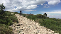
Videos of Puerto de Navacerrada Mountain Bike



Recent Trail Reports
| status | trail | date | condition | info | user |
|---|---|---|---|---|---|
| Camino del Calvario | Nov 8, 2026 @ 8:47am (Europe/Madrid) Nov 7, 2026 | Very Dry | Checapardo | ||
| El Majarzal | Nov 8, 2026 @ 8:47am (Europe/Madrid) Nov 7, 2026 | Very Dry | Checapardo | ||
| La Hojarasca | Nov 8, 2026 @ 8:47am (Europe/Madrid) Nov 7, 2026 | Ideal | Checapardo | ||
| Whistler | Oct 15, 2026 @ 2:36pm (Europe/Madrid) Oct 15, 2026 | Ideal | kinde | ||
| Vejiga de Río Pradillo | Oct 8, 2026 @ 4:39pm (Europe/Madrid) Oct 8, 2026 | Very Dry | valomatin | ||
| Prado del Pino | Aug 31, 2026 @ 9:01am (Europe/Madrid) Aug 31, 2026 | Dry | coletassoft | ||
| El Calvario | Aug 31, 2026 @ 9:01am (Europe/Madrid) Aug 31, 2026 | Ideal | coletassoft | ||
| El Miedo | Aug 31, 2026 @ 9:01am (Europe/Madrid) Aug 31, 2026 | Very Dry | coletassoft | ||
| La Bola del Mundo | Aug 31, 2026 @ 9:01am (Europe/Madrid) Aug 31, 2026 | Ideal | coletassoft | ||
| Enlace Calvario | Aug 31, 2026 @ 9:01am (Europe/Madrid) Aug 31, 2026 | Ideal | coletassoft |
Activity Feed
| username | action | type | title | date |
|---|---|---|---|---|
| kikoborrico | ridden | trail | activity #107646911 and 1 more | Nov 12, 2026 @ 2:47am Nov 12, 2026 |
| Checapardo | add | report | activity #107427673 and 2 more | Nov 8, 2026 @ 8:08am Nov 8, 2026 |
| otazu | wishlist | route | activity #107406542 | Nov 8, 2026 @ 2:58am Nov 8, 2026 |
| hongoalpino | comment | trail | activity #107348744 | Nov 7, 2026 @ 7:39am Nov 7, 2026 |
| Roland_daniela | wishlist | route | activity #107111325 | Nov 3, 2026 @ 12:46am Nov 3, 2026 |
Recent Comments
| username | type | title | comment | date |
|---|---|---|---|---|
| trail | Bajada muy rápida con un paso técnico antes... | Nov 7, 2026 @ 7:39am Nov 7, 2026 | ||
| report | Nobody has been riding this trail for a long... | Oct 8, 2026 @ 7:40am Oct 8, 2026 | ||
| trail | La primera parte hasta que llegas al cruce del... | Aug 6, 2026 @ 8:13am Aug 6, 2026 | ||
| trail | Está prohibido ir en bici por este sendero | Jun 21, 2026 @ 3:53pm Jun 21, 2026 | ||
| trail | Entrada con mucha pendiente... luego se suaviza. | Jun 14, 2026 @ 8:59am Jun 14, 2026 |
Nearby Areas
| name | distance | ||||
|---|---|---|---|---|---|
| La Barranca | 8 | 16 | 1.7 km | ||
| Puerto de la Fuenfria | 8 | 38 | 2.8 km | ||
| Cerro del Telégrafo | 3 | 14 | 5.6 km | ||
| La Pedriza | 6 | 11 | 5.9 km | ||
| Pinares de Valsaín | 9 | 76 | 6.3 km |
Local Badges
-

Completionist0 awarded
Activity Type Stats
| activitytype | trails | distance | descent | descent distance | total vertical | rating | global rank | state rank | photos | reports | routes | activity logs |
|---|---|---|---|---|---|---|---|---|---|---|---|---|
| Mountain Bike | 54 | 66 miles | 20,066 ft | 40 miles | 3,852 ft | #2,898 | #256 | 75 | 398 | 2 | 1,414 | |
| E-Bike | 54 | 66 miles | 20,066 ft | 40 miles | 3,852 ft | #402 | #184 | 2 | 391 | 2 | 512 | |
| Gravel Bike | 12 | 18 miles | 748 ft | 4 miles | 3,527 ft | #4,230 | #102 | 45 | 14 | |||
| Horse | 11 | 17 miles | 725 ft | 4 miles | 3,527 ft | #965 | #72 | 21 | ||||
| Hike | 64 | 87 miles | 25,282 ft | 49 miles | 4,203 ft | #403 | #96 | 1 | 399 | 1 | 379 | |
| Trail Running | 64 | 87 miles | 25,282 ft | 49 miles | 4,203 ft | #1,538 | #290 | 4 | 396 | 1 | 109 |
Frequently Asked Questions
▼
What are the highest rated mountain biking trails in Puerto de Navacerrada?
The highest rated mountain biking trails in Puerto de Navacerrada are:
- Correcaminos (4.4/5)
- Pradera de Siete Picos (4.2/5)
- La Sal (4.2/5)
- La Bola del Mundo (4.1/5)
- Mina de Las Cortes (4.1/5)
▼
Where can I park to ride in Puerto de Navacerrada?
There are 2 parking locations listed in Puerto de Navacerrada. The most popular parking spots are:
▼
What is the longest trail in Puerto de Navacerrada?
The longest trail in Puerto de Navacerrada is Arroyo de La Angostura at 5.8 miles. View all trails sorted by distance.
▼
What are the best & highest rated hiking trails in Puerto de Navacerrada?
The best hiking trails in Puerto de Navacerrada are: View all hiking trails sorted by popularity score.
▼
What are the best & highest rated trail running trails in Puerto de Navacerrada?
The best trail running trails in Puerto de Navacerrada are: View all trail running trails sorted by popularity score.
▼
How many trails are in Puerto de Navacerrada?
Puerto de Navacerrada has a total of 64 trails. Of those, 54 are designated for mountain biking. Browse top mountain biking trails in Puerto de Navacerrada to find detailed information including difficulty ratings, distances, and trail conditions.
▼
Which trail has the most elevation gain in Puerto de Navacerrada?
The trail with the most elevation gain in Puerto de Navacerrada is La Bola del Mundo with 1,317 ft of elevation gain. View all trails sorted by elevation gain.
▼
Which trail has the most elevation descent in Puerto de Navacerrada?
The trail with the most elevation descent in Puerto de Navacerrada is Loma del Noruego with 1,454 ft of elevation descent. View all trails sorted by elevation descent.
▼
What activities are most popular in Puerto de Navacerrada?
Puerto de Navacerrada supports the following activities: Mountain Biking, E-Biking, Horseback, Hiking, Trail Running.
▼
What are the steepest mountain biking trails in Puerto de Navacerrada?
The steepest mountain biking trail in Puerto de Navacerrada is Camino Schmidt with an average grade of 16.9%. View all trails sorted by grade.
▼
What trails have the biggest jumps in Puerto de Navacerrada?
The trails with the biggest jumps in Puerto de Navacerrada are: Browse all mountain bike trails to find trails with jumps and technical features.
▼
Are the trails open in Puerto de Navacerrada?
The overall region status for Puerto de Navacerrada is Minor Issue / Yellow. Out of 44 trails:
- Clear / Green: 34
- Minor Issue / Yellow: 6
- Significant Issue / Amber: 3
- Closed: 1
▼
Can I ride an ebike in Puerto de Navacerrada?
Yes, Puerto de Navacerrada supports e-bike riding. There are 54 trails in Puerto de Navacerrada that allow e-bikes. Check the e-bike trails listing for specific trail access details and any local regulations.
▼
What are the most popular mountain biking routes in Puerto de Navacerrada?
The most popular mountain biking routes in Puerto de Navacerrada are: View all mountain biking routes in Puerto de Navacerrada.
▼
What are the most popular Strava Segments in Puerto de Navacerrada?
The most popular Strava segments in Puerto de Navacerrada are:
- Bola del Mundo to the fence (10,574 athletes)
- Muerte en Vida!!! (Bola del Mundo) (10,224 athletes)
- Sprint Llegada Vuelta España (9,994 athletes)
▼
What are some popular technical trail features in Puerto de Navacerrada?
There are 3 technical trail features (TTFs) in Puerto de Navacerrada. Some popular features include: View all technical trail features in Puerto de Navacerrada.
▼
What trails are closed in Puerto de Navacerrada?
There are currently 1 closed trails in Puerto de Navacerrada. The breakdown of all trail statuses is:
- Clear / Green: 34
- Minor Issue / Yellow: 6
- Significant Issue / Amber: 3
- Closed: 1
▼
What are the most popular mountain biking trails in Puerto de Navacerrada?
The most popular mountain biking trails in Puerto de Navacerrada are: View all mountain biking trails sorted by popularity.
▼
What are the best beginner ride trails in Puerto de Navacerrada?
The best beginner mountain biking trails in Puerto de Navacerrada are:
- La Bola del Mundo (5/5)
- Fast trail (0/5)
- Regajo de Los Baldios (0/5)
Activities
Trails
- By coletassoft & contributors
- Admins: apply
- #5175 - 5,666 views
- puerto de navacerrada activity log | embed map of Puerto de Navacerrada mountain bike trails | puerto de navacerrada mountain biking points of interest polygons
Downloading of trail gps tracks in kml & gpx formats is enabled for Puerto de Navacerrada.
You must login to download files.
