close
-
Layers w
- Weather Layers
- Pro
- Pro
- Pro
- Pro
- Pro
- Pro
- More Layers
- Pro
- Pro
- Pro
- Pro
-
Upgrade to

3D
Trail Conditions
- Unknown
- Snow Groomed
- Snow Packed
- Snow Covered
- Snow Cover Partial
- Freeze/thaw Cycle
- Icy
- Prevalent Mud
- Wet
- Variable
- Ideal
- Dry
- Very Dry
Trail Flow (Ridden Direction)
Trailforks scans users ridelogs to determine the most popular direction each trail is ridden. A good flowing trail network will have most trails flowing in a single direction according to their intension.
The colour categories are based on what percentage of riders are riding a trail in its intended direction.
The colour categories are based on what percentage of riders are riding a trail in its intended direction.
- > 96%
- > 90%
- > 80%
- > 70%
- > 50%
- < 50%
- bi-directional trail
- no data
Trail Last Ridden
Trailforks scans ridelogs to determine the last time a trail was ridden.
- < 2 days
- < 1 week
- < 2 weeks
- < 1 month
- < 6 months
- > 6 months
Trail Ridden Direction
The intended direction a trail should be ridden.
- Downhill Only
- Downhill Primary
- Both Directions
- Uphill Primary
- Uphill Only
- One Direction
Contribute Details
Colors indicate trail is missing specified detail.
- Description
- Photos
- Description & Photos
- Videos
Trail Popularity ?
Trailforks scans ridelogs to determine which trails are ridden the most in the last 9 months.
Trails are compared with nearby trails in the same city region with a possible 25 colour shades.
Think of this as a heatmap, more rides = more kinetic energy = warmer colors.
- most popular
- popular
- less popular
- not popular
ATV/ORV/OHV Filter
Max Vehicle Width
inches
US Cell Coverage
Legend

Radar Time
Activity Recordings
Trailforks uses anonymized public activity data.
?
Activity Recordings
Trailforks uses anonymized public activity data.
?
Personal Heatmap
▶
Activity Types
all
/
none
▶
Options
2
Date range
month
–
Winter Trails
Warning
A routing network for winter maps does not exist. Selecting trails using the winter trails layer has been disabled.
Missing Trails
Most Popular
Least Popular
Trails are colored based on popularity. The more popular a trail is, the more red. Less popular trails trend towards green.
Jump Magnitude Heatmap
Heatmap of where riders jump on trails. Zoom in to see individual jumps, click circles to view jump details.
BC Backroad Status
![map legend]()
Service Road Atlas is a free to use, community-driven service for viewing and creating reports on the numerous back-country service roads around B.C. and Alberta.

Slope Aspect
Direction the slope faces
Trails Deemphasized
Trails are shown in grey.
Only show trails with no bike usage.
Suggested Layers
Based on selected activity type
Save the current map location and zoom level as your default home location whenever this page is loaded.
Save
No description for Rangiora has been added yet!
Login or register to submit one.
Activities Click to view
- Mountain Bike
63 trails
- E-Bike
31 trails
- Gravel Bike
0 trails
- Adaptive Bike
0 trails
- Hike
43 trails
- Trail Running
43 trails
Region Details
- 10
- 2
- 12
- 24
- 1
- 2
Region Status
Open as of Apr 11, 2026Stats
- Avg Trail Rating
- Trails (view details)
- 52
- Trails Mountain Bike
- 63
- Trails E-Bike
- 31
- Trails Horse
- 1
- Trails Hike
- 43
- Trails Trail Running
- 43
- Total Distance
- 52 miles
- Total Descent
- 12,247 ft
- Total Vertical
- 4,467 ft
- Highest Trailhead
- 4,470 ft
- Reports
- 424
- Photos
- 134
- Ridden Counter
- 5,306
Sub Regions
-
Ashley Forest
- 6
- 22
- 1
- 1
Popular Rangiora Mountain Biking Trails
• 35 ★ 4.2 • 10 miles • 1,844 ft • 356 •
This is an old stock route formed in 1879. It's overall gradient is generally okay, but as the weather takes its toll, the track has been weathered into a fun mountain bike track with exposed roots, fords and plenty of rocks. From the...
• 85 ★ 3.7 • 3 miles • 59 ft • 179 •
A shared walking and cycling track. This track has been recently deforested and regeneration planting is underway. Lookouts are signposted along the way to afford you views of the Tūtaepatu Lagoon and mountains.
• 65 ★ 3.5 • 2 miles • 35 ft • 165 •
The Rakahuri Trail is a fun, two way shared trail that runs alongside the Ashley/Rakahuri River. Within the trail there is a dedicated mountain bike park which has areas of one way riding, offering you the freedom of knowing you have...
• 70 ★ 3.5 • 1 mile • 41 ft • 141 •
Really easy trail. Can get really muddy sometimes. You also have the option of taking the trail further all the the way to Waikuku beach or the other way to the Airfield. Good for practising things such as cornering and endurance. It is...
• 100 ★ 3.0 • 584 ft • 0 ft • 140 •
Popular green difficulty singletrack. This mountain bike primary trail can be used both directions and has a easy overall physical rating with a 0 ft green climb. Trail visibility is always easy to follow. On average it takes 1 minutes to complete this trail.
• 90 ★ 4.4 • 3,015 ft • 177 ft • 136 •
Popular green difficulty singletrack. This mountain bike primary trail can be used both directions and has a moderate overall physical rating with a 177 ft blue climb. Trail visibility is always easy to follow. On average it takes 7 minutes to complete this trail.
• 65 ★ 4.8 • 1,286 ft • 0 ft • 130 •
Moderately popular green difficulty singletrack. This mountain bike primary trail can be used downhill primary and has a moderate overall physical rating. Trail visibility is always easy to follow. On average it takes 1 minutes to complete this trail.
• 75 ★ 4.0 • 1,785 ft • 0 ft • 124 •
Popular blue difficulty singletrack. This mountain bike primary trail can be used downhill primary. It features jump. On average it takes 1 minutes to complete this trail.
Rangiora Mountain Bike Routes
27 miles • 4,368 ft • 0 • Out & Back •
Ride from Barron Ave Ashley Forest to top of Mt Grey via Mt Grey Road
★ 2.0 • 5 miles • 357 ft • 0 • Out & Back •
Route to Ashley forest from Rangiora using off road trails where possible
14 miles • 1,578 ft • 0 • Loop •
Nice loop ride in Ashley Forest. Start at the forest HQ. Couple of climbs to make you puff a bit but a...
Photos of Rangiora Mountain Bike
Videos of Rangiora Mountain Bike
trail: Wharfedale Track
0:27 |
314 |
Jan 4, 2020
trail: Wharfedale Track
0:20 |
894 |
May 1, 2016

trail: Double Dropper
2:27 |
134 |
Apr 5, 2025 , Rangiora

trail: Pig Route
0:58 |
505 |
Jan 9, 2022 , Rangiora
youtuber
![ASHLEY FOREST, RANGIORA MOUNTAIN BIKING TRAILS...]()
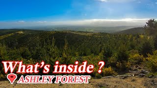
10:08 |
1021 |
Dec 8, 2021

trail: Wharfedale Track
9:44 |
1487 |
Jun 11, 2018 , Rangiora

trail: Wharfedale Track
8:15 |
1204 |
Apr 29, 2018 , Rangiora
Recent Trail Reports
| status | trail | date | condition | info | user |
|---|---|---|---|---|---|
| Wharfedale Track | Apr 11, 2026 @ 8:27pm (Pacific/Auckland) Apr 11, 2026 | Ideal | cuzzykev | ||
| Coopers Creek and Link Track | Apr 3, 2026 @ 5:13pm (Pacific/Auckland) Apr 2, 2026 | Variable | HVMB | ||
| Full Weasel | Mar 1, 2026 @ 10:09am (Pacific/Auckland) Feb 28, 2026 | Dry | bryanmmch | ||
| Ollie Oop | Mar 1, 2026 @ 10:09am (Pacific/Auckland) Feb 28, 2026 | Dry | bryanmmch | ||
| Huff N Puff | Mar 1, 2026 @ 10:09am (Pacific/Auckland) Feb 28, 2026 | Dry | bryanmmch | ||
| Mac n Cheese | Mar 1, 2026 @ 10:09am (Pacific/Auckland) Feb 28, 2026 | Dry | bryanmmch | ||
| Access Road | Mar 1, 2026 @ 10:09am (Pacific/Auckland) Feb 28, 2026 | Dry | bryanmmch | ||
| Sparky | Mar 1, 2026 @ 10:09am (Pacific/Auckland) Feb 28, 2026 | Dry | bryanmmch | ||
| Tina Turner | Mar 1, 2026 @ 10:09am (Pacific/Auckland) Feb 28, 2026 | Dry | bryanmmch | ||
| Double Dropper | Mar 1, 2026 @ 10:09am (Pacific/Auckland) Feb 28, 2026 | Dry | bryanmmch |
Activity Feed
| username | action | type | title | date |
|---|---|---|---|---|
| Noahtrapp | wishlist | route | activity #95911693 | May 30, 2026 @ 11:28pm May 30, 2026 |
| peddlerpete | ridden | trail | activity #95907735 | May 30, 2026 @ 8:28pm May 30, 2026 |
| ZdvRaD | wishlist | region | activity #95849881 | May 30, 2026 @ 7:29am May 30, 2026 |
| ZdvRaD | wishlist | route | activity #95849308 and 1 more | May 30, 2026 @ 7:22am May 30, 2026 |
| ZdvRaD | wishlist | trail | activity #95849293 | May 30, 2026 @ 7:21am May 30, 2026 |
Recent Comments
| username | type | title | comment | date |
|---|---|---|---|---|
| trail | 50% walking your bike. Definitely not a... | Apr 2, 2026 @ 9:12pm Apr 2, 2026 | ||
| trail | Looks like part of the trail is more like a... | Jun 26, 2025 @ 6:19am Jun 26, 2025 | ||
| trail | EPIC!! E bikers dream, if you love a tech... | Jun 1, 2025 @ 8:46pm Jun 1, 2025 | ||
| trail | Sign at gate saying track closed until further... | Feb 1, 2025 @ 3:37pm Feb 1, 2025 | ||
| trail | A bit like a roller coaster | Jan 30, 2025 @ 1:57am Jan 30, 2025 |
Local Badges
-

Epic Ride Climb 2k61 awarded -

Climbing 10k Badge49 awarded -

Climbing 100k Badge3 awarded -

Epic Ride Descent 2k64 awarded -

Descent 10k Badge48 awarded -

Descent 100k Badge4 awarded
Bike & Skill Parks
| name | type | city | rating |
|---|---|---|---|
| North Canterbury BMX Track | skill park | Rangiora |
Activity Type Stats
| activitytype | trails | distance | descent | descent distance | total vertical | rating | global rank | state rank | photos | reports | routes | ridelogs |
|---|---|---|---|---|---|---|---|---|---|---|---|---|
| Mountain Bike | 63 | 52 miles | 12,247 ft | 22 miles | 4,469 ft | #1,350 | #31 | 133 | 424 | 3 | 8,987 | |
| E-Bike | 31 | 8 miles | 1,693 ft | 4 miles | 784 ft | #2,566 | #40 | 368 | 2 | 841 | ||
| Horse | 1 | 6 miles | 489 ft | 1 mile | 2,448 ft | 22 | ||||||
| Hike | 43 | 45 miles | 10,574 ft | 19 miles | 4,469 ft | #949 | #18 | 414 | 494 | |||
| Trail Running | 43 | 45 miles | 10,574 ft | 19 miles | 4,469 ft | #2,556 | #36 | 1 | 414 | 290 |
Frequently Asked Questions About Rangiora
▼
What are the best places to ride in Rangiora?
Rangiora has 1 areas to explore for mountain biking. The top rated areas are:
▼
What are the highest rated mountain biking trails in Rangiora?
The highest rated mountain biking trails in Rangiora are:
- Sam's Downhill (4.3/5)
- Jack and Jill (4.3/5)
- Rally Sprint (4.3/5)
- Bypass II (4.3/5)
- Pig Route (4.3/5)
▼
What is the best time of the year to ride in Rangiora?
Based on ride log data, the most popular months to ride in Rangiora are:
- December (43 activities)
- January (40 activities)
- February (40 activities)
▼
Where can I park to ride in Rangiora?
There are 4 parking locations listed in Rangiora. The most popular parking spots are: View all parking and trailhead locations on the map to plan your visit.
Activities
Trails
- By nakinoah
 & contributors
 - Admins: Alps2Ocean-Cycle-Trail, MBA, rhino333
- #7716 - 14,222 views
- rangiora activity log | embed map of Rangiora mountain bike trails | rangiora mountain biking points of interest
Downloading of trail gps tracks in kml & gpx formats is enabled for Rangiora.
You must login to download files.