close
-
Layers w
- Weather Layers
- Pro
- Pro
- Pro
- Pro
- Pro
- Pro
- More Layers
- Pro
- Pro
- Pro
- Pro
-
Upgrade to

3D
Trail Conditions
- Unknown
- Snow Groomed
- Snow Packed
- Snow Covered
- Snow Cover Partial
- Freeze/thaw Cycle
- Icy
- Prevalent Mud
- Wet
- Variable
- Ideal
- Dry
- Very Dry
Trail Flow (Ridden Direction)
Trailforks scans users ridelogs to determine the most popular direction each trail is ridden. A good flowing trail network will have most trails flowing in a single direction according to their intension.
The colour categories are based on what percentage of riders are riding a trail in its intended direction.
The colour categories are based on what percentage of riders are riding a trail in its intended direction.
- > 96%
- > 90%
- > 80%
- > 70%
- > 50%
- < 50%
- bi-directional trail
- no data
Trail Last Ridden
Trailforks scans ridelogs to determine the last time a trail was ridden.
- < 2 days
- < 1 week
- < 2 weeks
- < 1 month
- < 6 months
- > 6 months
Trail Ridden Direction
The intended direction a trail should be ridden.
- Downhill Only
- Downhill Primary
- Both Directions
- Uphill Primary
- Uphill Only
- One Direction
Contribute Details
Colors indicate trail is missing specified detail.
- Description
- Photos
- Description & Photos
- Videos
Trail Popularity ?
Trailforks scans ridelogs to determine which trails are ridden the most in the last 9 months.
Trails are compared with nearby trails in the same city region with a possible 25 colour shades.
Think of this as a heatmap, more rides = more kinetic energy = warmer colors.
- most popular
- popular
- less popular
- not popular
ATV/ORV/OHV Filter
Max Vehicle Width
inches
US Cell Coverage
Legend

Radar Time
Activity Recordings
Trailforks uses anonymized public activity data.
?
Activity Recordings
Trailforks uses anonymized public activity data.
?
Personal Heatmap
▶
Activity Types
all
/
none
▶
Options
2
Date range
month
–
Winter Trails
Warning
A routing network for winter maps does not exist. Selecting trails using the winter trails layer has been disabled.
Missing Trails
Most Popular
Least Popular
Trails are colored based on popularity. The more popular a trail is, the more red. Less popular trails trend towards green.
Jump Magnitude Heatmap
Heatmap of where riders jump on trails. Zoom in to see individual jumps, click circles to view jump details.
BC Backroad Status
![map legend]()
Service Road Atlas is a free to use, community-driven service for viewing and creating reports on the numerous back-country service roads around B.C. and Alberta.

Slope Aspect
Direction the slope faces
Trails Deemphasized
Trails are shown in grey.
Only show trails with no bike usage.
Suggested Layers
Based on selected activity type
Save the current map location and zoom level as your default home location whenever this page is loaded.
Save
No description for Rebild has been added yet!
Login or register to submit one.
Activities Click to view
- Mountain Bike
9 trails
- Gravel Bike
0 trails
- Winter Fat Bike
0 trails
- Hike
1 trails
- Trail Running
1 trails
Region Details
- 2
- 4
- 3
Region Status
Open as of May 20, 2025Stats
- Avg Trail Rating
- Trails (view details)
- 9
- Trails Mountain Bike
- 9
- Trails Hike
- 1
- Trails Trail Running
- 1
- Total Distance
- 28 miles
- Total Descent Distance
- 13 miles
- Total Descent
- 3,023 ft
- Total Vertical
- 286 ft
- Highest Trailhead
- 344 ft
- Reports
- 46
- Photos
- 28
- Ridden Counter
- 589
Sub Regions
-
Rold Skov
- 2
- 1
Popular Rebild Mountain Biking Trails
• 60 ★ 4.0 • 1 mile • 48 ft • 100 •
Very nice trail, marked as red alternative to the blue track
• 90 ★ 0.0 • 3 miles • 240 ft • 67 •
Northern section of the red track of Rold Skov round trip
• 100 ★ 0.0 • 9 miles • 900 ft • 55 •
Undulating and very winding round course in Rold Skov (forest). Can be exhausting in the long run. Track of the Rold 24 hour race.
• 35 ★ 5.0 • 12 miles • 1,132 ft • 46 •
En fantastisk flot tur gennem smukke omgivelser. Det blå spor undgår de sværeste passager i området og der køres en del på grusveje. Med det sagt byder blåt spor dog stadig på masser af underholdning, og har flere hurtige...
• 25 ★ 2.5 • 1,319 ft • 81 ft • 28 •
This is a short uphill trail starting with a fairly steep ascent. Once the initial steep ascent is completed there is a relatively flat middle piece before the trail has a moderate ascent again on the last part. The trail is cut in the...
Rebild Mountain Bike Routes
★ 4.0 • 15 miles • 1,639 ft • 2 •
This route includes the official route known as The Big Blue, however there a several side trails included...
★ 4.0 • 11 miles • 907 ft • 0 • Loop •
An easy route through the forests of and around Rebild. Nothing technical at all. The route starts and...
8 miles • 766 ft • 0 •
A fabulous loop amongst the forest with flowy, fun sections, some slightly techy downhill descents and...
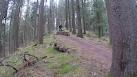
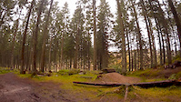
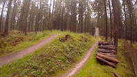
Photos of Rebild Mountain Bike
Videos of Rebild Mountain Bike
trail: Rold skov DH
0:09 |
25 |
Jan 14, 2020
trail: Bredodde
3:56 |
276 |
Mar 3, 2019

trail: Rold skov DH
0:01 |
36 |
Dec 26, 2016
trail: Rold skov DH
0:10 |
51 |
Dec 26, 2016
trail: Rold skov DH
0:50 |
81 |
Dec 9, 2016
trail: Rold skov DH
0:15 |
26 |
Dec 7, 2016
trail: Rold skov DH
2:39 |
76 |
Aug 10, 2015
trail: Rold skov DH
2:41 |
378 |
Nov 2, 2014
Recent Trail Reports
| status | trail | date | condition | info | user |
|---|---|---|---|---|---|
| Rold Skov 24 Timer | May 20, 2025 @ 6:29pm May 20, 2025 | Dry | Flintegaarden | ||
| Rold Skov Stor rute 1 (Rød) | May 15, 2025 @ 6:18pm May 15, 2025 | Dry | Flintegaarden | ||
| Vedsted Skov Stor rute (Rød) | Aug 1, 2024 @ 8:20am Aug 1, 2024 | Ideal | Frank1cZ1n | ||
| Bredodde | Apr 21, 2024 @ 3:55am Apr 21, 2024 | Variable | skrivtilper | ||
| Højodde | Sep 16, 2023 @ 3:42am Sep 16, 2023 | Ideal | trailforks Trailforks | ||
| Urskoven | Sep 16, 2023 @ 3:42am Sep 16, 2023 | Dry | trailforks Trailforks | ||
| Rold Skov - Blåt spor | Aug 27, 2023 @ 1:05am Aug 27, 2023 | Variable | hoffet | ||
| Hylden | Nov 10, 2020 @ 9:11am Nov 10, 2020 | Ideal | Flintegaarden |
Activity Feed
| username | action | type | title | date |
|---|---|---|---|---|
| DanielV | wishlist | route | activity #96526062 and 1 more | Jun 8, 2026 @ 1:18am Jun 8, 2026 |
| Ginger_Gravelgirl | wishlist | trail | activity #96109307 | Jun 2, 2026 @ 2:17pm Jun 2, 2026 |
| Ginger_Gravelgirl | wishlist | region | activity #96109277 | Jun 2, 2026 @ 2:16pm Jun 2, 2026 |
| MichaelwOJuH9 | ridden | route | activity #85694149 | Dec 18, 2025 @ 6:47am Dec 18, 2025 |
| znEkMW | ridden | trail | activity #80226032 | Sep 13, 2025 @ 2:09am Sep 13, 2025 |
Recent Comments
| username | type | title | comment | date |
|---|---|---|---|---|
| trail | It sure looks more like a route. | Jun 19, 2025 @ 3:49am Jun 19, 2025 | ||
| trail | Easy trail. Should be green. | Jul 1, 2022 @ 11:23pm Jul 1, 2022 | ||
| trail | Fordi det er sort. Det skal ikke være nemt.... | Jun 9, 2019 @ 5:07am Jun 9, 2019 |
Bike & Skill Parks
| name | type | city | rating |
|---|---|---|---|
| Rold Skov MTB Teknik Område | skill park | Rebild |
Activity Type Stats
| activitytype | trails | distance | descent | descent distance | total vertical | rating | global rank | state rank | photos | reports | routes | ridelogs |
|---|---|---|---|---|---|---|---|---|---|---|---|---|
| Mountain Bike | 9 | 28 miles | 3,025 ft | 13 miles | 285 ft | #2,147 | #6 | 28 | 46 | 3 | 5,309 | |
| Hike | 1 | 1,319 ft | 26 ft | 492 ft | 75 ft | #2,918 | #24 | 43 | 80 | |||
| Trail Running | 1 | 1,319 ft | 26 ft | 492 ft | 75 ft | #2,417 | #24 | 43 | 10 |
Frequently Asked Questions About Rebild
▼
What are the best places to ride in Rebild?
Rebild has 1 areas to explore for mountain biking. The top rated areas are:
▼
What are the highest rated mountain biking trails in Rebild?
The highest rated mountain biking trails in Rebild are:
- Rold skov DH (4.1/5)
- Rold Skov - Blåt spor (4.1/5)
- Urskoven (4/5)
- Hylden (3.6/5)
- Rold Skov 24 Timer (0/5)
▼
What is the best time of the year to ride in Rebild?
Based on ride log data, the most popular months to ride in Rebild are:
- October (39 activities)
- July (36 activities)
- May (29 activities)
▼
Where can I park to ride in Rebild?
There are 1 parking locations listed in Rebild. The most popular parking spots are:
- By rytters & contributors
- Admins: trail-niels
- #13236 - 2,875 views
- rebild activity log | embed map of Rebild mountain bike trails | rebild mountain biking points of interest
Downloading of trail gps tracks in kml & gpx formats is enabled for Rebild.
You must login to download files.