close
-
Layers w
- Weather Layers
- Pro
- Pro
- Pro
- Pro
- Pro
- Pro
- More Layers
- Pro
- Pro
- Pro
- Pro
-
Upgrade to

3D
Trail Conditions
- Unknown
- Snow Groomed
- Snow Packed
- Snow Covered
- Snow Cover Partial
- Freeze/thaw Cycle
- Icy
- Prevalent Mud
- Wet
- Variable
- Ideal
- Dry
- Very Dry
Trail Flow (Ridden Direction)
Trailforks scans users ridelogs to determine the most popular direction each trail is ridden. A good flowing trail network will have most trails flowing in a single direction according to their intension.
The colour categories are based on what percentage of riders are riding a trail in its intended direction.
The colour categories are based on what percentage of riders are riding a trail in its intended direction.
- > 96%
- > 90%
- > 80%
- > 70%
- > 50%
- < 50%
- bi-directional trail
- no data
Trail Last Ridden
Trailforks scans ridelogs to determine the last time a trail was ridden.
- < 2 days
- < 1 week
- < 2 weeks
- < 1 month
- < 6 months
- > 6 months
Trail Ridden Direction
The intended direction a trail should be ridden.
- Downhill Only
- Downhill Primary
- Both Directions
- Uphill Primary
- Uphill Only
- One Direction
Contribute Details
Colors indicate trail is missing specified detail.
- Description
- Photos
- Description & Photos
- Videos
Trail Popularity ?
Trailforks scans ridelogs to determine which trails are ridden the most in the last 9 months.
Trails are compared with nearby trails in the same city region with a possible 25 colour shades.
Think of this as a heatmap, more rides = more kinetic energy = warmer colors.
- most popular
- popular
- less popular
- not popular
ATV/ORV/OHV Filter
Max Vehicle Width
inches
US Cell Coverage
Legend

Radar Time
Activity Recordings
Trailforks uses anonymized public activity data.
?
Activity Recordings
Trailforks uses anonymized public activity data.
?
Personal Heatmap
▶
Activity Types
all
/
none
▶
Options
2
Date range
month
–
Winter Trails
Warning
A routing network for winter maps does not exist. Selecting trails using the winter trails layer has been disabled.
Missing Trails
Most Popular
Least Popular
Trails are colored based on popularity. The more popular a trail is, the more red. Less popular trails trend towards green.
Jump Magnitude Heatmap
Heatmap of where riders jump on trails. Zoom in to see individual jumps, click circles to view jump details.
BC Backroad Status
![map legend]()
Service Road Atlas is a free to use, community-driven service for viewing and creating reports on the numerous back-country service roads around B.C. and Alberta.

Slope Aspect
Direction the slope faces
Trails Deemphasized
Trails are shown in grey.
Only show trails with no bike usage.
Suggested Layers
Based on selected activity type
Save the current map location and zoom level as your default home location whenever this page is loaded.
Save
No description for Reigate has been added yet!
Login or register to submit one.
This region uses the Uk/Euro style trail grading system.
Activities Click to view
- Mountain Bike
7 trails
- Adaptive Bike
0 trails
- Winter Fat Bike
0 trails
- Hike
6 trails
- Trail Running
6 trails
Region Details
- 1
- 3
- 2
- 1
Region Status
Caution as of Apr 29, 2026Stats
- Avg Trail Rating
- Trails (view details)
- 7
- Trails Mountain Bike
- 7
- Trails Hike
- 6
- Trails Trail Running
- 6
- Total Distance
- 3 miles
- Total Descent
- 774 ft
- Total Vertical
- 420 ft
- Highest Trailhead
- 691 ft
- Reports
- 114
- Photos
- 5
- Ridden Counter
- 655
Popular Reigate Mountain Biking Trails
• 100 ★ 3.5 • 630 ft • 0 ft • 132 •
Popular blue difficulty singletrack. This mountain bike primary trail can be used both directions. Trail visibility is always easy to follow. On average it takes minutes to complete this trail.
• 75 ★ 4.0 • 1,677 ft • 0 ft • 117 •
Straightforward trail with small built tabletops and berms. Careful of the steep drop on the edge in some sections
• 90 ★ 4.7 • 2 miles • 0 ft • 114 •
A fast and fun mostly single track trail, just off the North Downs Way in Reigate. Can be busy with horse riders and other trail users. Holds up well in the winter or with wet weather, but be prepared to get muddy.
• 25 ★ 0.0 • 1,520 ft • 4 ft • 28 •
Real short but a few poppy small jumps one good flowy booter and finish after a fallen tree drop-off. Seriously loose!!!
• 50 ★ 0.0 • 499 ft • 0 ft • 23 •
A couple of berms and some small chutes to drop into. A red only
• 5 ★ 0.0 • 241 ft • 0 ft • 20 •
Less popular red difficulty singletrack. This mountain bike primary trail can be used downhill only. Trail visibility is sometimes hard to follow.
Videos of Reigate Mountain Bike
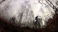
trail: Loam Ranger
0:09 |
1955 |
Dec 30, 2014

trail: Finding the Steep
2:54 |
1868 |
Aug 2, 2020 , Reigate

trail: Enter the Woods
2:54 |
537 |
Aug 2, 2020 , Reigate

trail: Flicks
2:54 |
608 |
Aug 2, 2020 , Reigate
Recent Trail Reports
| status | trail | date | condition | info | user |
|---|---|---|---|---|---|
| Gate to Gate | Apr 29, 2026 @ 5:40pm (Europe/London) Apr 29, 2026 | Dry | ThexMiniman | ||
| Finding the Steep | Apr 29, 2026 @ 5:40pm (Europe/London) Apr 29, 2026 | Unknown | ThexMiniman | ||
| Enter the Woods | Apr 29, 2026 @ 5:40pm (Europe/London) Apr 29, 2026 | Dry | ThexMiniman | ||
| Flicks | Apr 29, 2026 @ 5:40pm (Europe/London) Apr 29, 2026 | Dry | ThexMiniman | ||
| Yum. Yum. Singletrack | Apr 26, 2025 @ 8:24am Apr 26, 2025 | Ideal | ThexMiniman | ||
| Fist Pump | Jul 25, 2023 @ 3:08am Jul 25, 2023 | Dry | JosephyhNXkz | ||
| Loam Ranger | Dec 5, 2021 @ 1:08am Dec 5, 2021 | Variable | coombsd | ||
| Searching for the Steep | May 25, 2019 @ 12:38am May 25, 2019 | Very Dry | ThexMiniman |
Activity Feed
| username | action | type | title | date |
|---|---|---|---|---|
| ThexMiniman | add | report | activity #93670937 and 4 more | Apr 29, 2026 @ 2:05pm Apr 29, 2026 |
| Leszkor5b3v0 | ridden | trail | activity #93226654 | Apr 23, 2026 @ 10:59am Apr 23, 2026 |
| Samschofs | ridden | trail | activity #91508712 | Mar 29, 2026 @ 5:28am Mar 29, 2026 |
| Shiftandsend | wishlist | trail | activity #90198486 | Mar 8, 2026 @ 8:03am Mar 8, 2026 |
| scottgeeson | wishlist | trail | activity #86435152 | Jan 1, 2026 @ 5:34am Jan 1, 2026 |
Recent Comments
| username | type | title | comment | date |
|---|---|---|---|---|
| report | As per 8 March comments, still totally blocked | Mar 29, 2025 @ 9:49am Mar 29, 2025 | ||
| trail | Having been cleared last summer, several trees... | Mar 29, 2025 @ 9:47am Mar 29, 2025 | ||
| trail | There is a tree midway blocking the trail | Feb 3, 2024 @ 3:17am Feb 3, 2024 | ||
| trail | Trail still there, Red graded IMO, there are... | Jul 26, 2023 @ 4:51am Jul 26, 2023 | ||
| trail | Running ok, first time riding today on my... | Jan 29, 2022 @ 9:12am Jan 29, 2022 |
Activity Type Stats
| activitytype | trails | distance | descent | descent distance | total vertical | rating | global rank | state rank | photos | reports | routes | ridelogs |
|---|---|---|---|---|---|---|---|---|---|---|---|---|
| Mountain Bike | 7 | 3 miles | 774 ft | 2 miles | 420 ft | #8,584 | #331 | 5 | 114 | 6,281 | ||
| Hike | 6 | 2 miles | 653 ft | 2 miles | 420 ft | #9,594 | #302 | 114 | 194 | |||
| Trail Running | 6 | 2 miles | 653 ft | 2 miles | 420 ft | #8,982 | #283 | 114 | 391 |
Frequently Asked Questions About Reigate
▼
What are the highest rated mountain biking trails in Reigate?
The highest rated mountain biking trails in Reigate are:
- Yum. Yum. Singletrack (4.2/5)
- Flicks (4/5)
- Fist Pump (4/5)
- Enter the Woods (3.8/5)
- Loam Ranger (0/5)
▼
What is the best time of the year to ride in Reigate?
Based on ride log data, the most popular months to ride in Reigate are:
- May (20 activities)
- June (19 activities)
- March (17 activities)
▼
Where can I park to ride in Reigate?
Check the Reigate trail map for trailhead and parking information. Community members regularly update access and parking details for trails in the area.
▼
What is the longest trail in Reigate?
The longest trail in Reigate is Yum. Yum. Singletrack at 2.5 km. View all trails sorted by distance.
- By EuanMTB & contributors
- Admins: wisey, MathieuC, cemoorelife
- #16466 - 6,779 views
- reigate activity log | embed map of Reigate mountain bike trails |
Downloading of trail gps tracks in kml & gpx formats is enabled for Reigate.
You must login to download files.