close
-
Layers w
- Weather Layers
- Pro
- Pro
- Pro
- Pro
- Pro
- Pro
- More Layers
- Pro
- Pro
- Pro
- Pro
-
Upgrade to

3D
Trail Conditions
- Unknown
- Snow Groomed
- Snow Packed
- Snow Covered
- Snow Cover Partial
- Freeze/thaw Cycle
- Icy
- Prevalent Mud
- Wet
- Variable
- Ideal
- Dry
- Very Dry
Trail Flow (Ridden Direction)
Trailforks scans users ridelogs to determine the most popular direction each trail is ridden. A good flowing trail network will have most trails flowing in a single direction according to their intension.
The colour categories are based on what percentage of riders are riding a trail in its intended direction.
The colour categories are based on what percentage of riders are riding a trail in its intended direction.
- > 96%
- > 90%
- > 80%
- > 70%
- > 50%
- < 50%
- bi-directional trail
- no data
Trail Last Ridden
Trailforks scans ridelogs to determine the last time a trail was ridden.
- < 2 days
- < 1 week
- < 2 weeks
- < 1 month
- < 6 months
- > 6 months
Trail Ridden Direction
The intended direction a trail should be ridden.
- Downhill Only
- Downhill Primary
- Both Directions
- Uphill Primary
- Uphill Only
- One Direction
Contribute Details
Colors indicate trail is missing specified detail.
- Description
- Photos
- Description & Photos
- Videos
Trail Popularity ?
Trailforks scans ridelogs to determine which trails are ridden the most in the last 9 months.
Trails are compared with nearby trails in the same city region with a possible 25 colour shades.
Think of this as a heatmap, more rides = more kinetic energy = warmer colors.
- most popular
- popular
- less popular
- not popular
ATV/ORV/OHV Filter
Max Vehicle Width
inches
US Cell Coverage
Legend

Radar Time
Activity Recordings
Trailforks uses anonymized public activity data.
?
Activity Recordings
Trailforks uses anonymized public activity data.
?
Personal Heatmap
▶
Activity Types
all
/
none
▶
Options
2
Date range
month
–
Winter Trails
Warning
A routing network for winter maps does not exist. Selecting trails using the winter trails layer has been disabled.
Missing Trails
Most Popular
Least Popular
Trails are colored based on popularity. The more popular a trail is, the more red. Less popular trails trend towards green.
Jump Magnitude Heatmap
Heatmap of where riders jump on trails. Zoom in to see individual jumps, click circles to view jump details.
BC Backroad Status
![map legend]()
Service Road Atlas is a free to use, community-driven service for viewing and creating reports on the numerous back-country service roads around B.C. and Alberta.

Slope Aspect
Direction the slope faces
Trails Deemphasized
Trails are shown in grey.
Only show trails with no bike usage.
Suggested Layers
Based on selected activity type
Save the current map location and zoom level as your default home location whenever this page is loaded.
SaveRincón is one of the 78 municipios of Puerto Rico.
Activities Click to view
- Mountain Bike
12 trails
- E-Bike
12 trails
- Gravel Bike
0 trails
- Adaptive Bike
0 trails
- Hike
12 trails
- Trail Running
12 trails
Region Details
- 5
- 6
- 1
Region Status
Open as of Mar 31, 2026Stats
- Avg Trail Rating
- Trails (view details)
- 12
- Trails Mountain Bike
- 12
- Trails E-Bike
- 12
- Trails Hike
- 12
- Trails Trail Running
- 12
- Total Distance
- 9 miles
- Total Descent
- 1,294 ft
- Total Vertical
- 177 ft
- Highest Trailhead
- 193 ft
- Reports
- 44
- Photos
- 76
- Ridden Counter
- 1,706
Sub Regions
-
Cowboys
- 1
-
El Faro Rincón Trails
- 4
-
El Faro Trail Network
Popular Rincon Mountain Biking Trails
• 95 ★ 5.0 • 502 ft • 35 ft • 170 •
Popular green difficulty singletrack. This mountain bike primary trail can be used both directions. On average it takes 1 minutes to complete this trail.
• 75 ★ 5.0 • 3 miles • 444 ft • 167 •
Almendro a Las Agonías + La Playa (Lado izquierdo) would be the third singletrack that you'll ideally take if riding the whole El Faro Rincón Trails. It also starts in the spot known as Almendro which is the trailhead the other trails...
• 100 ★ 0.0 • 4,511 ft • 93 ft • 141 •
(Línea Central) would be the second singletrack that you'll ideally take when riding El Faro Rincón Trails. It features a downhill section called La Palma.
• 60 ★ 0.0 • 1 mile • 113 ft • 94 •
(Lado Derecho) ideally would be the first trail to ride if you plan to ride all El Faro Rincón Trails. This singletrack crosses two doubletracks, and .
• 20 ★ 0.0 • 211 ft • 16 ft • 57 •
Less popular green difficulty doubletrack. This mountain bike primary trail can be used both directions. On average it takes minutes to complete this trail.
• 15 ★ 5.0 • 180 ft • 0 ft • 56 •
Less popular green difficulty doubletrack. This mountain bike primary trail can be used both directions. On average it takes minutes to complete this trail.
• 45 ★ 5.0 • 781 ft • 15 ft • 47 •
Moderately popular green difficulty singletrack. This mountain bike primary trail can be used both directions and has a moderate overall physical rating. On average it takes 3 minutes to complete this trail.
Rincon Mountain Bike Routes
3 miles • 420 ft • 2 •
Puerto Rico MTB Cup race course. The race is registered and organized as Class 1 and Junior Series by UCI...
• 12 miles • 1,544 ft • 8 •
• 6 miles • 545 ft • 7 •
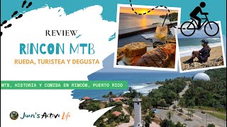
Videos of Rincon Mountain Bike
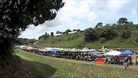
trail: Cowboys
2:56 |
273 |
Oct 6, 2015
11:24 |
49 |
Jul 27, 2025

31:04 |
78 |
Sep 30, 2024

trail: more Domes Beach
16:23 |
79 |
Sep 30, 2024 , Rincon
Recent Trail Reports
| status | trail | date | condition | info | user |
|---|---|---|---|---|---|
| Almendro a Las Agonías | Mar 31, 2026 @ 6:33am (America/Puerto_Rico) Mar 31, 2026 | Unknown | pdaggett21 | ||
| Connector | Feb 28, 2024 @ 2:02am Feb 28, 2024 | Very Dry | rafyvega | ||
| Almendro a La Z | Feb 19, 2024 @ 5:14am Feb 19, 2024 | Variable | wildmeff | ||
| Connector | Jul 16, 2023 @ 5:00am Jul 16, 2023 | Wet | cobrapr | ||
| La Cancha a Almendro | Jul 16, 2023 @ 5:00am Jul 16, 2023 | Ideal | cobrapr | ||
| El Mango | Feb 9, 2023 @ 11:53am Feb 9, 2023 | Dry | vorpal | ||
| Agonia shortcut | Feb 22, 2022 @ 1:34pm Feb 22, 2022 | Ideal | rodriguezfont | ||
| Access Trail | Jan 5, 2021 @ 7:05am Jan 5, 2021 | Ideal | gabrielo03 | ||
| La Cuesta | Feb 29, 2020 @ 3:51am Feb 29, 2020 | Wet | rafyvega | ||
| Access road | Feb 29, 2020 @ 3:51am Feb 29, 2020 | Wet | rafyvega |
Activity Feed
| username | action | type | title | date |
|---|---|---|---|---|
| pdaggett21 | add | report | activity #91637292 | Mar 31, 2026 @ 3:33am Mar 31, 2026 |
| TylerNelsonEYi | comment | route | activity #89464353 | Feb 24, 2026 @ 8:03am Feb 24, 2026 |
| Christian114 | wishlist | trail | activity #85466724 and 1 more | Dec 13, 2025 @ 11:02am Dec 13, 2025 |
| jeffr907 | ridden | trail | activity #85032132 | Dec 1, 2025 @ 3:10pm Dec 1, 2025 |
| axelsantiagopr | add | event | activity #84598833 | Nov 23, 2025 @ 7:22am Nov 23, 2025 |
Local Badges
-

Epic Ride Climb 2k5 awarded -

Climbing 10k Badge5 awarded -

Climbing 100k Badge0 awarded -

Epic Ride Descent 2k5 awarded -

Descent 10k Badge5 awarded -

Descent 100k Badge0 awarded
Activity Type Stats
| activitytype | trails | distance | descent | descent distance | total vertical | rating | global rank | state rank | photos | reports | routes | ridelogs |
|---|---|---|---|---|---|---|---|---|---|---|---|---|
| Mountain Bike | 12 | 9 miles | 1,293 ft | 4 miles | 177 ft | #1,864 | #9 | 76 | 44 | 1 | 1,702 | |
| E-Bike | 12 | 9 miles | 1,293 ft | 4 miles | 177 ft | #1,683 | #14 | 36 | 1 | 43 | ||
| Hike | 12 | 9 miles | 1,293 ft | 4 miles | 177 ft | #2,685 | #17 | 44 | 1 | 125 | ||
| Trail Running | 12 | 9 miles | 1,293 ft | 4 miles | 177 ft | #2,185 | #15 | 44 | 1 | 131 |
Frequently Asked Questions About Rincon
▼
What are the best places to ride in Rincon?
Rincon has 3 areas to explore for mountain biking. The top rated areas are:
▼
What are the highest rated mountain biking trails in Rincon?
The highest rated mountain biking trails in Rincon are:
- Connector (4.1/5)
- Connector (4.1/5)
- Almendro a Las Agonías (4.1/5)
- more Domes Beach (4.1/5)
- Almendro a La Z (0/5)
▼
What is the best time of the year to ride in Rincon?
Based on ride log data, the most popular months to ride in Rincon are:
- February (21 activities)
- March (12 activities)
- January (7 activities)
▼
Where can I park to ride in Rincon?
Activities
- By rampagus
 Monagas & contributors
 - Admins: apply
- #10415 - 8,637 views
- rincon activity log | embed map of Rincon mountain bike trails | rincon mountain biking points of interest
Downloading of trail gps tracks in kml & gpx formats is enabled for Rincon.
You must login to download files.