close
-
Layers w
- Weather Layers
- Pro
- Pro
- Pro
- Pro
- Pro
- Pro
- More Layers
- Pro
- Pro
- Pro
- Pro
-
Upgrade to

3D
Trail Conditions
- Unknown
- Snow Groomed
- Snow Packed
- Snow Covered
- Snow Cover Partial
- Freeze/thaw Cycle
- Icy
- Prevalent Mud
- Wet
- Variable
- Ideal
- Dry
- Very Dry
Trail Flow (Ridden Direction)
Trailforks scans users ridelogs to determine the most popular direction each trail is ridden. A good flowing trail network will have most trails flowing in a single direction according to their intension.
The colour categories are based on what percentage of riders are riding a trail in its intended direction.
The colour categories are based on what percentage of riders are riding a trail in its intended direction.
- > 96%
- > 90%
- > 80%
- > 70%
- > 50%
- < 50%
- bi-directional trail
- no data
Trail Last Ridden
Trailforks scans ridelogs to determine the last time a trail was ridden.
- < 2 days
- < 1 week
- < 2 weeks
- < 1 month
- < 6 months
- > 6 months
Trail Ridden Direction
The intended direction a trail should be ridden.
- Downhill Only
- Downhill Primary
- Both Directions
- Uphill Primary
- Uphill Only
- One Direction
Contribute Details
Colors indicate trail is missing specified detail.
- Description
- Photos
- Description & Photos
- Videos
Trail Popularity ?
Trailforks scans ridelogs to determine which trails are ridden the most in the last 9 months.
Trails are compared with nearby trails in the same city region with a possible 25 colour shades.
Think of this as a heatmap, more rides = more kinetic energy = warmer colors.
- most popular
- popular
- less popular
- not popular
ATV/ORV/OHV Filter
Max Vehicle Width
inches
US Cell Coverage
Legend

Radar Time
Activity Recordings
Trailforks uses anonymized public activity data.
?
Activity Recordings
Trailforks uses anonymized public activity data.
?
Personal Heatmap
▶
Activity Types
all
/
none
▶
Options
2
Date range
month
–
Winter Trails
Warning
A routing network for winter maps does not exist. Selecting trails using the winter trails layer has been disabled.
Missing Trails
Most Popular
Least Popular
Trails are colored based on popularity. The more popular a trail is, the more red. Less popular trails trend towards green.
Jump Magnitude Heatmap
Heatmap of where riders jump on trails. Zoom in to see individual jumps, click circles to view jump details.
BC Backroad Status
![map legend]()
Service Road Atlas is a free to use, community-driven service for viewing and creating reports on the numerous back-country service roads around B.C. and Alberta.

Slope Aspect
Direction the slope faces
Trails Deemphasized
Trails are shown in grey.
Only show trails with no bike usage.
Suggested Layers
Based on selected activity type
Save the current map location and zoom level as your default home location whenever this page is loaded.
Save
No description for Rogla has been added yet!
Login or register to submit one.
This region uses the Uk/Euro style trail grading system.
Activities Click to view
- Mountain Bike
11 trails
- Adaptive Bike
0 trails
- Winter Fat Bike
0 trails
Region Details
- 2
- 3
- 3
- 3
Region Status
Open as of Jun 28, 2025Stats
- Avg Trail Rating
- Global Ranking
- #2,965
- State Ranking
- #26
- Trails (view details)
- 11
- Trails Mountain Bike
- 11
- Trails E-Bike
- 3
- Trails Hike
- 2
- Trails Trail Running
- 2
- Total Distance
- 7 miles
- Total Descent
- 3,087 ft
- Total Vertical
- 1,242 ft
- Highest Trailhead
- 4,931 ft
- Reports
- 48
- Photos
- 12
- Ridden Counter
- 714
Sub Regions
-
Bike Park Rogla
- 1
- 3
- 3
Popular Rogla Mountain Biking Trails
• 80 ★ 4.6 • 2,129 ft • 0 ft • 119 •
Flowy trail, alternating between manmade and natural features.
• 70 ★ 4.6 • 2,392 ft • 0 ft • 117 •
Flowy trail alternating between manmade and natural features. Proga 2 blue and Proga 4 black difficulty!
• 35 ★ 4.8 • 2,969 ft • 0 ft • 82 •
Progla 7. Black trail in Bike Park Rogla. Switches between natural and handmade parts. Very well built, especially in the lower woods.
• 25 ★ 4.4 • 4,147 ft • 18 ft • 68 •
Starts out pretty flat, then gets flowy later on. Natural root sections alternate with flowy manmade berms and rollers.
• 100 ★ 5.0 • 1 mile • 0 ft • 50 •
A Smooth Ride for All The Family Flow Trail at Bike Park Rogla is an intermediate-level, natural flow trail that features plenty of rolling hills for pumping. It's also suitable for beginners as it doesn't include any jumps. The trail...
• 90 ★ 0.0 • 4,596 ft • 0 ft • 49 •
A Challenge for Experienced Riders The intermediate trail at Bike Park Rogla is designed for experienced riders and offers a variety of technical sections. The initial part of the trail is rocky and rooty, testing your riding skills. As...
• 100 ★ 5.0 • 1 mile • 406 ft • 46 •
Doubletrack connection to the Rogla Bikepark
Rogla Mountain Bike Routes
39 miles • 5,296 ft • 0 • Point to Point •
Stage 27 of Slovenian mountain bike route (Slovenska turnokolesarska pot – STKP).
36 miles • 5,197 ft • 0 • Point to Point •
Stage 31 of Slovenian mountain bike route (Slovenska turnokolesarska pot – STKP).
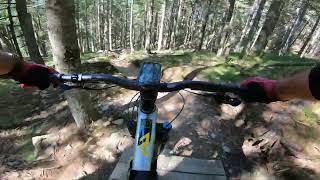
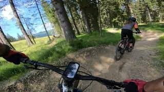
Photos of Rogla Mountain Bike
Videos of Rogla Mountain Bike
trail: Trail 9
14:51 |
36 |
Mar 3, 2026 , Rogla
trail: Trail 8
5:41 |
50 |
Dec 21, 2025 , Rogla

trail: Trail 8
11:00 |
38 |
Nov 24, 2025 , Rogla
trail: Proga 3
11:00 |
28 |
Nov 24, 2025 , Rogla

trail: Proga 2 and 4
11:00 |
29 |
Nov 24, 2025 , Rogla
trail: Proga 2 and 4
3:16 |
124 |
Aug 26, 2024 , Rogla
trail: Proga 3
2:43 |
85 |
Aug 26, 2024 , Rogla
trail: Trail 8
6:36 |
126 |
Aug 25, 2024 , Rogla
Recent Trail Reports
| status | trail | date | condition | info | user |
|---|---|---|---|---|---|
| Connector Trail Lower | Jun 28, 2025 @ 7:04am Jun 28, 2025 | Ideal | Ha22y AED Maribor | ||
| Proga 2 and 4 | Jun 28, 2025 @ 7:04am Jun 28, 2025 | Ideal | Ha22y AED Maribor | ||
| Proga 7 and 6 | Aug 25, 2024 @ 10:37am Aug 25, 2024 | Ideal | Vajtos | ||
| Proga 3 | Aug 25, 2024 @ 10:37am Aug 25, 2024 | Ideal | Vajtos | ||
| Trail 8 | Aug 25, 2024 @ 10:37am Aug 25, 2024 | Dry | Vajtos | ||
| Trail 9 | Aug 25, 2024 @ 10:37am Aug 25, 2024 | Dry | Vajtos | ||
| Pesek - Rogla Climb | Sep 18, 2023 @ 7:30am Sep 18, 2023 | Ideal | tomazs6 | ||
| Proga 5 | Aug 24, 2023 @ 1:54am Aug 24, 2023 | Ideal | Vajtos | ||
| Connector Trail Upper | Jun 25, 2023 @ 3:08am Jun 25, 2023 | Ideal | Vajtos |
Activity Feed
| username | action | type | title | date |
|---|---|---|---|---|
| DominikMuc | wishlist | region | activity #96010456 | Jun 1, 2026 @ 5:21am Jun 1, 2026 |
| gaborkurucz89 | wishlist | region | activity #94677617 | May 14, 2026 @ 3:25am May 14, 2026 |
| btpaZR | wishlist | trail | activity #92061527 | Apr 6, 2026 @ 9:57am Apr 6, 2026 |
| vuk1976 | add | video | activity #89907549 | Mar 3, 2026 @ 11:21am Mar 3, 2026 |
| vuk1976 | add | video | activity #85840652 | Dec 21, 2025 @ 7:05am Dec 21, 2025 |
Recent Comments
| username | type | title | comment | date |
|---|---|---|---|---|
| trail | Really nice fun trail, suitable for everyone. | Jul 13, 2024 @ 8:56am Jul 13, 2024 | ||
| trail | Super easy and flowy trail. Good for... | Aug 31, 2023 @ 7:27am Aug 31, 2023 | ||
| trail | C Če bi uredili zadnji del bi bilo to kar piše | Jul 15, 2023 @ 7:31am Jul 15, 2023 | ||
| trail | Small but very good bike park. There are up to... | Apr 13, 2018 @ 5:59am Apr 13, 2018 | ||
| trail | Small but very good bike park. There are up to... | Apr 13, 2018 @ 5:59am Apr 13, 2018 |
Local Badges
-

Epic Mountain Bike Climb 2k2 awarded -

Climbing 10k Badge0 awarded -

Mountain Biking 100k Badge0 awarded -

Epic Ride Descent 2k2 awarded -

Descent 10k Badge0 awarded -

Descent 100k Badge0 awarded
Bike & Skill Parks
| name | type | city | rating |
|---|---|---|---|
| Bike Park Rogla | bike park | Rogla |
Activity Type Stats
| activitytype | trails | distance | descent | descent distance | total vertical | rating | global rank | state rank | photos | reports | routes | ridelogs |
|---|---|---|---|---|---|---|---|---|---|---|---|---|
| Mountain Bike | 11 | 7 miles | 3,087 ft | 5 miles | 1,243 ft | #2,965 | #26 | 12 | 47 | 2 | 492 | |
| E-Bike | 3 | 3 miles | 1,083 ft | 2 miles | 1,243 ft | 42 | 85 | |||||
| Hike | 2 | 3 miles | 1,083 ft | 2 miles | 1,243 ft | 42 | 1 | 137 | ||||
| Trail Running | 2 | 3 miles | 1,083 ft | 2 miles | 1,243 ft | 42 | 18 |
Frequently Asked Questions About Rogla
▼
What are the best places to ride in Rogla?
Rogla has 1 areas to explore for mountain biking. The top rated areas are:
▼
What are the highest rated mountain biking trails in Rogla?
The highest rated mountain biking trails in Rogla are:
- Proga 7 and 6 (4.4/5)
- Proga 3 (4.3/5)
- Proga 2 and 4 (4.3/5)
- Proga 5 (4.2/5)
- Trail 8 (4.1/5)
▼
What is the best time of the year to ride in Rogla?
Based on ride log data, the most popular months to ride in Rogla are:
- December (7 activities)
- September (6 activities)
- April (4 activities)
▼
Where can I park to ride in Rogla?
There are 2 parking locations listed in Rogla. The most popular parking spots are:
Activities
Trails
Points of Interest
- By zocknroll
 TRAILFORKS TRAILANDIJA & contributors
 - Admins: star69
- #33249 - 3,025 views
- rogla activity log | embed map of Rogla mountain bike trails | rogla mountain biking points of interest
Downloading of trail gps tracks in kml & gpx formats is enabled for Rogla.
You must login to download files.