close
-
Layers w
- Weather Layers
- Pro
- Pro
- Pro
- Pro
- Pro
- Pro
- More Layers
- Pro
- Pro
- Pro
- Pro
-
Upgrade to

3D
Trail Conditions
- Unknown
- Snow Groomed
- Snow Packed
- Snow Covered
- Snow Cover Partial
- Freeze/thaw Cycle
- Icy
- Prevalent Mud
- Wet
- Variable
- Ideal
- Dry
- Very Dry
Trail Flow (Ridden Direction)
Trailforks scans users ridelogs to determine the most popular direction each trail is ridden. A good flowing trail network will have most trails flowing in a single direction according to their intension.
The colour categories are based on what percentage of riders are riding a trail in its intended direction.
The colour categories are based on what percentage of riders are riding a trail in its intended direction.
- > 96%
- > 90%
- > 80%
- > 70%
- > 50%
- < 50%
- bi-directional trail
- no data
Trail Last Ridden
Trailforks scans ridelogs to determine the last time a trail was ridden.
- < 2 days
- < 1 week
- < 2 weeks
- < 1 month
- < 6 months
- > 6 months
Trail Ridden Direction
The intended direction a trail should be ridden.
- Downhill Only
- Downhill Primary
- Both Directions
- Uphill Primary
- Uphill Only
- One Direction
Contribute Details
Colors indicate trail is missing specified detail.
- Description
- Photos
- Description & Photos
- Videos
Trail Popularity ?
Trailforks scans ridelogs to determine which trails are ridden the most in the last 9 months.
Trails are compared with nearby trails in the same city region with a possible 25 colour shades.
Think of this as a heatmap, more rides = more kinetic energy = warmer colors.
- most popular
- popular
- less popular
- not popular
ATV/ORV/OHV Filter
Max Vehicle Width
inches
US Cell Coverage
Legend

Radar Time
Activity Recordings
Trailforks uses anonymized public activity data.
?
Activity Recordings
Trailforks uses anonymized public activity data.
?
Personal Heatmap
▶
Activity Types
all
/
none
▶
Options
2
Date range
month
–
Winter Trails
Warning
A routing network for winter maps does not exist. Selecting trails using the winter trails layer has been disabled.
Missing Trails
Most Popular
Least Popular
Trails are colored based on popularity. The more popular a trail is, the more red. Less popular trails trend towards green.
Jump Magnitude Heatmap
Heatmap of where riders jump on trails. Zoom in to see individual jumps, click circles to view jump details.
BC Backroad Status
![map legend]()
Service Road Atlas is a free to use, community-driven service for viewing and creating reports on the numerous back-country service roads around B.C. and Alberta.

Slope Aspect
Direction the slope faces
Trails Deemphasized
Trails are shown in grey.
Only show trails with no bike usage.
Suggested Layers
Based on selected activity type
Save the current map location and zoom level as your default home location whenever this page is loaded.
Save
No description for Rouen has been added yet!
Login or register to submit one.
This region uses the Uk/Euro style trail grading system.
Activities Click to view
- Mountain Bike
151 trails
- E-Bike
121 trails
- Adaptive Bike
0 trails
- Winter Fat Bike
0 trails
- Horse
35 trails
- Hike
139 trails
- Trail Running
139 trails
Region Details
- 14
- 83
- 49
- 2
Region Status
Open as of Jun 1, 2026Local Trail Association
Stats
- Avg Trail Rating
- Trails (view details)
- 148
- Trails Mountain Bike
- 151
- Trails E-Bike
- 121
- Trails Horse
- 35
- Trails Hike
- 139
- Trails Trail Running
- 139
- Trails Dirtbike/Moto
- 1
- Total Distance
- 87 miles
- Total Descent
- 17,943 ft
- Total Vertical
- 581 ft
- Highest Trailhead
- 587 ft
- Reports
- 2,117
- Photos
- 33
- Ridden Counter
- 1,853
Sub Regions
-
Foret de Domaniale du Trait Maulevrier (Duclair)
- 12
- 23
- 1
-
Forêt de la Londe
- 29
- 9
- 1
-
Foret de Roumare
- 37
- 15
-
Foret Verte
- 5
- 1
Popular Rouen Mountain Biking Trails
• 100 ★ 3.0 • 1,442 ft • 41 ft • 35 •
Popular blue difficulty singletrack. This mountain bike primary trail can be used downhill primary. It features skinny. On average it takes 1 minutes to complete this trail.
• 85 ★ 4.0 • 2,274 ft • 7 ft • 30 •
Popular green difficulty singletrack. This mountain bike primary trail can be used both directions. On average it takes 3 minutes to complete this trail.
• 90 ★ 4.6 • 4,991 ft • 23 ft • 28 •
Popular green difficulty family friendly singletrack. This mountain bike primary trail can be used downhill primary. It features roller coaster. On average it takes 6 minutes to complete this trail.
• 65 ★ 4.7 • 1,155 ft • 30 ft • 28 •
Moderately popular green difficulty singletrack. This mountain bike primary trail can be used both directions and has a easy overall physical rating with a 30 ft green climb. Trail visibility is always easy to follow. On average it takes 1 minutes to complete this trail.
• 60 ★ 5.0 • 3,453 ft • 33 ft • 24 •
Moderately popular blue difficulty singletrack. This mountain bike primary trail can be used both directions and has a moderate overall physical rating with a 33 ft blue climb. It features berm. Trail visibility is sometimes hard to follow. On average it takes 4 minutes to complete this trail.
• 40 ★ 4.0 • 2,382 ft • 0 ft • 24 •
Moderately popular blue difficulty singletrack. This mountain bike primary trail can be used both directions. On average it takes 2 minutes to complete this trail.
• 75 ★ 3.0 • 3,015 ft • 0 ft • 23 •
Popular blue difficulty singletrack. This mountain bike primary trail can be used both directions and has a moderate overall physical rating with a 0 ft blue climb. On average it takes 2 minutes to complete this trail.
• 100 ★ 0.0 • 1 mile • 25 ft • 23 •
Popular green difficulty singletrack. This mountain bike primary trail can be used both directions and has a easy overall physical rating with a 25 ft green climb. On average it takes 8 minutes to complete this trail.
Rouen Mountain Bike Routes
18 miles • 2,023 ft • 10 • Loop •
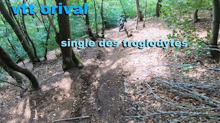
Trace inspirée des EndurOrival du challenge Enduro Normandie Series. Les spéciales sont très roulantes...
25 miles • 1,799 ft • 0 • Loop •
Tour de la Foret Verte avec depart de Canteleu
Videos of Rouen Mountain Bike

trail: Momo
3:31 |
22834 |
Feb 2, 2017

trail: Momo
4:42 |
21169 |
Dec 24, 2014
trail: Forêt Noire
0:12 |
122 |
Aug 31, 2013
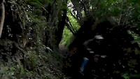
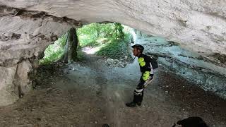
trail: Grottes Orival
10:59 |
159 |
Mar 12, 2023 , Rouen

trail: Robert le Diable
10:59 |
85 |
Feb 2, 2023 , Rouen
trail: Sous les 17 Tournants
10:59 |
187 |
Feb 2, 2023 , Rouen

trail: Roches pt3
10:59 |
86 |
Feb 2, 2023 , Rouen

trail: Roches pt2
10:59 |
107 |
Feb 2, 2023 , Rouen
Current Trail Warnings
| status | trail | date | condition | user | info |
|---|---|---|---|---|---|
| Javelina | Jun 1, 2026 @ 4:07pm (Europe/Paris) Jun 1, 2026 | Dry | r-p-x | Chantier forestier au début, un peu... |
Recent Trail Reports
Activity Feed
| username | action | type | title | date |
|---|---|---|---|---|
| fvtt | like | report | activity #96032218 | Jun 1, 2026 @ 11:53am Jun 1, 2026 |
| r-p-x | add | report | activity #96015000 | Jun 1, 2026 @ 7:07am Jun 1, 2026 |
| fvtt | add | report | activity #95236049 and 5 more | May 22, 2026 @ 5:54am May 22, 2026 |
| r-p-x | comment | report | activity #94376941 | May 9, 2026 @ 2:04pm May 9, 2026 |
| fvtt | comment | report | activity #94216330 | May 7, 2026 @ 7:38am May 7, 2026 |
Recent Comments
| username | type | title | comment | date |
|---|---|---|---|---|
| report | Super ! Merci 👍 | May 9, 2026 @ 2:04pm May 9, 2026 | ||
| report | C'est nettoyé! | May 7, 2026 @ 7:38am May 7, 2026 | ||
| report | Une belle passerelle a été mise sur un... | Apr 26, 2026 @ 1:44am Apr 26, 2026 | ||
| report | Découvert aujourd'hui, effectivement deux... | Mar 8, 2026 @ 4:17pm Mar 8, 2026 | ||
| report | Effectivement, j'ai vu ça aujourd'hui..... | Sep 21, 2025 @ 2:12pm Sep 21, 2025 |
Local Badges
-

10 Green Trails33 awarded -

Epic Ride Climb 2k35 awarded -

Climbing 10k Badge40 awarded -

Climbing 100k Badge9 awarded -

Epic Ride Descent 2k36 awarded -

Descent 10k Badge40 awarded
Activity Type Stats
| activitytype | trails | distance | descent | descent distance | total vertical | rating | global rank | state rank | photos | reports | routes | ridelogs |
|---|---|---|---|---|---|---|---|---|---|---|---|---|
| Mountain Bike | 151 | 87 miles | 17,943 ft | 50 miles | 581 ft | #1,217 | #22 | 33 | 2,117 | 3 | 8,049 | |
| E-Bike | 121 | 71 miles | 14,964 ft | 41 miles | 581 ft | #1,667 | #100 | 2,079 | 2 | 1,063 | ||
| Horse | 35 | 26 miles | 3,041 ft | 13 miles | 446 ft | #825 | #35 | 58 | ||||
| Hike | 139 | 82 miles | 16,729 ft | 47 miles | 502 ft | #2,373 | #57 | 2,111 | 520 | |||
| Trail Running | 139 | 82 miles | 16,729 ft | 47 miles | 502 ft | #1,925 | #50 | 2,111 | 174 | |||
| Dirtbike/Moto | 1 | 4,567 ft | 135 ft | 2,516 ft | 105 ft | 52 | 1 |
Frequently Asked Questions About Rouen
▼
What are the best places to ride in Rouen?
Rouen has 4 areas to explore for mountain biking. The top rated areas are:
▼
What are the highest rated mountain biking trails in Rouen?
The highest rated mountain biking trails in Rouen are:
- Mare Lecompte (4.3/5)
- Pistatof (4.3/5)
- Autoroute (4.3/5)
- La piquante (4.2/5)
- Roro dantesque version longue (4.2/5)
▼
What is the best time of the year to ride in Rouen?
Based on ride log data, the most popular months to ride in Rouen are:
- May (51 activities)
- June (42 activities)
- July (40 activities)
▼
Where can I park to ride in Rouen?
There are 11 parking locations listed in Rouen. The most popular parking spots are: View all parking and trailhead locations on the map to plan your visit.
Activities
- By liebherrmaster & contributors
- Admins: VTT Rouen, EnDHuro76
- #13379 - 4,725 views
- rouen activity log | embed map of Rouen mountain bike trails | rouen mountain biking points of interest
Downloading of trail gps tracks in kml & gpx formats is enabled for Rouen.
You must login to download files.