close
-
Layers w
- Weather Layers
- Pro
- Pro
- Pro
- Pro
- Pro
- Pro
- More Layers
- Pro
- Pro
- Pro
- Pro
-
Upgrade to

3D
Trail Conditions
- Unknown
- Snow Groomed
- Snow Packed
- Snow Covered
- Snow Cover Partial
- Freeze/thaw Cycle
- Icy
- Prevalent Mud
- Wet
- Variable
- Ideal
- Dry
- Very Dry
Trail Flow (Ridden Direction)
Trailforks scans users ridelogs to determine the most popular direction each trail is ridden. A good flowing trail network will have most trails flowing in a single direction according to their intension.
The colour categories are based on what percentage of riders are riding a trail in its intended direction.
The colour categories are based on what percentage of riders are riding a trail in its intended direction.
- > 96%
- > 90%
- > 80%
- > 70%
- > 50%
- < 50%
- bi-directional trail
- no data
Trail Last Ridden
Trailforks scans ridelogs to determine the last time a trail was ridden.
- < 2 days
- < 1 week
- < 2 weeks
- < 1 month
- < 6 months
- > 6 months
Trail Ridden Direction
The intended direction a trail should be ridden.
- Downhill Only
- Downhill Primary
- Both Directions
- Uphill Primary
- Uphill Only
- One Direction
Contribute Details
Colors indicate trail is missing specified detail.
- Description
- Photos
- Description & Photos
- Videos
Trail Popularity ?
Trailforks scans ridelogs to determine which trails are ridden the most in the last 9 months.
Trails are compared with nearby trails in the same city region with a possible 25 colour shades.
Think of this as a heatmap, more rides = more kinetic energy = warmer colors.
- most popular
- popular
- less popular
- not popular
ATV/ORV/OHV Filter
Max Vehicle Width
inches
US Cell Coverage
Legend

Radar Time
Activity Recordings
Trailforks uses anonymized public activity data.
?
Activity Recordings
Trailforks uses anonymized public activity data.
?
Personal Heatmap
▶
Activity Types
all
/
none
▶
Options
2
Date range
month
–
Winter Trails
Warning
A routing network for winter maps does not exist. Selecting trails using the winter trails layer has been disabled.
Missing Trails
Most Popular
Least Popular
Trails are colored based on popularity. The more popular a trail is, the more red. Less popular trails trend towards green.
Jump Magnitude Heatmap
Heatmap of where riders jump on trails. Zoom in to see individual jumps, click circles to view jump details.
BC Backroad Status
![map legend]()
Service Road Atlas is a free to use, community-driven service for viewing and creating reports on the numerous back-country service roads around B.C. and Alberta.

Slope Aspect
Direction the slope faces
Trails Deemphasized
Trails are shown in grey.
Only show trails with no bike usage.
Suggested Layers
Based on selected activity type
Save the current map location and zoom level as your default home location whenever this page is loaded.
SaveLittle hill above Belfort
Primary Trail Type: All-Mountain & Downhill
Shuttleable: YES
Land Status: Community Forest
 google parking directions
 Access Info:
first car park while you climb up the road
This region uses the Uk/Euro style trail grading system.
Activities Click to view
- Mountain Bike
23 trails
- E-Bike
23 trails
- Hike
9 trails
- Trail Running
9 trails
Region Details
- 1
- 1
- 12
- 1
- 7
- 1
Region Status
Open as of May 16, 2026Stats
- Avg Trail Rating
- Trails (view details)
- 23
- Trails Mountain Bike
- 23
- Trails E-Bike
- 23
- Trails Hike
- 9
- Trails Trail Running
- 9
- Total Distance
- 11 miles
- Total Descent
- 5,381 ft
- Total Vertical
- 807 ft
- Highest Trailhead
- 2,071 ft
- Reports
- 383
- Photos
- 21
- Ridden Counter
- 1,247
Popular Salbert Mountain Biking Trails
• 100 ★ 5.0 • 5,054 ft • 39 ft • 120 •
Popular blue difficulty singletrack. This mountain bike primary trail can be used downhill only and has a easy overall physical rating with a 39 ft green climb. It features jump. On average it takes 4 minutes to complete this trail.
• 100 ★ 5.0 • 1,105 ft • 0 ft • 116 •
Popular green difficulty singletrack. This mountain bike primary trail can be used downhill primary. On average it takes minutes to complete this trail.
• 70 ★ 4.0 • 1,768 ft • 3 ft • 86 •
nice singletrack with some steep bits and switch back àa the beginning and the end a long flat section in the middle
• 75 ★ 5.0 • 958 ft • 0 ft • 64 •
Popular black difficulty singletrack. This mountain bike primary trail can be used downhill primary. It features rock garden. On average it takes 2 minutes to complete this trail.
• 85 ★ 3.0 • 2,951 ft • 10 ft • 63 •
Brand new trail 2019 S-Line for school line Many berms and table top
• 55 ★ 4.0 • 4,055 ft • 0 ft • 61 •
Moderately popular black difficulty singletrack. This mountain bike primary trail can be used downhill primary. It features drop, jump and rock garden. On average it takes 4 minutes to complete this trail.
Salbert Mountain Bike Routes
• 11 miles • 3,303 ft • 10 •
• 23 miles • 4,011 ft • 9 •
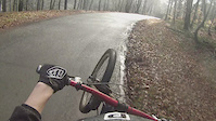
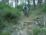
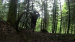
Photos of Salbert Mountain Bike
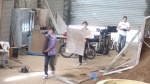
Videos of Salbert Mountain Bike
trail: Gambas
4:12 |
101 |
Feb 9, 2016

trail: La route
0:36 |
118 |
Oct 18, 2015
trail: Mousse
2:30 |
327 |
Feb 24, 2014
trail: Ré-émetteur
4:52 |
361 |
Mar 28, 2013
trail: Gourmandise
11:57 |
1057 |
Feb 15, 2011

trail: Grizzly
5:45 |
490 |
Oct 30, 2010
trail: Mysterio 1
2:26 |
457 |
May 20, 2010
trail: Mousse
3:10 |
480 |
Oct 18, 2009
Recent Trail Reports
| status | trail | date | condition | info | user |
|---|---|---|---|---|---|
| Gambas | May 16, 2026 @ 1:59pm (Europe/Zurich) May 16, 2026 | Ideal | nobrain | ||
| Remontée face Nord easy | May 16, 2026 @ 1:59pm (Europe/Zurich) May 16, 2026 | Ideal | nobrain | ||
| Peanut | May 16, 2026 @ 1:59pm (Europe/Zurich) May 16, 2026 | Ideal | nobrain | ||
| Ré-émetteur | May 16, 2026 @ 1:59pm (Europe/Zurich) May 16, 2026 | Ideal | nobrain | ||
| Gypsy 3 | Apr 5, 2026 @ 1:45pm (Europe/Zurich) Apr 5, 2026 | Ideal | gempen72 | ||
| Gipsy 2 | Apr 5, 2026 @ 1:45pm (Europe/Zurich) Apr 5, 2026 | Ideal | gempen72 | ||
| Gourmandise | Apr 5, 2026 @ 1:45pm (Europe/Zurich) Apr 5, 2026 | Ideal | gempen72 | ||
| S-Line | Apr 5, 2026 @ 1:45pm (Europe/Zurich) Apr 5, 2026 | Ideal | gempen72 | ||
| Gargamel | Mar 15, 2026 @ 1:04pm (Europe/Zurich) Mar 15, 2026 | Variable | nobrain | ||
| Gipsy 1 | Feb 28, 2026 @ 9:03am (Europe/Zurich) Feb 28, 2026 | Ideal | nobrain |
Activity Feed
| username | action | type | title | date |
|---|---|---|---|---|
| nobrain | add | report | activity #94833077 and 4 more | May 16, 2026 @ 10:47am May 16, 2026 |
| provencemb | update | trail | activity #94217982 | May 7, 2026 @ 8:10am May 7, 2026 |
| freeridefox420 | wishlist | trail | activity #93892315 | May 2, 2026 @ 1:54pm May 2, 2026 |
| gempen72 | add | report | activity #91991509 and 6 more | Apr 5, 2026 @ 10:43am Apr 5, 2026 |
| nobrain | add | report | activity #90659155 and 2 more | Mar 15, 2026 @ 2:01pm Mar 15, 2026 |
Nearby Areas
| name | distance | ||||
|---|---|---|---|---|---|
| Ballon d'Alsace | 2 | 11.3 km | |||
| Ride A Mollau | 6 | 24 | 16.3 km | ||
| Bikepark du Markstein | 1 | 2 | 21 km | ||
| Enduro Bressaud | 1 | 17 | 7 | 24.4 km | |
| Glaserberg | 1 | 2 | 26.2 km |
Local Badges
-

Completionist0 awarded
Activity Type Stats
| activitytype | trails | distance | descent | descent distance | total vertical | rating | global rank | state rank | photos | reports | routes | ridelogs |
|---|---|---|---|---|---|---|---|---|---|---|---|---|
| Mountain Bike | 23 | 11 miles | 5,381 ft | 7 miles | 807 ft | #3,835 | #80 | 21 | 378 | 1 | 711 | |
| E-Bike | 23 | 11 miles | 5,381 ft | 7 miles | 807 ft | #3,809 | #127 | 344 | 1 | 174 | ||
| Hike | 9 | 7 miles | 1,690 ft | 2 miles | 686 ft | #7,655 | #169 | 350 | 47 | |||
| Trail Running | 9 | 7 miles | 1,690 ft | 2 miles | 686 ft | #6,875 | #165 | 350 | 8 |
Frequently Asked Questions About Salbert
▼
What are the highest rated mountain biking trails in Salbert?
The highest rated mountain biking trails in Salbert are:
- Gambas (4.3/5)
- Ré-émetteur (4.1/5)
- Gipsy 2 (4.1/5)
- Mysterio 1 (4.1/5)
- Gipsy 1 (4.1/5)
▼
What is the best time of the year to ride in Salbert?
Based on ride log data, the most popular months to ride in Salbert are:
- May (7 activities)
- July (3 activities)
- December (3 activities)
▼
Where can I park to ride in Salbert?
There are 1 parking locations listed in Salbert. The most popular parking spots are:
▼
What is the longest trail in Salbert?
The longest trail in Salbert is Montée Vita-Goulet at 1.6 miles. View all trails sorted by distance.
- By nobrain
 & contributors
 - Admins: apply
- #10373 - 4,310 views
- salbert activity log | embed map of Salbert mountain bike trails | salbert mountain biking points of interest
Downloading of trail gps tracks in kml & gpx formats is enabled for Salbert.
You must login to download files.