close
-
Layers w
- Weather Layers
- Pro
- Pro
- Pro
- Pro
- Pro
- Pro
- More Layers
- Pro
- Pro
- Pro
- Pro
-
Upgrade to

3D
Trail Conditions
- Unknown
- Snow Groomed
- Snow Packed
- Snow Covered
- Snow Cover Partial
- Freeze/thaw Cycle
- Icy
- Prevalent Mud
- Wet
- Variable
- Ideal
- Dry
- Very Dry
Trail Flow (Ridden Direction)
Trailforks scans users ridelogs to determine the most popular direction each trail is ridden. A good flowing trail network will have most trails flowing in a single direction according to their intension.
The colour categories are based on what percentage of riders are riding a trail in its intended direction.
The colour categories are based on what percentage of riders are riding a trail in its intended direction.
- > 96%
- > 90%
- > 80%
- > 70%
- > 50%
- < 50%
- bi-directional trail
- no data
Trail Last Ridden
Trailforks scans ridelogs to determine the last time a trail was ridden.
- < 2 days
- < 1 week
- < 2 weeks
- < 1 month
- < 6 months
- > 6 months
Trail Ridden Direction
The intended direction a trail should be ridden.
- Downhill Only
- Downhill Primary
- Both Directions
- Uphill Primary
- Uphill Only
- One Direction
Contribute Details
Colors indicate trail is missing specified detail.
- Description
- Photos
- Description & Photos
- Videos
Trail Popularity ?
Trailforks scans ridelogs to determine which trails are ridden the most in the last 9 months.
Trails are compared with nearby trails in the same city region with a possible 25 colour shades.
Think of this as a heatmap, more rides = more kinetic energy = warmer colors.
- most popular
- popular
- less popular
- not popular
ATV/ORV/OHV Filter
Max Vehicle Width
inches
US Cell Coverage
Legend

Radar Time
Activity Recordings
Trailforks uses anonymized public activity data.
?
Activity Recordings
Trailforks uses anonymized public activity data.
?
Personal Heatmap
▶
Activity Types
all
/
none
▶
Options
2
Date range
month
–
Winter Trails
Warning
A routing network for winter maps does not exist. Selecting trails using the winter trails layer has been disabled.
Missing Trails
Most Popular
Least Popular
Trails are colored based on popularity. The more popular a trail is, the more red. Less popular trails trend towards green.
Jump Magnitude Heatmap
Heatmap of where riders jump on trails. Zoom in to see individual jumps, click circles to view jump details.
BC Backroad Status
![map legend]()
Service Road Atlas is a free to use, community-driven service for viewing and creating reports on the numerous back-country service roads around B.C. and Alberta.

Slope Aspect
Direction the slope faces
Trails Deemphasized
Trails are shown in grey.
Only show trails with no bike usage.
Suggested Layers
Based on selected activity type
Save the current map location and zoom level as your default home location whenever this page is loaded.
Save
No description for Salisbury has been added yet!
Login or register to submit one.
This region uses the Uk/Euro style trail grading system.
Activities Click to view
- Mountain Bike
15 trails
- E-Bike
7 trails
- Gravel Bike
0 trails
- Adaptive Bike
0 trails
- Winter Fat Bike
0 trails
- Hike
1 trails
- Trail Running
1 trails
Region Details
- 2
- 1
- 3
- 7
- 2
Region Status
Open as of Jun 18, 2025Stats
- Avg Trail Rating
- Trails (view details)
- 15
- Trails Mountain Bike
- 15
- Trails E-Bike
- 7
- Trails Hike
- 1
- Trails Trail Running
- 1
- Trails Dirtbike/Moto
- 1
- Total Distance
- 5 miles
- Total Descent
- 2,124 ft
- Total Vertical
- 461 ft
- Highest Trailhead
- 614 ft
- Reports
- 44
- Photos
- 109
- Ridden Counter
- 2,689
Sub Regions
-
Tidworth Freeride Park
- 2
- 7
- 2
Popular Salisbury Mountain Biking Trails
• 95 ★ 4.4 • 1,385 ft • 0 ft • 275 •
Fun trail starting at a podium type structure leading to fast rooty section with a few small drops. Then the trail opens out into some super flowy berms. As these are constructed out of chalk don't ride if its wet!! Then there are a few...
• 80 ★ 4.0 • 1,667 ft • 0 ft • 221 •
Popular red difficulty singletrack. This mountain bike primary trail can be used downhill only. On average it takes 6 minutes to complete this trail.
• 55 ★ 5.0 • 1,520 ft • 0 ft • 196 •
"Recently reworked in collaboration with B1KE’s partners in grime, ‘DirtKraft’, is Fun on Flow and Freeride hits. It is a series of jumps that descends pretty much straight down the hill. Starting with a fairly innocuous step up...
• 50 ★ 0.0 • 1,581 ft • 0 ft • 186 •
"Sick note is the easier of the DH trails initially contouring across the top of the hill and then picking up pace as it begins to descend. Offering a number of rollable challenges which include rollers small table tops and a couple of...
• 90 ★ 5.0 • 1,470 ft • 0 ft • 172 •
Popular blue difficulty singletrack. This mountain bike primary trail can be used downhill only. It features berm, drop and jump. On average it takes 4 minutes to complete this trail.
• 100 ★ 0.0 • 1,345 ft • 0 ft • 166 •
"River flow is one of the more natural trails it requires the rider to work harder to find their flow. There are series of slightly larger drops which are not quite rollable linking some tight corners will test your ability more the...
• 5 ★ 4.6 • 1,850 ft • 0 ft • 160 •
A fun black-rated trail with very technical drops and steps in the top section with a fun line of average size dirt jumps at the bottom.
• 5 ★ 0.0 • 1,772 ft • 0 ft • 152 •
Less popular red difficulty singletrack. This mountain bike primary trail can be used downhill only. On average it takes 7 minutes to complete this trail.
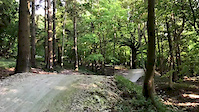
Photos of Salisbury Mountain Bike
Videos of Salisbury Mountain Bike
trail: Collingbourne Gully Run
0:09 |
237 |
Sep 5, 2020
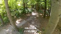
trail: Oblivion
0:51 |
335 |
May 21, 2019
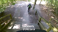
trail: Sick Note
0:29 |
211 |
May 21, 2019

0:18 |
1 |
Dec 3, 2018

0:18 |
109 |
Dec 3, 2018
0:38 |
192 |
Aug 9, 2018
0:36 |
23 |
Aug 9, 2018
trail: White Line
0:14 |
798 |
Aug 9, 2018
Recent Trail Reports
| status | trail | date | condition | info | user |
|---|---|---|---|---|---|
| Collingbourne Gully Run | Jun 5, 2023 @ 1:14am Jun 5, 2023 | Dry | rorykendrick1978 | ||
| Oblivion | Aug 13, 2022 @ 3:53am Aug 13, 2022 | Very Dry | moggers | ||
| Broken Bridges | Aug 31, 2021 @ 10:31am Aug 31, 2021 | Ideal | Cnorris1978 | ||
| Sick Note | Apr 11, 2021 @ 7:54am Apr 11, 2021 | Dry | Polfrey | ||
| River Flow | Apr 11, 2021 @ 7:54am Apr 11, 2021 | Dry | Polfrey | ||
| 99 Beeches | Apr 11, 2021 @ 7:54am Apr 11, 2021 | Dry | Polfrey | ||
| Harewarren Woods Access Track | Oct 27, 2020 @ 12:53am Oct 27, 2020 | Wet | SurlyBen | ||
| Hooper Struve | Aug 30, 2020 @ 3:52am Aug 30, 2020 | Dry | smithfeeble | ||
| Tidworth Freeride Park Push-Up #2 | Aug 30, 2020 @ 3:52am Aug 30, 2020 | Dry | smithfeeble | ||
| White Line | Jun 5, 2020 @ 6:28pm Jun 5, 2020 | Dry | corkblork |
Activity Feed
| username | action | type | title | date |
|---|---|---|---|---|
| Dukeinlondon | add | trail | activity #84381444 | Nov 19, 2025 @ 1:23am Nov 19, 2025 |
| Charlie12artpro | wishlist | region | activity #79427760 | Sep 1, 2025 @ 11:12am Sep 1, 2025 |
| Ollie9518 | wishlist | region | activity #76954871 | Jul 29, 2025 @ 8:02am Jul 29, 2025 |
| gabt | add | photo | activity #76438763 | Jul 22, 2025 @ 12:36am Jul 22, 2025 |
| William0101 | add | photo | activity #73146199 | Jun 5, 2025 @ 11:43am Jun 5, 2025 |
Recent Comments
| username | type | title | comment | date |
|---|---|---|---|---|
| trail | I think this trail no longer exists - local... | Nov 12, 2023 @ 2:13am Nov 12, 2023 | ||
| report | There are some other trails to ride that feed... | Jul 6, 2020 @ 12:35am Jul 6, 2020 | ||
| trail | Tidworth should have a track called:... | Jan 29, 2020 @ 11:23am Jan 29, 2020 |
Local Badges
-

Epic Ride Climb 2k18 awarded -

Climbing 10k Badge21 awarded -

Climbing 100k Badge1 awarded -

Epic Ride Descent 2k18 awarded -

Descent 10k Badge21 awarded -

Descent 100k Badge1 awarded
Bike & Skill Parks
| name | type | city | rating |
|---|---|---|---|
| Tidworth Freeride Park | bike park | Salisbury | |
| Andover BMX Track | skill park | Salisbury | |
| Knightwood BMX Track | skill park | Salisbury |
Activity Type Stats
| activitytype | trails | distance | descent | descent distance | total vertical | rating | global rank | state rank | photos | reports | routes | ridelogs |
|---|---|---|---|---|---|---|---|---|---|---|---|---|
| Mountain Bike | 15 | 5 miles | 2,123 ft | 4 miles | 463 ft | #3,136 | #98 | 109 | 44 | 5,777 | ||
| E-Bike | 7 | 3 miles | 928 ft | 2 miles | 463 ft | #3,938 | #146 | 43 | 279 | |||
| Hike | 1 | 3,622 ft | 13 ft | 1,050 ft | 10 ft | #7,081 | #195 | 36 | 497 | |||
| Trail Running | 1 | 3,622 ft | 13 ft | 1,050 ft | 10 ft | #6,576 | #185 | 36 | 109 | |||
| Dirtbike/Moto | 1 | 6 | 1 |
Frequently Asked Questions About Salisbury
▼
What are the best places to ride in Salisbury?
Salisbury has 1 areas to explore for mountain biking. The top rated areas are:
▼
What are the highest rated mountain biking trails in Salisbury?
The highest rated mountain biking trails in Salisbury are:
- Hooper Struve (4.3/5)
- 99 Beeches (4.2/5)
- General Berminator (4.2/5)
- Sick Note (4.2/5)
- White Line (4.1/5)
▼
What is the best time of the year to ride in Salisbury?
Based on ride log data, the most popular months to ride in Salisbury are:
- April (22 activities)
- October (19 activities)
- September (16 activities)
▼
Where can I park to ride in Salisbury?
There are 1 parking locations listed in Salisbury. The most popular parking spots are:
- By cranxwork & contributors
- Admins: wisey, MathieuC, cemoorelife
- #5051 - 8,498 views
- salisbury activity log | embed map of Salisbury mountain bike trails | salisbury mountain biking points of interest
Downloading of trail gps tracks in kml & gpx formats is enabled for Salisbury.
You must login to download files.