close
-
Layers w
- Weather Layers
- Pro
- Pro
- Pro
- Pro
- Pro
- Pro
- More Layers
- Pro
- Pro
- Pro
- Pro
-
Upgrade to

3D
Trail Conditions
- Unknown
- Snow Groomed
- Snow Packed
- Snow Covered
- Snow Cover Partial
- Freeze/thaw Cycle
- Icy
- Prevalent Mud
- Wet
- Variable
- Ideal
- Dry
- Very Dry
Trail Flow (Ridden Direction)
Trailforks scans users ridelogs to determine the most popular direction each trail is ridden. A good flowing trail network will have most trails flowing in a single direction according to their intension.
The colour categories are based on what percentage of riders are riding a trail in its intended direction.
The colour categories are based on what percentage of riders are riding a trail in its intended direction.
- > 96%
- > 90%
- > 80%
- > 70%
- > 50%
- < 50%
- bi-directional trail
- no data
Trail Last Ridden
Trailforks scans ridelogs to determine the last time a trail was ridden.
- < 2 days
- < 1 week
- < 2 weeks
- < 1 month
- < 6 months
- > 6 months
Trail Ridden Direction
The intended direction a trail should be ridden.
- Downhill Only
- Downhill Primary
- Both Directions
- Uphill Primary
- Uphill Only
- One Direction
Contribute Details
Colors indicate trail is missing specified detail.
- Description
- Photos
- Description & Photos
- Videos
Trail Popularity ?
Trailforks scans ridelogs to determine which trails are ridden the most in the last 9 months.
Trails are compared with nearby trails in the same city region with a possible 25 colour shades.
Think of this as a heatmap, more rides = more kinetic energy = warmer colors.
- most popular
- popular
- less popular
- not popular
ATV/ORV/OHV Filter
Max Vehicle Width
inches
US Cell Coverage
Legend

Radar Time
Activity Recordings
Trailforks uses anonymized public activity data.
?
Activity Recordings
Trailforks uses anonymized public activity data.
?
Personal Heatmap
▶
Activity Types
all
/
none
▶
Options
2
Date range
month
–
Winter Trails
Warning
A routing network for winter maps does not exist. Selecting trails using the winter trails layer has been disabled.
Missing Trails
Most Popular
Least Popular
Trails are colored based on popularity. The more popular a trail is, the more red. Less popular trails trend towards green.
Jump Magnitude Heatmap
Heatmap of where riders jump on trails. Zoom in to see individual jumps, click circles to view jump details.
BC Backroad Status
![map legend]()
Service Road Atlas is a free to use, community-driven service for viewing and creating reports on the numerous back-country service roads around B.C. and Alberta.

Slope Aspect
Direction the slope faces
Trails Deemphasized
Trails are shown in grey.
Only show trails with no bike usage.
Suggested Layers
Based on selected activity type
Save the current map location and zoom level as your default home location whenever this page is loaded.
Save
No description for Schlanders has been added yet!
Login or register to submit one.
eBikes Allowed:
Yes
AKA: Silandro
This region uses the Uk/Euro style trail grading system.
Activities Click to view
- Mountain Bike
85 trails
- E-Bike
85 trails
- Gravel Bike
0 trails
- Adaptive Bike
0 trails
- Winter Fat Bike
0 trails
- Hike
87 trails
- Trail Running
87 trails
- Downhill Ski
41 trails
Region Details
- 20
- 11
- 24
- 16
- 10
- 4
Region Status
Caution as of 3 daysStats
- Avg Trail Rating
- Trails (view details)
- 131
- Trails Mountain Bike
- 85
- Trails E-Bike
- 85
- Trails Hike
- 87
- Trails Trail Running
- 87
- Trails Downhill Ski
- 41
- Total Distance
- 293 miles
- Total Descent
- 152,159 ft
- Total Vertical
- 9,694 ft
- Highest Trailhead
- 10,663 ft
- Reports
- 575
- Photos
- 380
- Ridden Counter
- 4,794
Sub Regions
-
Vinschgau
- 11
- 24
- 17
- 9
- 2
Popular Schlanders Mountain Biking Trails
• 100 ★ 4.2 • 2 miles • 159 ft • 864 •
Track near Schlanders/Latsch, build in 2015 and sponsored and maintained by the german bike manufacturer with the same name. This trail is a freeride trail and some intermediate riding skills are needed for some of the features. Access...
• 100 ★ 4.6 • 3 miles • 1,146 ft • 670 •
Nice and Flowy trail traversing from the bottom of Holy Hansen to Laces town
• 100 ★ 4.1 • 2 miles • 545 ft • 281 •
Trail is closed every day until 3 pm. Quite exposed and narrow for the first 500 meters. Some roots, rocks and switchbacks can be walked if necessary. After a short downhill on a fire road the Propain/14er trail goes down to the left.
• 85 ★ 4.7 • 2 miles • 0 ft • 239 •
Alpine ridge trail with rocky and flowy sections that brings you from the top of the Goflaner Scharte to the KreuzJoch, where starts the treeline of the forest.
• 90 ★ 3.9 • 2 miles • 325 ft • 217 •
Epic alpine trail from Passo Stelvio to the Furkelhutte, with a good mix of flow and technical sections. Unique view on the north face of the Ortles.
• 75 ★ 4.7 • 3 miles • 62 ft • 196 •
Popular hiking path!!! First switchbacks are a bit difficult, after that the path goes along the Madritschbach as a multiple singletrack over some rocks. Some rocks require a good eye for the best line when riding fast. Mostly flat with...
Schlanders Mountain Bike Routes
★ 5.0 • 18 miles • 3,513 ft • 13 • Shuttled •
The Goldsee Trail has been one of the top trails in the Alps for decades. Since 2013, the combination with...
★ 3.8 • 14 miles • 3,825 ft • 0 • Loop •
The best way to reach the Holy Hansen trail from Goldrain town, up on a steep forest road.
16 miles • 237 ft • 0 •
Full descent from the Madritsch Joch to the ZufallHutte and then to the town of Goldrain through the...
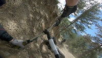
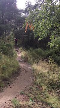
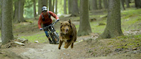
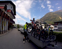
Photos of Schlanders Mountain Bike
Videos of Schlanders Mountain Bike

trail: Holy Hansen
0:00 |
119 |
Jan 4, 2022

trail: Flipsi Trail
0:54 |
155 |
Mar 30, 2021
trail: Flipsi Trail
0:08 |
183 |
Aug 18, 2020
trail: Holy Hansen
0:14 |
154 |
Jun 13, 2019
trail: Holy Hansen
4:00 |
5846 |
Nov 19, 2018
trail: Holy Hansen
7:37 |
87 |
Oct 24, 2018
youtuber
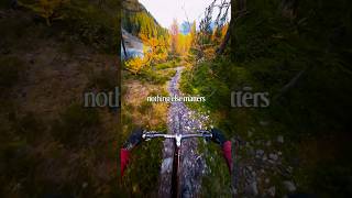
![nothing else matters]()
trail: Tibettrail (Pylon Trail)
0:26 |
16 |
Feb 10, 2026 , Schlanders
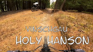
trail: Holy Hansen
14:21 |
28 |
Jan 12, 2026 , Schlanders
Current Trail Warnings
| status | trail | date | condition | user | info |
|---|---|---|---|---|---|
| 36er (unterer Teil) | May 30, 2026 @ 5:28pm (Europe/Rome) May 30, 2026 | Unknown | AlexPosch | Catastrophic, it’s a fire road ending... |
Recent Trail Reports
| status | trail | date | condition | info | user |
|---|---|---|---|---|---|
| Fontana Trail | Jun 17, 2026 @ 1:35pm (Europe/Rome) 3 days | Unknown | beatIt | ||
| Flipsi Trail | Jun 15, 2026 @ 3:10pm (Europe/Vaduz) Jun 15, 2026 | Very Dry | mcharza | ||
| Panorama | Jun 15, 2026 @ 3:10pm (Europe/Vaduz) Jun 15, 2026 | Very Dry | mcharza | ||
| schartlkamm uphill | May 31, 2026 @ 1:36pm (Europe/Vaduz) May 31, 2026 | Dry | squeezen | ||
| Aigen Trail | May 30, 2026 @ 11:27am (Europe/Vaduz) May 30, 2026 | Very Dry | squeezen | ||
| Looking for holy | May 30, 2026 @ 11:27am (Europe/Vaduz) May 30, 2026 | Ideal | squeezen | ||
| Marbles Access | May 30, 2026 @ 11:27am (Europe/Vaduz) May 30, 2026 | Ideal | squeezen | ||
| Holy Hansen | Apr 27, 2026 @ 5:44pm (Europe/Rome) Apr 27, 2026 | Very Dry | Hockeyjet | ||
| Holy Hansen to MortererLeger connection Trail | Apr 27, 2026 @ 5:43pm (Europe/Rome) Apr 27, 2026 | Ideal | Hockeyjet | ||
| Propain Access Road | Apr 20, 2026 @ 9:55am (Europe/Vaduz) Apr 20, 2026 | Dry | Benni23186 |
National Scenic Trails & Official Routes
-
Trans-Altarezia Bike #32
- Mountain Bike
- E-Bike

Activity Feed
| username | action | type | title | date |
|---|---|---|---|---|
| AndiSebi | ridden | trail | activity #97319561 and 1 more | Jun 19, 2026 @ 8:25am 11 hours |
| danielito21-15-9 | wishlist | route | activity #97244465 | Jun 18, 2026 @ 5:13am 2 days |
| AndiSebi | ridden | trail | activity #97239868 and 1 more | Jun 18, 2026 @ 2:52am 2 days |
| beatIt | add | report | activity #97173910 | Jun 17, 2026 @ 4:35am 3 days |
| XTAdventures | ridden | trail | activity #97160576 | Jun 16, 2026 @ 8:49pm 3 days |
Recent Comments
| username | type | title | comment | date |
|---|---|---|---|---|
| trail | Warning: In Section Two, there’s a jump that... | May 5, 2026 @ 10:57pm May 5, 2026 | ||
| trail | Looks like an old fireroad mostly, not very... | Mar 28, 2026 @ 6:48am Mar 28, 2026 | ||
| report | asciutto, condizioni perfette | Dec 19, 2025 @ 1:47pm Dec 19, 2025 | ||
| report | condizioni perfette | Dec 19, 2025 @ 1:46pm Dec 19, 2025 | ||
| trail | Schönet Trail. Aber definitiv Blau | Oct 18, 2025 @ 11:59am Oct 18, 2025 |
Local Badges
-

Epic Mountain Bike Climb 2k41 awarded -

Climbing 10k Badge0 awarded -

Mountain Biking 100k Badge0 awarded -

Epic Ride Descent 2k41 awarded -

Descent 10k Badge3 awarded -

Descent 100k Badge0 awarded
Activity Type Stats
| activitytype | trails | distance | descent | descent distance | total vertical | rating | global rank | state rank | photos | reports | routes | ridelogs |
|---|---|---|---|---|---|---|---|---|---|---|---|---|
| Mountain Bike | 85 | 250 miles | 108,228 ft | 154 miles | 9,259 ft | #677 | #10 | 379 | 537 | 3 | 4,884 | |
| E-Bike | 85 | 248 miles | 104,974 ft | 151 miles | 9,695 ft | #373 | #36 | 1 | 395 | 1 | 901 | |
| Hike | 87 | 251 miles | 109,219 ft | 154 miles | 9,695 ft | #333 | #9 | 497 | 457 | |||
| Trail Running | 87 | 251 miles | 109,219 ft | 154 miles | 9,695 ft | #468 | #11 | 497 | 38 | |||
| Downhill Ski | 41 | 33 miles | 36,864 ft | 33 miles | 5,443 ft | #195 | #18 | 39 | 230 |
Frequently Asked Questions About Schlanders
▼
What are the best places to ride in Schlanders?
Schlanders has 4 areas to explore for mountain biking. The top rated areas are:
▼
What are the highest rated mountain biking trails in Schlanders?
The highest rated mountain biking trails in Schlanders are:
- Schartlkamm trail (4.5/5)
- Madritschjoch > Enzianhütte (4.5/5)
- Plankamodui (4.5/5)
- Aigen Trail (4.5/5)
- Platzleid Trail (4.4/5)
▼
What is the best time of the year to ride in Schlanders?
Based on ride log data, the most popular months to ride in Schlanders are:
- July (32 activities)
- September (32 activities)
- May (27 activities)
▼
Where can I park to ride in Schlanders?
There are 2 parking locations listed in Schlanders. The most popular parking spots are:
Activities
- By trailpapst
 TRAILFORKS swiss IMBA SCHWEIZ & contributors
 - Admins: caval, larry81541, micheletraversi
- #60496 - 1,180 views
- schlanders activity log | embed map of Schlanders mountain bike trails | schlanders mountain biking points of interest
Downloading of trail gps tracks in kml & gpx formats is enabled for Schlanders.
You must login to download files.