close
-
Layers w
- Weather Layers
- Pro
- Pro
- Pro
- Pro
- Pro
- Pro
- More Layers
- Pro
- Pro
- Pro
- Pro
-
Upgrade to

3D
Trail Conditions
- Unknown
- Snow Groomed
- Snow Packed
- Snow Covered
- Snow Cover Partial
- Freeze/thaw Cycle
- Icy
- Prevalent Mud
- Wet
- Variable
- Ideal
- Dry
- Very Dry
Trail Flow (Ridden Direction)
Trailforks scans users ridelogs to determine the most popular direction each trail is ridden. A good flowing trail network will have most trails flowing in a single direction according to their intension.
The colour categories are based on what percentage of riders are riding a trail in its intended direction.
The colour categories are based on what percentage of riders are riding a trail in its intended direction.
- > 96%
- > 90%
- > 80%
- > 70%
- > 50%
- < 50%
- bi-directional trail
- no data
Trail Last Ridden
Trailforks scans ridelogs to determine the last time a trail was ridden.
- < 2 days
- < 1 week
- < 2 weeks
- < 1 month
- < 6 months
- > 6 months
Trail Ridden Direction
The intended direction a trail should be ridden.
- Downhill Only
- Downhill Primary
- Both Directions
- Uphill Primary
- Uphill Only
- One Direction
Contribute Details
Colors indicate trail is missing specified detail.
- Description
- Photos
- Description & Photos
- Videos
Trail Popularity ?
Trailforks scans ridelogs to determine which trails are ridden the most in the last 9 months.
Trails are compared with nearby trails in the same city region with a possible 25 colour shades.
Think of this as a heatmap, more rides = more kinetic energy = warmer colors.
- most popular
- popular
- less popular
- not popular
ATV/ORV/OHV Filter
Max Vehicle Width
inches
US Cell Coverage
Legend

Radar Time
Activity Recordings
Trailforks uses anonymized public activity data.
?
Activity Recordings
Trailforks uses anonymized public activity data.
?
Personal Heatmap
▶
Activity Types
all
/
none
▶
Options
2
Date range
month
–
Winter Trails
Warning
A routing network for winter maps does not exist. Selecting trails using the winter trails layer has been disabled.
Missing Trails
Most Popular
Least Popular
Trails are colored based on popularity. The more popular a trail is, the more red. Less popular trails trend towards green.
Jump Magnitude Heatmap
Heatmap of where riders jump on trails. Zoom in to see individual jumps, click circles to view jump details.
BC Backroad Status
![map legend]()
Service Road Atlas is a free to use, community-driven service for viewing and creating reports on the numerous back-country service roads around B.C. and Alberta.

Slope Aspect
Direction the slope faces
Trails Deemphasized
Trails are shown in grey.
Only show trails with no bike usage.
Suggested Layers
Based on selected activity type
Save the current map location and zoom level as your default home location whenever this page is loaded.
SaveThe Trials Training Center Gravity Park is located in Sequatchie Valley, TN and is open to the public year round, rain or shine. There is 650+ acres of land with 1000 vertical feet to play with, and currently 7 full DH runs with shuttle roads to the top of each one. *Trails 1-4 are located on the backside mountain and require 4 wheel drive to reach. The base of these trails comes out behind the shop and are full of great rocky terrain with hundreds of different lines to chose from and are hike-a-bike reachable without use of shuttle. Trails 5 (Goat) through 7 are located on the front facing mountain and access roads are reachable with any vehicle.
We share this land with a National and World Trials dirt bike facility that has a full service shop and bath house as well as cabins outfitted with wi-fi, heating and air
All riders AND non-riders are required to sign a waiver for land use. Minors are required to have a signature from a guardian. Waivers can be found on the table by the shop and placed in the black dropbox with payment. Payment is required of all riders before riding.
Helmets are required anytime you are riding on TTC land.
source: TTC Gravity Park Facebook Page
Primary Trail Type: All-Mountain & Downhill
Shuttleable: YES
Land Status: Private Property
Access Info:
300 Woodland Drive, Sequatchie, TN. Head on up to the shop to sign in, sign a waiver, pay some dues and meet up with other riders.
Links
Activities Click to view
- Mountain Bike
3 trails
- Hike
1 trails
- Trail Running
1 trails
Region Details
- 1
- 2
Region Status
Open as of Jun 19, 2024Stats
- Avg Trail Rating
- Trails (view details)
- 3
- Trails Mountain Bike
- 3
- Trails Hike
- 1
- Trails Trail Running
- 1
- Total Distance
- 3 miles
- Total Descent
- 2,056 ft
- Total Vertical
- 994 ft
- Highest Trailhead
- 1,746 ft
- Reports
- 4
- Photos
- 57
- Ridden Counter
- 113
Sub Regions
-
TTC Gravity Park
- 2
Popular Sequatchie Mountain Biking Trails
• 100 ★ 5.0 • 3,711 ft • 0 ft • 22 •
2022 Downhill Southeast Track (Round #1) In Loving Memory of Austin Lee Brown. RIP Brother
• 5 ★ 4.9 • 4,921 ft • 9 ft • 20 •
(otherwise known as ) is extremely steep, and features a rock face in the beggining.
• 70 ★ 0.0 • 4,941 ft • 220 ft • 1 •
Popular green difficulty singletrack. This multi-use trail can be used both directions and has a easy overall physical rating with a 220 ft green climb. Trail visibility is always easy to follow.
Sequatchie Mountain Bike Routes
★ 4.5 • 11 miles • 3,115 ft • 2 • Point to Point • Race •
Welcome to the 2nd edition of the TTC Enduro now named the TTC Bone Breaker Enduro. As participants...
Photos of Sequatchie Mountain Bike
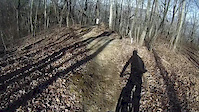
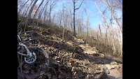
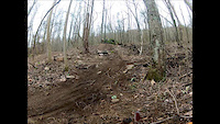
Videos of Sequatchie Mountain Bike

3:54 |
184 |
Feb 1, 2016
3:37 |
174 |
Jan 29, 2016
0:52 |
409 |
Feb 7, 2015

3:18 |
488 |
Jul 2, 2014

3:34 |
188 |
Feb 9, 2014

2:22 |
259 |
Jan 27, 2014
3:46 |
377 |
Mar 25, 2013

0:43 |
294 |
Nov 18, 2012
Recent Trail Reports
| status | trail | date | condition | info | user |
|---|---|---|---|---|---|
| D'Saus | Mar 3, 2024 @ 1:30am Mar 3, 2024 | Variable | almphoto CVTA |
Activity Feed
| username | action | type | title | date |
|---|---|---|---|---|
| BikeRegCom | add | event | activity #86707122 | Jan 5, 2026 @ 12:45pm Jan 5, 2026 |
| lonelogger | wishlist | trail | activity #74012882 and 1 more | Jun 17, 2025 @ 7:05pm Jun 17, 2025 |
| Gravity-CoOp | add | photo | activity #67966125 and 3 more | Mar 18, 2025 @ 6:51am Mar 18, 2025 |
| update | event | activity #62329820 | Nov 26, 2024 @ 12:08pm Nov 26, 2024 | |
| update | event | activity #61375330 | Nov 5, 2024 @ 1:50pm Nov 5, 2024 |
Recent Comments
| username | type | title | comment | date |
|---|---|---|---|---|
| trail | They need to put all the stages from the GNR... | Nov 8, 2021 @ 8:29pm Nov 8, 2021 | ||
| trail | This needs an update. There is way more then... | Oct 21, 2019 @ 12:39pm Oct 21, 2019 |
Activity Type Stats
| activitytype | trails | distance | descent | descent distance | total vertical | rating | global rank | state rank | photos | reports | routes | ridelogs |
|---|---|---|---|---|---|---|---|---|---|---|---|---|
| Mountain Bike | 3 | 3 miles | 2,057 ft | 2 miles | 994 ft | #5,408 | #1,817 | 58 | 4 | 3 | 607 | |
| Hike | 1 | 4,941 ft | 197 ft | 2,497 ft | 157 ft | #15,429 | #5,669 | 5 | 161 | |||
| Trail Running | 1 | 4,941 ft | 197 ft | 2,497 ft | 157 ft | #15,195 | #5,500 | 5 | 3 |
- By TreyDownhill
 & contributors
 - Admins: apply
- #7367 - 3,228 views
- sequatchie activity log | embed map of Sequatchie mountain bike trails | sequatchie mountain biking points of interest
Downloading of trail gps tracks in kml & gpx formats is enabled for Sequatchie.
You must login to download files.