close
-
Layers w
- Weather Layers
- Pro
- Pro
- Pro
- Pro
- Pro
- Pro
- More Layers
- Pro
- Pro
- Pro
- Pro
-
Upgrade to

3D
Trail Conditions
- Unknown
- Snow Groomed
- Snow Packed
- Snow Covered
- Snow Cover Partial
- Freeze/thaw Cycle
- Icy
- Prevalent Mud
- Wet
- Variable
- Ideal
- Dry
- Very Dry
Trail Flow (Ridden Direction)
Trailforks scans users ridelogs to determine the most popular direction each trail is ridden. A good flowing trail network will have most trails flowing in a single direction according to their intension.
The colour categories are based on what percentage of riders are riding a trail in its intended direction.
The colour categories are based on what percentage of riders are riding a trail in its intended direction.
- > 96%
- > 90%
- > 80%
- > 70%
- > 50%
- < 50%
- bi-directional trail
- no data
Trail Last Ridden
Trailforks scans ridelogs to determine the last time a trail was ridden.
- < 2 days
- < 1 week
- < 2 weeks
- < 1 month
- < 6 months
- > 6 months
Trail Ridden Direction
The intended direction a trail should be ridden.
- Downhill Only
- Downhill Primary
- Both Directions
- Uphill Primary
- Uphill Only
- One Direction
Contribute Details
Colors indicate trail is missing specified detail.
- Description
- Photos
- Description & Photos
- Videos
Trail Popularity ?
Trailforks scans ridelogs to determine which trails are ridden the most in the last 9 months.
Trails are compared with nearby trails in the same city region with a possible 25 colour shades.
Think of this as a heatmap, more rides = more kinetic energy = warmer colors.
- most popular
- popular
- less popular
- not popular
ATV/ORV/OHV Filter
Max Vehicle Width
inches
US Cell Coverage
Legend

Radar Time
Activity Recordings
Trailforks uses anonymized public activity data.
?
Activity Recordings
Trailforks uses anonymized public activity data.
?
Personal Heatmap
▶
Activity Types
all
/
none
▶
Options
2
Date range
month
–
Winter Trails
Warning
A routing network for winter maps does not exist. Selecting trails using the winter trails layer has been disabled.
Missing Trails
Most Popular
Least Popular
Trails are colored based on popularity. The more popular a trail is, the more red. Less popular trails trend towards green.
Jump Magnitude Heatmap
Heatmap of where riders jump on trails. Zoom in to see individual jumps, click circles to view jump details.
BC Backroad Status
![map legend]()
Service Road Atlas is a free to use, community-driven service for viewing and creating reports on the numerous back-country service roads around B.C. and Alberta.

Slope Aspect
Direction the slope faces
Trails Deemphasized
Trails are shown in grey.
Only show trails with no bike usage.
Suggested Layers
Based on selected activity type
Save the current map location and zoom level as your default home location whenever this page is loaded.
Save
No description for Slinger has been added yet!
Login or register to submit one.
Activities Click to view
- Mountain Bike
30 trails
- E-Bike
16 trails
- Gravel Bike
0 trails
- Adaptive Bike
0 trails
- Horse
12 trails
- Hike
14 trails
- Trail Running
14 trails
- Downhill Ski
25 trails
- Nordic Ski
7 trails
Region Details
- 4
- 8
- 9
- 5
- 4
Region Status
Caution as of Jul 10, 2026Stats
- Avg Trail Rating
- Trails (view details)
- 74
- Trails Mountain Bike
- 30
- Trails E-Bike
- 16
- Trails Horse
- 12
- Trails Hike
- 14
- Trails Trail Running
- 14
- Trails Downhill Ski
- 25
- Trails Nordic Ski
- 7
- Total Distance
- 28 miles
- Total Descent Distance
- 11 miles
- Total Descent
- 3,621 ft
- Total Vertical
- 242 ft
- Highest Trailhead
- 1,241 ft
- Reports
- 3,660
- Photos
- 60
- Ridden Counter
- 5,976
Sub Regions
-
Heritage Trails Park
- 3
- 5
- 2
-
Little Moraine State Forest Pike Lake Unit
-
Little Switzerland Ski Area
- 3
- 5
- 3
- 2
Popular Slinger Mountain Biking Trails
• 70 ★ 4.4 • 2 miles • 183 ft • 339 •
is a wooded cross country trail that challenges a rider's fitness and gives the rider a taste of everything the kettle moraine has to offer. Tight twisty turns, natural gravel sections, rooty descents, and punchy climbs. Enjoy.
• 80 ★ 4.8 • 1 mile • 137 ft • 333 •
is a mile of machine built flow that features large drops and gap jumps that will challenge advanced riders, yet 's bypasses are equally fun and allow strong intermediate riders to safely ride the trail and progress their skill. Roll or...
• 95 ★ 4.9 • 2,628 ft • 60 ft • 324 •
' parallel tracks of gaps on left and tables on right provide fun and variety for the rider. Whether you roll or jump the tables, hit the gaps, or even transfer between the two, will leave you smiling.
• 100 ★ 4.2 • 1,578 ft • 9 ft • 308 •
Rolling the waves or jumping the waves is equally fun. On this versatile flow trail newer riders can safely roll the track, yet has enough spicy options-kickers, table tops, and gap jumps-that will keep advanced riders smiling on this...
• 65 ★ 4.6 • 1 mile • 36 ft • 305 •
is a family friendly trail that meanders through a kettle moraine meadow. Alternative lines within give riders the option to experience skinnies, rock gardens, and even some gentle jumps.
• 90 ★ 4.4 • 600 ft • 0 ft • 272 •
A mind blowing double black diamond experience gliding through the woods of the Kettle Moraine. is rated double black diamond. This means Glunslinger is rated for expert riders only. Please use your best judgment and ride within your...
• 100 ★ 5.0 • 2,064 ft • 39 ft • 211 •
is a groovy addition to the Heritage trail system. features wooden ramps, a bridge with optional jump, a wall ride, twisting winding flow, rollable rock drops, tabletop jumps, gap jumps, and of course lots of hip jumps. has well marked...
• 60 ★ 5.0 • 1,480 ft • 30 ft • 172 •
Moderately popular green difficulty singletrack. This mountain bike primary trail can be used one direction and has a easy overall physical rating with a 30 ft green climb. On average it takes 1 minutes to complete this trail.
Slinger Mountain Bike Routes
★ 5.0 • 3,543 ft • 55 ft • 2 • Loop •
For those who like to keep their tires in the air as much as possible, Heritage Trails offers the - Jump...
★ 5.0 • 2 miles • 181 ft • 3 • Loop •
The Heritage Sampler gives intermediate to advance riders a tour of what Heritage Trails has to offer....
★ 5.0 • 1 mile • 35 ft • 1 •
is the perfect introduction to those new to the sport of mountain biking and also serves as a fantastic...
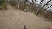
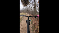
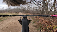
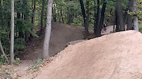
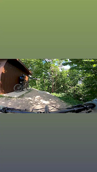
Photos of Slinger Mountain Bike
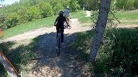
Videos of Slinger Mountain Bike
trail: Young Guns
0:14 |
25 |
Apr 26, 2026

trail: Double Dragon
2:37 |
2 |
Feb 18, 2026
trail: Double Dragon
0:51 |
|
Jun 7, 2023
trail: Double Dragon
0:49 |
|
Jun 7, 2023

trail: PBJ
8:46 |
634 |
Nov 25, 2020
trail: PBR
0:08 |
|
Nov 15, 2020
trail: PBR
0:11 |
157 |
Oct 7, 2020
trail: Green Machine
0:01 |
191 |
Jun 3, 2020
Recent Trail Reports
Activity Feed
| username | action | type | title | date |
|---|---|---|---|---|
| ese-prometheus | wishlist | region | activity #98982208 | Jul 11, 2026 @ 5:40pm Jul 11, 2026 |
| Mdweege | add | report | activity #98956903 and 25 more | Jul 11, 2026 @ 11:45am Jul 11, 2026 |
| Mdweege | add | report | activity #98899094 and 24 more | Jul 10, 2026 @ 7:49pm Jul 10, 2026 |
| Mdweege | add | report | activity #98727105 and 24 more | Jul 8, 2026 @ 11:27am Jul 8, 2026 |
| Mdweege | add | report | activity #98524795 and 24 more | Jul 5, 2026 @ 11:56am Jul 5, 2026 |
Recent Comments
| username | type | title | comment | date |
|---|---|---|---|---|
| report | Closed for major re-routing | Apr 13, 2025 @ 5:57am Apr 13, 2025 | ||
| trail | Nope, I gotta clean up the data points. | Nov 1, 2024 @ 4:57pm Nov 1, 2024 | ||
| trail | dang that red bar at the top got me scared and... | Oct 27, 2024 @ 8:07pm Oct 27, 2024 | ||
| trail | Fun warm up trail! | Jun 25, 2024 @ 6:38am Jun 25, 2024 | ||
| report | Trails are all open again to public. Just stay... | Jul 3, 2023 @ 9:55am Jul 3, 2023 |
Local Badges
-

Epic Ride Climb 2k0 awarded -

Climbing 10k Badge6 awarded -

Climbing 100k Badge0 awarded -

Epic Ride Descent 2k1 awarded -

Descent 10k Badge6 awarded -

Descent 100k Badge0 awarded
Bike & Skill Parks
| name | type | city | rating |
|---|---|---|---|
| Little Switzerland Ski Area | bike park | Slinger |
Activity Type Stats
| activitytype | trails | distance | descent | descent distance | total vertical | rating | global rank | state rank | photos | reports | routes | ridelogs |
|---|---|---|---|---|---|---|---|---|---|---|---|---|
| Mountain Bike | 30 | 12 miles | 1,706 ft | 5 miles | 223 ft | #2,214 | #796 | 60 | 3,660 | 3 | 3,305 | |
| E-Bike | 16 | 8 miles | 778 ft | 3 miles | 154 ft | #4,993 | #1,560 | 3,447 | 3 | 290 | ||
| Horse | 12 | 11 miles | 659 ft | 4 miles | 203 ft | #2,301 | #1,271 | 149 | ||||
| Hike | 14 | 13 miles | 814 ft | 5 miles | 207 ft | #7,849 | #2,769 | 349 | 323 | |||
| Trail Running | 14 | 13 miles | 814 ft | 5 miles | 207 ft | #8,593 | #2,866 | 349 | 33 | |||
| Downhill Ski | 25 | 3 miles | 1,086 ft | 2 miles | 167 ft | #480 | #197 | 12 | 208 | |||
| Nordic Ski | 7 | 3 miles | 171 ft | 4,675 ft | 69 ft | #1,354 | #625 | 19 |
Frequently Asked Questions About Slinger
▼
What are the best places to ride in Slinger?
Slinger has 5 areas to explore for mountain biking. The top rated areas are:
▼
What are the highest rated mountain biking trails in Slinger?
The highest rated mountain biking trails in Slinger are:
- Double Dragon (4.5/5)
- Young Guns (4.4/5)
- Fraggle Rocks (4.3/5)
- Black & Blue (4.3/5)
- Winter Bypass (4.2/5)
▼
What is the best time of the year to ride in Slinger?
Based on ride log data, the most popular months to ride in Slinger are:
- October (21 activities)
- September (19 activities)
- July (18 activities)
▼
Where can I park to ride in Slinger?
Activities
Trails
- By feardabeast
 TRAILFORKS & contributors
 - Admins: METRO
- #17892 - 4,725 views
- slinger activity log | embed map of Slinger mountain bike trails | slinger mountain biking points of interest
Downloading of trail gps tracks in kml & gpx formats is enabled for Slinger.
You must login to download files.