close
-
Layers w
- Weather Layers
- Pro
- Pro
- Pro
- Pro
- Pro
- Pro
- More Layers
- Pro
- Pro
- Pro
- Pro
-
Upgrade to

3D
Trail Conditions
- Unknown
- Snow Groomed
- Snow Packed
- Snow Covered
- Snow Cover Partial
- Freeze/thaw Cycle
- Icy
- Prevalent Mud
- Wet
- Variable
- Ideal
- Dry
- Very Dry
Trail Flow (Ridden Direction)
Trailforks scans users ridelogs to determine the most popular direction each trail is ridden. A good flowing trail network will have most trails flowing in a single direction according to their intension.
The colour categories are based on what percentage of riders are riding a trail in its intended direction.
The colour categories are based on what percentage of riders are riding a trail in its intended direction.
- > 96%
- > 90%
- > 80%
- > 70%
- > 50%
- < 50%
- bi-directional trail
- no data
Trail Last Ridden
Trailforks scans ridelogs to determine the last time a trail was ridden.
- < 2 days
- < 1 week
- < 2 weeks
- < 1 month
- < 6 months
- > 6 months
Trail Ridden Direction
The intended direction a trail should be ridden.
- Downhill Only
- Downhill Primary
- Both Directions
- Uphill Primary
- Uphill Only
- One Direction
Contribute Details
Colors indicate trail is missing specified detail.
- Description
- Photos
- Description & Photos
- Videos
Trail Popularity ?
Trailforks scans ridelogs to determine which trails are ridden the most in the last 9 months.
Trails are compared with nearby trails in the same city region with a possible 25 colour shades.
Think of this as a heatmap, more rides = more kinetic energy = warmer colors.
- most popular
- popular
- less popular
- not popular
ATV/ORV/OHV Filter
Max Vehicle Width
inches
US Cell Coverage
Legend

Radar Time
Activity Recordings
Trailforks uses anonymized public activity data.
?
Activity Recordings
Trailforks uses anonymized public activity data.
?
Personal Heatmap
▶
Activity Types
all
/
none
▶
Options
2
Date range
month
–
Winter Trails
Warning
A routing network for winter maps does not exist. Selecting trails using the winter trails layer has been disabled.
Missing Trails
Most Popular
Least Popular
Trails are colored based on popularity. The more popular a trail is, the more red. Less popular trails trend towards green.
Jump Magnitude Heatmap
Heatmap of where riders jump on trails. Zoom in to see individual jumps, click circles to view jump details.
BC Backroad Status
![map legend]()
Service Road Atlas is a free to use, community-driven service for viewing and creating reports on the numerous back-country service roads around B.C. and Alberta.

Slope Aspect
Direction the slope faces
Trails Deemphasized
Trails are shown in grey.
Only show trails with no bike usage.
Suggested Layers
Based on selected activity type
Save the current map location and zoom level as your default home location whenever this page is loaded.
Save
No description for Solingen has been added yet!
Login or register to submit one.
This region uses the Uk/Euro style trail grading system.
Activities Click to view
- Mountain Bike
23 trails
- E-Bike
23 trails
- Winter Fat Bike
0 trails
- Hike
18 trails
- Trail Running
18 trails
Region Details
- 1
- 10
- 10
- 2
Region Status
Open as of May 17, 2026Stats
- Avg Trail Rating
- Trails (view details)
- 23
- Trails Mountain Bike
- 23
- Trails E-Bike
- 23
- Trails Hike
- 18
- Trails Trail Running
- 18
- Total Distance
- 11 miles
- Total Descent
- 4,160 ft
- Total Vertical
- 704 ft
- Highest Trailhead
- 1,040 ft
- Reports
- 185
- Photos
- 53
- Ridden Counter
- 2,775
Popular Solingen Mountain Biking Trails
• 100 ★ 4.7 • 2,951 ft • 14 ft • 153 •
Insgesamt bietet der Trail vier verschiedene Linien, auf denen jeder auf seine Kosten kommt. Die blaue Hauptlinie Flowkey macht ihrem Namen alle Ehre und bietet mit vielen Anliegern und kleinen Tables den perfekten Ride nach unten....
• 100 ★ 4.7 • 462 ft • 0 ft • 147 •
Popular blue difficulty other. This mountain bike primary trail can be used one direction and has a moderate overall physical rating. It features jump and other. On average it takes 3 minutes to complete this trail.
• 85 ★ 4.9 • 3,151 ft • 20 ft • 67 •
Highly rated popular red difficulty singletrack. This mountain bike primary trail can be used downhill only and has a hard overall physical rating. It features berm, drop, jump, gap jump, rock face and rock garden. Trail visibility is always easy to follow. On average it takes 1 hour21 minutes to complete this trail.
• 80 ★ 1.5 • 1,681 ft • 122 ft • 32 •
Nice alternative trial segment to boring Klingenpfad fireroad.
• 95 ★ 2.0 • 1,991 ft • 25 ft • 32 •
Popular green difficulty singletrack. This multi-use trail can be used both directions and has a easy overall physical rating with a 25 ft green climb. Trail visibility is always easy to follow. On average it takes 2 minutes to complete this trail.
Photos of Solingen Mountain Bike
Videos of Solingen Mountain Bike

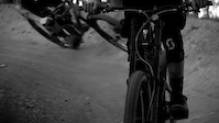
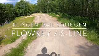
trail: Klingentrail Flowkey
0:36 |
113 |
Jun 21, 2020
trail: Klingentrail Flowkey
2:42 |
2710 |
Nov 1, 2018
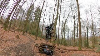
trail: Downhill Kothen
0:27 |
735 |
May 2, 2013
trail: Downhill Kothen
8:09 |
1105 |
May 18, 2021 , Solingen

trail: Klingentail S-Line
2:08 |
525 |
Jan 2, 2020 , Solingen
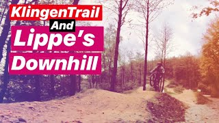
trail: Klingentrail Flowkey
5:34 |
657 |
Nov 6, 2019 , Solingen
trail: Klingentrail Flowkey
0:58 |
938 |
Aug 20, 2019 , Solingen
Recent Trail Reports
| status | trail | date | condition | info | user |
|---|---|---|---|---|---|
| Ohligser Heide Waldweg | Oct 16, 2025 @ 9:40am (Europe/Luxembourg) Oct 16, 2025 | Variable | SebastianOCbyed | ||
| Ohligser Heide Waldweg | Oct 16, 2025 @ 9:40am (Europe/Luxembourg) Oct 16, 2025 | Variable | SebastianOCbyed | ||
| Bruchermühle - Schloss Caspersbroich | Oct 12, 2025 @ 10:07am (Europe/Luxembourg) Oct 12, 2025 | Variable | SebastianOCbyed | ||
| Ohligser Heide Waldweg | Oct 3, 2025 @ 10:51am (Europe/Luxembourg) Oct 3, 2025 | Ideal | SebastianOCbyed | ||
| Caspersbroich Gravelweg | Oct 1, 2025 @ 5:32pm (Europe/Luxembourg) Oct 1, 2025 | Variable | SebastianOCbyed | ||
| Ittertal Waldtrail | Aug 26, 2025 @ 5:09pm Aug 26, 2025 | Very Dry | trailforks Trailforks | ||
| Downhill Kothen | May 14, 2025 @ 11:18am May 14, 2025 | Dry | Ralli | ||
| Klingentrail Flowkey | Oct 6, 2024 @ 10:22am Oct 6, 2024 | Ideal | bertpasch | ||
| Igelsforst Ittertal-Pfad | Aug 25, 2024 @ 3:24pm Aug 25, 2024 | Variable | Ioniansailor | ||
| Papermill | Aug 10, 2024 @ 1:34am Aug 10, 2024 | Ideal | Ioniansailor |
Activity Feed
| username | action | type | title | date |
|---|---|---|---|---|
| Digla | wishlist | trail | activity #96943197 | Jun 14, 2026 @ 12:49am 2 days |
| Digla | wishlist | trail | activity #96901402 | Jun 13, 2026 @ 11:42am 2 days |
| SYr5F | ridden | trail | activity #96211310 | Jun 4, 2026 @ 1:39am Jun 4, 2026 |
| Digla | wishlist | trail | activity #93032999 | Apr 20, 2026 @ 12:07pm Apr 20, 2026 |
| RLHnep | wishlist | trail | activity #92213286 | Apr 8, 2026 @ 3:05pm Apr 8, 2026 |
Recent Comments
| username | type | title | comment | date |
|---|---|---|---|---|
| trail | Derzeit tot, da komplett zugewachsen | Jun 14, 2022 @ 8:34am Jun 14, 2022 | ||
| trail | Aktuell durch Waldarbeitern nicht fahrbar | Mar 26, 2021 @ 12:58pm Mar 26, 2021 | ||
| trail | Cooler Trail! Ein bisschen zu gewuchert aber... | Oct 18, 2020 @ 4:22am Oct 18, 2020 | ||
| report | Changed | Sep 28, 2020 @ 10:02am Sep 28, 2020 |
Local Badges
-

Epic Ride Climb 2k26 awarded -

Climbing 10k Badge42 awarded -

Climbing 100k Badge2 awarded -

Epic Ride Descent 2k26 awarded -

Descent 10k Badge42 awarded -

Descent 100k Badge2 awarded
Activity Type Stats
| activitytype | trails | distance | descent | descent distance | total vertical | rating | global rank | state rank | photos | reports | routes | ridelogs |
|---|---|---|---|---|---|---|---|---|---|---|---|---|
| Mountain Bike | 23 | 11 miles | 4,160 ft | 8 miles | 705 ft | #4,456 | #79 | 53 | 185 | 4,737 | ||
| E-Bike | 23 | 11 miles | 4,160 ft | 8 miles | 705 ft | #3,069 | #62 | 114 | 1,114 | |||
| Hike | 18 | 9 miles | 3,284 ft | 6 miles | 633 ft | #5,869 | #64 | 138 | 191 | |||
| Trail Running | 18 | 9 miles | 3,284 ft | 6 miles | 633 ft | #5,308 | #64 | 138 | 91 |
Frequently Asked Questions About Solingen
▼
What are the highest rated mountain biking trails in Solingen?
The highest rated mountain biking trails in Solingen are:
- Downhill Kothen (4.4/5)
- Klingentrail Flowkey (4.4/5)
- Klingentail S-Line (4.2/5)
- Ittertal Waldtrail (4.1/5)
- Lütters Breitenbruch (3.9/5)
▼
What is the best time of the year to ride in Solingen?
Based on ride log data, the most popular months to ride in Solingen are:
- August (37 activities)
- July (36 activities)
- March (35 activities)
▼
Where can I park to ride in Solingen?
There are 2 parking locations listed in Solingen. The most popular parking spots are:
▼
What is the longest trail in Solingen?
The longest trail in Solingen is Ittertal Trail at 1.6 km. View all trails sorted by distance.
- By canadaka
 Trailforks & contributors
 - Admins: Wuppertrails
- #18156 - 10,581 views
- solingen activity log | embed map of Solingen mountain bike trails | solingen mountain biking points of interest
Downloading of trail gps tracks in kml & gpx formats is enabled for Solingen.
You must login to download files.