close
-
Layers w
- Weather Layers
- Pro
- Pro
- Pro
- Pro
- Pro
- Pro
- More Layers
- Pro
- Pro
- Pro
- Pro
-
Upgrade to

3D
Trail Conditions
- Unknown
- Snow Groomed
- Snow Packed
- Snow Covered
- Snow Cover Partial
- Freeze/thaw Cycle
- Icy
- Prevalent Mud
- Wet
- Variable
- Ideal
- Dry
- Very Dry
Trail Flow (Ridden Direction)
Trailforks scans users ridelogs to determine the most popular direction each trail is ridden. A good flowing trail network will have most trails flowing in a single direction according to their intension.
The colour categories are based on what percentage of riders are riding a trail in its intended direction.
The colour categories are based on what percentage of riders are riding a trail in its intended direction.
- > 96%
- > 90%
- > 80%
- > 70%
- > 50%
- < 50%
- bi-directional trail
- no data
Trail Last Ridden
Trailforks scans ridelogs to determine the last time a trail was ridden.
- < 2 days
- < 1 week
- < 2 weeks
- < 1 month
- < 6 months
- > 6 months
Trail Ridden Direction
The intended direction a trail should be ridden.
- Downhill Only
- Downhill Primary
- Both Directions
- Uphill Primary
- Uphill Only
- One Direction
Contribute Details
Colors indicate trail is missing specified detail.
- Description
- Photos
- Description & Photos
- Videos
Trail Popularity ?
Trailforks scans ridelogs to determine which trails are ridden the most in the last 9 months.
Trails are compared with nearby trails in the same city region with a possible 25 colour shades.
Think of this as a heatmap, more rides = more kinetic energy = warmer colors.
- most popular
- popular
- less popular
- not popular
ATV/ORV/OHV Filter
Max Vehicle Width
inches
US Cell Coverage
Legend

Radar Time
Activity Recordings
Trailforks uses anonymized public activity data.
?
Activity Recordings
Trailforks uses anonymized public activity data.
?
Personal Heatmap
▶
Activity Types
all
/
none
▶
Options
2
Date range
month
–
Winter Trails
Warning
A routing network for winter maps does not exist. Selecting trails using the winter trails layer has been disabled.
Missing Trails
Most Popular
Least Popular
Trails are colored based on popularity. The more popular a trail is, the more red. Less popular trails trend towards green.
Jump Magnitude Heatmap
Heatmap of where riders jump on trails. Zoom in to see individual jumps, click circles to view jump details.
BC Backroad Status
![map legend]()
Service Road Atlas is a free to use, community-driven service for viewing and creating reports on the numerous back-country service roads around B.C. and Alberta.

Slope Aspect
Direction the slope faces
Trails Deemphasized
Trails are shown in grey.
Only show trails with no bike usage.
Suggested Layers
Based on selected activity type
Save the current map location and zoom level as your default home location whenever this page is loaded.
Save
No description for Sullivan has been added yet!
Login or register to submit one.
Activities Click to view
- Mountain Bike
5 trails
- Hike
7 trails
- Trail Running
7 trails
Region Details
- 1
- 2
- 1
Region Status
Open as of May 11, 2026Stats
- Avg Trail Rating
- Trails (view details)
- 6
- Trails Mountain Bike
- 5
- Trails Hike
- 7
- Trails Trail Running
- 7
- Total Distance
- 9 miles
- Total Descent Distance
- 3 miles
- Total Descent
- 518 ft
- Total Vertical
- 44 ft
- Highest Trailhead
- 659 ft
- Reports
- 25
- Photos
- 10
- Ridden Counter
- 179
Sub Regions
-
Camp Camfield
- 1
- 2
- 1
Popular Sullivan Mountain Biking Trails
• 100 ★ 4.5 • 2 miles • 85 ft • 47 •
Popular green difficulty singletrack. This multi-use trail can be used both directions. On average it takes 16 minutes to complete this trail.
• 85 ★ 5.0 • 3 miles • 194 ft • 42 •
Popular blue difficulty singletrack. This multi-use trail can be used one direction. It features drop. On average it takes 18 minutes to complete this trail.
• 50 ★ 3.5 • 2 miles • 150 ft • 37 •
Moderately popular blue difficulty singletrack. This multi-use trail can be used both directions. On average it takes 14 hours42 minutes to complete this trail.
• 35 ★ 3.0 • 5,171 ft • 82 ft • 29 •
Most demanding trail at Camp Camfield for Hike and Bike. One mile steep up and down hills with tight corners.
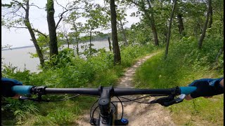
Photos of Sullivan Mountain Bike
Videos of Sullivan Mountain Bike

trail: Orange Trail
16:18 |
46 |
Jul 4, 2025 , Sullivan
trail: Blue Trail
16:18 |
56 |
Jul 4, 2025 , Sullivan

trail: Green Trail
16:18 |
54 |
Jul 4, 2025 , Sullivan
Recent Trail Reports
| status | trail | date | condition | info | user |
|---|---|---|---|---|---|
| Parling Access | Aug 25, 2023 @ 6:40am Aug 25, 2023 | Ideal | WillieJacobsz Trailforks | ||
| Orange Trail | Aug 25, 2023 @ 6:40am Aug 25, 2023 | Ideal | WillieJacobsz Trailforks | ||
| Green Trail | Aug 25, 2023 @ 6:40am Aug 25, 2023 | Ideal | WillieJacobsz Trailforks | ||
| Blue Trail | Aug 25, 2023 @ 6:40am Aug 25, 2023 | Ideal | WillieJacobsz Trailforks | ||
| Black Trail | Aug 25, 2023 @ 6:39am Aug 25, 2023 | Ideal | WillieJacobsz Trailforks |
Activity Feed
| username | action | type | title | date |
|---|---|---|---|---|
| AlCreamean | add | photo | activity #95931072 | May 31, 2026 @ 5:53am May 31, 2026 |
| AlCreamean | add | photo | activity #95854986 and 1 more | May 30, 2026 @ 8:27am May 30, 2026 |
| AlCreamean | wishlist | trail | activity #91913692 | Apr 4, 2026 @ 10:47am Apr 4, 2026 |
| dvroberts411 | comment | trail | activity #77525112 | Aug 6, 2025 @ 7:16am Aug 6, 2025 |
| alhartman1 | wishlist | trail | activity #76810832 | Jul 27, 2025 @ 5:34am Jul 27, 2025 |
Recent Comments
| username | type | title | comment | date |
|---|---|---|---|---|
| trail | Rode here on a weekday in early August. My... | Aug 6, 2025 @ 7:16am Aug 6, 2025 | ||
| trail | If there's leaves on trail just avoid. | Nov 25, 2019 @ 8:06am Nov 25, 2019 |
Activity Type Stats
| activitytype | trails | distance | descent | descent distance | total vertical | rating | global rank | state rank | photos | reports | routes | ridelogs |
|---|---|---|---|---|---|---|---|---|---|---|---|---|
| Mountain Bike | 5 | 8 miles | 495 ft | 3 miles | 43 ft | #9,068 | #2,874 | 10 | 25 | 815 | ||
| Hike | 7 | 9 miles | 518 ft | 3 miles | 46 ft | #11,864 | #4,257 | 25 | 61 | |||
| Trail Running | 7 | 9 miles | 518 ft | 3 miles | 46 ft | #11,748 | #4,095 | 25 | 2 |
Frequently Asked Questions About Sullivan
▼
What are the best places to ride in Sullivan?
Sullivan has 2 areas to explore for mountain biking. The top rated areas are:
▼
What are the highest rated mountain biking trails in Sullivan?
The highest rated mountain biking trails in Sullivan are:
- Orange Trail (4.1/5)
- Green Trail (4.1/5)
- Blue Trail (3.9/5)
- Black Trail (3.8/5)
▼
What is the best time of the year to ride in Sullivan?
Based on ride log data, the most popular months to ride in Sullivan are:
- July (4 activities)
- November (2 activities)
- September (2 activities)
▼
Where can I park to ride in Sullivan?
There are 1 parking locations listed in Sullivan. The most popular parking spots are:
- By AlienFit27 & contributors
- Admins: apply
- #13826 - 1,421 views
- sullivan activity log | embed map of Sullivan mountain bike trails | sullivan mountain biking points of interest
Downloading of trail gps tracks in kml & gpx formats is enabled for Sullivan.
You must login to download files.