close
-
Layers w
- Weather Layers
- Pro
- Pro
- Pro
- Pro
- Pro
- Pro
- More Layers
- Pro
- Pro
- Pro
- Pro
-
Upgrade to

3D
Trail Conditions
- Unknown
- Snow Groomed
- Snow Packed
- Snow Covered
- Snow Cover Partial
- Freeze/thaw Cycle
- Icy
- Prevalent Mud
- Wet
- Variable
- Ideal
- Dry
- Very Dry
Trail Flow (Ridden Direction)
Trailforks scans users ridelogs to determine the most popular direction each trail is ridden. A good flowing trail network will have most trails flowing in a single direction according to their intension.
The colour categories are based on what percentage of riders are riding a trail in its intended direction.
The colour categories are based on what percentage of riders are riding a trail in its intended direction.
- > 96%
- > 90%
- > 80%
- > 70%
- > 50%
- < 50%
- bi-directional trail
- no data
Trail Last Ridden
Trailforks scans ridelogs to determine the last time a trail was ridden.
- < 2 days
- < 1 week
- < 2 weeks
- < 1 month
- < 6 months
- > 6 months
Trail Ridden Direction
The intended direction a trail should be ridden.
- Downhill Only
- Downhill Primary
- Both Directions
- Uphill Primary
- Uphill Only
- One Direction
Contribute Details
Colors indicate trail is missing specified detail.
- Description
- Photos
- Description & Photos
- Videos
Trail Popularity ?
Trailforks scans ridelogs to determine which trails are ridden the most in the last 9 months.
Trails are compared with nearby trails in the same city region with a possible 25 colour shades.
Think of this as a heatmap, more rides = more kinetic energy = warmer colors.
- most popular
- popular
- less popular
- not popular
ATV/ORV/OHV Filter
Max Vehicle Width
inches
US Cell Coverage
Legend

Radar Time
Activity Recordings
Trailforks uses anonymized public activity data.
?
Activity Recordings
Trailforks uses anonymized public activity data.
?
Personal Heatmap
▶
Activity Types
all
/
none
▶
Options
2
Date range
month
–
Winter Trails
Warning
A routing network for winter maps does not exist. Selecting trails using the winter trails layer has been disabled.
Missing Trails
Most Popular
Least Popular
Trails are colored based on popularity. The more popular a trail is, the more red. Less popular trails trend towards green.
Jump Magnitude Heatmap
Heatmap of where riders jump on trails. Zoom in to see individual jumps, click circles to view jump details.
BC Backroad Status
![map legend]()
Service Road Atlas is a free to use, community-driven service for viewing and creating reports on the numerous back-country service roads around B.C. and Alberta.

Slope Aspect
Direction the slope faces
Trails Deemphasized
Trails are shown in grey.
Only show trails with no bike usage.
Suggested Layers
Based on selected activity type
Save the current map location and zoom level as your default home location whenever this page is loaded.
Save
No description for Telde has been added yet!
Login or register to submit one.
This region uses the Uk/Euro style trail grading system.
Activities Click to view
- Mountain Bike
40 trails
- E-Bike
39 trails
- Horse
11 trails
- Hike
40 trails
- Trail Running
40 trails
Region Details
- 13
- 4
- 13
- 10
Region Status
Open as of May 2, 2026Stats
- Avg Trail Rating
- Trails (view details)
- 40
- Trails Mountain Bike
- 40
- Trails E-Bike
- 39
- Trails Horse
- 11
- Trails Hike
- 40
- Trails Trail Running
- 40
- Total Distance
- 63 miles
- Total Descent Distance
- 45 miles
- Total Descent
- 24,425 ft
- Total Vertical
- 6,158 ft
- Highest Trailhead
- 6,182 ft
- Reports
- 11
- Photos
- 4
- Ridden Counter
- 594
Sub Regions
-
Valle de Valsequillo
- 3
- 13
- 10
Popular Telde Mountain Biking Trails
• 60 ★ 3.7 • 1 mile • 0 ft • 43 •
Moderately popular blue difficulty singletrack. This multi-use trail can be used downhill primary and has a moderate overall physical rating. Trail visibility is always easy to follow. On average it takes 11 minutes to complete this trail.
• 100 ★ 0.0 • 3 miles • 4 ft • 31 •
Popular green difficulty singletrack. This multi-use trail can be used both directions. Trail visibility is always easy to follow. On average it takes 20 minutes to complete this trail.
• 95 ★ 0.0 • 1 mile • 19 ft • 27 •
Popular blue difficulty singletrack. This multi-use trail can be used downhill primary. Trail visibility is always easy to follow. On average it takes 13 minutes to complete this trail.
• 90 ★ 0.0 • 2,913 ft • 0 ft • 24 •
Popular blue difficulty singletrack. This multi-use trail can be used downhill primary. Trail visibility is always easy to follow. On average it takes 5 minutes to complete this trail.
• 70 ★ 0.0 • 2 miles • 0 ft • 21 •
Popular blue difficulty singletrack. This multi-use trail can be used downhill primary. Trail visibility is always easy to follow. On average it takes 15 minutes to complete this trail.
• 100 ★ 0.0 • 3,104 ft • 0 ft • 20 •
Circuito de carreras del Campeonato de Canarias de Descenso
• 90 ★ 5.0 • 2 miles • 91 ft • 19 •
The first part of the trail is a really fast ridge, the second part is full of switchbacks, none of them too technical.
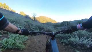
Videos of Telde Mountain Bike
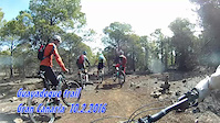
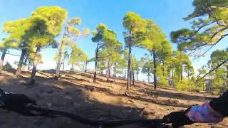
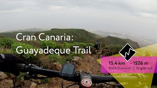
trail: Guayadeque Trail
12:26 |
512 |
Feb 16, 2016
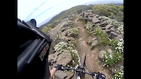
trail: Guayadeque Trail
3:45 |
527 |
Apr 18, 2015
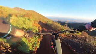
trail: Guayadeque Trail
17:43 |
214 |
Jan 14, 2025 , Telde

trail: Guayadeque Trail
17:43 |
81 |
Jan 14, 2025 , Telde

trail: Los Bucios
14:32 |
127 |
Jan 14, 2025 , Telde
trail: La Calderilla
14:32 |
75 |
Jan 14, 2025 , Telde
trail: Guayadeque Trail
11:58 |
90 |
Jan 14, 2025 , Telde
trail: Guayadeque Trail
19:16 |
886 |
Feb 3, 2020 , Telde
Recent Trail Reports
| status | trail | date | condition | info | user |
|---|---|---|---|---|---|
| Barranco de San Miguel | Mar 23, 2023 @ 1:13am Mar 23, 2023 | Ideal | pezamontes | ||
| La Mareta | Feb 17, 2023 @ 2:17am Feb 17, 2023 | Ideal | pezamontes | ||
| Paso de La Caldera | Jan 26, 2023 @ 3:37am Jan 26, 2023 | Ideal | asierpagoaga | ||
| Costa La Pardilla | Jan 14, 2023 @ 4:55pm Jan 14, 2023 | Ideal | pezamontes | ||
| Noche magica part 2 | Jun 3, 2022 @ 9:24am Jun 3, 2022 | Dry | antoniomariani | ||
| Guayadeque Trail | Mar 11, 2022 @ 3:07am Mar 11, 2022 | Dry | blaze-j |
Activity Feed
| username | action | type | title | date |
|---|---|---|---|---|
| JillFJohnson | wishlist | trail | activity #88956025 | Feb 15, 2026 @ 6:55am Feb 15, 2026 |
| TeresaLEWjdu | wishlist | trail | activity #88718625 | Feb 11, 2026 @ 4:07am Feb 11, 2026 |
| NorbertxvxAgF | wishlist | trail | activity #88396259 | Feb 5, 2026 @ 1:40pm Feb 5, 2026 |
| GarethRoderick | wishlist | trail | activity #84086137 | Nov 13, 2025 @ 12:39pm Nov 13, 2025 |
| micheletraversi | vote | trail | activity #73969751 | Jun 17, 2025 @ 7:22am Jun 17, 2025 |
Recent Comments
| username | type | title | comment | date |
|---|---|---|---|---|
| report | Ya han quitado la valla y se puede pasar sin... | Mar 16, 2023 @ 11:36am Mar 16, 2023 | ||
| trail | Schöne Natur, ein paar nette Stellen aber... | Feb 3, 2022 @ 10:18am Feb 3, 2022 | ||
| trail | Really good downhill trail! Almost no... | Dec 27, 2018 @ 1:48pm Dec 27, 2018 |
Local Badges
-

Completionist0 awarded -

Epic Mountain Bike Climb 2k204 awarded -

Climbing 10k Badge32 awarded -

Mountain Biking 100k Badge2 awarded -

Epic Ride Descent 2k204 awarded -

Descent 10k Badge32 awarded
Activity Type Stats
| activitytype | trails | distance | descent | descent distance | total vertical | rating | global rank | state rank | photos | reports | routes | ridelogs |
|---|---|---|---|---|---|---|---|---|---|---|---|---|
| Mountain Bike | 40 | 63 miles | 24,426 ft | 45 miles | 6,158 ft | #5,372 | #309 | 4 | 11 | 3,903 | ||
| E-Bike | 39 | 63 miles | 24,426 ft | 45 miles | 6,158 ft | #2,524 | #313 | 10 | 142 | |||
| Horse | 11 | 27 miles | 7,953 ft | 17 miles | 6,102 ft | #1,489 | #116 | |||||
| Hike | 40 | 63 miles | 24,426 ft | 45 miles | 6,158 ft | #4,033 | #280 | 11 | 301 | |||
| Trail Running | 40 | 63 miles | 24,426 ft | 45 miles | 6,158 ft | #3,458 | #273 | 11 | 39 |
Frequently Asked Questions About Telde
▼
What are the best places to ride in Telde?
Telde has 1 areas to explore for mountain biking. The top rated areas are:
▼
What are the highest rated mountain biking trails in Telde?
The highest rated mountain biking trails in Telde are:
- Los Alfaques (4.1/5)
- Noche magica part 1 (4.1/5)
- Guayadeque Trail (3.8/5)
- Barranco de San Miguel (0/5)
- Tara (0/5)
▼
What is the best time of the year to ride in Telde?
Based on ride log data, the most popular months to ride in Telde are:
- November (11 activities)
- January (5 activities)
- October (4 activities)
▼
Where can I park to ride in Telde?
Check the Telde trail map for trailhead and parking information. Community members regularly update access and parking details for trails in the area.
Activities
Trails
Points of Interest
- By dhguidecanarias & contributors
- Admins: not-really
- #39225 - 813 views
- telde activity log | embed map of Telde mountain bike trails | telde mountain biking points of interest
Downloading of trail gps tracks in kml & gpx formats is enabled for Telde.
You must login to download files.