close
-
Layers w
- Weather Layers
- Pro
- Pro
- Pro
- Pro
- Pro
- Pro
- More Layers
- Pro
- Pro
- Pro
- Pro
-
Upgrade to

3D
Trail Conditions
- Unknown
- Snow Groomed
- Snow Packed
- Snow Covered
- Snow Cover Partial
- Freeze/thaw Cycle
- Icy
- Prevalent Mud
- Wet
- Variable
- Ideal
- Dry
- Very Dry
Trail Flow (Ridden Direction)
Trailforks scans users ridelogs to determine the most popular direction each trail is ridden. A good flowing trail network will have most trails flowing in a single direction according to their intension.
The colour categories are based on what percentage of riders are riding a trail in its intended direction.
The colour categories are based on what percentage of riders are riding a trail in its intended direction.
- > 96%
- > 90%
- > 80%
- > 70%
- > 50%
- < 50%
- bi-directional trail
- no data
Trail Last Ridden
Trailforks scans ridelogs to determine the last time a trail was ridden.
- < 2 days
- < 1 week
- < 2 weeks
- < 1 month
- < 6 months
- > 6 months
Trail Ridden Direction
The intended direction a trail should be ridden.
- Downhill Only
- Downhill Primary
- Both Directions
- Uphill Primary
- Uphill Only
- One Direction
Contribute Details
Colors indicate trail is missing specified detail.
- Description
- Photos
- Description & Photos
- Videos
Trail Popularity ?
Trailforks scans ridelogs to determine which trails are ridden the most in the last 9 months.
Trails are compared with nearby trails in the same city region with a possible 25 colour shades.
Think of this as a heatmap, more rides = more kinetic energy = warmer colors.
- most popular
- popular
- less popular
- not popular
ATV/ORV/OHV Filter
Max Vehicle Width
inches
US Cell Coverage
Legend

Radar Time
Activity Recordings
Trailforks uses anonymized public activity data.
?
Activity Recordings
Trailforks uses anonymized public activity data.
?
Personal Heatmap
▶
Activity Types
all
/
none
▶
Options
2
Date range
month
–
Winter Trails
Warning
A routing network for winter maps does not exist. Selecting trails using the winter trails layer has been disabled.
Missing Trails
Most Popular
Least Popular
Trails are colored based on popularity. The more popular a trail is, the more red. Less popular trails trend towards green.
Jump Magnitude Heatmap
Heatmap of where riders jump on trails. Zoom in to see individual jumps, click circles to view jump details.
BC Backroad Status
![map legend]()
Service Road Atlas is a free to use, community-driven service for viewing and creating reports on the numerous back-country service roads around B.C. and Alberta.

Slope Aspect
Direction the slope faces
Trails Deemphasized
Trails are shown in grey.
Only show trails with no bike usage.
Suggested Layers
Based on selected activity type
Save the current map location and zoom level as your default home location whenever this page is loaded.
Save
No description for Thann has been added yet!
Login or register to submit one.
This region uses the Uk/Euro style trail grading system.
Activities Click to view
- Mountain Bike
78 trails
- E-Bike
68 trails
- Adaptive Bike
4 trails
- Winter Fat Bike
0 trails
- Horse
6 trails
- Hike
62 trails
- Trail Running
61 trails
Region Details
- 19
- 1
- 2
- 26
- 10
- 2
Region Status
Caution as of May 31, 2026Stats
- Avg Trail Rating
- Trails (view details)
- 62
- Trails Mountain Bike
- 78
- Trails E-Bike
- 68
- Trails Adaptive Bike
- 4
- Trails Horse
- 6
- Trails Hike
- 62
- Trails Trail Running
- 61
- Total Distance
- 33 miles
- Total Descent
- 18,129 ft
- Total Vertical
- 3,260 ft
- Highest Trailhead
- 4,067 ft
- Reports
- 214
- Photos
- 21
- Ridden Counter
- 996
Popular Thann Mountain Biking Trails
• 60 ★ 3.3 • 1,818 ft • 0 ft • 60 • • hike
NIce little run with few switchbacks, in a mix of gravel and loam dirt with few option for biking. Quite fun !
• ★ 4.4 • 5,020 ft • 150 ft • 52 •
Trail assez naturel avec tout de meme quelques saut et virage relevé, plutot rapide, tres fun avec quelque passsages techniques et cassants evitable facilement. EN : A fairly natural trail with a few jumps and banked turns, quite fast,...
• ★ 4.5 • 2,808 ft • 9 ft • 46 •
Trail assez shapé, qui roule vite, tres fun ! Dans la terre, quelques racines et cailloux, un banger ! La fin et un peu plus droite et moin fun. A pretty well-maintained trail that’s fast and loads of fun! On the dirt, with a few...
• 15 ★ 0.0 • 4,665 ft • 44 ft • 30 • • hike
Less popular green difficulty singletrack. This hike primary trail. On average it takes 12 minutes to complete this trail.
• 95 ★ 3.0 • 4,377 ft • 0 ft • 26 • • hike
Popular blue difficulty singletrack. This hike primary trail can be used downhill primary. It features rock garden. On average it takes 7 minutes to complete this trail.
• 15 ★ 3.6 • 2 miles • 12 ft • 26 •
Nice singletrack from the summit of Hohrupt to the abbaye of Murbach A local classic with nice switchback
• ★ 5.0 • 2,254 ft • 0 ft • 25 •
Trail avec un bon flow dans de la gravette, quelques sauts. Ca commence avec un faible pente, puis ca s'accentue, en devenant un peu plus technique. Trail with a good flow in small lose rocks, a few jumps. It starts with a gentle slope,...
Thann Mountain Bike Routes
22 miles • 5,344 ft • 4 • Point to Point •
Willer sur Thur -> Moosch par Thannerhubel, Rossberg et Vogelstein
15 miles • 3,221 ft • 0 •
Photos of Thann Mountain Bike
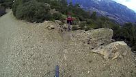
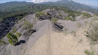
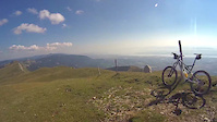
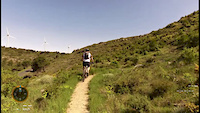
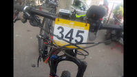
Videos of Thann Mountain Bike
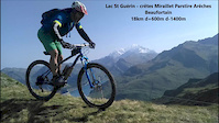
trail: Crêtes !
8:31 |
290 |
Feb 8, 2018
trail: Crêtes !
13:56 |
171 |
Nov 9, 2017

trail: Crêtes !
3:33 |
192 |
Sep 4, 2017
trail: Crêtes !
2:08 |
77 |
Jun 3, 2017
trail: Crêtes !
11:52 |
81 |
May 11, 2017

trail: Crêtes !
9:25 |
174 |
May 16, 2016
trail: Crêtes !
6:23 |
45 |
May 31, 2015
trail: Crêtes !
7:22 |
194 |
May 25, 2015
Recent Trail Reports
| status | trail | date | condition | info | user |
|---|---|---|---|---|---|
| hohrupf classic | May 31, 2026 @ 9:14am (Europe/Paris) May 31, 2026 | Dry | karls-drowning | ||
| Amselkopf | May 23, 2026 @ 10:40pm (Europe/Paris) May 23, 2026 | Ideal | nolan431 | ||
| Herrenstubenkopf | May 11, 2026 @ 2:24am (America/Vancouver) May 11, 2026 | Ideal | provencemb B MTB Co | ||
| Pastet | May 11, 2026 @ 2:21am (America/Vancouver) May 11, 2026 | Ideal | provencemb B MTB Co | ||
| Erzenbach | May 11, 2026 @ 2:11am (America/Vancouver) May 11, 2026 | Ideal | provencemb B MTB Co | ||
| Camps Turenne | May 11, 2026 @ 2:11am (America/Vancouver) May 11, 2026 | Ideal | provencemb B MTB Co | ||
| Sudel Part 1 | May 2, 2026 @ 9:18am (Europe/Paris) May 2, 2026 | Dry | DAVIDRITN | ||
| Buba-gump | Apr 25, 2026 @ 9:02am (Europe/Zurich) Apr 25, 2026 | Dry | nobrain | ||
| Sudel Part 3 | Sep 21, 2025 @ 10:40am (Europe/Paris) Sep 21, 2025 | Ideal | karls-drowning | ||
| Sudel part 2 | Sep 21, 2025 @ 10:39am (Europe/Paris) Sep 21, 2025 | Dry | karls-drowning |
Activity Feed
| username | action | type | title | date |
|---|---|---|---|---|
| endurodughetto | vote | trail | activity #96400162 | Jun 6, 2026 @ 1:02pm Jun 6, 2026 |
| Neofunk68 | difficultyvote | trail | activity #96005970 | Jun 1, 2026 @ 3:05am Jun 1, 2026 |
| Neofunk68 | vote | trail | activity #96005953 and 1 more | Jun 1, 2026 @ 3:05am Jun 1, 2026 |
| karls-drowning | difficultyvote | trail | activity #95912951 | May 31, 2026 @ 12:16am May 31, 2026 |
| karls-drowning | add | report | activity #95912924 | May 31, 2026 @ 12:16am May 31, 2026 |
Recent Comments
| username | type | title | comment | date |
|---|---|---|---|---|
| trail | Linked up from above to finish run into the... | Apr 29, 2026 @ 8:04am Apr 29, 2026 | ||
| trail | I accessed this from the hiking trail a bit... | Apr 29, 2026 @ 8:02am Apr 29, 2026 | ||
| trail | Great track. Fast sections and still some... | Apr 29, 2026 @ 8:01am Apr 29, 2026 | ||
| trail | Fun link to further down. Short. not too hard. | Apr 29, 2026 @ 8:00am Apr 29, 2026 | ||
| trail | Really nice and sometimes techy Trail! | Apr 13, 2026 @ 2:44pm Apr 13, 2026 |
Local Badges
-

10 Blue Trails11 awarded -

Epic Ride Climb 2k240 awarded -

Climbing 10k Badge23 awarded -

Climbing 100k Badge3 awarded -

Epic Ride Descent 2k240 awarded -

Descent 10k Badge23 awarded
Bike & Skill Parks
| name | type | city | rating |
|---|---|---|---|
| Cernay | skill park | Thann |
Activity Type Stats
| activitytype | trails | distance | descent | descent distance | total vertical | rating | global rank | state rank | photos | reports | routes | ridelogs |
|---|---|---|---|---|---|---|---|---|---|---|---|---|
| Mountain Bike | 78 | 33 miles | 18,130 ft | 25 miles | 3,261 ft | #4,203 | #142 | 21 | 214 | 3 | 2,493 | |
| E-Bike | 68 | 21 miles | 10,033 ft | 15 miles | 3,261 ft | #2,890 | #162 | 198 | 1 | 608 | ||
| Adaptive Bike | 4 | #137 | #128 | |||||||||
| Horse | 6 | 3 miles | 617 ft | 1 mile | 1,555 ft | #1,033 | #43 | 19 | ||||
| Hike | 62 | 30 miles | 15,522 ft | 22 miles | 3,261 ft | #4,082 | #115 | 206 | 71 | |||
| Trail Running | 61 | 29 miles | 15,233 ft | 22 miles | 3,261 ft | #3,918 | #126 | 206 | 43 |
Frequently Asked Questions About Thann
▼
What are the best places to ride in Thann?
Thann has 1 areas to explore for mountain biking.
▼
What are the highest rated mountain biking trails in Thann?
The highest rated mountain biking trails in Thann are:
- Herrenstubenkopf (4.2/5)
- HOP A GEISHOUSE (4.1/5)
- Pastet (4/5)
- Erzenbach (4/5)
- Vita trail (4/5)
▼
What is the best time of the year to ride in Thann?
Based on ride log data, the most popular months to ride in Thann are:
- June (13 activities)
- August (10 activities)
- April (10 activities)
▼
Where can I park to ride in Thann?
Activities
Trails
Points of Interest
- By maettu99 & contributors
- Admins: provencemb
- #10183 - 4,786 views
- thann activity log | embed map of Thann mountain bike trails | thann mountain biking points of interest
Downloading of trail gps tracks in kml & gpx formats is enabled for Thann.
You must login to download files.