close
-
Layers w
- Weather Layers
- Pro
- Pro
- Pro
- Pro
- Pro
- Pro
- More Layers
- Pro
- Pro
- Pro
- Pro
-
Upgrade to

3D
Trail Conditions
- Unknown
- Snow Groomed
- Snow Packed
- Snow Covered
- Snow Cover Partial
- Freeze/thaw Cycle
- Icy
- Prevalent Mud
- Wet
- Variable
- Ideal
- Dry
- Very Dry
Trail Flow (Ridden Direction)
Trailforks scans users ridelogs to determine the most popular direction each trail is ridden. A good flowing trail network will have most trails flowing in a single direction according to their intension.
The colour categories are based on what percentage of riders are riding a trail in its intended direction.
The colour categories are based on what percentage of riders are riding a trail in its intended direction.
- > 96%
- > 90%
- > 80%
- > 70%
- > 50%
- < 50%
- bi-directional trail
- no data
Trail Last Ridden
Trailforks scans ridelogs to determine the last time a trail was ridden.
- < 2 days
- < 1 week
- < 2 weeks
- < 1 month
- < 6 months
- > 6 months
Trail Ridden Direction
The intended direction a trail should be ridden.
- Downhill Only
- Downhill Primary
- Both Directions
- Uphill Primary
- Uphill Only
- One Direction
Contribute Details
Colors indicate trail is missing specified detail.
- Description
- Photos
- Description & Photos
- Videos
Trail Popularity ?
Trailforks scans ridelogs to determine which trails are ridden the most in the last 9 months.
Trails are compared with nearby trails in the same city region with a possible 25 colour shades.
Think of this as a heatmap, more rides = more kinetic energy = warmer colors.
- most popular
- popular
- less popular
- not popular
ATV/ORV/OHV Filter
Max Vehicle Width
inches
US Cell Coverage
Legend

Radar Time
Activity Recordings
Trailforks uses anonymized public activity data.
?
Activity Recordings
Trailforks uses anonymized public activity data.
?
Personal Heatmap
▶
Activity Types
all
/
none
▶
Options
2
Date range
month
–
Winter Trails
Warning
A routing network for winter maps does not exist. Selecting trails using the winter trails layer has been disabled.
Missing Trails
Most Popular
Least Popular
Trails are colored based on popularity. The more popular a trail is, the more red. Less popular trails trend towards green.
Jump Magnitude Heatmap
Heatmap of where riders jump on trails. Zoom in to see individual jumps, click circles to view jump details.
BC Backroad Status
![map legend]()
Service Road Atlas is a free to use, community-driven service for viewing and creating reports on the numerous back-country service roads around B.C. and Alberta.

Slope Aspect
Direction the slope faces
Trails Deemphasized
Trails are shown in grey.
Only show trails with no bike usage.
Suggested Layers
Based on selected activity type
Save the current map location and zoom level as your default home location whenever this page is loaded.
Save
No description for Thun has been added yet!
Login or register to submit one.
This region uses the Uk/Euro style trail grading system.
Activities Click to view
- Mountain Bike
16 trails
- E-Bike
15 trails
- Gravel Bike
0 trails
- Adaptive Bike
0 trails
- Hike
14 trails
- Trail Running
14 trails
Region Details
- 9
- 5
Region Status
Open as of Jun 13, 2026Stats
- Avg Trail Rating
- Trails (view details)
- 16
- Trails Mountain Bike
- 17
- Trails E-Bike
- 15
- Trails Hike
- 14
- Trails Trail Running
- 14
- Total Distance
- 11 miles
- Total Descent Distance
- 7 miles
- Total Descent
- 5,667 ft
- Total Vertical
- 1,820 ft
- Highest Trailhead
- 3,805 ft
- Reports
- 342
- Photos
- 66
- Ridden Counter
- 4,800
Sub Regions
-
Bikepark Thunersee - Rabeflueh
- 5
- 3
Popular Thun Mountain Biking Trails
• 95 ★ 4.8 • 1 mile • 0 ft • 465 •
Verspielter Flowtrail mit hohen Steilwandkurven und vielen Sprüngen.
• 100 ★ 4.9 • 2 miles • 4 ft • 458 •
Highly rated popular blue difficulty family friendly machine groomed. This mountain bike primary trail and has a moderate overall physical rating. It features berm, drop, jump, gap jump and roller coaster. On average it takes 15 minutes to complete this trail.
• 80 ★ 4.0 • 2,749 ft • 182 ft • 103 •
The narrow challenger for XC freaks brings you to the top of the Offcamber Trail. At rainy days the first part is really muddy.
• 75 ★ 4.5 • 1,709 ft • 0 ft • 84 •
Popular red difficulty singletrack. This multi-use trail can be used downhill only. Trail visibility is sometimes hard to follow. On average it takes 6 minutes to complete this trail.
• 65 ★ 4.5 • 869 ft • 0 ft • 76 •
Ein abwechslungsreicher kurzer Trail mit Wellen und technische Abschnitten.
• 50 ★ 4.5 • 2,556 ft • 0 ft • 64 • • hike
This trail is always the most dry trail in the Thun area. Watch out for hikkers!!! Most parts on the hikking trail.
Thun Mountain Bike Routes
6 miles • 1,607 ft • 3 •
Wem zuwenig ist kann Extendet machen. Oberhalb vom Start ein knackiger Anstieg hoch bis zum Offcamber...
★ 5.0 • 17 miles • 4,374 ft • 0 • Loop •
From Thun Trainstation to Reutigen by Bike in 20min. Alternative take Veloland Route 8 Aare - it's...
4 miles • 1,141 ft • 3 •
Der einfachste Aufstieg durch den Wald an den Start des Trails.
6 miles • 1,316 ft • 2 •
Aufstieg auf einer mehrheitlich ruhigen Strasse zum Start des Trails.
27 miles • 3,168 ft • 0 • Loop •
Explore whole Diemtigtal in one scenic Ride. Don't forget to pass by the DH Racing Track at Wiriehorn...
Photos of Thun Mountain Bike
Videos of Thun Mountain Bike
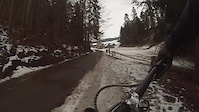
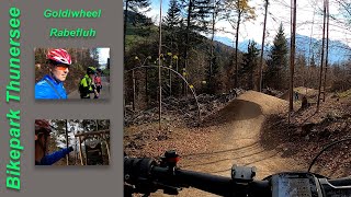
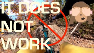
trail: Goldiwheel Trail
5:18 |
287 |
Jan 22, 2021
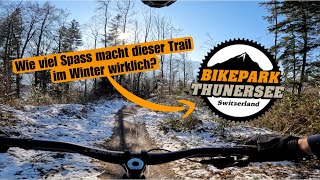
2:11 |
18 |
Sep 10, 2025
youtuber
![Winter POV Goldiwheel Trail 2025 | Bike Park...]()
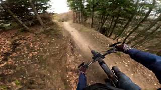
trail: Goldiwheel Trail
5:02 |
84 |
Jan 18, 2025 , Thun
trail: Rabenfluh Trail
6:04 |
591 |
Mar 10, 2024 , Thun
trail: Goldiwheel Trail
15:35 |
1304 |
May 5, 2021 , Thun
trail: Goldiwheel Trail
3:29 |
1051 |
Feb 27, 2021 , Thun
trail: Rabenfluh Trail
0:51 |
1229 |
Jun 23, 2020 , Thun
trail: Rabeflueh Offcamber
2:33 |
975 |
Jun 6, 2018 , Thun
Recent Trail Reports
| status | trail | date | condition | info | user |
|---|---|---|---|---|---|
| Winteregg | Jun 13, 2026 @ 6:41pm (Europe/Zurich) Jun 13, 2026 | Ideal | Marc1915 | ||
| Goldiwheel Trail | Jun 13, 2026 @ 6:40pm (Europe/Zurich) Jun 13, 2026 | Dry | Marc1915 | ||
| Rabenfluh Trail | May 10, 2026 @ 9:05am (Europe/Zurich) May 10, 2026 | Dry | chriguc | ||
| Extendet Climb | May 10, 2026 @ 9:05am (Europe/Zurich) May 10, 2026 | Ideal | chriguc | ||
| Connector Climb | May 10, 2026 @ 9:05am (Europe/Zurich) May 10, 2026 | Dry | chriguc | ||
| Rabeflue Climb | Apr 18, 2026 @ 10:31am (Europe/Zurich) Apr 18, 2026 | Dry | Mva87 | ||
| Bach Trail | Dec 14, 2025 @ 11:25am (Europe/Zurich) Dec 14, 2025 | Variable | daflow17 | ||
| Einzeller | Dec 14, 2025 @ 11:25am (Europe/Zurich) Dec 14, 2025 | Variable | daflow17 | ||
| Haltenegg | Dec 14, 2025 @ 11:25am (Europe/Zurich) Dec 14, 2025 | Variable | daflow17 | ||
| Rabeflueh Offcamber | Dec 19, 2025 @ 9:51am (Europe/Zurich) Dec 19, 2025 | Variable | menukunz Thun Kandertal |
Activity Feed
| username | action | type | title | date |
|---|---|---|---|---|
| 3HvXrl | wishlist | route | activity #97515581 | Jun 21, 2026 @ 1:22pm 3 hours |
| Yuriy0ogDiY | wishlist | trail | activity #97324217 | Jun 19, 2026 @ 9:31am 2 days |
| XTAdventures | ridden | trail | activity #97160518 | Jun 16, 2026 @ 8:47pm Jun 16, 2026 |
| Marc1915 | add | report | activity #96888796 | Jun 13, 2026 @ 9:41am Jun 13, 2026 |
| Marc1915 | ridden | trail | activity #96888765 | Jun 13, 2026 @ 9:41am Jun 13, 2026 |
Recent Comments
| username | type | title | comment | date |
|---|---|---|---|---|
| trail | Geil, so steil | Nov 10, 2024 @ 11:16pm Nov 10, 2024 | ||
| report | Thanks! You can leave the bags out by Francis... | Oct 11, 2023 @ 12:48pm Oct 11, 2023 | ||
| trail | If you hate yourself, choose to ride the trail... | Sep 5, 2023 @ 1:55pm Sep 5, 2023 | ||
| trail | Top | Aug 14, 2023 @ 1:23pm Aug 14, 2023 | ||
| trail | Half way the trail there are a lot trees and... | Jul 28, 2023 @ 7:45am Jul 28, 2023 |
Local Badges
-

10 Blue Trails81 awarded -

Epic Ride Climb 2k168 awarded -

Climbing 10k Badge71 awarded -

Climbing 100k Badge4 awarded -

Epic Ride Descent 2k251 awarded -

Descent 10k Badge81 awarded
Bike & Skill Parks
| name | type | city | rating |
|---|---|---|---|
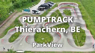
| Pumptrack Lerchenfeld | skill park | Thun | |
| Pumptrack Thierachern | skill park | Thun | |
| Dirt Jump Park Steffisburg | skill park | Thun |
Activity Type Stats
| activitytype | trails | distance | descent | descent distance | total vertical | rating | global rank | state rank | photos | reports | routes | ridelogs |
|---|---|---|---|---|---|---|---|---|---|---|---|---|
| Mountain Bike | 16 | 9 miles | 5,502 ft | 6 miles | 1,821 ft | #2,534 | #31 | 66 | 351 | 6 | 7,678 | |
| E-Bike | 15 | 9 miles | 4,970 ft | 6 miles | 1,821 ft | #2,233 | #85 | 2 | 327 | 2 | 857 | |
| Hike | 14 | 7 miles | 2,694 ft | 3 miles | 1,821 ft | #3,729 | #71 | 2 | 323 | 227 | ||
| Trail Running | 14 | 7 miles | 2,694 ft | 3 miles | 1,821 ft | #3,299 | #60 | 323 | 85 |
Frequently Asked Questions About Thun
▼
What are the best places to ride in Thun?
Thun has 1 areas to explore for mountain biking. The top rated areas are:
▼
What are the highest rated mountain biking trails in Thun?
The highest rated mountain biking trails in Thun are:
- Goldiwheel Trail (4.6/5)
- Rabenfluh Trail (4.6/5)
- Haltenegg (4.2/5)
- Einzeller (4.1/5)
- Hirzelaass (4.1/5)
▼
What is the best time of the year to ride in Thun?
Based on ride log data, the most popular months to ride in Thun are:
- May (85 activities)
- April (78 activities)
- June (62 activities)
▼
Where can I park to ride in Thun?
There are 6 parking locations listed in Thun. The most popular parking spots are:
- Parking Offcamber
- Parking
- Parking Gürbe Trailcenter
- Parking Rabenfluh Trail
- Parking Bike Park Steffisburg
Activities
Trails
- By NoodlezTrailnet & contributors
- Admins: Thun Kandertal
- #14287 - 13,003 views
- thun activity log | embed map of Thun mountain bike trails | thun mountain biking points of interest
Downloading of trail gps tracks in kml & gpx formats is enabled for Thun.
You must login to download files.