close
-
Layers w
- Weather Layers
- Pro
- Pro
- Pro
- Pro
- Pro
- Pro
- More Layers
- Pro
- Pro
- Pro
- Pro
-
Upgrade to

3D
Trail Conditions
- Unknown
- Snow Groomed
- Snow Packed
- Snow Covered
- Snow Cover Partial
- Freeze/thaw Cycle
- Icy
- Prevalent Mud
- Wet
- Variable
- Ideal
- Dry
- Very Dry
Trail Flow (Ridden Direction)
Trailforks scans users ridelogs to determine the most popular direction each trail is ridden. A good flowing trail network will have most trails flowing in a single direction according to their intension.
The colour categories are based on what percentage of riders are riding a trail in its intended direction.
The colour categories are based on what percentage of riders are riding a trail in its intended direction.
- > 96%
- > 90%
- > 80%
- > 70%
- > 50%
- < 50%
- bi-directional trail
- no data
Trail Last Ridden
Trailforks scans ridelogs to determine the last time a trail was ridden.
- < 2 days
- < 1 week
- < 2 weeks
- < 1 month
- < 6 months
- > 6 months
Trail Ridden Direction
The intended direction a trail should be ridden.
- Downhill Only
- Downhill Primary
- Both Directions
- Uphill Primary
- Uphill Only
- One Direction
Contribute Details
Colors indicate trail is missing specified detail.
- Description
- Photos
- Description & Photos
- Videos
Trail Popularity ?
Trailforks scans ridelogs to determine which trails are ridden the most in the last 9 months.
Trails are compared with nearby trails in the same city region with a possible 25 colour shades.
Think of this as a heatmap, more rides = more kinetic energy = warmer colors.
- most popular
- popular
- less popular
- not popular
ATV/ORV/OHV Filter
Max Vehicle Width
inches
US Cell Coverage
Legend

Radar Time
Activity Recordings
Trailforks uses anonymized public activity data.
?
Activity Recordings
Trailforks uses anonymized public activity data.
?
Personal Heatmap
▶
Activity Types
all
/
none
▶
Options
2
Date range
month
–
Winter Trails
Warning
A routing network for winter maps does not exist. Selecting trails using the winter trails layer has been disabled.
Missing Trails
Most Popular
Least Popular
Trails are colored based on popularity. The more popular a trail is, the more red. Less popular trails trend towards green.
Jump Magnitude Heatmap
Heatmap of where riders jump on trails. Zoom in to see individual jumps, click circles to view jump details.
BC Backroad Status
![map legend]()
Service Road Atlas is a free to use, community-driven service for viewing and creating reports on the numerous back-country service roads around B.C. and Alberta.

Slope Aspect
Direction the slope faces
Trails Deemphasized
Trails are shown in grey.
Only show trails with no bike usage.
Suggested Layers
Based on selected activity type
Save the current map location and zoom level as your default home location whenever this page is loaded.
Save
No description for Thüringen has been added yet!
Login or register to submit one.
Links
This region uses the Uk/Euro style trail grading system.
Region Details
- 8
- 120
- 163
- 64
- 11
Stats
- Avg Trail Rating
- Trails (view details)
- 366
- Trails Mountain Bike
- 398
- Trails E-Bike
- 393
- Trails Horse
- 3
- Trails Hike
- 268
- Trails Trail Running
- 269
- Trails Nordic Ski
- 6
- Total Distance
- 157 miles
- Total Descent
- 73,394 ft
- Total Vertical
- 2,667 ft
- Highest Trailhead
- 3,202 ft
- Reports
- 1,191
- Photos
- 307
- Ridden Counter
- 6,134
Sub Regions
- Eisenach (Stadtkreis) (9)
- Eisenach (9)
- Hörselberg (6)
- Eisenach (9)
- Erfurt (Stadtkreis) (16)
- Erfurt (16)
- Erfurt (16)
- Gera (Stadtkreis) (7)
- Ilm-Kreis (145)
- Amt Wachsenburg (3)
- Arnstadt (9)
- Ilmenau (98)
- Trailpark Lindenberg (14)
- Amt Wachsenburg (3)
- Jena (Stadtkreis) (21)
- Jena (21)
- Saaletal - Jena (20)
- Jena (21)
- Kyffhäuserkreis (9)
- Bad Frankenhausen (6)
- Kyffhäuserland (3)
- Bad Frankenhausen (6)
- Landkreis Eichsfeld (5)
- Landkreis Gotha (38)
- Bad Tabarz (16)
- Inselsberg (11)
- Gotha (8)
- Bad Tabarz (16)
- Landkreis Greiz (1)
- Landkreis Hildburghausen (10)
- Schleusingen (9)
- Schleusingen (9)
- Landkreis Nordhausen (7)
- Großlohra (1)
- Nordhausen (5)
- Großlohra (1)
- Landkreis Saalfeld-Rudolstadt (17)
- Saalfeld (17)
- Saalfeld (17)
- Landkreis Schmalkalden-Meiningen (39)
- Dolmar-Salzbrücke (3)
- Meiningen (20)
- Oberhof (12)
- Bike Park Oberhof (12)
- Zella-Mehlis (3)
- Dolmar-Salzbrücke (3)
- Landkreis Sonneberg (21)
- Saale-Holzland-Kreis (11)
- Kahla (5)
- Lippersdorf-Erdmannsdorf (1)
- VG Südliches Saaletal (2)
- Kahla (5)
- Saale-Orla-Kreis (7)
- Suhl (Stadtkreis) (30)
- Suhl (30)
- Suhl (30)
- Unstrut-Hainich-Kreis (0)
- Muhlhausen (0)
- Muhlhausen (0)
- Wartburgkreis (1)
- Ruhla (1)
Popular Thüringen Mountain Biking Trails
• 90 ★ 3.6 • 3,323 ft • 0 ft • 138 •
Länge: 950 km Schwierigkeit: leicht Helmpflicht Auflage: Brechsand / Kalk
• 50 ★ 3.5 • 1,821 ft • 0 ft • 128 •
Mit den Jungs um Gregor Siegmund und Fahrrad Eberhardt/Gotha haben wir zusammen an den verschiedenen Stunts des Trails gebastelt. Es erwartet euch jede Menge Action: viele Jumps, technische Passagen, natürliches Gelände und...
• 80 ★ 4.5 • 2,736 ft • 0 ft • 96 •
Freeride mit 2m Drop, Tables, Doubles und Anliegerkurven. Es gibt immer wieder Verbinder zur Downhillstrecke, dem .
• 100 ★ 3.5 • 1 mile • 0 ft • 93 •
Popular green difficulty family friendly singletrack. This mountain bike primary trail can be used downhill only and has a easy overall physical rating. It features berm and jump. Trail visibility is always easy to follow. On average it takes 4 minutes to complete this trail.
• 100 ★ 5.0 • 2,890 ft • 0 ft • 53 •
Popular blue difficulty singletrack. This mountain bike primary trail can be used both directions. On average it takes 5 minutes to complete this trail.
• 100 ★ 4.0 • 892 ft • 0 ft • 45 •
Popular blue difficulty singletrack. This mountain bike primary trail can be used downhill only. On average it takes minutes to complete this trail.
Thüringen Mountain Bike Routes
25 miles • 2,308 ft • 0 •
My first uploadMy first uploadMy first uploadMy first upload
19 miles • 3,843 ft • 0 • Point to Point •
2011 Inselsbergmarathon Bad Tabarz
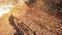
Photos of Thüringen Mountain Bike
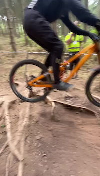
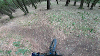
Videos of Thüringen Mountain Bike
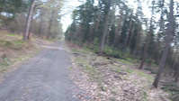
trail: Wilde Hilde
3:17 |
6 |
Apr 18, 2026
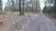
trail: Wilde Hilde
3:21 |
2 |
Apr 18, 2026
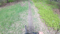
trail: Dörty Dörte
0:36 |
8 |
Apr 18, 2026
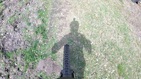
trail: Dörty Dörte
0:49 |
4 |
Apr 18, 2026
trail: Dudelpump Mackenrode
0:21 |
22 |
Apr 8, 2023
0:10 |
73 |
Jul 23, 2022
trail: Habichtsburg-Trail
3:24 |
77 |
Dec 13, 2020
trail: MHV Special Track V1
2:03 |
361 |
Jul 16, 2019
Recent Trail Reports
Activity Feed
| username | action | type | title | date |
|---|---|---|---|---|
| calidad | add | report | activity #97003667 and 4 more | Jun 14, 2026 @ 2:09pm 3 days |
| calidad | ridden | trail | activity #97003625 | Jun 14, 2026 @ 2:09pm 3 days |
| calidad | wishlist | trail | activity #97003595 | Jun 14, 2026 @ 2:08pm 3 days |
| calidad | add | photo | activity #96963146 and 1 more | Jun 14, 2026 @ 6:45am Jun 14, 2026 |
| calidad | checkin | trail | activity #96963089 | Jun 14, 2026 @ 6:44am Jun 14, 2026 |
Recent Comments
| username | type | title | comment | date |
|---|---|---|---|---|
| trail | Leider kaum mehr vorhanden. Nicht lohnend. | Apr 9, 2026 @ 8:50am Apr 9, 2026 | ||
| report | Grüße wie wäre denn der aktuelle Zustand... | Dec 21, 2025 @ 12:05pm Dec 21, 2025 | ||
| trail | Ansich schöne Strecke leider is der letzte... | Oct 24, 2025 @ 8:55am Oct 24, 2025 | ||
| trail | Durch Forst Arbeiten nicht mehr nutzbar. | Sep 14, 2025 @ 9:37am Sep 14, 2025 | ||
| trail | Alles zugewachsen und verwildert. | Jun 15, 2025 @ 4:20am Jun 15, 2025 |
Local Badges
-

Epic Mountain Bike Climb 2k32 awarded -

Epic Ride 50k35 awarded -
Epic Ride 50k54 awarded -
Epic Ride 50k191 awarded -

Mountain Biking 100k Badge0 awarded -

Epic Ride Descent 2k32 awarded
Bike & Skill Parks
| name | type | city | rating |
|---|---|---|---|
| Bike Park Oberhof | bike park | Oberhof | |
| Bikearena Silbersattel | bike park | Coburg | |
| Bikepark Kahla | skill park | Kahla | |
| Pumptrack Seebach | skill park | Bad Tabarz | |
| Pumptrack Ilmenau | skill park | Ilmenau |
Activity Type Stats
| activitytype | trails | distance | descent | descent distance | total vertical | rating | global rank | state rank | photos | reports | routes | ridelogs |
|---|---|---|---|---|---|---|---|---|---|---|---|---|
| Mountain Bike | 398 | 157 miles | 73,396 ft | 126 miles | 2,667 ft | 303 | 1,191 | 2 | 36,254 | |||
| E-Bike | 393 | 155 miles | 72,339 ft | 125 miles | 2,667 ft | 3 | 894 | 1 | 4,344 | |||
| Horse | 3 | 1,230 ft | 89 ft | 1,155 ft | 89 ft | 8 | ||||||
| Hike | 268 | 130 miles | 59,833 ft | 103 miles | 2,654 ft | 1 | 1,097 | 1,625 | ||||
| Trail Running | 269 | 130 miles | 60,013 ft | 103 miles | 2,654 ft | 1,110 | 497 | |||||
| Nordic Ski | 6 | 412 |
Activities
Trails
- By Thomesch
 & contributors
 - Admins: Sasse82, elreyrules, cemoorelife
- #23593 - 8,627 views
- thüringen activity log | embed map of Thüringen mountain bike trails | thüringen mountain biking points of interest
Downloading of trail gps tracks in kml & gpx formats is enabled for Thüringen.
You must login to download files.