
close
3D
Trail Conditions
- Unknown
- Snow Groomed
- Snow Packed
- Snow Covered
- Snow Cover Partial
- Freeze/thaw Cycle
- Icy
- Prevalent Mud
- Wet
- Variable
- Ideal
- Dry
- Very Dry
Trail Flow (Ridden Direction)
Trailforks scans users activity logs to determine the most popular direction each trail is ridden. A good flowing trail network will have most trails flowing in a single direction according to their intension.
The colour categories are based on what percentage of users are riding a trail in its intended direction.
The colour categories are based on what percentage of users are riding a trail in its intended direction.
- > 96%
- > 90%
- > 80%
- > 70%
- > 50%
- < 50%
- bi-directional trail
- no data
Trail Last Used
Trailforks scans activity logs to determine the last time a trail was ridden.
- < 2 days
- < 1 week
- < 2 weeks
- < 1 month
- < 6 months
- > 6 months
Trail Ridden Direction
The intended direction a trail should be ridden.
- Downhill Only
- Downhill Primary
- Both Directions
- Uphill Primary
- Uphill Only
- One Direction
Contribute Details
Colors indicate trail is missing specified detail.
- Description
- Photos
- Description & Photos
- Videos
Trail Popularity ?
Trailforks scans activity logs to determine which trails are ridden the most in the last 9 months.
Trails are compared with nearby trails in the same city region with a possible 25 colour shades.
Think of this as a heatmap, more activities = more kinetic energy = warmer colors.
- most popular
- popular
- less popular
- not popular
ATV/ORV/OHV Filter
Max Vehicle Width
inches
US Cell Coverage
Legend

Radar Time
Activity Recordings
Trailforks uses anonymized public activity data.
?
Activity Recordings
Trailforks uses anonymized public activity data.
?
Winter Trails
Warning
A routing network for winter maps does not exist. Selecting trails using the winter trails layer has been disabled.
Missing Trails
Most Popular
Least Popular
Trails are colored based on popularity. The more popular a trail is, the more red. Less popular trails trend towards green.
Jump Magnitude Heatmap
Heatmap of where users jump on trails. Zoom in to see individual jumps, click circles to view jump details.
BC Backroad Status
![map legend]()
Service Road Atlas is a free to use, community-driven service for viewing and creating reports on the numerous back-country service roads around B.C. and Alberta.

Slope Aspect
Direction the slope faces
Trails Deemphasized
Trails are shown in grey.
Only show trails with no bike usage.
Suggested Layers
Based on selected activity type
Save the current map location and zoom level as your default home location whenever this page is loaded.
SaveOverview
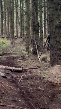
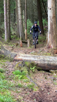
Ticknock National Mountain Bike Trail Centre is a purpose-built mountain-bike network in Ticknock Forest in the Dublin Mountains, immediately south of Dublin. Managed by Coillte, the network combines purpose-built singletrack with forest roads and open upland terrain, providing a challenging mountain-bike experience with extensive views over Dublin City, Dublin Bay, Bray Head and the Wicklow Mountains. Ticknock is one of Coillte's five National Mountain Bike Trail Centres and is one of Ireland's most accessible major mountain-bike destinations.
The network has a distinctly fast and technical character. Forest-road climbs lead into tight, twisting singletrack with fast descents, frequent changes of elevation, bermed turns, rocky sections, rollers and other technical features. The upper portions are exposed and can be very windy in poor weather, while the combination of rock, roots, mud, loose stone and gravel can become particularly challenging when wet.
Ticknock also occupies an important position within the wider Dublin Mountains trail network. The surrounding forest and uplands contain walking routes including the Dublin Mountains Way, Wicklow Way and Fairy Castle Loop, together with permanent orienteering courses and extensive forest roads. Mountain bikers should therefore expect to encounter walkers, runners and forestry vehicles throughout the area.
Trails
The principal Red Loop is approximately 13 km long with around 306 metres of climbing and generally takes 90–120 minutes. It is graded difficult to severe and follows a combination of forest roads and purpose-built singletrack. The route includes Barn Stormer, Tom's Climb, Devil's Elbow, Blazing Saddles, the Pump Track and Skylines://www.trailforks.com/trails/skyline-26560/]Skyline[/L]. The riding varies from fast and flowing to tight and technical, with frequent steep and narrow sections, rocky terrain, roots, loose surfaces and technical features. It is not suitable for novice mountain bikers.
The After Burner black-grade option adds approximately 2 km and 30 metres of climbing to the network. It branches from the Red Loop at The Fork and climbs toward the highest point of the mountain-bike network beneath Two Rock Mountain before descending through a highly technical sequence of rock steps, sweeping berms, rocky sections, steep rooty pitches, rollers and other technical features. It is graded severe throughout and should only be attempted by highly experienced and highly competent riders.
The trail system includes a number of individually named sections that give the network much of its distinctive character. Barn Stormer provides the first major descent after leaving the trailhead, while Tom's Climb is the longest climbing section, eventually reaching Kilmashogue forest road. Devil's Elbow is a fast, rocky descent incorporating drops and bermed sections. Blazing Saddles leads toward the upper portions of the network, while the Pump Track provides a short, feature-rich section containing tabletops and rollers. Skylines://www.trailforks.com/trails/skyline-26560/]Skyline[/L], at more than 2 km, forms the final major descent and is one of the signature sections of the Red Loop.
The trails are waymarked in one direction, and riders should follow the arrows rather than attempting to ride the network in reverse. The combination of sustained climbing, technical descents and repeated changes of pace makes Ticknock primarily a fitness- and skills-oriented cross-country trail centre rather than a conventional downhill park.
Land Managers & Trail Associations
The underlying land and mountain-bike trail network are managed by Coillte, Ireland's state-owned forestry company. Ticknock is one of Coillte's five National Mountain Bike Trail Centres, alongside Coolaney, Ballinastoe, Ballyhoura and Slieve Blooms. Coillte manages the forest estate, recreational access and trail infrastructure while also conducting commercial forestry and woodland-management operations within the wider area.
Ticknock forms part of the wider Dublin Mountains Partnership, a collaborative initiative involving public agencies and local stakeholders working to improve recreation, access, conservation and visitor management in the Dublin Mountains. The mountain-bike trails are therefore part of a much larger recreational landscape that includes walking, hiking, orienteering and other outdoor activities.
Biking.ie operates bike-hire and mountain-bike services at the Ticknock trailhead and provides local support for riders using the National Mountain Bike Centre. Biking.ie Dublin
Ticknock National Mountain Bike Trail Centre is a purpose-built mountain-bike network in Ticknock Forest in the Dublin Mountains, immediately south of Dublin. Managed by Coillte, the network combines purpose-built singletrack with forest roads and open upland terrain, providing a challenging mountain-bike experience with extensive views over Dublin City, Dublin Bay, Bray Head and the Wicklow Mountains. Ticknock is one of Coillte's five National Mountain Bike Trail Centres and is one of Ireland's most accessible major mountain-bike destinations.
The network has a distinctly fast and technical character. Forest-road climbs lead into tight, twisting singletrack with fast descents, frequent changes of elevation, bermed turns, rocky sections, rollers and other technical features. The upper portions are exposed and can be very windy in poor weather, while the combination of rock, roots, mud, loose stone and gravel can become particularly challenging when wet.
Ticknock also occupies an important position within the wider Dublin Mountains trail network. The surrounding forest and uplands contain walking routes including the Dublin Mountains Way, Wicklow Way and Fairy Castle Loop, together with permanent orienteering courses and extensive forest roads. Mountain bikers should therefore expect to encounter walkers, runners and forestry vehicles throughout the area.
Trails
The principal Red Loop is approximately 13 km long with around 306 metres of climbing and generally takes 90–120 minutes. It is graded difficult to severe and follows a combination of forest roads and purpose-built singletrack. The route includes Barn Stormer, Tom's Climb, Devil's Elbow, Blazing Saddles, the Pump Track and Skylines://www.trailforks.com/trails/skyline-26560/]Skyline[/L]. The riding varies from fast and flowing to tight and technical, with frequent steep and narrow sections, rocky terrain, roots, loose surfaces and technical features. It is not suitable for novice mountain bikers.
The After Burner black-grade option adds approximately 2 km and 30 metres of climbing to the network. It branches from the Red Loop at The Fork and climbs toward the highest point of the mountain-bike network beneath Two Rock Mountain before descending through a highly technical sequence of rock steps, sweeping berms, rocky sections, steep rooty pitches, rollers and other technical features. It is graded severe throughout and should only be attempted by highly experienced and highly competent riders.
The trail system includes a number of individually named sections that give the network much of its distinctive character. Barn Stormer provides the first major descent after leaving the trailhead, while Tom's Climb is the longest climbing section, eventually reaching Kilmashogue forest road. Devil's Elbow is a fast, rocky descent incorporating drops and bermed sections. Blazing Saddles leads toward the upper portions of the network, while the Pump Track provides a short, feature-rich section containing tabletops and rollers. Skylines://www.trailforks.com/trails/skyline-26560/]Skyline[/L], at more than 2 km, forms the final major descent and is one of the signature sections of the Red Loop.
The trails are waymarked in one direction, and riders should follow the arrows rather than attempting to ride the network in reverse. The combination of sustained climbing, technical descents and repeated changes of pace makes Ticknock primarily a fitness- and skills-oriented cross-country trail centre rather than a conventional downhill park.
Land Managers & Trail Associations
The underlying land and mountain-bike trail network are managed by Coillte, Ireland's state-owned forestry company. Ticknock is one of Coillte's five National Mountain Bike Trail Centres, alongside Coolaney, Ballinastoe, Ballyhoura and Slieve Blooms. Coillte manages the forest estate, recreational access and trail infrastructure while also conducting commercial forestry and woodland-management operations within the wider area.
Ticknock forms part of the wider Dublin Mountains Partnership, a collaborative initiative involving public agencies and local stakeholders working to improve recreation, access, conservation and visitor management in the Dublin Mountains. The mountain-bike trails are therefore part of a much larger recreational landscape that includes walking, hiking, orienteering and other outdoor activities.
Biking.ie operates bike-hire and mountain-bike services at the Ticknock trailhead and provides local support for riders using the National Mountain Bike Centre. Biking.ie Dublin
Primary Trail Type: Cross-Country
eBikes Allowed:
Yes
AKA: Three Rock
Land Status: National Forest
Land Manager: Coillte
 google parking directions plan a road trip here
 Access Info:
The principal trailhead is at Ticknock Forest, south of Dublin, and is accessed from Ticknock Road via the forest entrance. Coillte provides a large car park with approximately 100 spaces. The car park is currently listed as open from 6:00 a.m. to 10:00 p.m.
The trailhead provides direct access to the mountain-bike network as well as the area's walking trails. Facilities include parking, picnic facilities and access to the wider forest recreation area. Bike hire and associated services are available through Biking.ie at the trailhead.
Ticknock is particularly accessible from Dublin and can become very busy, especially during weekends and periods of good weather. Riders should allow additional time for parking and should not obstruct access roads, forest entrances or emergency routes.
The trailhead also provides access to the wider Ticknock recreation area and nearby Three Rock and Two Rock mountains. Riders should be aware that mountain-bike trails intersect with walking routes and forest roads, while the upper slopes are exposed to weather.
Current trail conditions should be checked before riding. Following storm damage in early 2026, Coillte reported that most Ticknock MTB sections had reopened but that Blazing Saddles, Devil's Elbow and Lower Tomahawk remained closed while repair work was being completed. Temporary closures and diversions can change as forestry and trail-maintenance work progresses.
The trailhead provides direct access to the mountain-bike network as well as the area's walking trails. Facilities include parking, picnic facilities and access to the wider forest recreation area. Bike hire and associated services are available through Biking.ie at the trailhead.
Ticknock is particularly accessible from Dublin and can become very busy, especially during weekends and periods of good weather. Riders should allow additional time for parking and should not obstruct access roads, forest entrances or emergency routes.
The trailhead also provides access to the wider Ticknock recreation area and nearby Three Rock and Two Rock mountains. Riders should be aware that mountain-bike trails intersect with walking routes and forest roads, while the upper slopes are exposed to weather.
Current trail conditions should be checked before riding. Following storm damage in early 2026, Coillte reported that most Ticknock MTB sections had reopened but that Blazing Saddles, Devil's Elbow and Lower Tomahawk remained closed while repair work was being completed. Temporary closures and diversions can change as forestry and trail-maintenance work progresses.
Disclaimer:
Ticknock is a designated mountain-bike trail network, and riders should remain on the waymarked cycling routes and follow the directional arrows. Helmets are required, and riders should use a mountain bike in good working order and select a route appropriate to their fitness and technical ability. The Red Loop is difficult to severe, while After Burner is severe throughout and is intended only for highly experienced riders.
The trails use multiple sections of forest road and cross numerous walking trails. Riders should expect to encounter pedestrians, runners, forestry vehicles and other forest users at any time. Speed should be controlled, particularly at crossings and on shared sections, and riders should give appropriate consideration to other users.
The upper mountain sections are exposed and can become extremely windy in poor weather. Rock, roots, mud, loose stones and gravel may become slippery when wet. Riders should carry appropriate clothing, water, repair equipment and communications and should ensure that their fitness and technical ability are appropriate for the selected route.
Coillte forestry operations, storm damage and trail maintenance can result in temporary closures or diversions. Riders must obey all closure signs, safety notices and instructions from Coillte staff. Current Coillte trail updates should be checked before riding, particularly following severe weather.
Coillte permits non-powered and power-assisted bicycles on designated cycling trails, provided the bicycle can be ridden when the motor is not providing assistance. Fully powered electric bicycles that do not require pedalling are not permitted on Coillte lands.
The trails use multiple sections of forest road and cross numerous walking trails. Riders should expect to encounter pedestrians, runners, forestry vehicles and other forest users at any time. Speed should be controlled, particularly at crossings and on shared sections, and riders should give appropriate consideration to other users.
The upper mountain sections are exposed and can become extremely windy in poor weather. Rock, roots, mud, loose stones and gravel may become slippery when wet. Riders should carry appropriate clothing, water, repair equipment and communications and should ensure that their fitness and technical ability are appropriate for the selected route.
Coillte forestry operations, storm damage and trail maintenance can result in temporary closures or diversions. Riders must obey all closure signs, safety notices and instructions from Coillte staff. Current Coillte trail updates should be checked before riding, particularly following severe weather.
Coillte permits non-powered and power-assisted bicycles on designated cycling trails, provided the bicycle can be ridden when the motor is not providing assistance. Fully powered electric bicycles that do not require pedalling are not permitted on Coillte lands.
Links
This region uses the Uk/Euro style trail grading system.
Trail info last updated
Region Supporters & Maintainers

Activities Click to view
- Mountain Bike
137 trails
- E-Bike
123 trails
- Hike
65 trails
- Trail Running
65 trails
Region Details

- 18
- 4
- 25
- 26
- 63
Region Status
Open as of Oct 6, 2026Stats
- Avg Trail Rating
- Trails (view details)
- 144
- Trails Mountain Bike
- 137
- Trails E-Bike
- 123
- Trails Gravel Bike
- 38
- Trails Adaptive Bike
- 9
- Trails Winter Fat Bike
- 3
- Trails Hike
- 65
- Trails Trail Running
- 65
- Total Distance
- 46 miles
- Total Descent Distance
- 30 miles
- Total Descent
- 18,190 ft
- Total Vertical
- 1,234 ft
- Highest Trailhead
- 1,745 ft
- Reports
- 4,871
- Photos
- 238
- Completed Counter
- 31,110
Articles

Video: Behind the Scenes of Building Greg Callaghan's Dream Trail
Mar 19, 2025 from pinkbike.com
Part 1 of a 3-part series documenting the whole process, from designing, building, and testing all the way up to opening the trail.
Popular Ticknock National Mountain Bike Trail Centre Trails
• 100 ★ 4.4 • 1,119 ft • 0 ft • 929 •
The best well known and flowy trail around. Transformed some couple years ago from a tech trail with the adage of big berms and smooth flowing lines and extended all the way down to the Biking.ie hut. The surface is firm and...
• 100 ★ 4.3 • 1 mile • 243 ft • 799 •
Part of the Ticknock trail center oficial trail Euroskeptic is broadly used by most of riders to start their ride in the area. It connects to several natural trails. The descent section is fast and fun with some small rockgardens and...
• 100 ★ 5.0 • 577 ft • 0 ft • 786 •
Highly rated popular red difficulty singletrack. This mountain bike primary trail can be used downhill primary and has a moderate overall physical rating. It features rock face. On average it takes minutes to complete this trail.
• 100 ★ 4.5 • 1,312 ft • 0 ft • 723 •
last section of Ticknock MTB trail that leaves you right next to the cafe and bike wash area
• 95 ★ 4.4 • 883 ft • 0 ft • 695 •
Popular blue difficulty singletrack. This mountain bike primary trail can be used downhill only. It features jump, pump track and roller coaster. Trail visibility is always easy to follow. On average it takes 2 minutes to complete this trail.
• 95 ★ 4.4 • 4,948 ft • 201 ft • 688 •
Second section of the official trail center trail. Climb only trail with no major obstacles or difficulties. Is not a shared trail but you may find hikers on it, be respectful even if you have priority.
• 85 ★ 4.9 • 4,406 ft • 3 ft • 678 •
One of the blue trail in the Gap perfect for novice riders and kids. If you go fast there are several small doubles and tricky berms.
• 85 ★ 4.5 • 4,452 ft • 45 ft • 669 •
Bike only trail part of the official trail center marked trails in Ticknock. Recently revamped is fun and fast. No big obstacles, good trail for novice-mid level riders. Can be done on gravel bike and if you are a masochist, also on CX
Mountain Bike Routes
10 miles • 2,089 ft • 5 • Loop •
Wednesday Nighttime spin for winter training and a social pint afterwards in Blue Light!
48 miles • 7,315 ft • 6 •
Loop from Mount Venus/Cruagh via Wicklow Way to Ballinastoe
51 miles • 7,431 ft • 0 •
Photos of Ticknock National Mountain Bike Trail Centre Mountain Bike
Videos of Ticknock National Mountain Bike Trail Centre Mountain Bike



Recent Trail Reports
| status | trail | date | condition | info | user |
|---|---|---|---|---|---|
| RipRide | Oct 6, 2026 @ 7:01pm (Europe/Dublin) Oct 6, 2026 | Unknown | fiddyj | ||
| Tir na Shouge | Oct 3, 2026 @ 2:20pm (Europe/Dublin) Oct 3, 2026 | Ideal | harryquinn3 | ||
| Skyline | Oct 3, 2026 @ 2:20pm (Europe/Dublin) Oct 3, 2026 | Ideal | harryquinn3 | ||
| Skyline | Oct 3, 2026 @ 2:20pm (Europe/Dublin) Oct 3, 2026 | Ideal | harryquinn3 | ||
| Uplift | Sep 12, 2026 @ 12:14pm (Europe/Dublin) Sep 12, 2026 | Ideal | elyari TRAILFORKS | ||
| Fireroad | Sep 12, 2026 @ 12:14pm (Europe/Dublin) Sep 12, 2026 | Ideal | elyari TRAILFORKS | ||
| Walk Up (GAP skillspark) | Sep 12, 2026 @ 12:14pm (Europe/Dublin) Sep 12, 2026 | Ideal | elyari TRAILFORKS | ||
| Rim Dinger | Sep 12, 2026 @ 12:14pm (Europe/Dublin) Sep 12, 2026 | Ideal | elyari TRAILFORKS | ||
| Loam Neeson | Sep 12, 2026 @ 12:14pm (Europe/Dublin) Sep 12, 2026 | Ideal | elyari TRAILFORKS | ||
| Rock Stacker | Sep 12, 2026 @ 12:14pm (Europe/Dublin) Sep 12, 2026 | Ideal | elyari TRAILFORKS |
Activity Feed
| username | action | type | title | date |
|---|---|---|---|---|
| fiddyj | add | report | activity #105351618 and 1 more | Oct 6, 2026 @ 11:00am Oct 6, 2026 |
| TierneySgR9p4 | ridden | trail | activity #105276853 and 15 more | Oct 5, 2026 @ 8:53am Oct 5, 2026 |
| harryquinn3 | add | report | activity #105130693 and 4 more | Oct 3, 2026 @ 11:21am Oct 3, 2026 |
| Mhopkinsdublin | wishlist | trail | activity #104868419 | Sep 29, 2026 @ 2:59pm Sep 29, 2026 |
| TierneySgR9p4 | ridden | trail | activity #104513693 and 3 more | Sep 24, 2026 @ 2:37pm Sep 24, 2026 |
Recent Comments
| username | type | title | comment | date |
|---|---|---|---|---|
| report | yup pretty sure they are gone quite a while. | Jun 2, 2026 @ 3:30pm Jun 2, 2026 | ||
| trail | The climb is a piece of work, 10/10 would... | Jan 1, 2026 @ 11:56am Jan 1, 2026 | ||
| report | Hot damn, how'd you fit that machine in your... | Sep 10, 2024 @ 10:24pm Sep 10, 2024 | ||
| report | @Aussierob: not really, I've clipped out some... | Aug 19, 2024 @ 6:09am Aug 19, 2024 | ||
| report | @flipfantasia: I have a great little silky... | Aug 18, 2024 @ 9:40pm Aug 18, 2024 |
Nearby Areas
| name | distance | ||||
|---|---|---|---|---|---|
| Stepaside village | 1 | 1.2 km | |||
| Tibradden Woods | 4 | 13 | 1.6 km | ||
| The GAP | 4 | 6 | 1.7 km | ||
| Cruagh Woods | 3 | 12 | 7 | 2.5 km | |
| Barnaslingan Wood | 2 | 1 | 3.6 km |
Local Badges
-

Completionist0 awarded




Activity Type Stats
| activitytype | trails | distance | descent | descent distance | total vertical | rating | global rank | state rank | photos | reports | routes | activity logs |
|---|---|---|---|---|---|---|---|---|---|---|---|---|
| Mountain Bike | 137 | 44 miles | 18,054 ft | 29 miles | 1,165 ft | #63 | #1 | 237 | 4,871 | 7 | 25,869 | |
| E-Bike | 123 | 39 miles | 16,644 ft | 27 miles | 1,165 ft | #285 | #5 | 1 | 4,390 | 1 | 3,930 | |
| Gravel Bike | 38 | 16 miles | 2,044 ft | 4 miles | 1,234 ft | #279 | #1 | 262 | 19 | |||
| Adaptive Bike | 9 | 4 miles | 318 ft | 3,402 ft | 787 ft | #279 | #1 | 353 | ||||
| Winter Fat Bike | 2 | 3,950 ft | 180 ft | 1,594 ft | 935 ft | #279 | #1 | 210 | ||||
| Hike | 65 | 24 miles | 7,300 ft | 13 miles | 1,234 ft | #1,307 | #6 | 4,627 | 446 | |||
| Trail Running | 65 | 24 miles | 7,300 ft | 13 miles | 1,234 ft | #746 | #6 | 4,633 | 520 |
Frequently Asked Questions
▼
What are the highest rated mountain biking trails in Ticknock National Mountain Bike Trail Centre?
The highest rated mountain biking trails in Ticknock National Mountain Bike Trail Centre are:
- Tickety Boo (4.5/5)
- Witches Cauldron (4.5/5)
- Pumptrack (4.5/5)
- Byrner (4.5/5)
- Sacred Stones (4.5/5)
▼
What is the best time of the year to ride in Ticknock National Mountain Bike Trail Centre?
Based on activity log data, the most popular months to ride in Ticknock National Mountain Bike Trail Centre are:
- June (193 activities)
- August (191 activities)
- May (190 activities)
▼
Where can I park to ride in Ticknock National Mountain Bike Trail Centre?
There are 8 parking locations listed in Ticknock National Mountain Bike Trail Centre. The most popular parking spots are: View all parking and trailhead locations on the map to plan your visit.
▼
What is the longest trail in Ticknock National Mountain Bike Trail Centre?
The longest trail in Ticknock National Mountain Bike Trail Centre is Devils Elbow at 2.3 km. View all trails sorted by distance.
▼
What are the best & highest rated hiking trails in Ticknock National Mountain Bike Trail Centre?
The best hiking trails in Ticknock National Mountain Bike Trail Centre are:
- Hikers access from cabin
- Boneshaker
- Wicklow way to Three Rock
- Descent to Woops
- Dogtown to Dreamtrack
▼
What are the best & highest rated trail running trails in Ticknock National Mountain Bike Trail Centre?
The best trail running trails in Ticknock National Mountain Bike Trail Centre are: View all trail running trails sorted by popularity score.
▼
How many trails are in Ticknock National Mountain Bike Trail Centre?
Ticknock National Mountain Bike Trail Centre has a total of 144 trails. Of those, 137 are designated for mountain biking. Browse top mountain biking trails in Ticknock National Mountain Bike Trail Centre to find detailed information including difficulty ratings, distances, and trail conditions.
▼
Which trail has the most elevation gain in Ticknock National Mountain Bike Trail Centre?
The trail with the most elevation gain in Ticknock National Mountain Bike Trail Centre is Devils Elbow with 74 m of elevation gain. View all trails sorted by elevation gain.
▼
Which trail has the most elevation descent in Ticknock National Mountain Bike Trail Centre?
The trail with the most elevation descent in Ticknock National Mountain Bike Trail Centre is 3Rock to GAP with 188 m of elevation descent. View all trails sorted by elevation descent.
▼
What activities are most popular in Ticknock National Mountain Bike Trail Centre?
Ticknock National Mountain Bike Trail Centre supports the following activities: Mountain Biking, E-Biking, Hiking, Trail Running.
▼
What are the steepest mountain biking trails in Ticknock National Mountain Bike Trail Centre?
The steepest mountain biking trail in Ticknock National Mountain Bike Trail Centre is Pedal Up Higher Area (steep) with an average grade of 12%. View all trails sorted by grade.
▼
Are there any trails with scenic viewpoints in Ticknock National Mountain Bike Trail Centre?
Yes, there are 3 scenic viewpoints marked along trails in Ticknock National Mountain Bike Trail Centre. Some popular viewpoints include: Explore more points of interest to find trails with the best views.
▼
What trails have the biggest jumps in Ticknock National Mountain Bike Trail Centre?
The trails with the biggest jumps in Ticknock National Mountain Bike Trail Centre are: Browse all mountain bike trails to find trails with jumps and technical features.
▼
Are the trails open in Ticknock National Mountain Bike Trail Centre?
The overall region status for Ticknock National Mountain Bike Trail Centre is Clear / Green. Out of 141 trails:
- Clear / Green: 125
- Minor Issue / Yellow: 8
- Significant Issue / Amber: 6
- Closed: 2
▼
Can I ride an ebike in Ticknock National Mountain Bike Trail Centre?
Yes, Ticknock National Mountain Bike Trail Centre supports e-bike riding. There are 136 trails in Ticknock National Mountain Bike Trail Centre that allow e-bikes. Check the e-bike trails listing for specific trail access details and any local regulations.
▼
What are the most popular mountain biking routes in Ticknock National Mountain Bike Trail Centre?
The most popular mountain biking routes in Ticknock National Mountain Bike Trail Centre are: View all mountain biking routes in Ticknock National Mountain Bike Trail Centre.
▼
What type of bike is most common in Ticknock National Mountain Bike Trail Centre?
Based on activity log data, the most common bike types used in Ticknock National Mountain Bike Trail Centre are:
- AM (240 activities)
▼
What are the most popular Strava Segments in Ticknock National Mountain Bike Trail Centre?
The most popular Strava segments in Ticknock National Mountain Bike Trail Centre are:
- Son of Expressway Lower Half (7,837 athletes)
- Pandemic (5,489 athletes)
- Gap - Pedal Up Forest Section (4,727 athletes)
▼
What trails are closed in Ticknock National Mountain Bike Trail Centre?
There are currently 2 closed trails in Ticknock National Mountain Bike Trail Centre. The breakdown of all trail statuses is:
- Clear / Green: 125
- Minor Issue / Yellow: 8
- Significant Issue / Amber: 6
- Closed: 2
▼
What are the most popular mountain biking trails in Ticknock National Mountain Bike Trail Centre?
The most popular mountain biking trails in Ticknock National Mountain Bike Trail Centre are: View all mountain biking trails sorted by popularity.
▼
What are the best beginner ride trails in Ticknock National Mountain Bike Trail Centre?
The best beginner mountain biking trails in Ticknock National Mountain Bike Trail Centre are: View all beginner mountain biking trails in Ticknock National Mountain Bike Trail Centre.
Activities
Trails
- Hard trails in Ticknock National Mountain Bike Trail Centre
- Easy trails in Ticknock National Mountain Bike Trail Centre
- Favorite trails in Ticknock National Mountain Bike Trail Centre
- Most ridden trails in Ticknock National Mountain Bike Trail Centre
- Singletrack in Ticknock National Mountain Bike Trail Centre
- Viewpoint trails in Ticknock National Mountain Bike Trail Centre
- Trails with technical features in Ticknock National Mountain Bike Trail Centre
- Race routes in Ticknock National Mountain Bike Trail Centre
Points of Interest
- By motrocks & contributors
- Admins: COILLTE
- #10707 - 48,027 views
- ticknock national mountain bike trail centre activity log | embed map of Ticknock National Mountain Bike Trail Centre mountain bike trails | ticknock national mountain bike trail centre mountain biking points of interest
Downloading of trail gps tracks in kml & gpx formats is enabled for Ticknock National Mountain Bike Trail Centre.
You must login to download files.