
close
-
Layers w
- Weather Layers
- Pro
- Pro
- Pro
- Pro
- Pro
- Pro
- More Layers
- Pro
- Pro
- Pro
- Pro
-
Upgrade to

3D
Trail Conditions
- Unknown
- Snow Groomed
- Snow Packed
- Snow Covered
- Snow Cover Partial
- Freeze/thaw Cycle
- Icy
- Prevalent Mud
- Wet
- Variable
- Ideal
- Dry
- Very Dry
Trail Flow (Ridden Direction)
Trailforks scans users activity logs to determine the most popular direction each trail is ridden. A good flowing trail network will have most trails flowing in a single direction according to their intension.
The colour categories are based on what percentage of users are riding a trail in its intended direction.
The colour categories are based on what percentage of users are riding a trail in its intended direction.
- > 96%
- > 90%
- > 80%
- > 70%
- > 50%
- < 50%
- bi-directional trail
- no data
Trail Last Ridden
Trailforks scans activity logs to determine the last time a trail was ridden.
- < 2 days
- < 1 week
- < 2 weeks
- < 1 month
- < 6 months
- > 6 months
Trail Ridden Direction
The intended direction a trail should be ridden.
- Downhill Only
- Downhill Primary
- Both Directions
- Uphill Primary
- Uphill Only
- One Direction
Contribute Details
Colors indicate trail is missing specified detail.
- Description
- Photos
- Description & Photos
- Videos
Trail Popularity ?
Trailforks scans activity logs to determine which trails are ridden the most in the last 9 months.
Trails are compared with nearby trails in the same city region with a possible 25 colour shades.
Think of this as a heatmap, more activities = more kinetic energy = warmer colors.
- most popular
- popular
- less popular
- not popular
ATV/ORV/OHV Filter
Max Vehicle Width
inches
US Cell Coverage
Legend

Radar Time
Activity Recordings
Trailforks uses anonymized public activity data.
?
Activity Recordings
Trailforks uses anonymized public activity data.
?
Personal Heatmap
▶
Activity Types
all
/
none
▶
Options
2
Date range
month
–
Winter Trails
Warning
A routing network for winter maps does not exist. Selecting trails using the winter trails layer has been disabled.
Missing Trails
Most Popular
Least Popular
Trails are colored based on popularity. The more popular a trail is, the more red. Less popular trails trend towards green.
Jump Magnitude Heatmap
Heatmap of where users jump on trails. Zoom in to see individual jumps, click circles to view jump details.
BC Backroad Status
![map legend]()
Service Road Atlas is a free to use, community-driven service for viewing and creating reports on the numerous back-country service roads around B.C. and Alberta.

Slope Aspect
Direction the slope faces
Trails Deemphasized
Trails are shown in grey.
Only show trails with no bike usage.
Suggested Layers
Based on selected activity type
Save the current map location and zoom level as your default home location whenever this page is loaded.
SaveUMBA acknowledges the traditional territory of the Yuułuʔiłʔatḥ Government - Ucluelet First Nation and are honored to be maintaining the trail system on Č̓um̓aat̓a (Mt.Ozzard)
Activities Click to view
- Mountain Bike
21 trails
- E-Bike
17 trails
- Gravel Bike
0 trails
- Hike
56 trails
- Trail Running
54 trails
- Dirtbike/Moto
25 trails
Region Details
- 6
- 2
- 4
- 6
- 1
Region Status
Open as of Jun 5, 2026
Stats
- Avg Trail Rating
- Trails (view details)
- 39
- Trails Mountain Bike
- 22
- Trails E-Bike
- 17
- Trails Horse
- 3
- Trails Hike
- 58
- Trails Trail Running
- 54
- Trails Dirtbike/Moto
- 25
- Trails Observed Trials
- 2
- Trails ATV/ORV/OHV
- 3
- Trails Snowmobile
- 3
- Trails Snowshoe
- 11
- Trails Backcountry Ski
- 11
- Total Distance
- 36 miles
- Total Descent
- 6,298 ft
- Total Vertical
- 5,305 ft
- Highest Trailhead
- 5,331 ft
- Reports
- 128
- Photos
- 126
- Completed Counter
- 5,679
Articles
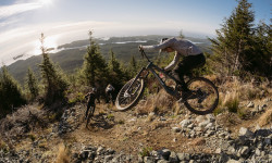
Photo Epic: Surfing & Shredding in Ucluelet with Norco Factory Racing's Henry Fitzgerald, Elliot Jamieson & Lucas Cruz
Mar 30, 2022 from pinkbike.com
A November road trip on the Island.
Sub Regions
-
Kennedy River Woodlands
-
Mt Ozzard (č̓umaat̓a)
- 4
- 3
- 1
Popular Ucluelet Mountain Biking Trails
• 80 ★ 5.0 • 2,034 ft • 0 ft • 283 •
(Pronounced "tla-yack", meaning "swift/move rapidly/quick/fast", formerly known as Lower Root Chute) Rebuilt in 2019 to bypass heavily eroded Double Black sections. Multiple drops, and gaps with ride arounds on all features. Slippery...
• 70 ★ 4.9 • 1,860 ft • 25 ft • 283 •
(Pronounced "ook-miss", meaning "joy/happiness/joyful", formerly known as Rocksteady) A technical banked flow trail with substantial fast woodwork and multiple steep sections.
• 95 ★ 0.0 • 732 ft • 0 ft • 279 •
(Pronounced "tsa-chee-satlh", meaning "go to the creek") A tight but flowing banked single track hugging the beautiful small creek. Rebuilt in 2024 and running great. Cut in from the road climb for a couple hot warmup laps, or ride it...
• 100 ★ 4.0 • 1,814 ft • 135 ft • 192 •
Our new signature climbing trail, pronounced "up-pee-us" and meaning "Going uphill"
• 40 ★ 5.0 • 2,211 ft • 45 ft • 154 •
Pronounced "Mook-too" and translating to "first of many together/working together" from the local indigenous dialect. This trail was a collaborative project between UMBA and Ucluelet First Nation. Signature hand built downhill flow...
• 85 ★ 5.0 • 2,044 ft • 10 ft • 150 •
Pronounced "Jit-hwah Hy-eee", meaning "Winding snake / Snake moving side to side" A fun, fast flowy Downhill only trail with a few steeper gnarly sections. Some very nice berms especially toward the bottom
• 75 ★ 0.0 • 1,900 ft • 0 ft • 138 •
Pronounced "sitk-augh-a-tus", meaning "Rolling downhill"
• 45 ★ 4.7 • 1,460 ft • 0 ft • 124 •
(Pronounced "nih-chin-gwaas", meaning "submerged trees or roots", formerly known as Upper Root Chute) This trail is very steep with lots of roots. It is muddy and slippery at all but the driest times. It is quite technical, but has flow...
Photos of Ucluelet Mountain Bike
Videos of Ucluelet Mountain Bike
trail: Muuxtuu (mook-too)
0:49 |
597 |
Jul 3, 2021
trail: ʔuuqmis (ook-miss)
3:29 |
746 |
Sep 6, 2020
trail: ʔuuqmis (ook-miss)
0:12 |
|
Jun 4, 2020
trail: ʔuuqmis (ook-miss)
0:27 |
361 |
Jun 4, 2020
trail: ničink̓ʷas (nih-chin-gwaas)
3:12 |
1083 |
Apr 2, 2019
trail: ničink̓ʷas (nih-chin-gwaas)
0:07 |
479 |
Aug 27, 2017
trail: ničink̓ʷas (nih-chin-gwaas)
0:34 |
300 |
Aug 27, 2017
trail: ničink̓ʷas (nih-chin-gwaas)
0:21 |
382 |
Aug 27, 2017
Recent Trail Reports
| status | trail | date | condition | info | user |
|---|---|---|---|---|---|
| č̓itxʷaa ḥiyii (Jit-hwah Hy-eee) | Apr 25, 2026 @ 11:53am (America/Vancouver) Apr 25, 2026 | Unknown | dgoldenlion | ||
| Muuxtuu (mook-too) | Aug 25, 2025 @ 11:01am Aug 25, 2025 | Dry | schwalbai | ||
| ʔapp̓iʕas (up-pee-us) Climb Trail | Jun 15, 2025 @ 4:35pm Jun 15, 2025 | Wet | Mtn-Steve | ||
| c̓itkʕaaʔat̓as (sitk-augh-a-tus) | Jun 15, 2025 @ 4:35pm Jun 15, 2025 | Ideal | Mtn-Steve | ||
| Lower Access Trail / Peak Hike | May 31, 2025 @ 12:05pm May 31, 2025 | Ideal | sonoutlaw | ||
| Upper Access Trail / Peak Hike | May 31, 2025 @ 12:05pm May 31, 2025 | Ideal | sonoutlaw | ||
| Ucluelet Multi Use Path | May 8, 2025 @ 10:45am May 8, 2025 | Ideal | Backpocket | ||
| ʔuuqmis (ook-miss) | Apr 16, 2025 @ 12:00pm Apr 16, 2025 | Dry | Polobaiona | ||
| ƛ̓ay̓ax (tla-yack) | Mar 3, 2025 @ 12:32pm Mar 3, 2025 | Wet | cornwheel | ||
| c̓aaʔułan̓uł (tsa-oolth-a-noolth) | Jan 15, 2025 @ 12:30pm Jan 15, 2025 | Ideal | Shafto |
Activity Feed
| username | action | type | title | date |
|---|---|---|---|---|
| Dubnyk | add | poi | activity #98797105 and 3 more | Jul 9, 2026 @ 10:37am Jul 9, 2026 |
| Dubnyk | update | region | activity #98796806 | Jul 9, 2026 @ 10:33am Jul 9, 2026 |
| Dubnyk | add | poi | activity #98796700 | Jul 9, 2026 @ 10:32am Jul 9, 2026 |
| Dubnyk | ridden | trail | activity #98796584 and 1 more | Jul 9, 2026 @ 10:30am Jul 9, 2026 |
| Dubnyk | update | trail | activity #98796492 and 1 more | Jul 9, 2026 @ 10:29am Jul 9, 2026 |
Recent Comments
| username | type | title | comment | date |
|---|---|---|---|---|
| trail | Rebuilt in 2024 and running great. Cut in from... | Apr 21, 2025 @ 3:40pm Apr 21, 2025 | ||
| trail | Steep, wet gnar and chundery in spots but... | Mar 25, 2025 @ 11:49pm Mar 25, 2025 | ||
| trail | Sick trail — a bit of a leg burner climbing... | Nov 15, 2023 @ 2:23pm Nov 15, 2023 | ||
| trail | Back for a spring ride, a well built nicely... | May 15, 2023 @ 12:08pm May 15, 2023 | ||
| trail | Outstanding work constructing this excellent... | Nov 3, 2022 @ 9:52am Nov 3, 2022 |
Local Badges
-

Epic Ride Descent 2k5 awarded -

Descent 10k Badge4 awarded -

Descent 100k Badge0 awarded -

Epic Mountain Bike Climb 2k3 awarded -

Climbing 10k Badge2 awarded -

Mountain Biking 100k Badge0 awarded
Bike & Skill Parks
| name | type | city | rating |
|---|---|---|---|
| Ucluelet Dirt Jumps | skill park | Ucluelet |

Activity Type Stats
| activitytype | trails | distance | descent | descent distance | total vertical | rating | global rank | state rank | photos | reports | routes | activity logs |
|---|---|---|---|---|---|---|---|---|---|---|---|---|
| Mountain Bike | 21 | 19 miles | 4,970 ft | 9 miles | 2,746 ft | #4,264 | #100 | 115 | 123 | 2,405 | ||
| E-Bike | 17 | 13 miles | 1,214 ft | 5 miles | 2,746 ft | #4,340 | #96 | 73 | 93 | |||
| Horse | 3 | 8 miles | 486 ft | 2 miles | 2,457 ft | 10 | ||||||
| Hike | 56 | 25 miles | 3,947 ft | 9 miles | 5,305 ft | #2,097 | #81 | 11 | 92 | 1 | 2,254 | |
| Trail Running | 54 | 25 miles | 3,947 ft | 9 miles | 5,305 ft | #4,104 | #101 | 92 | 1 | 717 | ||
| Dirtbike/Moto | 25 | 17 miles | 1,490 ft | 6 miles | 2,664 ft | #167 | #28 | 14 | 71 | |||
| Observed Trials | 2 | 1 | ||||||||||
| ATV/ORV/OHV | 3 | 8 miles | 486 ft | 2 miles | 2,457 ft | 10 | 4 | |||||
| Snowmobile | 3 | 2 | ||||||||||
| Snowshoe | 11 | 7 | ||||||||||
| Backcountry Ski | 11 | 80 |
Frequently Asked Questions About Ucluelet
▼
What are the best places to ride in Ucluelet?
Ucluelet has 2 areas to explore for mountain biking. The top rated areas are:
▼
What are the highest rated mountain biking trails in Ucluelet?
The highest rated mountain biking trails in Ucluelet are:
- ʔuuqmis (ook-miss) (4.5/5)
- ƛ̓ay̓ax (tla-yack) (4.4/5)
- Muuxtuu (mook-too) (4.4/5)
- ničink̓ʷas (nih-chin-gwaas) (4.3/5)
- ʔapp̓iʕas (up-pee-us) Climb Trail (4/5)
▼
What is the best time of the year to ride in Ucluelet?
Based on activity log data, the most popular months to ride in Ucluelet are:
- July (38 activities)
- August (21 activities)
- September (19 activities)
▼
Where can I park to ride in Ucluelet?
There are 14 parking locations listed in Ucluelet. The most popular parking spots are: View all parking and trailhead locations on the map to plan your visit.
Activities
Trails
Points of Interest
- Hišimy̓awiƛ (5040 Alpine Hut) Cabin
- Amphitrite Point Lighthouse Sight
- Triple Peak Summit
- Adder Mountain Summit
- Mount Gibson Summit
- MacKenzie Summit
- Redwall Peak Summit
- Canoe Peak Summit
- Klitsa Mountain Summit
- Steamboat Mountain Summit
- Broughton Peaks (1,019 m)
- Draw Mountain (852 m)
- Mount Redford (760 m)
- By estade & contributors
- Admins: Dubnyk, UMBA
- #15310 - 20,970 views
- ucluelet activity log | embed map of Ucluelet mountain bike trails | ucluelet mountain biking points of interest
Downloading of trail gps tracks in kml & gpx formats is enabled for Ucluelet.
You must login to download files.