close
-
Layers w
- Weather Layers
- Pro
- Pro
- Pro
- Pro
- Pro
- Pro
- More Layers
- Pro
- Pro
- Pro
- Pro
-
Upgrade to

3D
Trail Conditions
- Unknown
- Snow Groomed
- Snow Packed
- Snow Covered
- Snow Cover Partial
- Freeze/thaw Cycle
- Icy
- Prevalent Mud
- Wet
- Variable
- Ideal
- Dry
- Very Dry
Trail Flow (Ridden Direction)
Trailforks scans users ridelogs to determine the most popular direction each trail is ridden. A good flowing trail network will have most trails flowing in a single direction according to their intension.
The colour categories are based on what percentage of riders are riding a trail in its intended direction.
The colour categories are based on what percentage of riders are riding a trail in its intended direction.
- > 96%
- > 90%
- > 80%
- > 70%
- > 50%
- < 50%
- bi-directional trail
- no data
Trail Last Ridden
Trailforks scans ridelogs to determine the last time a trail was ridden.
- < 2 days
- < 1 week
- < 2 weeks
- < 1 month
- < 6 months
- > 6 months
Trail Ridden Direction
The intended direction a trail should be ridden.
- Downhill Only
- Downhill Primary
- Both Directions
- Uphill Primary
- Uphill Only
- One Direction
Contribute Details
Colors indicate trail is missing specified detail.
- Description
- Photos
- Description & Photos
- Videos
Trail Popularity ?
Trailforks scans ridelogs to determine which trails are ridden the most in the last 9 months.
Trails are compared with nearby trails in the same city region with a possible 25 colour shades.
Think of this as a heatmap, more rides = more kinetic energy = warmer colors.
- most popular
- popular
- less popular
- not popular
ATV/ORV/OHV Filter
Max Vehicle Width
inches
US Cell Coverage
Legend

Radar Time
Activity Recordings
Trailforks uses anonymized public activity data.
?
Activity Recordings
Trailforks uses anonymized public activity data.
?
Personal Heatmap
▶
Activity Types
all
/
none
▶
Options
2
Date range
month
–
Winter Trails
Warning
A routing network for winter maps does not exist. Selecting trails using the winter trails layer has been disabled.
Missing Trails
Most Popular
Least Popular
Trails are colored based on popularity. The more popular a trail is, the more red. Less popular trails trend towards green.
Jump Magnitude Heatmap
Heatmap of where riders jump on trails. Zoom in to see individual jumps, click circles to view jump details.
BC Backroad Status
![map legend]()
Service Road Atlas is a free to use, community-driven service for viewing and creating reports on the numerous back-country service roads around B.C. and Alberta.

Slope Aspect
Direction the slope faces
Trails Deemphasized
Trails are shown in grey.
Only show trails with no bike usage.
Suggested Layers
Based on selected activity type
Save the current map location and zoom level as your default home location whenever this page is loaded.
Save
No description for Ustroń has been added yet!
Login or register to submit one.
This region uses the Uk/Euro style trail grading system.
Activities Click to view
- Mountain Bike
12 trails
- E-Bike
5 trails
- Adaptive Bike
0 trails
- Winter Fat Bike
0 trails
- Horse
0 trails
- Hike
9 trails
- Trail Running
9 trails
- Observed Trials
0 trails
- Snowshoe
0 trails
- Downhill Ski
0 trails
- Backcountry Ski
3 trails
- Nordic Ski
0 trails
Region Details
- 1
- 5
- 4
- 1
Region Status
Open as of Jun 6, 2026Stats
- Avg Trail Rating
- Trails (view details)
- 11
- Trails Mountain Bike
- 12
- Trails E-Bike
- 5
- Trails Hike
- 9
- Trails Trail Running
- 9
- Trails Backcountry Ski
- 3
- Total Distance
- 12 miles
- Total Descent
- 6,018 ft
- Total Vertical
- 1,595 ft
- Highest Trailhead
- 2,896 ft
- Reports
- 23
- Photos
- 94
- Ridden Counter
- 647
Sub Regions
-
Bike Park Palenica
- 1
- 2
- 1
Popular Ustroń Mountain Biking Trails
• 35 ★ 4.4 • 3,628 ft • 9 ft • 113 •
Highly rated less popular red difficulty mixed. This mountain bike primary trail can be used one direction. It features drop, jump, gap jump and wallride. On average it takes 7 minutes to complete this trail.
• 70 ★ 5.0 • 2,877 ft • 0 ft • 113 •
Popular red difficulty singletrack. This mountain bike primary trail can be used one direction and has a moderate overall physical rating. It features bridge, drop and jump. On average it takes 5 minutes to complete this trail.
Palenica Flow Permanently Closed
• 100 ★ 5.0 • 2,220 ft • 0 ft • 94 •
Popular blue difficulty closed machine groomed. This mountain bike primary trail can be used downhill only. It features pump track and roller coaster. On average it takes 2 minutes to complete this trail.
• 50 ★ 4.0 • 4 miles • 750 ft • 44 • • hike
Moderately popular blue difficulty mixed. This hike primary trail can be used both directions and has a moderate overall physical rating with a 750 ft blue climb. On average it takes 45 minutes to complete this trail.
• 90 ★ 5.0 • 2,677 ft • 5 ft • 24 • • hike
Popular red difficulty singletrack. This hike primary trail can be used downhill only and has a moderate overall physical rating. It features rock garden. On average it takes 4 minutes to complete this trail.
• 75 ★ 0.0 • 3,806 ft • 0 ft • 16 • • hike
Przyjemna trasa zjazdowa czerwonym szlakiem pieszym. Troszkę kamieniście, ale bez przesady. Ogólnie szerszy singiel. Uwaga na pieszych!
• 5 ★ 2.5 • 1 mile • 46 ft • 15 • • hike
Less popular blue difficulty singletrack. This hike primary trail can be used downhill only. It features rock garden. On average it takes 6 minutes to complete this trail.
• 65 ★ 0.0 • 1 mile • 0 ft • 13 • • hike
Zjazd źółtym szlakiem turystycznym, więc uwaga na pieszych. Przyjemny zjazd wąską ścieżką leśną w większości zboczem. Trochę korzeni. Rzadko kamieniście. Jeden trudny drop (+/- w połowie). Podjazd bardzo trudny, w dużej...
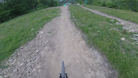
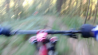
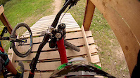
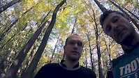
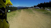
Photos of Ustroń Mountain Bike
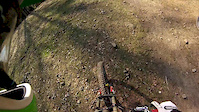
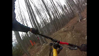
Videos of Ustroń Mountain Bike
trail: Palenica
0:24 |
26 |
Oct 19, 2024
trail: Palenica
0:10 |
51 |
Oct 8, 2021
trail: Palenica Flow
2:58 |
228 |
Aug 14, 2016
trail: Black
3:39 |
495 |
Oct 28, 2014

trail: Black
3:39 |
19 |
Oct 28, 2014
trail: Black
5:55 |
204 |
Jul 22, 2014
trail: Black
2:22 |
386 |
Mar 30, 2014
trail: Black
2:49 |
108 |
Mar 25, 2014
Recent Trail Reports
| status | trail | date | condition | info | user |
|---|---|---|---|---|---|
| Czerwony z Czantorii | Jan 4, 2025 @ 11:17am Jan 4, 2025 | Snow Covered | KarolinaTo WE | ||
| Beskidek | Jan 4, 2025 @ 11:17am Jan 4, 2025 | Snow Covered | KarolinaTo WE | ||
| Your Mama | Jul 23, 2023 @ 11:32pm Jul 23, 2023 | Dry | gurgulec | ||
| Black | Jul 23, 2023 @ 11:29pm Jul 23, 2023 | Ideal | gurgulec | ||
| Palenica Flow | Jul 23, 2023 @ 11:25pm Jul 23, 2023 | Ideal | gurgulec | ||
| Równica Grzbiet | May 21, 2022 @ 11:56pm May 21, 2022 | Ideal | maciejp | ||
| Droga na Małą Czantorię | May 21, 2022 @ 11:56pm May 21, 2022 | Ideal | maciejp |
Activity Feed
| username | action | type | title | date |
|---|---|---|---|---|
| trailforks | add | video | activity #97717442 | Jun 24, 2026 @ 12:35pm Jun 24, 2026 |
| trailforks | add | video | activity #92753280 | Apr 16, 2026 @ 4:00pm Apr 16, 2026 |
| LukHan | wishlist | trail | activity #77511720 | Aug 6, 2025 @ 1:41am Aug 6, 2025 |
| palm | ridden | trail | activity #74906148 | Jun 30, 2025 @ 12:17pm Jun 30, 2025 |
| KarolinaTo | add | report | activity #64072685 and 1 more | Jan 4, 2025 @ 12:09pm Jan 4, 2025 |
Recent Comments
| username | type | title | comment | date |
|---|---|---|---|---|
| trail | Turbopłynna fajna, szeroka trasa DH z fajnymi... | Jul 23, 2023 @ 11:29pm Jul 23, 2023 |
Local Badges
-

Epic Mountain Bike Climb 2k1 awarded -

Climbing 10k Badge0 awarded -

Mountain Biking 100k Badge0 awarded -

Epic Ride Descent 2k1 awarded -

Descent 10k Badge0 awarded -

Descent 100k Badge0 awarded
Bike & Skill Parks
| name | type | city | rating |
|---|---|---|---|
| Bike Park Palenica | bike park | Ustroń |
Activity Type Stats
| activitytype | trails | distance | descent | descent distance | total vertical | rating | global rank | state rank | photos | reports | routes | ridelogs |
|---|---|---|---|---|---|---|---|---|---|---|---|---|
| Mountain Bike | 12 | 12 miles | 6,017 ft | 7 miles | 1,594 ft | #4,237 | #92 | 94 | 23 | 1 | 3,138 | |
| E-Bike | 5 | 3 miles | 705 ft | 1 mile | 1,089 ft | #4,146 | #340 | 16 | 146 | |||
| Hike | 9 | 10 miles | 4,360 ft | 6 miles | 1,594 ft | #5,356 | #98 | 18 | 797 | |||
| Trail Running | 9 | 10 miles | 4,360 ft | 6 miles | 1,594 ft | #5,029 | #93 | 18 | 83 | |||
| Backcountry Ski | 3 | 6 miles | 2,625 ft | 4 miles | 1,594 ft | #215 | #28 | 219 |
Frequently Asked Questions About Ustroń
▼
What are the best places to ride in Ustroń?
Ustroń has 1 areas to explore for mountain biking. The top rated areas are:
▼
What are the highest rated mountain biking trails in Ustroń?
The highest rated mountain biking trails in Ustroń are:
- Orłowa (4.2/5)
- Your Mama (4.2/5)
- Black (4.1/5)
- Równica Grzbiet (4/5)
- Beskidek (3.6/5)
▼
What is the best time of the year to ride in Ustroń?
Based on ride log data, the most popular months to ride in Ustroń are:
- July (27 activities)
- June (12 activities)
- May (9 activities)
▼
Where can I park to ride in Ustroń?
There are 1 parking locations listed in Ustroń. The most popular parking spots are:
Activities
Trails
- By grucha
 & contributors
 - Admins: apply
- #4228 - 4,847 views
- ustroń activity log | embed map of Ustroń mountain bike trails | ustroń mountain biking points of interest
Downloading of trail gps tracks in kml & gpx formats is enabled for Ustroń.
You must login to download files.