close
-
Layers w
- Weather Layers
- Pro
- Pro
- Pro
- Pro
- Pro
- Pro
- More Layers
- Pro
- Pro
- Pro
- Pro
-
Upgrade to

3D
Trail Conditions
- Unknown
- Snow Groomed
- Snow Packed
- Snow Covered
- Snow Cover Partial
- Freeze/thaw Cycle
- Icy
- Prevalent Mud
- Wet
- Variable
- Ideal
- Dry
- Very Dry
Trail Flow (Ridden Direction)
Trailforks scans users ridelogs to determine the most popular direction each trail is ridden. A good flowing trail network will have most trails flowing in a single direction according to their intension.
The colour categories are based on what percentage of riders are riding a trail in its intended direction.
The colour categories are based on what percentage of riders are riding a trail in its intended direction.
- > 96%
- > 90%
- > 80%
- > 70%
- > 50%
- < 50%
- bi-directional trail
- no data
Trail Last Ridden
Trailforks scans ridelogs to determine the last time a trail was ridden.
- < 2 days
- < 1 week
- < 2 weeks
- < 1 month
- < 6 months
- > 6 months
Trail Ridden Direction
The intended direction a trail should be ridden.
- Downhill Only
- Downhill Primary
- Both Directions
- Uphill Primary
- Uphill Only
- One Direction
Contribute Details
Colors indicate trail is missing specified detail.
- Description
- Photos
- Description & Photos
- Videos
Trail Popularity ?
Trailforks scans ridelogs to determine which trails are ridden the most in the last 9 months.
Trails are compared with nearby trails in the same city region with a possible 25 colour shades.
Think of this as a heatmap, more rides = more kinetic energy = warmer colors.
- most popular
- popular
- less popular
- not popular
ATV/ORV/OHV Filter
Max Vehicle Width
inches
US Cell Coverage
Legend

Radar Time
Activity Recordings
Trailforks uses anonymized public activity data.
?
Activity Recordings
Trailforks uses anonymized public activity data.
?
Personal Heatmap
▶
Activity Types
all
/
none
▶
Options
2
Date range
month
–
Winter Trails
Warning
A routing network for winter maps does not exist. Selecting trails using the winter trails layer has been disabled.
Missing Trails
Most Popular
Least Popular
Trails are colored based on popularity. The more popular a trail is, the more red. Less popular trails trend towards green.
Jump Magnitude Heatmap
Heatmap of where riders jump on trails. Zoom in to see individual jumps, click circles to view jump details.
BC Backroad Status
![map legend]()
Service Road Atlas is a free to use, community-driven service for viewing and creating reports on the numerous back-country service roads around B.C. and Alberta.

Slope Aspect
Direction the slope faces
Trails Deemphasized
Trails are shown in grey.
Only show trails with no bike usage.
Suggested Layers
Based on selected activity type
Save the current map location and zoom level as your default home location whenever this page is loaded.
Save
No description for Utiel has been added yet!
Login or register to submit one.
This region uses the Uk/Euro style trail grading system.
Activities Click to view
- Mountain Bike
544 trails
- E-Bike
544 trails
- Adaptive Bike
1 trails
- Hike
544 trails
- Trail Running
544 trails
Region Details
- 328
- 124
- 66
- 25
Region Status
Open as of May 23, 2026Stats
- Avg Trail Rating
- Trails (view details)
- 543
- Trails Mountain Bike
- 544
- Trails E-Bike
- 544
- Trails Gravel Bike
- 1
- Trails Adaptive Bike
- 1
- Trails Horse
- 3
- Trails Hike
- 544
- Trails Trail Running
- 544
- Trails Dirtbike/Moto
- 3
- Trails Observed Trials
- 1
- Total Distance
- 428 miles
- Total Descent
- 51,079 ft
- Total Vertical
- 2,868 ft
- Highest Trailhead
- 4,260 ft
- Reports
- 371
- Photos
- 41
- Ridden Counter
- 3,436
Sub Regions
-
Benagéber-Pantano
- 7
- 8
-
Camporrobles-Fuenterrobles
- 24
- 24
- 2
-
El Remedio
- 98
- 36
- 15
Popular Utiel Mountain Biking Trails
• 100 ★ 4.0 • 1 mile • 10 ft • 46 •
Sale del area recreativa, primer tramo rápido, luego ya empiezan tramos más rocosos.
• 95 ★ 0.0 • 1,467 ft • 0 ft • 33 •
Popular green difficulty singletrack. This multi-use trail can be used both directions. On average it takes 1 minutes to complete this trail.
• 100 ★ 0.0 • 863 ft • 59 ft • 33 •
Popular green difficulty singletrack. This multi-use trail can be used both directions and has a easy overall physical rating with a 59 ft green climb. On average it takes 1 minutes to complete this trail.
• 90 ★ 0.0 • 489 ft • 51 ft • 32 •
Popular green difficulty singletrack. This multi-use trail can be used both directions. On average it takes minutes to complete this trail.
• 90 ★ 0.0 • 1 mile • 177 ft • 32 •
Popular green difficulty singletrack. This multi-use trail can be used both directions and has a moderate overall physical rating with a 177 ft blue climb. On average it takes 8 minutes to complete this trail.
• 90 ★ 0.0 • 1,181 ft • 5 ft • 31 •
Popular green difficulty singletrack. This multi-use trail can be used both directions. On average it takes 1 minutes to complete this trail.
• 90 ★ 0.0 • 2,690 ft • 183 ft • 31 •
Popular green difficulty singletrack. This multi-use trail can be used both directions and has a moderate overall physical rating with a 183 ft blue climb. On average it takes 19 minutes to complete this trail.
• 90 ★ 0.0 • 2,625 ft • 36 ft • 31 •
Popular green difficulty singletrack. This multi-use trail can be used both directions and has a moderate overall physical rating with a 36 ft blue climb. On average it takes 2 minutes to complete this trail.
Utiel Mountain Bike Routes
24 miles • 2,302 ft • 22 • Loop •
La Sierra de La Bicuerca es una elevación montañosa formada por dos pequeñas sierras paralelas y un...
33 miles • 4,298 ft • 53 • Loop •
Recorrido de la Btt Machacacachas Utiel 2025, con multitud de sendas de nivel medio, entre verdes y azules.
25 miles • 3,964 ft • 30 •
Tocando sendas de la parte de la casa medina, con más flow que técnicas (Patetas Izquierda Commedia),...
13 miles • 2,578 ft • 5 • Loop •
Ruta de toma de contacto en la Sierra del Negrete, sobre la ermita del Remedio. Primera bajada "el...
25 miles • 3,961 ft • 31 •
Ruta circular con senderos de toda clase, por la zona baja de la Casa Medina y hasta lo alto de la sierra.
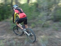
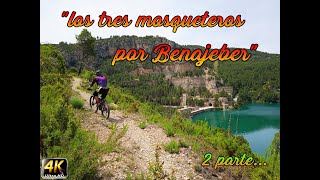
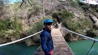
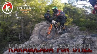
Photos of Utiel Mountain Bike


Recent Trail Reports
Activity Feed
| username | action | type | title | date |
|---|---|---|---|---|
| AMG | add | trail | activity #95571008 and 5 more | May 26, 2026 @ 9:42am May 26, 2026 |
| glosada | add | report | activity #95561631 | May 26, 2026 @ 6:54am May 26, 2026 |
| Chume82 | ridden | trail | activity #95139340 | May 20, 2026 @ 4:19pm May 20, 2026 |
| juanx | update | trail | activity #95129540 and 2 more | May 20, 2026 @ 1:18pm May 20, 2026 |
| Chume82 | add | trail | activity #95129485 and 2 more | May 20, 2026 @ 1:17pm May 20, 2026 |
Recent Comments
| username | type | title | comment | date |
|---|---|---|---|---|
| trail | Cerrada, pasa por una rambla que está... | Sep 13, 2025 @ 4:21am Sep 13, 2025 | ||
| trail | Antiguo DH en ruinas. La parte del barranco... | May 17, 2024 @ 4:48am May 17, 2024 | ||
| trail | En algún momento perdimos la traza y acabamos... | Sep 22, 2021 @ 3:44am Sep 22, 2021 | ||
| trail | Sucia de piedras y ramas, pero con cuidado se... | Apr 26, 2021 @ 12:24pm Apr 26, 2021 | ||
| trail | Algo sucia de piedras sueltas y ramas, pero se... | Apr 26, 2021 @ 12:21pm Apr 26, 2021 |
Local Badges
-

Bicuerca... a la saca!!!0 awarded -

Bicuerca !!!14 awarded -

Top 10 Trails0 awarded -

Epic Ride 50k398 awarded -

Completionist0 awarded -
Completionist0 awarded
Activity Type Stats
| activitytype | trails | distance | descent | descent distance | total vertical | rating | global rank | state rank | photos | reports | routes | ridelogs |
|---|---|---|---|---|---|---|---|---|---|---|---|---|
| Mountain Bike | 544 | 428 miles | 51,079 ft | 186 miles | 2,867 ft | #458 | #53 | 35 | 371 | 9 | 2,001 | |
| E-Bike | 544 | 428 miles | 51,079 ft | 186 miles | 2,867 ft | #125 | #63 | 6 | 366 | 3 | 75 | |
| Gravel Bike | 1 | #7,468 | #332 | 4 | 1 | 6 | ||||||
| Adaptive Bike | 1 | #547 | #194 | |||||||||
| Horse | 3 | 2,339 ft | 16 ft | 420 ft | 318 ft | 5 | ||||||
| Hike | 544 | 428 miles | 51,079 ft | 186 miles | 2,867 ft | #237 | #53 | 370 | 7 | 36 | ||
| Trail Running | 544 | 428 miles | 51,079 ft | 186 miles | 2,867 ft | #177 | #49 | 370 | 45 | |||
| Dirtbike/Moto | 3 | 4,623 ft | 194 ft | 2,959 ft | 371 ft | 5 | ||||||
| Observed Trials | 1 | 2,162 ft | 49 ft | 758 ft | 52 ft | 1 |
Frequently Asked Questions About Utiel
▼
What are the best places to ride in Utiel?
Utiel has 3 areas to explore for mountain biking. The top rated areas are:
▼
What are the highest rated mountain biking trails in Utiel?
The highest rated mountain biking trails in Utiel are:
- Limonero (corral De La Bicuerca) (4.1/5)
- Montaña Rusa (4.1/5)
- Funkcionario (4/5)
- Caseta De Ponce - Limonero (4/5)
- La Sardina (4/5)
▼
What is the best time of the year to ride in Utiel?
Based on ride log data, the most popular months to ride in Utiel are:
- December (12 activities)
- May (9 activities)
- October (5 activities)
▼
Where can I park to ride in Utiel?
There are 4 parking locations listed in Utiel. The most popular parking spots are: View all parking and trailhead locations on the map to plan your visit.
Activities
Trails
- utiel activity log | embed map of Utiel mountain bike trails | utiel mountain biking points of interest polygons
Downloading of trail gps tracks in kml & gpx formats is enabled for Utiel.
You must login to download files.