close
-
Layers w
- Weather Layers
- Pro
- Pro
- Pro
- Pro
- Pro
- Pro
- More Layers
- Pro
- Pro
- Pro
- Pro
-
Upgrade to

3D
Trail Conditions
- Unknown
- Snow Groomed
- Snow Packed
- Snow Covered
- Snow Cover Partial
- Freeze/thaw Cycle
- Icy
- Prevalent Mud
- Wet
- Variable
- Ideal
- Dry
- Very Dry
Trail Flow (Ridden Direction)
Trailforks scans users ridelogs to determine the most popular direction each trail is ridden. A good flowing trail network will have most trails flowing in a single direction according to their intension.
The colour categories are based on what percentage of riders are riding a trail in its intended direction.
The colour categories are based on what percentage of riders are riding a trail in its intended direction.
- > 96%
- > 90%
- > 80%
- > 70%
- > 50%
- < 50%
- bi-directional trail
- no data
Trail Last Ridden
Trailforks scans ridelogs to determine the last time a trail was ridden.
- < 2 days
- < 1 week
- < 2 weeks
- < 1 month
- < 6 months
- > 6 months
Trail Ridden Direction
The intended direction a trail should be ridden.
- Downhill Only
- Downhill Primary
- Both Directions
- Uphill Primary
- Uphill Only
- One Direction
Contribute Details
Colors indicate trail is missing specified detail.
- Description
- Photos
- Description & Photos
- Videos
Trail Popularity ?
Trailforks scans ridelogs to determine which trails are ridden the most in the last 9 months.
Trails are compared with nearby trails in the same city region with a possible 25 colour shades.
Think of this as a heatmap, more rides = more kinetic energy = warmer colors.
- most popular
- popular
- less popular
- not popular
ATV/ORV/OHV Filter
Max Vehicle Width
inches
US Cell Coverage
Legend

Radar Time
Activity Recordings
Trailforks uses anonymized public activity data.
?
Activity Recordings
Trailforks uses anonymized public activity data.
?
Personal Heatmap
▶
Activity Types
all
/
none
▶
Options
2
Date range
month
–
Winter Trails
Warning
A routing network for winter maps does not exist. Selecting trails using the winter trails layer has been disabled.
Missing Trails
Most Popular
Least Popular
Trails are colored based on popularity. The more popular a trail is, the more red. Less popular trails trend towards green.
Jump Magnitude Heatmap
Heatmap of where riders jump on trails. Zoom in to see individual jumps, click circles to view jump details.
BC Backroad Status
![map legend]()
Service Road Atlas is a free to use, community-driven service for viewing and creating reports on the numerous back-country service roads around B.C. and Alberta.

Slope Aspect
Direction the slope faces
Trails Deemphasized
Trails are shown in grey.
Only show trails with no bike usage.
Suggested Layers
Based on selected activity type
Save the current map location and zoom level as your default home location whenever this page is loaded.
Save
No description for Valongo has been added yet!
Login or register to submit one.
This region uses the Uk/Euro style trail grading system.
Activities Click to view
- Mountain Bike
18 trails
- E-Bike
15 trails
- Adaptive Bike
0 trails
- Hike
15 trails
- Trail Running
16 trails
Region Details
- 4
- 1
- 11
- 1
Region Status
Caution as of 2 daysStats
- Avg Trail Rating
- Trails (view details)
- 17
- Trails Mountain Bike
- 18
- Trails E-Bike
- 15
- Trails Hike
- 15
- Trails Trail Running
- 16
- Trails Dirtbike/Moto
- 3
- Total Distance
- 13 miles
- Total Descent
- 4,740 ft
- Total Vertical
- 1,165 ft
- Highest Trailhead
- 1,199 ft
- Reports
- 73
- Photos
- 106
- Ridden Counter
- 393
Sub Regions
-
Santa Justa
- 6
Popular Valongo Mountain Biking Trails
• 70 ★ 4.0 • 3,885 ft • 23 ft • 41 •
Popular blue difficulty singletrack. This mountain bike primary trail can be used downhill only and has a moderate overall physical rating. It features rock garden. On average it takes 8 minutes to complete this trail.
• 90 ★ 4.0 • 4,298 ft • 0 ft • 23 •
Popular blue difficulty singletrack. This multi-use trail can be used downhill only and has a moderate overall physical rating. It features berm, drop, jump and gap jump. Trail visibility is always easy to follow. On average it takes 11 minutes to complete this trail.
• 75 ★ 3.0 • 2,644 ft • 33 ft • 21 •
Popular blue difficulty singletrack. This multi-use trail can be used downhill primary and has a easy overall physical rating with a 33 ft green climb. It features rock garden. Trail visibility is always easy to follow. On average it takes 5 minutes to complete this trail.
• 25 ★ 4.0 • 1,939 ft • 50 ft • 18 •
Less popular blue difficulty singletrack. This mountain bike primary trail can be used downhill primary and has a moderate overall physical rating. It features rock garden. Trail visibility is always easy to follow. On average it takes 5 minutes to complete this trail.
• 50 ★ 5.0 • 3 miles • 55 ft • 18 •
Moderately popular green difficulty mixed. This mountain bike primary trail can be used downhill primary and has a easy overall physical rating with a 55 ft blue climb. On average it takes 24 minutes to complete this trail.
• 45 ★ 0.0 • 3,094 ft • 26 ft • 16 •
Moderately popular blue difficulty machine groomed. This mountain bike primary trail can be used downhill primary. On average it takes 3 minutes to complete this trail.
• 40 ★ 0.0 • 4,829 ft • 186 ft • 9 •
A subir é bom desafio técnico, a descer é rezar para que não esteja muito molhado!
Valongo Mountain Bike Routes
19 miles • 2,625 ft • 0 •
Dupla volta a serra da santa justa a passar por campo , s pedro da cova e valongo
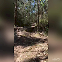
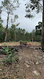
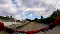
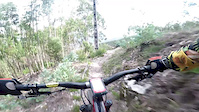
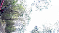
Photos of Valongo Mountain Bike
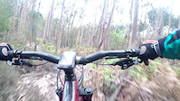
Videos of Valongo Mountain Bike
trail: Santa Justa I
2:23 |
221 |
Aug 28, 2020
trail: Santa Justa I
0:10 |
190 |
Jun 28, 2020
trail: Santa Justa I
0:18 |
48 |
Jun 2, 2020
trail: Sanatório Sul
2:27 |
178 |
May 15, 2020

trail: Santa Justa I
0:23 |
59 |
May 15, 2020
trail: Salamandra
3:04 |
203 |
Jun 24, 2019
trail: Santa Justa I
0:20 |
56 |
Apr 24, 2019
trail: Salamandra
0:12 |
84 |
Apr 13, 2019
Recent Trail Reports
| status | trail | date | condition | info | user |
|---|---|---|---|---|---|
| Santa Justa I | Jun 9, 2026 @ 11:40am (Europe/Lisbon) 2 days | Variable | mateus8573 | ||
| Falésia Short | Apr 26, 2026 @ 9:51am (Europe/Lisbon) Apr 26, 2026 | Dry | muska10 | ||
| Santa Justa Muros Longo | Apr 26, 2026 @ 8:18am (Europe/Lisbon) Apr 26, 2026 | Very Dry | muska10 | ||
| Salamandra | Apr 26, 2026 @ 8:20am (Europe/Lisbon) Apr 26, 2026 | Very Dry | muska10 | ||
| Ribeira | Jan 16, 2026 @ 10:24am (Europe/Lisbon) Jan 16, 2026 | Wet | rksMTB | ||
| Diabo Soft | Nov 9, 2025 @ 9:37am (Europe/Lisbon) Nov 9, 2025 | Variable | Zacksilva | ||
| On the Rocks | Apr 2, 2025 @ 9:58am Apr 2, 2025 | Variable | litlebuda | ||
| Travassos a Gens | Nov 1, 2024 @ 9:20am Nov 1, 2024 | Wet | Franklim | ||
| Legado Final 2 | Oct 19, 2024 @ 10:20am Oct 19, 2024 | Wet | Franklim | ||
| Diabo com Piri Piri | Oct 19, 2024 @ 10:20am Oct 19, 2024 | Wet | Franklim |
Activity Feed
| username | action | type | title | date |
|---|---|---|---|---|
| mateus8573 | add | report | activity #96594295 | Jun 9, 2026 @ 3:40am 2 days |
| AMG | update | trail | activity #94234427 | May 7, 2026 @ 12:21pm May 7, 2026 |
| mateus8573 | like | report | activity #94177337 | May 6, 2026 @ 2:17pm May 6, 2026 |
| muska10 | difficultyvote | trail | activity #93511742 | Apr 27, 2026 @ 5:51am Apr 27, 2026 |
| muska10 | vote | trail | activity #93511732 | Apr 27, 2026 @ 5:51am Apr 27, 2026 |
Local Badges
-

Epic Mountain Bike Climb 2k38 awarded -

Climbing 10k Badge13 awarded -

Mountain Biking 100k Badge0 awarded -

Epic Ride Descent 2k38 awarded -

Descent 10k Badge13 awarded -

Descent 100k Badge0 awarded
Activity Type Stats
| activitytype | trails | distance | descent | descent distance | total vertical | rating | global rank | state rank | photos | reports | routes | ridelogs |
|---|---|---|---|---|---|---|---|---|---|---|---|---|
| Mountain Bike | 18 | 13 miles | 4,741 ft | 8 miles | 1,165 ft | #4,027 | #39 | 106 | 73 | 3 | 2,433 | |
| E-Bike | 15 | 6 miles | 3,107 ft | 5 miles | 1,135 ft | #706 | #8 | 75 | 2 | 617 | ||
| Hike | 15 | 13 miles | 4,577 ft | 8 miles | 1,165 ft | #4,480 | #27 | 76 | 110 | |||
| Trail Running | 16 | 13 miles | 4,577 ft | 8 miles | 1,165 ft | #3,913 | #25 | 76 | 1 | 43 | ||
| Dirtbike/Moto | 3 | 2 miles | 558 ft | 4,327 ft | 358 ft | 9 |
Frequently Asked Questions About Valongo
▼
What are the best places to ride in Valongo?
Valongo has 1 areas to explore for mountain biking. The top rated areas are:
▼
What are the highest rated mountain biking trails in Valongo?
The highest rated mountain biking trails in Valongo are:
- Ribeira (4.1/5)
- Falésia Short (4.1/5)
- Salamandra (4.1/5)
- Santa Justa I (4/5)
- Diabo com Piri Piri (4/5)
▼
What is the best time of the year to ride in Valongo?
Based on ride log data, the most popular months to ride in Valongo are:
- March (18 activities)
- October (8 activities)
- May (5 activities)
▼
Where can I park to ride in Valongo?
There are 1 parking locations listed in Valongo. The most popular parking spots are:
Activities
Trails
Points of Interest
- By FranciscoCarneiro & contributors
- Admins: elyari, AMG, marcossantamaria
- #7080 - 4,073 views
- valongo activity log | embed map of Valongo mountain bike trails | valongo mountain biking points of interest
Downloading of trail gps tracks in kml & gpx formats is enabled for Valongo.
You must login to download files.