close
-
Layers w
- Weather Layers
- Pro
- Pro
- Pro
- Pro
- Pro
- Pro
- More Layers
- Pro
- Pro
- Pro
- Pro
-
Upgrade to

3D
Trail Conditions
- Unknown
- Snow Groomed
- Snow Packed
- Snow Covered
- Snow Cover Partial
- Freeze/thaw Cycle
- Icy
- Prevalent Mud
- Wet
- Variable
- Ideal
- Dry
- Very Dry
Trail Flow (Ridden Direction)
Trailforks scans users ridelogs to determine the most popular direction each trail is ridden. A good flowing trail network will have most trails flowing in a single direction according to their intension.
The colour categories are based on what percentage of riders are riding a trail in its intended direction.
The colour categories are based on what percentage of riders are riding a trail in its intended direction.
- > 96%
- > 90%
- > 80%
- > 70%
- > 50%
- < 50%
- bi-directional trail
- no data
Trail Last Ridden
Trailforks scans ridelogs to determine the last time a trail was ridden.
- < 2 days
- < 1 week
- < 2 weeks
- < 1 month
- < 6 months
- > 6 months
Trail Ridden Direction
The intended direction a trail should be ridden.
- Downhill Only
- Downhill Primary
- Both Directions
- Uphill Primary
- Uphill Only
- One Direction
Contribute Details
Colors indicate trail is missing specified detail.
- Description
- Photos
- Description & Photos
- Videos
Trail Popularity ?
Trailforks scans ridelogs to determine which trails are ridden the most in the last 9 months.
Trails are compared with nearby trails in the same city region with a possible 25 colour shades.
Think of this as a heatmap, more rides = more kinetic energy = warmer colors.
- most popular
- popular
- less popular
- not popular
ATV/ORV/OHV Filter
Max Vehicle Width
inches
US Cell Coverage
Legend

Radar Time
Activity Recordings
Trailforks uses anonymized public activity data.
?
Activity Recordings
Trailforks uses anonymized public activity data.
?
Personal Heatmap
▶
Activity Types
all
/
none
▶
Options
2
Date range
month
–
Winter Trails
Warning
A routing network for winter maps does not exist. Selecting trails using the winter trails layer has been disabled.
Missing Trails
Most Popular
Least Popular
Trails are colored based on popularity. The more popular a trail is, the more red. Less popular trails trend towards green.
Jump Magnitude Heatmap
Heatmap of where riders jump on trails. Zoom in to see individual jumps, click circles to view jump details.
BC Backroad Status
![map legend]()
Service Road Atlas is a free to use, community-driven service for viewing and creating reports on the numerous back-country service roads around B.C. and Alberta.

Slope Aspect
Direction the slope faces
Trails Deemphasized
Trails are shown in grey.
Only show trails with no bike usage.
Suggested Layers
Based on selected activity type
Save the current map location and zoom level as your default home location whenever this page is loaded.
Save
No description for Varzo has been added yet!
Login or register to submit one.
This region uses the Uk/Euro style trail grading system.
Activities Click to view
- Mountain Bike
12 trails
- E-Bike
12 trails
- Adaptive Bike
1 trails
- Hike
3 trails
- Trail Running
3 trails
Region Details
- 1
- 1
- 6
- 2
- 2
Region Status
Open as of Oct 18, 2025Stats
- Avg Trail Rating
- Trails (view details)
- 12
- Trails Mountain Bike
- 12
- Trails E-Bike
- 12
- Trails Gravel Bike
- 1
- Trails Adaptive Bike
- 1
- Trails Winter Fat Bike
- 1
- Trails Hike
- 3
- Trails Trail Running
- 3
- Total Distance
- 19 miles
- Total Descent
- 8,725 ft
- Total Vertical
- 5,742 ft
- Highest Trailhead
- 7,950 ft
- Reports
- 50
- Photos
- 11
- Ridden Counter
- 957
Sub Regions
-
Sando Bikepark
- 1
- 4
- 2
Popular Varzo Mountain Biking Trails
• 70 ★ 5.0 • 2 miles • 60 ft • 165 •
Popular blue difficulty alpine singletrack. This mountain bike primary trail can be used downhill only and has a moderate overall physical rating. It features berm, bridge, drop, jump, gap jump, rock garden and roller coaster. Trail visibility is always easy to follow. On average it takes 12 minutes to complete this trail.
• 100 ★ 5.0 • 3,629 ft • 0 ft • 155 •
Popular red difficulty singletrack. This mountain bike primary trail. It features berm, drop, jump, gap jump and rock garden. Exposure: Normal Injury Risk. Trail visibility is always easy to follow. On average it takes 4 minutes to complete this trail.
• 90 ★ 4.5 • 1 mile • 14 ft • 116 •
Popular blue difficulty singletrack. This mountain bike primary trail. It features berm, jump, rock garden and roller coaster. Trail visibility is always easy to follow. On average it takes 6 minutes to complete this trail.
• 80 ★ 5.0 • 1,198 ft • 0 ft • 61 •
Popular green difficulty singletrack. This mountain bike primary trail can be used downhill only. It features berm. Trail visibility is always easy to follow.
• 60 ★ 5.0 • 3,957 ft • 17 ft • 55 •
Moderately popular black difficulty singletrack. This mountain bike primary trail can be used downhill only. It features berm, drop, jump and gap jump. Trail visibility is always easy to follow.
• 50 ★ 0.0 • 561 ft • 0 ft • 38 •
Moderately popular black difficulty singletrack. This mountain bike primary trail can be used downhill only. It features berm and drop. Trail visibility is always easy to follow.
• 40 ★ 5.0 • 4 miles • 488 ft • 13 •
Moderately popular blue difficulty alpine singletrack. This mountain bike primary trail can be used downhill only and has a moderate overall physical rating with a 488 ft green climb. It features berm, jump, log ride, rock face, rock garden and roller coaster. On average it takes 1 hour8 minutes to complete this trail.
• 100 ★ 4.0 • 5 miles • 1,048 ft • 12 •
Bel percorso classico della zona e ben frequentato dai bikers, che stando in quota, con saliscendi, unisce gli abitati di Trasquera e San Domenico. Partendo da Trasquera: dapprima singletrack flow e relativamente facile anche se a...
Videos of Varzo Mountain Bike
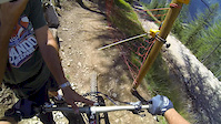
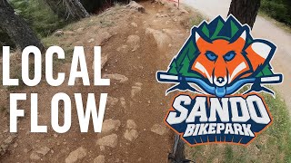
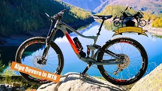
trail: Local Flow
3:07 |
252 |
Jul 31, 2018
trail: Local Flow
10:37 |
31 |
Oct 1, 2025 , Varzo

trail: Sando Air Line
3:20 |
61 |
Oct 1, 2025 , Varzo
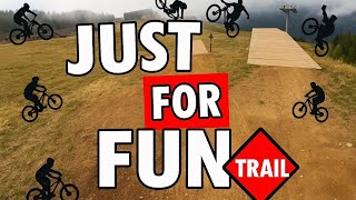
trail: Just 4 Fun
3:05 |
38 |
Oct 1, 2025 , Varzo
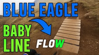
trail: Baby Line
6:42 |
33 |
Oct 1, 2025 , Varzo

trail: Blue Eagle
6:42 |
39 |
Oct 1, 2025 , Varzo
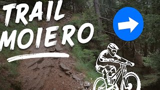
trail: Moiero
12:23 |
49 |
Sep 23, 2025 , Varzo
13:29 |
295 |
Oct 27, 2018
Recent Trail Reports
| status | trail | date | condition | info | user |
|---|---|---|---|---|---|
| Blue Eagle | Sep 13, 2025 @ 5:22pm (Europe/Rome) Sep 13, 2025 | Variable | StefanohANuF5 | ||
| Just 4 Fun | Sep 13, 2025 @ 5:20pm (Europe/Rome) Sep 13, 2025 | Variable | StefanohANuF5 | ||
| Moiero | Sep 13, 2025 @ 5:19pm (Europe/Rome) Sep 13, 2025 | Variable | StefanohANuF5 | ||
| Local Flow | Sep 13, 2025 @ 5:17pm (Europe/Rome) Sep 13, 2025 | Variable | StefanohANuF5 | ||
| Easy dosso 2500 | Aug 5, 2025 @ 2:06pm Aug 5, 2025 | Unknown | MG74 | ||
| Molla tutto | Aug 5, 2025 @ 2:03pm Aug 5, 2025 | Unknown | MG74 | ||
| Trasquera - Ponte Campo | Sep 24, 2022 @ 3:18am Sep 24, 2022 | Unknown | theendoflove |
Activity Feed
| username | action | type | title | date |
|---|---|---|---|---|
| Stefanof2Io9R | ridden | trail | activity #94273116 and 4 more | May 8, 2026 @ 12:46pm May 8, 2026 |
| Stefanof2Io9R | ridden | trail | activity #94198614 | May 6, 2026 @ 9:54pm May 6, 2026 |
| roelleemanA5OBwR | wishlist | region | activity #92174374 | Apr 8, 2026 @ 4:14am Apr 8, 2026 |
| MenteZCP | wishlist | trail | activity #91972530 | Apr 5, 2026 @ 6:18am Apr 5, 2026 |
| DavideOcchipinti | ridden | trail | activity #89610095 and 4 more | Feb 26, 2026 @ 8:47pm Feb 26, 2026 |
Recent Comments
| username | type | title | comment | date |
|---|---|---|---|---|
| trail | L’unica cosa veramente impegnativa è il... | Sep 13, 2025 @ 8:23am Sep 13, 2025 | ||
| trail | In bike park è data rossa, comunque... | Sep 13, 2025 @ 8:21am Sep 13, 2025 | ||
| trail | Le sezioni di single Trail sono molto belle e... | Sep 13, 2025 @ 8:19am Sep 13, 2025 | ||
| trail | Di certo non è blu... Al bike park prima la... | Sep 13, 2025 @ 8:16am Sep 13, 2025 | ||
| trail | Con la giusta esperienza praticamente si fa... | Aug 28, 2022 @ 12:26pm Aug 28, 2022 |
Bike & Skill Parks
| name | type | city | rating |
|---|---|---|---|
| Sando Bikepark | bike park | Varzo |
Activity Type Stats
| activitytype | trails | distance | descent | descent distance | total vertical | rating | global rank | state rank | photos | reports | routes | ridelogs |
|---|---|---|---|---|---|---|---|---|---|---|---|---|
| Mountain Bike | 12 | 19 miles | 8,724 ft | 11 miles | 5,741 ft | #3,697 | #215 | 11 | 50 | 872 | ||
| E-Bike | 12 | 19 miles | 8,724 ft | 11 miles | 5,741 ft | #4,247 | #407 | 47 | 242 | |||
| Gravel Bike | 1 | 3 miles | 43 ft | 400 ft | 2,464 ft | #6,553 | #552 | 2 | ||||
| Adaptive Bike | 1 | 3 miles | 43 ft | 400 ft | 2,464 ft | #353 | #493 | |||||
| Winter Fat Bike | 1 | 5 miles | 318 ft | 2 miles | 732 ft | #6,553 | #552 | |||||
| Hike | 3 | 10 miles | 1,814 ft | 4 miles | 4,570 ft | #8,522 | #530 | 39 | 387 | |||
| Trail Running | 3 | 10 miles | 1,814 ft | 4 miles | 4,570 ft | #8,060 | #518 | 39 | 8 |
Frequently Asked Questions About Varzo
▼
What are the best places to ride in Varzo?
Varzo has 1 areas to explore for mountain biking. The top rated areas are:
▼
What are the highest rated mountain biking trails in Varzo?
The highest rated mountain biking trails in Varzo are:
- Local Flow (4.2/5)
- Blue Eagle (4.1/5)
- Trasquera - Ponte Campo (4/5)
- Just 4 Fun (0/5)
- Baby Line (0/5)
▼
What is the best time of the year to ride in Varzo?
Based on ride log data, the most popular months to ride in Varzo are:
- August (15 activities)
- July (11 activities)
- October (10 activities)
▼
Where can I park to ride in Varzo?
Check the Varzo trail map for trailhead and parking information. Community members regularly update access and parking details for trails in the area.
- By denitopia
 TRAILFORKS VTA & contributors
 - Admins: silviu86, adessoomaipiu, marambo
- #24542 - 1,423 views
- varzo activity log | embed map of Varzo mountain bike trails |
Downloading of trail gps tracks in kml & gpx formats is enabled for Varzo.
You must login to download files.