
close
3D
Trail Conditions
- Unknown
- Snow Groomed
- Snow Packed
- Snow Covered
- Snow Cover Partial
- Freeze/thaw Cycle
- Icy
- Prevalent Mud
- Wet
- Variable
- Ideal
- Dry
- Very Dry
Trail Flow (Ridden Direction)
Trailforks scans users activity logs to determine the most popular direction each trail is ridden. A good flowing trail network will have most trails flowing in a single direction according to their intension.
The colour categories are based on what percentage of users are riding a trail in its intended direction.
The colour categories are based on what percentage of users are riding a trail in its intended direction.
- > 96%
- > 90%
- > 80%
- > 70%
- > 50%
- < 50%
- bi-directional trail
- no data
Trail Last Used
Trailforks scans activity logs to determine the last time a trail was ridden.
- < 2 days
- < 1 week
- < 2 weeks
- < 1 month
- < 6 months
- > 6 months
Trail Ridden Direction
The intended direction a trail should be ridden.
- Downhill Only
- Downhill Primary
- Both Directions
- Uphill Primary
- Uphill Only
- One Direction
Contribute Details
Colors indicate trail is missing specified detail.
- Description
- Photos
- Description & Photos
- Videos
Trail Popularity ?
Trailforks scans activity logs to determine which trails are ridden the most in the last 9 months.
Trails are compared with nearby trails in the same city region with a possible 25 colour shades.
Think of this as a heatmap, more activities = more kinetic energy = warmer colors.
- most popular
- popular
- less popular
- not popular
ATV/ORV/OHV Filter
Max Vehicle Width
inches
US Cell Coverage
Legend

Radar Time
Activity Recordings
Trailforks uses anonymized public activity data.
?
Activity Recordings
Trailforks uses anonymized public activity data.
?
Winter Trails
Warning
A routing network for winter maps does not exist. Selecting trails using the winter trails layer has been disabled.
Missing Trails
Most Popular
Least Popular
Trails are colored based on popularity. The more popular a trail is, the more red. Less popular trails trend towards green.
Jump Magnitude Heatmap
Heatmap of where users jump on trails. Zoom in to see individual jumps, click circles to view jump details.
BC Backroad Status
![map legend]()
Service Road Atlas is a free to use, community-driven service for viewing and creating reports on the numerous back-country service roads around B.C. and Alberta.

Slope Aspect
Direction the slope faces
Trails Deemphasized
Trails are shown in grey.
Only show trails with no bike usage.
Suggested Layers
Based on selected activity type
Save the current map location and zoom level as your default home location whenever this page is loaded.
SaveSi tratta di una delle zone più apprezzate per la mountain bike nei dintorni di Roma. Situata all'interno del Parco Regionale di Veio, questa area offre una rete di sentieri immersi in un paesaggio naturale ricco di boschi, colline e vallate, ideale per gli appassionati di MTB di tutti i livelli.
Caratteristiche principali della trail area
Sentieri Flow e mediamente tecnici. La zona è rinomata per i suoi trail ben curati, con fondo scorrevole di terreno vulcanico ben drenante.
Accessibilità: I trail sono facilmente accessibili dal paese di Sacrofano e Formello, con punti di partenza come il Parking Centro Sportivo Sacrofano oppure il parking Cotral. Da qui si può raggiungere la Macchia di Sacrofano, punto di inizio di molti sentieri.
Ambiente Naturale: L'area si estende tra la Macchia di Sacrofano e la Valle del Sorbo, offrendo un ambiente naturale variegato, con boschi di querce, pascoli e formazioni tufacee. Monte Musino, con i suoi 389 metri di altitudine, rappresenta la vetta più elevata della trail area e del Parco Regionale di Veio, un punto di riferimento per gli appassionati di mountain bike e trekking nei dintorni di Roma.
Caratteristiche principali della trail area
Sentieri Flow e mediamente tecnici. La zona è rinomata per i suoi trail ben curati, con fondo scorrevole di terreno vulcanico ben drenante.
Accessibilità: I trail sono facilmente accessibili dal paese di Sacrofano e Formello, con punti di partenza come il Parking Centro Sportivo Sacrofano oppure il parking Cotral. Da qui si può raggiungere la Macchia di Sacrofano, punto di inizio di molti sentieri.
Ambiente Naturale: L'area si estende tra la Macchia di Sacrofano e la Valle del Sorbo, offrendo un ambiente naturale variegato, con boschi di querce, pascoli e formazioni tufacee. Monte Musino, con i suoi 389 metri di altitudine, rappresenta la vetta più elevata della trail area e del Parco Regionale di Veio, un punto di riferimento per gli appassionati di mountain bike e trekking nei dintorni di Roma.
source: https://veiotrails.com/
Primary Trail Type: All-Mountain & Downhill
eBikes Allowed:
Yes
AKA: Veio Bike Park
Land Status: City Managed
 google parking directions plan a road trip here
Access Info:
- Centro Sportivo Comunale M. di Piero | Via di Monte Sarapollo, 20, 00060 Sacrofano RM
- Bar Il Castagneto | Via Formellese Km. 9.900, 00060 Formello RM
- Bar Pasticceria Centofanti | Via Nazario Sauro 37, 00060 Formello RM
- Bar Il Castagneto | Via Formellese Km. 9.900, 00060 Formello RM
- Bar Pasticceria Centofanti | Via Nazario Sauro 37, 00060 Formello RM
Links
This region uses the Uk/Euro style trail grading system.
Trail info last updated
Activities Click to view
- Mountain Bike
9 trails
- E-Bike
9 trails
- Horse
1 trails
- Hike
8 trails
- Trail Running
8 trails
Region Details

- 1
- 2
- 6
Region Status
Open as of Nov 5, 2026

Stats
- Avg Trail Rating
- Trails (view details)
- 9
- Trails Mountain Bike
- 9
- Trails E-Bike
- 9
- Trails Gravel Bike
- 1
- Trails Winter Fat Bike
- 1
- Trails Horse
- 1
- Trails Hike
- 8
- Trails Trail Running
- 8
- Total Distance
- 8 miles
- Total Descent
- 3,108 ft
- Total Vertical
- 698 ft
- Highest Trailhead
- 1,270 ft
- Reports
- 440
- Photos
- 23
- Completed Counter
- 1,401
Popular VeioTrails Mountain Biking Trails
• 80 ★ 4.4 • 4,434 ft • 24 ft • 175 •
Popular blue difficulty singletrack. This mountain bike primary trail can be used downhill primary. On average it takes 5 minutes to complete this trail.
• 70 ★ 3.7 • 2 miles • 181 ft • 174 •
Popular blue difficulty singletrack. This mountain bike primary trail can be used downhill primary and has a moderate overall physical rating. It features drop and jump. On average it takes 16 minutes to complete this trail.
• 90 ★ 4.0 • 1 mile • 26 ft • 163 •
The sister trail of Pecora, it is much longer and comes down in the second part parallel to Cinghiale.
• 60 ★ 3.5 • 2,406 ft • 38 ft • 144 •
Panoramic, wonderful trail that runs on a panoramic crest and features some nice jumps and technical spots.
• 50 ★ 2.5 • 1,497 ft • 23 ft • 130 •
Short trail with many jumps. What does a squirrel (scoiattolo) all day? Jumps!
• 100 ★ 4.0 • 1 mile • 4 ft • 114 •
New trail still in development, the trail is completed and usable, and in its stage of deveopment has many "contropendenze" that make for a nice change in the Park.
• 40 ★ 4.4 • 1 mile • 224 ft • 84 •
Moderately popular green difficulty singletrack. This mountain bike primary trail can be used downhill primary. On average it takes 13 minutes to complete this trail.
Photos of VeioTrails Mountain Bike
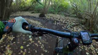
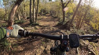
Videos of VeioTrails Mountain Bike
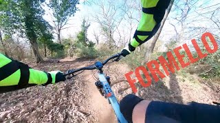
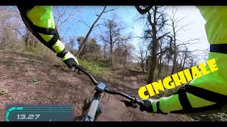
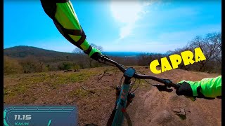
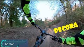
Recent Trail Reports
| status | trail | date | condition | info | user |
|---|---|---|---|---|---|
| Volpe | Nov 5, 2026 @ 3:57pm (Europe/Rome) Nov 5, 2026 | Ideal | lGfKkvA6 | ||
| Picchio | Nov 5, 2026 @ 3:56pm (Europe/Rome) Nov 5, 2026 | Ideal | lGfKkvA6 | ||
| Pecora | Oct 4, 2026 @ 9:33am (Europe/Vatican) Oct 4, 2026 | Very Dry | mostronzo | ||
| Scoiattolo | Sep 29, 2026 @ 10:54am (Europe/Rome) Sep 29, 2026 | Dry | Rugh | ||
| Capra | Sep 29, 2026 @ 10:54am (Europe/Rome) Sep 29, 2026 | Dry | Rugh | ||
| Cinghiale | Sep 21, 2026 @ 7:21pm (Europe/Rome) Sep 21, 2026 | Very Dry | lGfKkvA6 | ||
| Aquila | Apr 24, 2026 @ 5:15pm (Europe/Rome) Apr 24, 2026 | Dry | federfana | ||
| Falco New | May 25, 2025 @ 9:31am May 25, 2025 | Ideal | Carlosdelafuente |
Activity Feed
| username | action | type | title | date |
|---|---|---|---|---|
| lGfKkvA6 | add | report | activity #107235908 and 1 more | Nov 5, 2026 @ 6:56am Nov 5, 2026 |
| GiorgioNeXlsh | checkin | trail | activity #107058707 | Nov 2, 2026 @ 2:12am Nov 2, 2026 |
| GiorgioNeXlsh | ridden | trail | activity #107058700 | Nov 2, 2026 @ 2:12am Nov 2, 2026 |
| Carlosdelafuente | add | report | activity #106542691 and 1 more | Oct 24, 2026 @ 11:42pm Oct 24, 2026 |
| mostronzo | add | report | activity #105184760 | Oct 4, 2026 @ 4:38am Oct 4, 2026 |
Recent Comments
| username | type | title | comment | date |
|---|---|---|---|---|
| trail | Nice green trail, but please delete old... | Nov 13, 2025 @ 1:08am Nov 13, 2025 | ||
| report | Come sono gli altri trails? | Sep 1, 2025 @ 7:23am Sep 1, 2025 | ||
| report | E anche oggi 1 settembre l'albero caduto c'è... | Sep 1, 2025 @ 7:18am Sep 1, 2025 | ||
| trail | Bello e messo bene, niente fango e fondo... | Apr 21, 2025 @ 6:24am Apr 21, 2025 | ||
| trail | Il Trail è stato completamente ripulito e... | Jan 6, 2025 @ 5:32am Jan 6, 2025 |
Nearby Areas
| name | distance | ||||
|---|---|---|---|---|---|
| Riserva Naturale di Monte Mario | 2 | 2 | 11.3 km | ||
| Siena | 17 km | ||||
| Monte Ronco | 17 km | ||||
| Gerosa Bike | 17 km | ||||
| Campigna bike area | 17 km |
Activity Type Stats
| activitytype | trails | distance | descent | descent distance | total vertical | rating | global rank | state rank | photos | reports | routes | activity logs |
|---|---|---|---|---|---|---|---|---|---|---|---|---|
| Mountain Bike | 9 | 8 miles | 3,107 ft | 6 miles | 699 ft | #5,969 | #304 | 23 | 437 | 2,302 | ||
| E-Bike | 9 | 8 miles | 3,107 ft | 6 miles | 699 ft | #837 | #108 | 437 | 900 | |||
| Gravel Bike | 1 | 3,002 ft | 3 ft | 144 ft | 112 ft | #2,369 | #62 | 16 | 27 | |||
| Winter Fat Bike | 1 | 1 mile | 630 ft | 1 mile | 509 ft | #2,369 | #62 | 25 | 1 | |||
| Horse | 1 | 3,002 ft | 3 ft | 144 ft | 112 ft | #1,052 | #49 | 50 | ||||
| Hike | 8 | 7 miles | 2,631 ft | 5 miles | 699 ft | #9,359 | #370 | 420 | 10 | |||
| Trail Running | 8 | 7 miles | 2,631 ft | 5 miles | 699 ft | #8,515 | #360 | 420 | 10 |
Frequently Asked Questions
▼
What are the highest rated mountain biking trails in VeioTrails?
▼
What is the best time of the year to ride in VeioTrails?
Based on activity log data, the most popular months to ride in VeioTrails are:
- April (16 activities)
- June (10 activities)
- October (10 activities)
▼
Where can I park to ride in VeioTrails?
There are 3 parking locations listed in VeioTrails. The most popular parking spots are: View all parking and trailhead locations on the map to plan your visit.
▼
What is the longest trail in VeioTrails?
The longest trail in VeioTrails is Volpe at 1.6 miles. View all trails sorted by distance.
▼
How many trails are in VeioTrails?
VeioTrails has a total of 9 trails. Browse top mountain biking trails in VeioTrails to find detailed information including difficulty ratings, distances, and trail conditions.
▼
Which trail has the most elevation gain in VeioTrails?
The trail with the most elevation gain in VeioTrails is Aquila with 224 ft of elevation gain. View all trails sorted by elevation gain.
▼
Which trail has the most elevation descent in VeioTrails?
The trail with the most elevation descent in VeioTrails is Aquila with 631 ft of elevation descent. View all trails sorted by elevation descent.
▼
What activities are most popular in VeioTrails?
VeioTrails supports the following activities: Mountain Biking, E-Biking, Horseback, Hiking, Trail Running.
▼
Are there any trails with scenic viewpoints in VeioTrails?
Yes, there are 1 scenic viewpoints marked along trails in VeioTrails. Some popular viewpoints include: Explore more points of interest to find trails with the best views.
▼
What trails have the biggest jumps in VeioTrails?
The trails with the biggest jumps in VeioTrails are: Browse all mountain bike trails to find trails with jumps and technical features.
▼
Are the trails open in VeioTrails?
The overall region status for VeioTrails is Clear / Green. Out of 8 trails:
- Clear / Green: 7
- Minor Issue / Yellow: 1
▼
Can I ride an ebike in VeioTrails?
Yes, VeioTrails supports e-bike riding. There are 9 trails in VeioTrails that allow e-bikes. Check the e-bike trails listing for specific trail access details and any local regulations.
▼
What type of bike is most common in VeioTrails?
Based on activity log data, the most common bike types used in VeioTrails are:
- AM (12 activities)
▼
What are the most popular Strava Segments in VeioTrails?
The most popular Strava segments in VeioTrails are:
- PECORA 2 (2,593 athletes)
- Volpe interrotta (2,507 athletes)
- Track - Il Cinghiale - P1 (2,193 athletes)
▼
What are the most popular mountain biking trails in VeioTrails?
▼
What are the best beginner ride trails in VeioTrails?
The best beginner mountain biking trails in VeioTrails are: View all beginner mountain biking trails in VeioTrails.
Activities
Trails
Points of Interest
- By blackat666 & contributors
- Admins: albertoritm
- #15910 - 8,793 views
- veiotrails activity log | embed map of VeioTrails mountain bike trails | veiotrails mountain biking points of interest
Downloading of trail gps tracks in kml & gpx formats is enabled for VeioTrails.
You must login to download files.
