close
-
Layers w
- Weather Layers
- Pro
- Pro
- Pro
- Pro
- Pro
- Pro
- More Layers
- Pro
- Pro
- Pro
- Pro
-
Upgrade to

3D
Trail Conditions
- Unknown
- Snow Groomed
- Snow Packed
- Snow Covered
- Snow Cover Partial
- Freeze/thaw Cycle
- Icy
- Prevalent Mud
- Wet
- Variable
- Ideal
- Dry
- Very Dry
Trail Flow (Ridden Direction)
Trailforks scans users ridelogs to determine the most popular direction each trail is ridden. A good flowing trail network will have most trails flowing in a single direction according to their intension.
The colour categories are based on what percentage of riders are riding a trail in its intended direction.
The colour categories are based on what percentage of riders are riding a trail in its intended direction.
- > 96%
- > 90%
- > 80%
- > 70%
- > 50%
- < 50%
- bi-directional trail
- no data
Trail Last Ridden
Trailforks scans ridelogs to determine the last time a trail was ridden.
- < 2 days
- < 1 week
- < 2 weeks
- < 1 month
- < 6 months
- > 6 months
Trail Ridden Direction
The intended direction a trail should be ridden.
- Downhill Only
- Downhill Primary
- Both Directions
- Uphill Primary
- Uphill Only
- One Direction
Contribute Details
Colors indicate trail is missing specified detail.
- Description
- Photos
- Description & Photos
- Videos
Trail Popularity ?
Trailforks scans ridelogs to determine which trails are ridden the most in the last 9 months.
Trails are compared with nearby trails in the same city region with a possible 25 colour shades.
Think of this as a heatmap, more rides = more kinetic energy = warmer colors.
- most popular
- popular
- less popular
- not popular
ATV/ORV/OHV Filter
Max Vehicle Width
inches
US Cell Coverage
Legend

Radar Time
Activity Recordings
Trailforks uses anonymized public activity data.
?
Activity Recordings
Trailforks uses anonymized public activity data.
?
Personal Heatmap
▶
Activity Types
all
/
none
▶
Options
2
Date range
month
–
Winter Trails
Warning
A routing network for winter maps does not exist. Selecting trails using the winter trails layer has been disabled.
Missing Trails
Most Popular
Least Popular
Trails are colored based on popularity. The more popular a trail is, the more red. Less popular trails trend towards green.
Jump Magnitude Heatmap
Heatmap of where riders jump on trails. Zoom in to see individual jumps, click circles to view jump details.
BC Backroad Status
![map legend]()
Service Road Atlas is a free to use, community-driven service for viewing and creating reports on the numerous back-country service roads around B.C. and Alberta.

Slope Aspect
Direction the slope faces
Trails Deemphasized
Trails are shown in grey.
Only show trails with no bike usage.
Suggested Layers
Based on selected activity type
Save the current map location and zoom level as your default home location whenever this page is loaded.
Save
No description for Vic has been added yet!
Login or register to submit one.
This region uses the Uk/Euro style trail grading system.
Activities Click to view
- Mountain Bike
263 trails
- E-Bike
258 trails
- Adaptive Bike
1 trails
- Horse
11 trails
- Hike
245 trails
- Trail Running
243 trails
Region Details
- 62
- 56
- 109
- 25
- 8
Region Status
Open as of May 2, 2026Stats
- Avg Trail Rating
- Trails (view details)
- 260
- Trails Mountain Bike
- 263
- Trails E-Bike
- 258
- Trails Adaptive Bike
- 1
- Trails Horse
- 11
- Trails Hike
- 245
- Trails Trail Running
- 243
- Trails Dirtbike/Moto
- 3
- Total Distance
- 192 miles
- Total Descent
- 45,998 ft
- Total Vertical
- 2,658 ft
- Highest Trailhead
- 4,132 ft
- Reports
- 206
- Photos
- 64
- Ridden Counter
- 2,436
Sub Regions
-
Creu de Gurb
- 1
- 7
- 4
- 3
-
Muntanyola
- 2
- 8
- 1
- 2
-
Oristà
- 26
- 25
- 6
-
Taradell
- 20
- 54
- 9
- 1
-
Tona
- 2
- 4
- 1
Popular Vic Mountain Biking Trails
• 80 ★ 4.0 • 2 miles • 164 ft • 73 •
Popular blue difficulty singletrack. This multi-use trail can be used downhill primary. It features drop. Trail visibility is always easy to follow. On average it takes 19 minutes to complete this trail.
• 100 ★ 3.0 • 4,488 ft • 114 ft • 69 •
Camí ample bidireccional, de terreny sorrenc, amb alguns trams fluids i algun punt una mica tècnic.
• 85 ★ 2.0 • 4,150 ft • 85 ft • 63 •
enllaç que ens porta al trail traficants, pot estar un xic tapat per la vegetació però en general es camí fàcil i de bon seguir.
• 75 ★ 0.0 • 1 mile • 12 ft • 55 •
Popular blue difficulty singletrack. This multi-use trail can be used downhill only. On average it takes 10 minutes to complete this trail.
• 100 ★ 0.0 • 938 ft • 27 ft • 52 •
Popular green difficulty singletrack. This multi-use trail can be used both directions with a 27 ft blue climb. On average it takes 2 minutes to complete this trail.
• 90 ★ 0.0 • 630 ft • 0 ft • 42 •
Popular blue difficulty singletrack. This multi-use trail can be used downhill only. Trail visibility is always easy to follow. On average it takes minutes to complete this trail.
• 100 ★ 5.0 • 5,092 ft • 3 ft • 38 •
Popular blue difficulty singletrack. This multi-use trail can be used both directions. On average it takes 6 minutes to complete this trail.
• 95 ★ 0.0 • 659 ft • 0 ft • 37 •
La primera part es molt pronunciada, pero despres el sender es tornar bastant facil.
Vic Mountain Bike Routes
12 miles • 1,491 ft • 8 • Loop •
Ruta de 20 km i 7 corriols de poca dificultat amb excepció d'algun pas tècnic puntual. Temps total (bona...
9 miles • 1,565 ft • 7 • Loop •
Ruta corta pero muy divertida con algunos de los senderos más duros alrededor de Oristà. PD: Es posible...
28 miles • 3,854 ft • 8 • Loop •
Pedalada organitzada pel club ciclista taradell any 2023. 80% corriols, molt recomanable però no us en...
30 miles • 6,508 ft • 6 • Loop •
Collformic, Matagalls, Coll Pregón, Matagalls, Traficants
22 miles • 2,223 ft • 6 • Loop •
Ruta de pujada al Salt de la minyona/els munts baixada pels corriols. Parada a sopar a Sant julia.
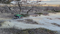
Photos of Vic Mountain Bike
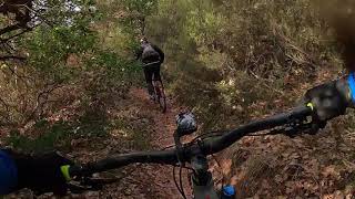
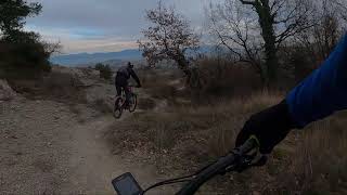
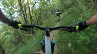
Videos of Vic Mountain Bike
trail: Terressos Blancs
0:32 |
|
Mar 13, 2024
trail: El Trabuc
9:07 |
193 |
Feb 7, 2021 , Vic

trail: St. Andreu de Gurb - C17
15:08 |
224 |
Feb 6, 2021 , Vic

trail: Terressos Blancs
15:08 |
310 |
Feb 6, 2021 , Vic
trail: Creu de Gurb - Volta Sud
15:08 |
285 |
Feb 6, 2021 , Vic

trail: Cementiri Gurb
15:08 |
222 |
Feb 6, 2021 , Vic

trail: Creu de Gurb - DH St. Roc
15:08 |
367 |
Feb 6, 2021 , Vic
trail: Gabadons
20:48 |
319 |
Nov 3, 2020 , Vic
Recent Trail Reports
| status | trail | date | condition | info | user |
|---|---|---|---|---|---|
| Can Serrà | Apr 26, 2026 @ 8:13am (Europe/Andorra) Apr 25, 2026 | Unknown | jic | ||
| St. Andreu de Gurb - C17 | Apr 11, 2026 @ 8:28am (Europe/Andorra) Apr 10, 2026 | Ideal | Jorditeixido | ||
| Terressos Blancs | Apr 11, 2026 @ 8:28am (Europe/Andorra) Apr 10, 2026 | Ideal | Jorditeixido | ||
| Creu de Gurb - DH Portell | Apr 11, 2026 @ 8:28am (Europe/Andorra) Apr 10, 2026 | Ideal | Jorditeixido | ||
| Benzinera Creu de Gurb | Apr 11, 2026 @ 8:28am (Europe/Andorra) Apr 10, 2026 | Ideal | Jorditeixido | ||
| San Sebastià enlace | Apr 11, 2026 @ 8:28am (Europe/Andorra) Apr 10, 2026 | Ideal | Jorditeixido | ||
| San Sebastià | Apr 11, 2026 @ 8:28am (Europe/Andorra) Apr 10, 2026 | Ideal | Jorditeixido | ||
| Creu de Gurb - DH St. Roc | Feb 19, 2026 @ 8:04am (Europe/Andorra) Feb 18, 2026 | Ideal | marti-darcabal | ||
| Creu De Gurb | Feb 19, 2026 @ 8:04am (Europe/Andorra) Feb 18, 2026 | Ideal | marti-darcabal | ||
| Cementiri Gurb | Feb 19, 2026 @ 8:04am (Europe/Andorra) Feb 18, 2026 | Ideal | marti-darcabal |
Activity Feed
| username | action | type | title | date |
|---|---|---|---|---|
| jic | add | report | activity #93429578 | Apr 26, 2026 @ 4:44am Apr 26, 2026 |
| Jorditeixido | add | report | activity #92388087 and 3 more | Apr 11, 2026 @ 7:09am Apr 11, 2026 |
| Jorditeixido | add | report | activity #92388086 and 1 more | Apr 11, 2026 @ 7:09am Apr 11, 2026 |
| quiquebueno | wishlist | trail | activity #92007574 | Apr 5, 2026 @ 2:29pm Apr 5, 2026 |
| AlbertoXQRVy | add | report | activity #91755906 | Apr 2, 2026 @ 5:36am Apr 2, 2026 |
Recent Comments
| username | type | title | comment | date |
|---|---|---|---|---|
| trail | ja torna a estar exhuberant i magic, baixar... | Feb 9, 2026 @ 5:06am Feb 9, 2026 | ||
| trail | Bones Sergi, Estupendo, ara ja pren sentint.... | Jan 7, 2026 @ 7:59am Jan 7, 2026 | ||
| trail | Hola Ramon, Mersi per el Feedback. Tens tota... | Jan 5, 2026 @ 9:47am Jan 5, 2026 | ||
| trail | El Primer tram és molt dret, solei, pedregós... | Dec 15, 2025 @ 2:15am Dec 15, 2025 | ||
| trail | Quan el vem netejar i preparar pq fos ciclable... | May 19, 2025 @ 12:42pm May 19, 2025 |
Local Badges
-

Epic Mountain Bike Climb 2k81 awarded -

Climbing 10k Badge30 awarded -

Mountain Biking 100k Badge1 awarded -

Epic Ride Descent 2k81 awarded -

Descent 10k Badge31 awarded -

Descent 100k Badge1 awarded
Bike & Skill Parks
| name | type | city | rating |
|---|---|---|---|
| Jufre Cycling | skill park | Vic |
Activity Type Stats
| activitytype | trails | distance | descent | descent distance | total vertical | rating | global rank | state rank | photos | reports | routes | ridelogs |
|---|---|---|---|---|---|---|---|---|---|---|---|---|
| Mountain Bike | 263 | 192 miles | 45,997 ft | 110 miles | 2,657 ft | #906 | #99 | 56 | 206 | 5 | 4,163 | |
| E-Bike | 258 | 190 miles | 45,361 ft | 108 miles | 2,162 ft | #219 | #92 | 8 | 205 | 4 | 313 | |
| Adaptive Bike | 1 | #382 | #151 | |||||||||
| Horse | 11 | 18 miles | 1,280 ft | 8 miles | 1,683 ft | #1,409 | #107 | 1 | ||||
| Hike | 245 | 186 miles | 43,940 ft | 105 miles | 2,657 ft | #913 | #124 | 204 | 242 | |||
| Trail Running | 243 | 182 miles | 43,530 ft | 103 miles | 2,657 ft | #636 | #119 | 204 | 1 | 525 | ||
| Dirtbike/Moto | 3 | 1 mile | 194 ft | 2,933 ft | 223 ft |
Frequently Asked Questions About Vic
▼
What are the best places to ride in Vic?
Vic has 5 areas to explore for mountain biking. The top rated areas are:
▼
What are the highest rated mountain biking trails in Vic?
The highest rated mountain biking trails in Vic are:
- Creu de Gurb - DH Portell (4.4/5)
- Escurçó (4.2/5)
- Torrent dels Casals (4.2/5)
- Terressos Blancs (4.2/5)
- El Cabirol (4.2/5)
▼
What is the best time of the year to ride in Vic?
Based on ride log data, the most popular months to ride in Vic are:
- August (6 activities)
- October (3 activities)
- May (2 activities)
▼
Where can I park to ride in Vic?
Check the Vic trail map for trailhead and parking information. Community members regularly update access and parking details for trails in the area.
Activities
Trails
- By Tonirov & contributors
- Admins: snaker4, kai-bcn, henrikenduro, Galis
- #29197 - 3,234 views
- vic activity log | embed map of Vic mountain bike trails | vic mountain biking points of interest
Downloading of trail gps tracks in kml & gpx formats is enabled for Vic.
You must login to download files.