close
-
Layers w
- Weather Layers
- Pro
- Pro
- Pro
- Pro
- Pro
- Pro
- More Layers
- Pro
- Pro
- Pro
- Pro
-
Upgrade to

3D
Trail Conditions
- Unknown
- Snow Groomed
- Snow Packed
- Snow Covered
- Snow Cover Partial
- Freeze/thaw Cycle
- Icy
- Prevalent Mud
- Wet
- Variable
- Ideal
- Dry
- Very Dry
Trail Flow (Ridden Direction)
Trailforks scans users ridelogs to determine the most popular direction each trail is ridden. A good flowing trail network will have most trails flowing in a single direction according to their intension.
The colour categories are based on what percentage of riders are riding a trail in its intended direction.
The colour categories are based on what percentage of riders are riding a trail in its intended direction.
- > 96%
- > 90%
- > 80%
- > 70%
- > 50%
- < 50%
- bi-directional trail
- no data
Trail Last Ridden
Trailforks scans ridelogs to determine the last time a trail was ridden.
- < 2 days
- < 1 week
- < 2 weeks
- < 1 month
- < 6 months
- > 6 months
Trail Ridden Direction
The intended direction a trail should be ridden.
- Downhill Only
- Downhill Primary
- Both Directions
- Uphill Primary
- Uphill Only
- One Direction
Contribute Details
Colors indicate trail is missing specified detail.
- Description
- Photos
- Description & Photos
- Videos
Trail Popularity ?
Trailforks scans ridelogs to determine which trails are ridden the most in the last 9 months.
Trails are compared with nearby trails in the same city region with a possible 25 colour shades.
Think of this as a heatmap, more rides = more kinetic energy = warmer colors.
- most popular
- popular
- less popular
- not popular
ATV/ORV/OHV Filter
Max Vehicle Width
inches
US Cell Coverage
Legend

Radar Time
Activity Recordings
Trailforks uses anonymized public activity data.
?
Activity Recordings
Trailforks uses anonymized public activity data.
?
Personal Heatmap
▶
Activity Types
all
/
none
▶
Options
2
Date range
month
–
Winter Trails
Warning
A routing network for winter maps does not exist. Selecting trails using the winter trails layer has been disabled.
Missing Trails
Most Popular
Least Popular
Trails are colored based on popularity. The more popular a trail is, the more red. Less popular trails trend towards green.
Jump Magnitude Heatmap
Heatmap of where riders jump on trails. Zoom in to see individual jumps, click circles to view jump details.
BC Backroad Status
![map legend]()
Service Road Atlas is a free to use, community-driven service for viewing and creating reports on the numerous back-country service roads around B.C. and Alberta.

Slope Aspect
Direction the slope faces
Trails Deemphasized
Trails are shown in grey.
Only show trails with no bike usage.
Suggested Layers
Based on selected activity type
Save the current map location and zoom level as your default home location whenever this page is loaded.
Save
No description for Vis has been added yet!
Login or register to submit one.
This region uses the Uk/Euro style trail grading system.
Activities Click to view
- Mountain Bike
16 trails
- E-Bike
8 trails
- Hike
15 trails
- Trail Running
15 trails
Region Details
- 6
- 1
- 5
Stats
- Avg Trail Rating
- Trails (view details)
- 12
- Trails Mountain Bike
- 15
- Trails E-Bike
- 7
- Trails Horse
- 3
- Trails Hike
- 14
- Trails Trail Running
- 14
- Trails Dirtbike/Moto
- 3
- Trails ATV/ORV/OHV
- 3
- Reports
- 13
- Photos
- 6
- Ridden Counter
- 277
Sub Regions
No riding areas or trails have been contributed in this region.
Help grow the crowd-sourced database by contributing a local riding area then trails can be added to it!
Popular Vis Mountain Biking Trails
• ★ 5.0 • 4,304 ft • 0 ft • 26 • • hike
Old mule path, rocky, used for mtb also. Marked hiking path. Carefully on the exit drop at the main road!
• ★ 5.0 • 1 mile • 0 ft • 25 • • hike
Marked hiking trail, very nice for MTB descent also. Rocky all the way. Beware and respect the hikers!
• ★ 0.0 • 1 mile • 0 ft • 22 • • hike
Old mule path, some gravel and asphalt at the bottom. Marked hiking path.
• 50 ★ 0.0 • 1 mile • 0 ft • 9 • • hike
Natural rocky trail, a lot of switchbacks, a few parts overgrown but fully rideable. Marked hiking path.
• ★ 4.0 • 4,393 ft • 0 ft • 4 • • hike
Old mule path, a few switcbacks, marked hiking path primary, also suitable for mtb descent. Old stone paving, pretty bumpy.
• ★ 0.0 • 1 mile • 0 ft • 2 • • hike
Old mule path, partly rocky, rideable in both directions. Marked hiking path.
Videos of Vis Mountain Bike
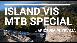
trail: Sv.Duh - Komiža
20:36 |
223 |
Aug 18, 2023 , Hvar
Recent Trail Reports
| status | trail | date | condition | info | user |
|---|---|---|---|---|---|
| Sv. Duh - Žena Glava Vis | Jun 7, 2025 @ 11:14am Jun 7, 2025 | Dry | ja1ric1 | ||
| Bratosavac Vis | Apr 17, 2025 @ 11:42am Apr 17, 2025 | Ideal | Flow-24 | ||
| Bratosavac Uphill Vis | Apr 17, 2025 @ 11:42am Apr 17, 2025 | Ideal | Flow-24 | ||
| Hum Uphill Vis | Apr 17, 2025 @ 11:42am Apr 17, 2025 | Ideal | Flow-24 | ||
| Sv. Andrija Vis | Apr 16, 2025 @ 4:42pm Apr 16, 2025 | Variable | Flow-24 | ||
| Sredinom Visa Vis | Jun 14, 2024 @ 5:29am Jun 14, 2024 | Dry | RomanKi |
Activity Feed
| username | action | type | title | date |
|---|---|---|---|---|
| palok | vote | trail | activity #95789688 | May 29, 2026 @ 11:00am May 29, 2026 |
| FxADE5 | ridden | trail | activity #85303076 | Dec 10, 2025 @ 12:58am Dec 10, 2025 |
| Teek-1 | add | photo | activity #80453993 | Sep 16, 2025 @ 2:41am Sep 16, 2025 |
| Teek-1 | ridden | trail | activity #79042852 | Aug 27, 2025 @ 5:57am Aug 27, 2025 |
| jure76 | ridden | trail | activity #75604520 | Jul 10, 2025 @ 11:16am Jul 10, 2025 |
Activity Type Stats
| activitytype | trails | distance | descent | descent distance | total vertical | rating | global rank | state rank | photos | reports | routes | ridelogs |
|---|---|---|---|---|---|---|---|---|---|---|---|---|
| Mountain Bike | 16 | 1 mile | 1,312 ft | 1 mile | 1,312 ft | 6 | 17 | 175 | ||||
| E-Bike | 8 | 1 mile | 1,312 ft | 1 mile | 1,312 ft | 14 | 68 | |||||
| Horse | 3 | 1 | ||||||||||
| Hike | 15 | 1 mile | 1,312 ft | 1 mile | 1,312 ft | 17 | 15 | |||||
| Trail Running | 15 | 1 mile | 1,312 ft | 1 mile | 1,312 ft | 17 | ||||||
| Dirtbike/Moto | 3 | |||||||||||
| ATV/ORV/OHV | 3 |
Frequently Asked Questions About Vis
▼
What are the highest rated mountain biking trails in Vis?
The highest rated mountain biking trails in Vis are:
- Bratosavac (4.2/5)
- Sv. Duh - Žena Glava (4.2/5)
- Sv. Andrija (4/5)
- Sv.Duh - Komiža (0/5)
- Sv. Mihovil (0/5)
▼
What is the best time of the year to ride in Vis?
Based on ride log data, the most popular months to ride in Vis are:
- October (1 activities)
▼
What is the longest trail in Vis?
The longest trail in Vis is Sv. Duh - Žena Glava at 2.3 km. View all trails sorted by distance.
▼
What are the best & highest rated hiking trails in Vis?
The best hiking trails in Vis are: View all hiking trails sorted by popularity score.
- By ivanvulas & contributors
- Admins: VjekoslavKrsanac
- #8164 - 3,788 views
- vis activity log | embed map of Vis mountain bike trails |
Downloading of trail gps tracks in kml & gpx formats is enabled for Vis.
You must login to download files.