close
-
Layers w
- Weather Layers
- Pro
- Pro
- Pro
- Pro
- Pro
- Pro
- More Layers
- Pro
- Pro
- Pro
- Pro
-
Upgrade to

3D
Trail Conditions
- Unknown
- Snow Groomed
- Snow Packed
- Snow Covered
- Snow Cover Partial
- Freeze/thaw Cycle
- Icy
- Prevalent Mud
- Wet
- Variable
- Ideal
- Dry
- Very Dry
Trail Flow (Ridden Direction)
Trailforks scans users ridelogs to determine the most popular direction each trail is ridden. A good flowing trail network will have most trails flowing in a single direction according to their intension.
The colour categories are based on what percentage of riders are riding a trail in its intended direction.
The colour categories are based on what percentage of riders are riding a trail in its intended direction.
- > 96%
- > 90%
- > 80%
- > 70%
- > 50%
- < 50%
- bi-directional trail
- no data
Trail Last Ridden
Trailforks scans ridelogs to determine the last time a trail was ridden.
- < 2 days
- < 1 week
- < 2 weeks
- < 1 month
- < 6 months
- > 6 months
Trail Ridden Direction
The intended direction a trail should be ridden.
- Downhill Only
- Downhill Primary
- Both Directions
- Uphill Primary
- Uphill Only
- One Direction
Contribute Details
Colors indicate trail is missing specified detail.
- Description
- Photos
- Description & Photos
- Videos
Trail Popularity ?
Trailforks scans ridelogs to determine which trails are ridden the most in the last 9 months.
Trails are compared with nearby trails in the same city region with a possible 25 colour shades.
Think of this as a heatmap, more rides = more kinetic energy = warmer colors.
- most popular
- popular
- less popular
- not popular
ATV/ORV/OHV Filter
Max Vehicle Width
inches
US Cell Coverage
Legend

Radar Time
Activity Recordings
Trailforks uses anonymized public activity data.
?
Activity Recordings
Trailforks uses anonymized public activity data.
?
Personal Heatmap
▶
Activity Types
all
/
none
▶
Options
2
Date range
month
–
Winter Trails
Warning
A routing network for winter maps does not exist. Selecting trails using the winter trails layer has been disabled.
Missing Trails
Most Popular
Least Popular
Trails are colored based on popularity. The more popular a trail is, the more red. Less popular trails trend towards green.
Jump Magnitude Heatmap
Heatmap of where riders jump on trails. Zoom in to see individual jumps, click circles to view jump details.
BC Backroad Status
![map legend]()
Service Road Atlas is a free to use, community-driven service for viewing and creating reports on the numerous back-country service roads around B.C. and Alberta.

Slope Aspect
Direction the slope faces
Trails Deemphasized
Trails are shown in grey.
Only show trails with no bike usage.
Suggested Layers
Based on selected activity type
Save the current map location and zoom level as your default home location whenever this page is loaded.
SaveGreat area for mountain bike that fit all levels of riders, from newbie, passing by novices, intermermediates and experts.
It’s only 100km from Bergen, the second largest city in Norway and easy to access by car or train.
Due the proximity with the west coast it gets rain at least 10 days a month (average). Good tyres recommended
It’s only 100km from Bergen, the second largest city in Norway and easy to access by car or train.
Due the proximity with the west coast it gets rain at least 10 days a month (average). Good tyres recommended
This region uses the Uk/Euro style trail grading system.
Activities Click to view
- Mountain Bike
44 trails
- Hike
38 trails
- Trail Running
38 trails
- Nordic Ski
3 trails
Region Details
- 10
- 1
- 17
- 10
- 6
Region Status
Open as of Jun 19, 2026Stats
- Avg Trail Rating
- Trails (view details)
- 45
- Trails Mountain Bike
- 44
- Trails E-Bike
- 38
- Trails Horse
- 1
- Trails Hike
- 38
- Trails Trail Running
- 38
- Trails Downhill Ski
- 1
- Trails Nordic Ski
- 3
- Total Distance
- 45 miles
- Total Descent Distance
- 27 miles
- Total Descent
- 19,578 ft
- Total Vertical
- 4,328 ft
- Highest Trailhead
- 4,584 ft
- Reports
- 50
- Photos
- 49
- Ridden Counter
- 750
Sub Regions
-
Hangur - Voss
- 2
- 2
- 1
-
Voss
- 12
- 3
- 4
Popular Voss Mountain Biking Trails
• 100 ★ 4.7 • 1 mile • 24 ft • 51 •
Voss MTB har stått på, lagt ned mange dugnadstimer og samarbeidet godt med grunneier når de har laget denne stien. Vennligst respekter skilting i terrenget, slik at de kan fortsette dette gode samarbeidet og videreutvikle Voss som...
• 80 ★ 3.7 • 4 miles • 379 ft • 45 •
Mostly easy to follow, but in some places it may look like it divides and then you always keep to the left. The trail ends at Voss Folkemuseum Mølstertunet
• 90 ★ 4.5 • 951 ft • 0 ft • 32 •
Rough and rooty trail with a few alternatives further down.
• 25 ★ 5.0 • 879 ft • 0 ft • 32 •
Nice ending to rebound from Hanguren and Raugstad trails if you do not want to take the car road back to Vangen. Some less attractive parties in final stretch down towards Orrefloten. In the last intersection can alternatively turn left...
• 85 ★ 3.0 • 2,664 ft • 36 ft • 29 •
Popular blue difficulty family friendly singletrack. This mountain bike primary trail can be used both directions. Trail visibility is always easy to follow. On average it takes 5 minutes to complete this trail.
• 60 ★ 4.5 • 3,071 ft • 0 ft • 23 •
Rough and rooty section of footpath that gets you to the start of Voss MTB Enduro trail
• 75 ★ 4.5 • 1,237 ft • 0 ft • 23 •
A fun little addition to the Voss MTB Enduro trail. A good area to park to start your ride!
• 70 ★ 5.0 • 2,490 ft • 188 ft • 21 •
Skut is a great ride out of Old Hanguren Restaurant with a panoramic view and a short and challenging climbing which requires great skills and physical. Enough to make you feel you did some exercise at end of the day. Locals love this...
Voss Mountain Bike Routes
★ 5.0 • 11 miles • 3,194 ft • 0 • Point to Point •
The Hjort Skyline Route takes you up and over Voss's most iconic landmark mountain, far away from the...
4 miles • 523 ft • 0 •
Mostly easy to follow, but in some places it may look like it divides and then you always keep to the...
1,663 ft • 0 • Point to Point • Race •
NEW Route! Connection trail to Bavallen DH. Just follow the Flags :) Ride it, help us establish the trail
Photos of Voss Mountain Bike
Videos of Voss Mountain Bike
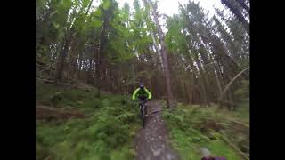
trail: Familieløypa - Family Slope
4:35 |
41 |
Jan 8, 2026 , Voss

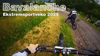
trail: Bavallen DH
3:51 |
62 |
Jan 8, 2026 , Voss

0:19 |
48 |
Jan 8, 2026 , Voss
trail: Voss MTB Storåsen Enduro
7:52 |
805 |
Sep 5, 2018 , Voss
Current Trail Warnings
| status | trail | date | condition | user | info |
|---|---|---|---|---|---|
| Old Hangur "DH" 1 | Jun 19, 2026 @ 11:51am (Europe/Oslo) Jun 19, 2026 | Wet | diegostrangerm | Trail work in Progress | |
| Hoggorm Creek | Jun 16, 2026 @ 1:36pm (Europe/Oslo) Jun 16, 2026 | Variable | diegostrangerm | Trailwork being performed on the trail -... |
Recent Trail Reports
| status | trail | date | condition | info | user |
|---|---|---|---|---|---|
| Lange Raugstad | Jul 28, 2025 @ 7:33am Jul 28, 2025 | Variable | Wahrolin | ||
| Bavallen DH | Jun 26, 2025 @ 12:00pm Jun 26, 2025 | Variable | joeg885 | ||
| Access NC2021 | Jun 26, 2025 @ 12:00pm Jun 26, 2025 | Ideal | joeg885 | ||
| Raugstad-Orrefloten | Jun 26, 2025 @ 11:59am Jun 26, 2025 | Variable | joeg885 | ||
| Bratte Raugstad | Jun 26, 2025 @ 11:59am Jun 26, 2025 | Variable | joeg885 | ||
| Flow If You Can | Jun 26, 2025 @ 11:59am Jun 26, 2025 | Wet | joeg885 | ||
| Skut | Jun 26, 2025 @ 11:59am Jun 26, 2025 | Wet | joeg885 | ||
| Familieløypa - Family Slope | Jun 26, 2025 @ 11:58am Jun 26, 2025 | Variable | joeg885 | ||
| Horgaletten Rockduro | Jun 23, 2025 @ 11:46pm Jun 23, 2025 | Wet | joeg885 | ||
| Ny Desserten | May 15, 2025 @ 11:34am May 15, 2025 | Dry | joeg885 |
Activity Feed
| username | action | type | title | date |
|---|---|---|---|---|
| diegostrangerm | add | report | activity #97304638 | Jun 19, 2026 @ 2:52am Jun 19, 2026 |
| diegostrangerm | add | report | activity #97099799 | Jun 16, 2026 @ 4:38am Jun 16, 2026 |
| diegostrangerm | add | trail | activity #97099612 | Jun 16, 2026 @ 4:33am Jun 16, 2026 |
| diegostrangerm | update | trail | activity #97099454 | Jun 16, 2026 @ 4:28am Jun 16, 2026 |
| CfwGdQFY | wishlist | region | activity #97091227 | Jun 16, 2026 @ 12:10am Jun 16, 2026 |
Recent Comments
| username | type | title | comment | date |
|---|---|---|---|---|
| trail | Great trail until the last 3k of... | Oct 25, 2025 @ 7:16am Oct 25, 2025 | ||
| trail | This is a connector for the Enduro trail and... | Jul 21, 2025 @ 10:21am Jul 21, 2025 | ||
| trail | Even in the middle of a heat wave with no rain... | Jul 21, 2025 @ 10:17am Jul 21, 2025 | ||
| trail | At the beginning, the uphill is steep but... | Jul 21, 2025 @ 10:05am Jul 21, 2025 | ||
| trail | I did this as a loop- rented a bike in... | Jul 18, 2024 @ 3:43pm Jul 18, 2024 |
Local Badges
-

Epic Mountain Bike Climb 2k35 awarded -

Climbing 10k Badge7 awarded -

Mountain Biking 100k Badge0 awarded -

Epic Ride Descent 2k35 awarded -

Descent 10k Badge7 awarded -

Descent 100k Badge0 awarded
Bike & Skill Parks
| name | type | city | rating |
|---|---|---|---|
| Hangur - Voss | bike park | Voss | |
| Voss Skillpark | skill park | Voss |
Activity Type Stats
| activitytype | trails | distance | descent | descent distance | total vertical | rating | global rank | state rank | photos | reports | routes | ridelogs |
|---|---|---|---|---|---|---|---|---|---|---|---|---|
| Mountain Bike | 44 | 44 miles | 19,577 ft | 27 miles | 4,327 ft | #1,417 | #19 | 49 | 50 | 3 | 2,669 | |
| E-Bike | 38 | 43 miles | 19,134 ft | 26 miles | 4,327 ft | #929 | #21 | 49 | 2 | 310 | ||
| Horse | 1 | |||||||||||
| Hike | 38 | 42 miles | 16,703 ft | 24 miles | 4,327 ft | #1,486 | #19 | 42 | 854 | |||
| Trail Running | 38 | 42 miles | 16,703 ft | 24 miles | 4,327 ft | #1,110 | #18 | 42 | 49 | |||
| Downhill Ski | 1 | 2 miles | 1,109 ft | 1 mile | 1,056 ft | 1 | 432 | |||||
| Nordic Ski | 3 | 4,285 ft | 43 ft | 1,690 ft | 49 ft | #167 | #14 | 269 |
Frequently Asked Questions About Voss
▼
What are the best places to ride in Voss?
Voss has 3 areas to explore for mountain biking. The top rated areas are:
▼
What are the highest rated mountain biking trails in Voss?
The highest rated mountain biking trails in Voss are:
- Voss MTB Storåsen Enduro (4.3/5)
- Svartaberget > Gulleigstreet (4.2/5)
- Raugstad-Orrefloten (4.2/5)
- Flow If You Can (4.1/5)
- Bratte Raugstad (4.1/5)
▼
What is the best time of the year to ride in Voss?
Based on ride log data, the most popular months to ride in Voss are:
- August (5 activities)
- May (3 activities)
- July (1 activities)
▼
Where can I park to ride in Voss?
Trails
Points of Interest
- By sarkanxxl & contributors
- Admins: Fausken77, diegostrangerm
- #24340 - 12,410 views
- voss activity log | embed map of Voss mountain bike trails | voss mountain biking points of interest
Downloading of trail gps tracks in kml & gpx formats is enabled for Voss.
You must login to download files.