close
-
Layers w
- Weather Layers
- Pro
- Pro
- Pro
- Pro
- Pro
- Pro
- More Layers
- Pro
- Pro
- Pro
- Pro
-
Upgrade to

3D
Trail Conditions
- Unknown
- Snow Groomed
- Snow Packed
- Snow Covered
- Snow Cover Partial
- Freeze/thaw Cycle
- Icy
- Prevalent Mud
- Wet
- Variable
- Ideal
- Dry
- Very Dry
Trail Flow (Ridden Direction)
Trailforks scans users ridelogs to determine the most popular direction each trail is ridden. A good flowing trail network will have most trails flowing in a single direction according to their intension.
The colour categories are based on what percentage of riders are riding a trail in its intended direction.
The colour categories are based on what percentage of riders are riding a trail in its intended direction.
- > 96%
- > 90%
- > 80%
- > 70%
- > 50%
- < 50%
- bi-directional trail
- no data
Trail Last Ridden
Trailforks scans ridelogs to determine the last time a trail was ridden.
- < 2 days
- < 1 week
- < 2 weeks
- < 1 month
- < 6 months
- > 6 months
Trail Ridden Direction
The intended direction a trail should be ridden.
- Downhill Only
- Downhill Primary
- Both Directions
- Uphill Primary
- Uphill Only
- One Direction
Contribute Details
Colors indicate trail is missing specified detail.
- Description
- Photos
- Description & Photos
- Videos
Trail Popularity ?
Trailforks scans ridelogs to determine which trails are ridden the most in the last 9 months.
Trails are compared with nearby trails in the same city region with a possible 25 colour shades.
Think of this as a heatmap, more rides = more kinetic energy = warmer colors.
- most popular
- popular
- less popular
- not popular
ATV/ORV/OHV Filter
Max Vehicle Width
inches
US Cell Coverage
Legend

Radar Time
Activity Recordings
Trailforks uses anonymized public activity data.
?
Activity Recordings
Trailforks uses anonymized public activity data.
?
Personal Heatmap
▶
Activity Types
all
/
none
▶
Options
2
Date range
month
–
Winter Trails
Warning
A routing network for winter maps does not exist. Selecting trails using the winter trails layer has been disabled.
Missing Trails
Most Popular
Least Popular
Trails are colored based on popularity. The more popular a trail is, the more red. Less popular trails trend towards green.
Jump Magnitude Heatmap
Heatmap of where riders jump on trails. Zoom in to see individual jumps, click circles to view jump details.
BC Backroad Status
![map legend]()
Service Road Atlas is a free to use, community-driven service for viewing and creating reports on the numerous back-country service roads around B.C. and Alberta.

Slope Aspect
Direction the slope faces
Trails Deemphasized
Trails are shown in grey.
Only show trails with no bike usage.
Suggested Layers
Based on selected activity type
Save the current map location and zoom level as your default home location whenever this page is loaded.
Save
No description for Waco has been added yet!
Login or register to submit one.
Activities Click to view
- Mountain Bike
321 trails
- E-Bike
281 trails
- Gravel Bike
32 trails
- Adaptive Bike
31 trails
- Winter Fat Bike
23 trails
- Horse
241 trails
- Hike
320 trails
- Trail Running
320 trails
Region Details
- 40
- 47
- 92
- 85
- 44
- 13
Region Status
Open as of Jun 21, 2026Stats
- Avg Trail Rating
- Trails (view details)
- 323
- Trails Mountain Bike
- 321
- Trails E-Bike
- 281
- Trails Gravel Bike
- 32
- Trails Adaptive Bike
- 31
- Trails Winter Fat Bike
- 23
- Trails Horse
- 241
- Trails Hike
- 320
- Trails Trail Running
- 320
- Total Distance
- 72 miles
- Total Descent Distance
- 25 miles
- Total Descent
- 6,423 ft
- Total Vertical
- 173 ft
- Highest Trailhead
- 548 ft
- Reports
- 824
- Photos
- 173
- Ridden Counter
- 30,833
Sub Regions
-
Cameron Park
- 36
- 58
- 75
- 44
- 13
-
Cotton Belt Trail
- 1
-
Lacy Point Nature Trail
- 24
- 1
-
Woodway Park
- 5
- 9
Popular Waco Mountain Biking Trails
• 95 ★ 3.7 • 932 ft • 0 ft • 675 •
Arguably, is the fastest and the best way to get to the top if you are willing to ride the downhills in that area: (Black), (Black), (Blue) and (Blue).
• 100 ★ 3.0 • 1,014 ft • 77 ft • 661 •
Upper section of , best way to the top in this part of the trail. Be ready for a short but steep climb.
• 95 ★ 3.0 • 502 ft • 7 ft • 613 •
Due to bridge weight restrictions, allowed on this trail.
• 85 ★ 3.7 • 2,625 ft • 114 ft • 609 •
Due to bridge weight restrictions, allowed on this trail.
• 100 ★ 3.3 • 1,827 ft • 25 ft • 553 •
Popular green difficulty singletrack. This mountain bike primary trail. On average it takes 4 minutes to complete this trail.
• 100 ★ 4.4 • 2,605 ft • 15 ft • 534 •
can be considered the beginning or the end of , depending on the trail direction. Easy to follow with moderate climbs and a sharp turn. Turns steep in the upper section right before hitting .
• 100 ★ 2.4 • 2,749 ft • 36 ft • 522 •
Popular green difficulty singletrack. This mountain bike primary trail can be used both directions. On average it takes 5 minutes to complete this trail.
• 95 ★ 4.7 • 1,138 ft • 0 ft • 520 •
Highly rated popular blue difficulty singletrack. This mountain bike primary trail. On average it takes 1 minutes to complete this trail.
Waco Mountain Bike Routes
9 miles • 842 ft • 26 •
Full Course route from the 2016 Cameron Park Blowout Presented by The Bear Mountain
7 miles • 773 ft • 20 •
Full Course route from the 2023 Cameron Park Blowout Presented by The Bear Mountain
★ 2.0 • 7 miles • 529 ft • 21 • Loop •
Inspired by this route . There are some small additions adding about a mile to the total distance, as well...
4 miles • 425 ft • 27 • Loop •
This trail offers a manageable 4-mile loop starting from the Mouth of the Bosque, featuring one...
8 miles • 825 ft • 20 •
Full Course route from the 2022 Cameron Park Blowout Presented by The Bear Mountain
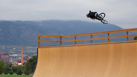
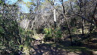
Photos of Waco Mountain Bike
Videos of Waco Mountain Bike

trail: Kite
0:26 |
109 |
Jun 9, 2022

trail: Colorado
11:06 |
67 |
Aug 3, 2016

trail: Low-Tide
2:10 |
144 |
Sep 19, 2015
trail: Lakeside Trail
2:20 |
615 |
Jan 30, 2015
trail: Lakeside Trail
4:16 |
138 |
Jan 29, 2015

trail: Sidewinder (South)
2:10 |
489 |
Feb 5, 2014

trail: Boomerang
2:07 |
141 |
Apr 10, 2012

40:38 |
101 |
Jan 6, 2025
Recent Trail Reports
Activity Feed
| username | action | type | title | date |
|---|---|---|---|---|
| NoelWeHs7 | add | trail | activity #97041047 | Jun 15, 2026 @ 7:50am Jun 15, 2026 |
| NoelWeHs7 | update | trail | activity #97040204 and 19 more | Jun 15, 2026 @ 7:35am Jun 15, 2026 |
| Nich00 | add | photo | activity #97013879 | Jun 14, 2026 @ 4:59pm Jun 14, 2026 |
| AGGyt0 | ridden | trail | activity #96832168 and 4 more | Jun 12, 2026 @ 3:42pm Jun 12, 2026 |
| NoelWeHs7 | update | trail | activity #96231279 and 11 more | Jun 4, 2026 @ 8:52am Jun 4, 2026 |
Recent Comments
| username | type | title | comment | date |
|---|---|---|---|---|
| trail | This is not a mountain bike trail. It is a... | Feb 12, 2026 @ 6:50am Feb 12, 2026 | ||
| trail | Love this trail! Very diverse. | Jan 2, 2026 @ 8:51am Jan 2, 2026 | ||
| trail | I loved hiking this one. | May 5, 2025 @ 7:01am May 5, 2025 | ||
| trail | Loved it. Very challenging to say the least. I... | May 5, 2025 @ 7:00am May 5, 2025 | ||
| trail | I loved it. Lots of elevation variations. | May 5, 2025 @ 6:59am May 5, 2025 |
Local Badges
-

10 Green Trails218 awarded -

10 Blue Trails343 awarded -

Epic Ride Climb 2k0 awarded -

Climbing 10k Badge20 awarded -

Climbing 100k Badge2 awarded -

Epic Ride Descent 2k0 awarded
Activity Type Stats
| activitytype | trails | distance | descent | descent distance | total vertical | rating | global rank | state rank | photos | reports | routes | ridelogs |
|---|---|---|---|---|---|---|---|---|---|---|---|---|
| Mountain Bike | 321 | 71 miles | 6,371 ft | 25 miles | 174 ft | #484 | #178 | 168 | 824 | 23 | 9,239 | |
| E-Bike | 281 | 51 miles | 5,463 ft | 17 miles | 167 ft | #1,303 | #849 | 3 | 739 | 2 | 260 | |
| Gravel Bike | 32 | 7 miles | 335 ft | 2 miles | 151 ft | #525 | #1,061 | 26 | 12 | |||
| Adaptive Bike | 31 | 6 miles | 407 ft | 2 miles | 151 ft | #508 | #1,803 | 40 | 1 | |||
| Winter Fat Bike | 23 | 6 miles | 1,545 ft | 3 miles | 128 ft | #335 | #1,100 | 259 | 1 | |||
| Horse | 241 | 41 miles | 4,035 ft | 14 miles | 157 ft | #604 | #529 | 165 | 3 | |||
| Hike | 320 | 71 miles | 6,309 ft | 25 miles | 174 ft | #1,796 | #783 | 2 | 822 | 1 | 591 | |
| Trail Running | 320 | 71 miles | 6,309 ft | 25 miles | 174 ft | #1,289 | #470 | 822 | 3 | 592 |
Frequently Asked Questions About Waco
▼
What are the best places to ride in Waco?
Waco has 4 areas to explore for mountain biking. The top rated areas are:
▼
What are the highest rated mountain biking trails in Waco?
The highest rated mountain biking trails in Waco are:
- California 56 (4.4/5)
- Sidewinder (North) (4.3/5)
- Fox Run (4.2/5)
- Sidewinder (South) (4.2/5)
- Thor (4.2/5)
▼
What is the best time of the year to ride in Waco?
Based on ride log data, the most popular months to ride in Waco are:
- August (97 activities)
- July (88 activities)
- March (80 activities)
▼
Where can I park to ride in Waco?
Activities
Trails
Points of Interest
- By brenthillier
 NSMBA TRAILFORKS & contributors
 - Admins: WBC
- #3694 - 11,352 views
- waco activity log | embed map of Waco mountain bike trails | waco mountain biking points of interest polygons
Downloading of trail gps tracks in kml & gpx formats is enabled for Waco.
You must login to download files.