close
-
Layers w
- Weather Layers
- Pro
- Pro
- Pro
- Pro
- Pro
- Pro
- More Layers
- Pro
- Pro
- Pro
- Pro
-
Upgrade to

3D
Trail Conditions
- Unknown
- Snow Groomed
- Snow Packed
- Snow Covered
- Snow Cover Partial
- Freeze/thaw Cycle
- Icy
- Prevalent Mud
- Wet
- Variable
- Ideal
- Dry
- Very Dry
Trail Flow (Ridden Direction)
Trailforks scans users ridelogs to determine the most popular direction each trail is ridden. A good flowing trail network will have most trails flowing in a single direction according to their intension.
The colour categories are based on what percentage of riders are riding a trail in its intended direction.
The colour categories are based on what percentage of riders are riding a trail in its intended direction.
- > 96%
- > 90%
- > 80%
- > 70%
- > 50%
- < 50%
- bi-directional trail
- no data
Trail Last Ridden
Trailforks scans ridelogs to determine the last time a trail was ridden.
- < 2 days
- < 1 week
- < 2 weeks
- < 1 month
- < 6 months
- > 6 months
Trail Ridden Direction
The intended direction a trail should be ridden.
- Downhill Only
- Downhill Primary
- Both Directions
- Uphill Primary
- Uphill Only
- One Direction
Contribute Details
Colors indicate trail is missing specified detail.
- Description
- Photos
- Description & Photos
- Videos
Trail Popularity ?
Trailforks scans ridelogs to determine which trails are ridden the most in the last 9 months.
Trails are compared with nearby trails in the same city region with a possible 25 colour shades.
Think of this as a heatmap, more rides = more kinetic energy = warmer colors.
- most popular
- popular
- less popular
- not popular
ATV/ORV/OHV Filter
Max Vehicle Width
inches
US Cell Coverage
Legend

Radar Time
Activity Recordings
Trailforks uses anonymized public activity data.
?
Activity Recordings
Trailforks uses anonymized public activity data.
?
Personal Heatmap
▶
Activity Types
all
/
none
▶
Options
2
Date range
month
–
Winter Trails
Warning
A routing network for winter maps does not exist. Selecting trails using the winter trails layer has been disabled.
Missing Trails
Most Popular
Least Popular
Trails are colored based on popularity. The more popular a trail is, the more red. Less popular trails trend towards green.
Jump Magnitude Heatmap
Heatmap of where riders jump on trails. Zoom in to see individual jumps, click circles to view jump details.
BC Backroad Status
![map legend]()
Service Road Atlas is a free to use, community-driven service for viewing and creating reports on the numerous back-country service roads around B.C. and Alberta.

Slope Aspect
Direction the slope faces
Trails Deemphasized
Trails are shown in grey.
Only show trails with no bike usage.
Suggested Layers
Based on selected activity type
Save the current map location and zoom level as your default home location whenever this page is loaded.
Save
No description for Warminster has been added yet!
Login or register to submit one.
This region uses the Uk/Euro style trail grading system.
Activities Click to view
- Mountain Bike
11 trails
- Adaptive Bike
0 trails
- Hike
1 trails
- Trail Running
1 trails
Region Details
- 1
- 2
- 3
- 4
- 1
Region Status
Open as of Jun 15, 2026Stats
- Avg Trail Rating
- Trails (view details)
- 11
- Trails Mountain Bike
- 11
- Trails E-Bike
- 2
- Trails Hike
- 1
- Trails Trail Running
- 1
- Total Distance
- 3 miles
- Total Descent
- 1,493 ft
- Total Vertical
- 387 ft
- Highest Trailhead
- 781 ft
- Reports
- 94
- Photos
- 49
- Ridden Counter
- 5,315
Sub Regions
-
Longleat Forest
- 1
-
Wind Hill Bikepark
- 1
-
Windhill Bikepark
- 1
- 2
- 3
- 1
Popular Warminster Mountain Biking Trails
• 60 ★ 4.8 • 1,663 ft • 0 ft • 647 •
Highly rated moderately popular red difficulty machine groomed. This mountain bike primary trail can be used downhill primary. It features berm, jump and gap jump. On average it takes 7 minutes to complete this trail.
• 90 ★ 4.5 • 2,487 ft • 0 ft • 623 •
The clue is in the name. The perfect start to your day at the park, and we strongly recommend you do start here. This Flow trail is as much fun for novices getting accustomed to Park life as it is for Pro’s seeking cheeky transfers....
• 40 ★ 4.0 • 1,512 ft • 0 ft • 508 •
"For lovers of downhill, technical natural trails that only require optional airtime, this trail is a test of skills beyond jumping. Off camber roots, motor whoops and an optional rock garden combine to create a trail that at speed is...
• 80 ★ 5.0 • 1,286 ft • 0 ft • 444 •
"Are you hard enough? Big doesn’t begin to describe it but its not just the size but the shape. A line built to provide a challenge but also allow riders to show their “stease.” Although the features are frankly ludicrous in size...
• 30 ★ 4.4 • 1,266 ft • 0 ft • 436 •
"Another trail that grows on riders and allows them to grow into discovering more lines. A small drop at the top is the only obligatory feature that cant be rolled but don’t think that means it’s easy to tame. An opt in big drop...
• 50 ★ 4.5 • 1,358 ft • 0 ft • 338 •
"A firm favourite and top to bottom action combining technical natural elements an a park feel latter half this trail is a rewording of one of the legacy trails from the ‘Allotment’ days. A split half way down allows rider to opt in...
• 10 ★ 4.5 • 1,280 ft • 0 ft • 226 •
"The clue is in the name but there is far more to this trail than roots alone. Steep and tech at the top fast and fluid at the bottom, beyond a knee high drop at the top and bottom your wheels don’t need to leave the ground unless you...
• 70 ★ 0.0 • 925 ft • 0 ft • 144 •
This trail has more moves than a collection of dads at a wedding! Since its addition to the trail network a few years ago it has proven to be a firm favourite, and just like its namesake is likely to go on performing well into its...
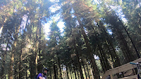
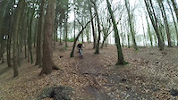
Photos of Warminster Mountain Bike
Videos of Warminster Mountain Bike
trail: Viagra Falls
0:13 |
|
Apr 10, 2024

trail: Ark At 'EE
0:22 |
100 |
Apr 2, 2022
trail: Blutopia
0:08 |
365 |
Oct 8, 2021
trail: Empuru
0:05 |
459 |
Nov 7, 2020
trail: Empuru
0:17 |
397 |
May 18, 2018
trail: Rootiful South
2:11 |
168 |
Oct 8, 2017
0:27 |
140 |
Jan 17, 2016

Recent Trail Reports
| status | trail | date | condition | info | user |
|---|---|---|---|---|---|
| Blutopia | Sep 4, 2025 @ 4:03am Sep 4, 2025 | Variable | Bootlace6641 | ||
| Empuru | Mar 22, 2025 @ 10:12am Mar 22, 2025 | Wet | IzCf6c | ||
| Pass The Dutchie | Feb 17, 2024 @ 6:20am Feb 17, 2024 | Wet | dtmco | ||
| Ark At 'EE | May 13, 2023 @ 3:16am May 13, 2023 | Ideal | Mtbtrailrider70 | ||
| Alternate Push Up | May 13, 2023 @ 3:16am May 13, 2023 | Ideal | Mtbtrailrider70 | ||
| Viagra Falls | Jun 11, 2022 @ 2:10am Jun 11, 2022 | Ideal | Eckythump | ||
| Feed 'Em To The Lions | Jun 11, 2022 @ 2:10am Jun 11, 2022 | Ideal | Eckythump | ||
| Rootiful South | Apr 2, 2022 @ 2:47am Apr 2, 2022 | Ideal | ikHUf | ||
| Push up | Apr 2, 2022 @ 2:47am Apr 2, 2022 | Variable | ikHUf | ||
| Death In Paradise | Mar 23, 2021 @ 10:28am Mar 23, 2021 | Variable | Ultimatesendracing |
Activity Feed
| username | action | type | title | date |
|---|---|---|---|---|
| Noah456456 | ridden | trail | activity #95693758 | May 28, 2026 @ 2:40am May 28, 2026 |
| cW5hG3 | ridden | trail | activity #92747882 | Apr 16, 2026 @ 2:26pm Apr 16, 2026 |
| semilhax | wishlist | trail | activity #92712082 | Apr 16, 2026 @ 3:03am Apr 16, 2026 |
| Ben3141592653 | ridden | trail | activity #92392623 | Apr 11, 2026 @ 8:02am Apr 11, 2026 |
| Ben3141592653 | ridden | trail | activity #92392048 and 3 more | Apr 11, 2026 @ 7:56am Apr 11, 2026 |
Recent Comments
| username | type | title | comment | date |
|---|---|---|---|---|
| trail | runs soooo nice. | Sep 8, 2021 @ 7:54am Sep 8, 2021 |
Local Badges
-

Epic Mountain Bike Climb 2k0 awarded -

Climbing 10k Badge1 awarded -

Mountain Biking 100k Badge0 awarded -

Epic Ride Descent 2k0 awarded -

Descent 10k Badge1 awarded -

Descent 100k Badge0 awarded
Bike & Skill Parks
| name | type | city | rating |
|---|---|---|---|
| Wind Hill Bikepark | bike park | Warminster | |
| Windhill Bikepark | bike park | Warminster | |
| Battlesbury hill dirt jumps | skill park | Warminster |
Activity Type Stats
| activitytype | trails | distance | descent | descent distance | total vertical | rating | global rank | state rank | photos | reports | routes | ridelogs |
|---|---|---|---|---|---|---|---|---|---|---|---|---|
| Mountain Bike | 11 | 3 miles | 1,493 ft | 2 miles | 387 ft | #3,148 | #99 | 49 | 94 | 7,383 | ||
| E-Bike | 2 | 1,552 ft | 207 ft | 1,490 ft | 312 ft | 80 | 1 | 814 | ||||
| Hike | 1 | 974 ft | 125 ft | 948 ft | 125 ft | #8,477 | #257 | 85 | 138 | |||
| Trail Running | 1 | 974 ft | 125 ft | 948 ft | 125 ft | #7,968 | #242 | 85 | 23 |
Frequently Asked Questions About Warminster
▼
What are the best places to ride in Warminster?
Warminster has 3 areas to explore for mountain biking. The top rated areas are:
▼
What are the highest rated mountain biking trails in Warminster?
The highest rated mountain biking trails in Warminster are:
- Empuru (4.4/5)
- Ark At 'EE (4.2/5)
- Blutopia (4.2/5)
- Viagra Falls (4.1/5)
- Rootiful South (4.1/5)
▼
What is the best time of the year to ride in Warminster?
Based on ride log data, the most popular months to ride in Warminster are:
- May (41 activities)
- September (25 activities)
- July (23 activities)
▼
Where can I park to ride in Warminster?
Check the Warminster trail map for trailhead and parking information. Community members regularly update access and parking details for trails in the area.
- By calamitycallum & contributors
- Admins: wisey, MathieuC, cemoorelife
- #8565 - 4,106 views
- warminster activity log | embed map of Warminster mountain bike trails |
Downloading of trail gps tracks in kml & gpx formats is enabled for Warminster.
You must login to download files.