close
-
Layers w
- Weather Layers
- Pro
- Pro
- Pro
- Pro
- Pro
- Pro
- More Layers
- Pro
- Pro
- Pro
- Pro
-
Upgrade to

3D
Trail Conditions
- Unknown
- Snow Groomed
- Snow Packed
- Snow Covered
- Snow Cover Partial
- Freeze/thaw Cycle
- Icy
- Prevalent Mud
- Wet
- Variable
- Ideal
- Dry
- Very Dry
Trail Flow (Ridden Direction)
Trailforks scans users ridelogs to determine the most popular direction each trail is ridden. A good flowing trail network will have most trails flowing in a single direction according to their intension.
The colour categories are based on what percentage of riders are riding a trail in its intended direction.
The colour categories are based on what percentage of riders are riding a trail in its intended direction.
- > 96%
- > 90%
- > 80%
- > 70%
- > 50%
- < 50%
- bi-directional trail
- no data
Trail Last Ridden
Trailforks scans ridelogs to determine the last time a trail was ridden.
- < 2 days
- < 1 week
- < 2 weeks
- < 1 month
- < 6 months
- > 6 months
Trail Ridden Direction
The intended direction a trail should be ridden.
- Downhill Only
- Downhill Primary
- Both Directions
- Uphill Primary
- Uphill Only
- One Direction
Contribute Details
Colors indicate trail is missing specified detail.
- Description
- Photos
- Description & Photos
- Videos
Trail Popularity ?
Trailforks scans ridelogs to determine which trails are ridden the most in the last 9 months.
Trails are compared with nearby trails in the same city region with a possible 25 colour shades.
Think of this as a heatmap, more rides = more kinetic energy = warmer colors.
- most popular
- popular
- less popular
- not popular
ATV/ORV/OHV Filter
Max Vehicle Width
inches
US Cell Coverage
Legend

Radar Time
Activity Recordings
Trailforks uses anonymized public activity data.
?
Activity Recordings
Trailforks uses anonymized public activity data.
?
Personal Heatmap
▶
Activity Types
all
/
none
▶
Options
2
Date range
month
–
Winter Trails
Warning
A routing network for winter maps does not exist. Selecting trails using the winter trails layer has been disabled.
Missing Trails
Most Popular
Least Popular
Trails are colored based on popularity. The more popular a trail is, the more red. Less popular trails trend towards green.
Jump Magnitude Heatmap
Heatmap of where riders jump on trails. Zoom in to see individual jumps, click circles to view jump details.
BC Backroad Status
![map legend]()
Service Road Atlas is a free to use, community-driven service for viewing and creating reports on the numerous back-country service roads around B.C. and Alberta.

Slope Aspect
Direction the slope faces
Trails Deemphasized
Trails are shown in grey.
Only show trails with no bike usage.
Suggested Layers
Based on selected activity type
Save the current map location and zoom level as your default home location whenever this page is loaded.
SaveThis region is Unsanctioned, Ride at your own Risk!
Mit Ausnahme des Happy Trail Friends e.V. Gelände am Kohlensiepen, sind alle Trails im Wittener Stadtgebiet nur geduldet.
Aus gegebenem Anlass ein paar Bitten, wenn sich alle danach verhalten könnten wir Glück haben und auch in ein paar Jahren noch von unserem tollen Trail Netzwerk profitieren
1. Seid freundlich (Ihr habt keinen Anspruch auf die Trails) und versucht zu Wanderen und Reitern ein positives Verhältnis zu pflegen!
2. Nutzt die Trails so wie die Trailbauer sie gedacht haben. Dies bedeutet, rollt nicht über Sprünge die ihr nicht springen könnt, fahrt keine Abkürzungen rein nur weil ihr eine Sektion nicht fahren könnt. Wenn ein Trail eurer Fahrkönnen übersteigt, fahrt einen anderen, wir haben genug. Alles plattrollen ist respektlos den Trailbauern gegenüber.
3. Bitte keine Vollbremsungen, dass ist nicht cool sondern maximal ein Zeichen dafür, dass ihr eure Bremsen nicht richtig kontrollieren könnt!
4. Frisch gebaute oder noch nicht fertige Trails werden NICHT gefahren! Auch hier wieder Respekt denjenigen die sie bauen, Trails wachsen nicht von allein!
5. Nehmt euren Müll mit (schade das man sowas überhaupt anmerken muss)
6. Bei Stürzen überlegen ob die Sanitäter wirklich in den Wald kommen müssen oder man es vielleicht nicht zur nächsten Straße schafft. Jeder unnötige Rettungseinsatz bringt den Sport wieder negativ in die Presse.
This region uses the Uk/Euro style trail grading system.
Activities Click to view
- Mountain Bike
26 trails
- E-Bike
26 trails
- Adaptive Bike
0 trails
- Hike
24 trails
- Trail Running
24 trails
Region Details
- 7
- 14
- 4
- 1
Region Status
Caution as of Jun 6, 2026Stats
- Avg Trail Rating
- Trails (view details)
- 26
- Trails Mountain Bike
- 26
- Trails E-Bike
- 26
- Trails Hike
- 24
- Trails Trail Running
- 24
- Total Distance
- 10 miles
- Total Descent
- 5,174 ft
- Total Vertical
- 505 ft
- Highest Trailhead
- 831 ft
- Reports
- 209
- Photos
- 31
- Ridden Counter
- 4,923
Popular Witten Mountain Biking Trails
• 100 ★ 4.6 • 2,083 ft • 3 ft • 371 •
Highly rated popular red difficulty singletrack. This mountain bike primary trail can be used downhill primary. On average it takes 3 minutes to complete this trail.
• 90 ★ 4.6 • 2,929 ft • 25 ft • 296 •
Nice flowy trail with some rocks in middle section.
• 95 ★ 4.9 • 1,647 ft • 0 ft • 270 •
Steep trail, natural drops, built berms. More of a DH-Trail. At the end there is a connecting trail to the lower part of (keep right, then uphill).
• 80 ★ 4.0 • 1,030 ft • 3 ft • 137 •
Nice Corners and fast sections, great variety of terrain for such a short trail....
• 60 ★ 3.5 • 3,698 ft • 138 ft • 122 •
First part very fast. Steep section in the middle. Way back uphill mostly on a fire road.
Witten Mountain Bike Routes
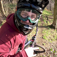
Photos of Witten Mountain Bike
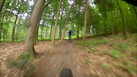
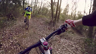
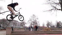
Videos of Witten Mountain Bike
trail: 50to01
4:42 |
1243 |
Jun 16, 2020
trail: Schießstand Wurzelpfad
4:20 |
1135 |
Aug 25, 2016
trail: Pauls Welt
4:55 |
1010 |
May 1, 2015
trail: Renner
3:24 |
1143 |
Apr 8, 2013
youtuber
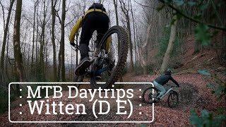
![Mountainbiken in Witten // MTB Daytrips // MTB...]()
12:35 |
136 |
Jan 2, 2024
trail: Moscow Mule
8:58 |
293 |
Jan 7, 2022 , Witten

Recent Trail Reports
| status | trail | date | condition | info | user |
|---|---|---|---|---|---|
| Little Champery | May 8, 2026 @ 5:00pm (Europe/Amsterdam) May 8, 2026 | Variable | Lobiwan8 | ||
| Gedern DH | May 8, 2026 @ 5:00pm (Europe/Amsterdam) May 8, 2026 | Variable | Lobiwan8 | ||
| Kurzes Stück | Apr 19, 2026 @ 12:14pm (Europe/Berlin) Apr 19, 2026 | Ideal | NewBroker | ||
| Wetterberg DH DropDropDrop | Apr 19, 2026 @ 12:14pm (Europe/Berlin) Apr 19, 2026 | Ideal | NewBroker | ||
| 50to01 | Mar 18, 2026 @ 9:50pm (Europe/Berlin) Mar 18, 2026 | Variable | Odulf | ||
| Schiffswinkeltrail Teil II | Mar 15, 2026 @ 11:58am (Europe/Amsterdam) Mar 15, 2026 | Wet | Md82 | ||
| Pauls Welt | Mar 9, 2026 @ 10:19pm (Europe/Berlin) Mar 9, 2026 | Ideal | seppo78 | ||
| Moscow Mule | Mar 1, 2026 @ 2:31pm (Europe/Amsterdam) Mar 1, 2026 | Ideal | Lobiwan8 | ||
| Kohlensiepen DH | Mar 1, 2026 @ 2:31pm (Europe/Amsterdam) Mar 1, 2026 | Unknown | Lobiwan8 | ||
| Hohenstein Kamm | Sep 29, 2025 @ 12:47pm (Europe/Amsterdam) Sep 29, 2025 | Ideal | Hinzi |
Activity Feed
| username | action | type | title | date |
|---|---|---|---|---|
| MarlonKnaken | wishlist | region | activity #97411808 | Jun 20, 2026 @ 10:39am Jun 20, 2026 |
| FwBxvG | wishlist | route | activity #97329599 | Jun 19, 2026 @ 10:43am Jun 19, 2026 |
| belgibelgi | ridden | trail | activity #95702115 and 1 more | May 28, 2026 @ 6:17am May 28, 2026 |
| Lobiwan8 | add | report | activity #94319598 and 1 more | May 9, 2026 @ 2:43am May 9, 2026 |
| Sasse82 | update | trail | activity #93778059 | May 1, 2026 @ 6:39am May 1, 2026 |
Recent Comments
| username | type | title | comment | date |
|---|---|---|---|---|
| trail | Das letzte Stück ist plötzlich nicht mehr... | Jul 23, 2025 @ 11:06pm Jul 23, 2025 | ||
| report | War für mich als Amateur schon hart. Über... | Jul 23, 2025 @ 11:01pm Jul 23, 2025 | ||
| trail | Aktuell liegen dicht hintereinander zwei... | Mar 12, 2025 @ 12:16pm Mar 12, 2025 | ||
| trail | Im oberen Teil wegen umgestürzter Bäume nur... | Oct 7, 2023 @ 7:13am Oct 7, 2023 | ||
| trail | Normaler breiter Wanderweg nichts besonderes | Feb 1, 2023 @ 9:35am Feb 1, 2023 |
Local Badges
-

10 Blue Trails114 awarded -

Epic Ride Climb 2k13 awarded -

Climbing 10k Badge60 awarded -

Climbing 100k Badge2 awarded -

Epic Ride Descent 2k14 awarded -

Descent 10k Badge60 awarded
Activity Type Stats
| activitytype | trails | distance | descent | descent distance | total vertical | rating | global rank | state rank | photos | reports | routes | ridelogs |
|---|---|---|---|---|---|---|---|---|---|---|---|---|
| Mountain Bike | 26 | 10 miles | 5,174 ft | 8 miles | 505 ft | #2,407 | #25 | 31 | 209 | 1 | 6,178 | |
| E-Bike | 26 | 10 miles | 5,174 ft | 8 miles | 505 ft | #1,881 | #34 | 163 | 1,117 | |||
| Hike | 24 | 10 miles | 4,941 ft | 7 miles | 505 ft | #3,367 | #26 | 194 | 198 | |||
| Trail Running | 24 | 10 miles | 4,941 ft | 7 miles | 505 ft | #2,841 | #24 | 194 | 115 |
Frequently Asked Questions About Witten
▼
What are the highest rated mountain biking trails in Witten?
The highest rated mountain biking trails in Witten are:
- Little Champery (4.5/5)
- Moscow Mule (4.4/5)
- Gedern DH (4.4/5)
- Kohlensiepen DH (4.3/5)
- Pauls Welt (4.3/5)
▼
What is the best time of the year to ride in Witten?
Based on ride log data, the most popular months to ride in Witten are:
- October (64 activities)
- September (52 activities)
- August (50 activities)
▼
Where can I park to ride in Witten?
There are 6 parking locations listed in Witten. The most popular parking spots are: View all parking and trailhead locations on the map to plan your visit.
▼
What is the longest trail in Witten?
The longest trail in Witten is Schießstand Wurzelpfad at 1.4 km. View all trails sorted by distance.
Activities
Trails
Points of Interest
- By Mattes1981
 & contributors
 - Admins: WTA, Chridel
- #19819 - 26,514 views
- witten activity log | embed map of Witten mountain bike trails | witten mountain biking points of interest
Downloading of trail gps tracks in kml & gpx formats is enabled for Witten.
You must login to download files.