close
-
Layers w
- Weather Layers
- Pro
- Pro
- Pro
- Pro
- Pro
- Pro
- More Layers
- Pro
- Pro
- Pro
- Pro
-
Upgrade to

3D
Trail Conditions
- Unknown
- Snow Groomed
- Snow Packed
- Snow Covered
- Snow Cover Partial
- Freeze/thaw Cycle
- Icy
- Prevalent Mud
- Wet
- Variable
- Ideal
- Dry
- Very Dry
Trail Flow (Ridden Direction)
Trailforks scans users ridelogs to determine the most popular direction each trail is ridden. A good flowing trail network will have most trails flowing in a single direction according to their intension.
The colour categories are based on what percentage of riders are riding a trail in its intended direction.
The colour categories are based on what percentage of riders are riding a trail in its intended direction.
- > 96%
- > 90%
- > 80%
- > 70%
- > 50%
- < 50%
- bi-directional trail
- no data
Trail Last Ridden
Trailforks scans ridelogs to determine the last time a trail was ridden.
- < 2 days
- < 1 week
- < 2 weeks
- < 1 month
- < 6 months
- > 6 months
Trail Ridden Direction
The intended direction a trail should be ridden.
- Downhill Only
- Downhill Primary
- Both Directions
- Uphill Primary
- Uphill Only
- One Direction
Contribute Details
Colors indicate trail is missing specified detail.
- Description
- Photos
- Description & Photos
- Videos
Trail Popularity ?
Trailforks scans ridelogs to determine which trails are ridden the most in the last 9 months.
Trails are compared with nearby trails in the same city region with a possible 25 colour shades.
Think of this as a heatmap, more rides = more kinetic energy = warmer colors.
- most popular
- popular
- less popular
- not popular
ATV/ORV/OHV Filter
Max Vehicle Width
inches
US Cell Coverage
Legend

Radar Time
Activity Recordings
Trailforks uses anonymized public activity data.
?
Activity Recordings
Trailforks uses anonymized public activity data.
?
Personal Heatmap
▶
Activity Types
all
/
none
▶
Options
2
Date range
month
–
Winter Trails
Warning
A routing network for winter maps does not exist. Selecting trails using the winter trails layer has been disabled.
Missing Trails
Most Popular
Least Popular
Trails are colored based on popularity. The more popular a trail is, the more red. Less popular trails trend towards green.
Jump Magnitude Heatmap
Heatmap of where riders jump on trails. Zoom in to see individual jumps, click circles to view jump details.
BC Backroad Status
![map legend]()
Service Road Atlas is a free to use, community-driven service for viewing and creating reports on the numerous back-country service roads around B.C. and Alberta.

Slope Aspect
Direction the slope faces
Trails Deemphasized
Trails are shown in grey.
Only show trails with no bike usage.
Suggested Layers
Based on selected activity type
Save the current map location and zoom level as your default home location whenever this page is loaded.
SaveThe city of Wolfeboro is home to the Wolfeboro Singletrack Alliance as well as the Cotton Valley Rail Trail.
Activities Click to view
- Mountain Bike
80 trails
- Winter Fat Bike
6 trails
- Hike
81 trails
- Trail Running
82 trails
- Snowshoe
50 trails
- Downhill Ski
7 trails
- Nordic Ski
36 trails
Region Details
- 3
- 29
- 41
- 6
Region Status
Open as of Jun 13, 2026Stats
- Avg Trail Rating
- Trails (view details)
- 98
- Trails Mountain Bike
- 80
- Trails E-Bike
- 2
- Trails Winter Fat Bike
- 6
- Trails Hike
- 81
- Trails Trail Running
- 82
- Trails Snowmobile
- 1
- Trails Snowshoe
- 50
- Trails Downhill Ski
- 7
- Trails Backcountry Ski
- 1
- Trails Nordic Ski
- 36
- Total Distance
- 50 miles
- Total Descent
- 5,818 ft
- Total Vertical
- 910 ft
- Highest Trailhead
- 1,418 ft
- Reports
- 536
- Photos
- 79
- Ridden Counter
- 12,394
Sub Regions
-
Abenaki Trail Network
- 5
- 14
- 3
-
Fernald Station Trail Network
- 8
- 5
-
Mirror Lake Trails
-
Sewall Woods Trail Network
- 15
- 18
- 3
-
Trask Mountain
- 4
Popular Wolfeboro Mountain Biking Trails
• 100 ★ 3.0 • 1,060 ft • 5 ft • 371 •
Popular blue difficulty singletrack. This mountain bike primary trail can be used both directions. On average it takes 2 minutes to complete this trail.
• 90 ★ 4.5 • 2,152 ft • 19 ft • 316 •
Popular green difficulty singletrack. This multi-use trail can be used both directions and has a easy overall physical rating with a 19 ft green climb. Trail visibility is always easy to follow. On average it takes 4 minutes to complete this trail.
• 100 ★ 4.3 • 1 mile • 76 ft • 314 •
Popular blue difficulty singletrack. This multi-use trail can be used both directions and has a easy overall physical rating with a 76 ft green climb. Trail visibility is always easy to follow. On average it takes 8 minutes to complete this trail.
• 95 ★ 4.5 • 4,370 ft • 5 ft • 305 •
This is a Blue Flow with berms, table tops, step ups and hip jumps. Pre-ride if not familiar with it. The jumps get larger the lower you go. Please use caution.
• 100 ★ 0.0 • 951 ft • 22 ft • 273 •
Popular green difficulty singletrack. This mountain bike primary trail can be used both directions. On average it takes 3 minutes to complete this trail.
• 75 ★ 0.0 • 1,470 ft • 16 ft • 267 •
Popular green difficulty singletrack. This multi-use trail can be used both directions and has a easy overall physical rating with a 16 ft green climb. Trail visibility is always easy to follow. On average it takes 2 minutes to complete this trail.
Wolfeboro Mountain Bike Routes
10 miles • 273 ft • 12 • Out & Back •
This route starts in downtown Wolfeboro at Foss Fields, the beginning of the Cotton Valley Rail Trail....
★ 3.0 • 3 miles • 377 ft • 5 • Loop •
SRS#3 and Expert race course. 7/23/2022 race day. www.summerraceseries.com
8 miles • 795 ft • 7 • Loop •
Here is a nice route to hit most of the single track trails in Abenaki from downtown Wolfeboro.
6 miles • 395 ft • 5 • Loop •
This is a nice loop to access Sewall Woods single track from downtown Wolfeboro.
4 miles • 471 ft • 0 • Loop • Race •
sport and expert race loop
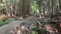
Photos of Wolfeboro Mountain Bike
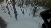
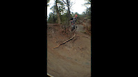
Videos of Wolfeboro Mountain Bike
trail: Fox Tail
0:14 |
137 |
Jul 27, 2022

trail: Sport
5:20 |
506 |
Nov 25, 2020

trail: Sport
3:14 |
53 |
Jun 15, 2020
trail: Lookout
0:30 |
363 |
Feb 17, 2015
trail: Sport
0:30 |
549 |
Nov 2, 2014

trail: Sport
2:02 |
145 |
Nov 25, 2011

trail: Sport
2:44 |
6247 |
Nov 12, 2010

trail: Freefall
0:30 |
467 |
May 26, 2023 , Wolfeboro
Recent Trail Reports
| status | trail | date | condition | info | user |
|---|---|---|---|---|---|
| Screamin' Eagle | Jun 13, 2026 @ 7:26am (America/New_York) Jun 13, 2026 | Ideal | andrewgillis11 | ||
| Tossin' Cookies | May 26, 2026 @ 5:38pm (America/New_York) May 26, 2026 | Unknown | levi932 | ||
| Summer Luv'n | May 5, 2026 @ 10:43am (America/New_York) May 5, 2026 | Wet | drudymeyer GWNC | ||
| Tommy Boy | May 5, 2026 @ 10:41am (America/New_York) May 5, 2026 | Variable | drudymeyer GWNC | ||
| Tomahawk Connector | May 5, 2026 @ 10:41am (America/New_York) May 5, 2026 | Variable | drudymeyer GWNC | ||
| Tomahawk | May 5, 2026 @ 10:41am (America/New_York) May 5, 2026 | Variable | drudymeyer GWNC | ||
| Knockout | May 5, 2026 @ 10:41am (America/New_York) May 5, 2026 | Variable | drudymeyer GWNC | ||
| Freefall | May 5, 2026 @ 10:41am (America/New_York) May 5, 2026 | Variable | drudymeyer GWNC | ||
| Fistfight | May 5, 2026 @ 10:41am (America/New_York) May 5, 2026 | Variable | drudymeyer GWNC | ||
| Blackeye | May 5, 2026 @ 10:41am (America/New_York) May 5, 2026 | Variable | drudymeyer GWNC |
Activity Feed
| username | action | type | title | date |
|---|---|---|---|---|
| andrewgillis11 | add | report | activity #96862136 | Jun 13, 2026 @ 4:26am Jun 13, 2026 |
| drudymeyer | add | trail | activity #96549813 | Jun 8, 2026 @ 10:37am Jun 8, 2026 |
| drudymeyer | update | trail | activity #96170875 | Jun 3, 2026 @ 11:43am Jun 3, 2026 |
| samlaj | wishlist | region | activity #96109765 | Jun 2, 2026 @ 2:26pm Jun 2, 2026 |
| msmcfate | update | trail | activity #96040862 | Jun 1, 2026 @ 2:25pm Jun 1, 2026 |
Recent Comments
| username | type | title | comment | date |
|---|---|---|---|---|
| report | Fistfight is currently clear | May 5, 2026 @ 7:42am May 5, 2026 | ||
| trail | This by far the best trail in the Fernald... | Nov 23, 2025 @ 2:51pm Nov 23, 2025 | ||
| trail | Quintessential NE tech trail with some good... | Oct 29, 2025 @ 1:34pm Oct 29, 2025 | ||
| trail | I hadn't rode this trail in 4-5 years and was... | Oct 29, 2025 @ 1:28pm Oct 29, 2025 | ||
| trail | This is a switchback climbing trail. There are... | Jul 23, 2025 @ 8:22am Jul 23, 2025 |
Local Badges
-

10 Blue Trails203 awarded -

Epic Ride Climb 2k1 awarded -

Climbing 10k Badge13 awarded -

Climbing 100k Badge0 awarded -

Completionist1 awarded -

Epic Ride Descent 2k1 awarded
Bike & Skill Parks
| name | type | city | rating |
|---|---|---|---|
| Jump | skill park | Wolfeboro | |
| Log Ride | skill park | Wolfeboro | |
| Wooden Bridge | skill park | Wolfeboro |
Activity Type Stats
| activitytype | trails | distance | descent | descent distance | total vertical | rating | global rank | state rank | photos | reports | routes | ridelogs |
|---|---|---|---|---|---|---|---|---|---|---|---|---|
| Mountain Bike | 80 | 41 miles | 4,508 ft | 17 miles | 912 ft | #1,865 | #683 | 73 | 525 | 7 | 6,552 | |
| E-Bike | 2 | 1 mile | 390 ft | 1 mile | 322 ft | 180 | 1 | 93 | ||||
| Winter Fat Bike | 6 | 15 miles | 1,549 ft | 7 miles | 912 ft | #220 | #1,020 | 30 | 17 | |||
| Hike | 81 | 42 miles | 3,970 ft | 15 miles | 912 ft | #4,033 | #1,426 | 3 | 517 | 275 | ||
| Trail Running | 82 | 42 miles | 4,085 ft | 16 miles | 912 ft | #3,503 | #1,041 | 4 | 517 | 280 | ||
| Snowmobile | 1 | 12 miles | 823 ft | 5 miles | 167 ft | 10 | ||||||
| Snowshoe | 50 | 27 miles | 1,959 ft | 9 miles | 827 ft | #519 | #188 | 198 | 21 | |||
| Downhill Ski | 7 | 4,964 ft | 610 ft | 4,554 ft | 190 ft | #631 | #292 | 41 | 235 | |||
| Backcountry Ski | 1 | 4,367 ft | 102 ft | 1,588 ft | 102 ft | 11 | 52 | |||||
| Nordic Ski | 36 | 24 miles | 1,923 ft | 10 miles | 827 ft | #559 | #180 | 182 | 339 |
Frequently Asked Questions About Wolfeboro
▼
What are the best places to ride in Wolfeboro?
Wolfeboro has 7 areas to explore for mountain biking. The top rated areas are:
▼
What are the highest rated mountain biking trails in Wolfeboro?
The highest rated mountain biking trails in Wolfeboro are:
- Blackeye (4.2/5)
- Almost Thayer (4.1/5)
- Home Run (4.1/5)
- Totem (4.1/5)
- Screamin' Eagle (4.1/5)
▼
What is the best time of the year to ride in Wolfeboro?
Based on ride log data, the most popular months to ride in Wolfeboro are:
- July (153 activities)
- August (141 activities)
- September (99 activities)
▼
Where can I park to ride in Wolfeboro?
There are 9 parking locations listed in Wolfeboro. The most popular parking spots are: View all parking and trailhead locations on the map to plan your visit.
Activities
Trails
Points of Interest
- By natenichols
 & contributors
 - Admins: WMNEMBA, CNH NEMBA, GWNC, WMNEMBA, MRTC
- #26013 - 7,586 views
- wolfeboro activity log | embed map of Wolfeboro mountain bike trails | wolfeboro mountain biking points of interest
Downloading of trail gps tracks in kml & gpx formats is enabled for Wolfeboro.
You must login to download files.