close
-
Layers w
- Weather Layers
- Pro
- Pro
- Pro
- Pro
- Pro
- Pro
- More Layers
- Pro
- Pro
- Pro
- Pro
-
Upgrade to

3D
Trail Conditions
- Unknown
- Snow Groomed
- Snow Packed
- Snow Covered
- Snow Cover Partial
- Freeze/thaw Cycle
- Icy
- Prevalent Mud
- Wet
- Variable
- Ideal
- Dry
- Very Dry
Trail Flow (Ridden Direction)
Trailforks scans users ridelogs to determine the most popular direction each trail is ridden. A good flowing trail network will have most trails flowing in a single direction according to their intension.
The colour categories are based on what percentage of riders are riding a trail in its intended direction.
The colour categories are based on what percentage of riders are riding a trail in its intended direction.
- > 96%
- > 90%
- > 80%
- > 70%
- > 50%
- < 50%
- bi-directional trail
- no data
Trail Last Ridden
Trailforks scans ridelogs to determine the last time a trail was ridden.
- < 2 days
- < 1 week
- < 2 weeks
- < 1 month
- < 6 months
- > 6 months
Trail Ridden Direction
The intended direction a trail should be ridden.
- Downhill Only
- Downhill Primary
- Both Directions
- Uphill Primary
- Uphill Only
- One Direction
Contribute Details
Colors indicate trail is missing specified detail.
- Description
- Photos
- Description & Photos
- Videos
Trail Popularity ?
Trailforks scans ridelogs to determine which trails are ridden the most in the last 9 months.
Trails are compared with nearby trails in the same city region with a possible 25 colour shades.
Think of this as a heatmap, more rides = more kinetic energy = warmer colors.
- most popular
- popular
- less popular
- not popular
ATV/ORV/OHV Filter
Max Vehicle Width
inches
US Cell Coverage
Legend

Radar Time
Activity Recordings
Trailforks uses anonymized public activity data.
?
Activity Recordings
Trailforks uses anonymized public activity data.
?
Personal Heatmap
▶
Activity Types
all
/
none
▶
Options
2
Date range
month
–
Winter Trails
Warning
A routing network for winter maps does not exist. Selecting trails using the winter trails layer has been disabled.
Missing Trails
Most Popular
Least Popular
Trails are colored based on popularity. The more popular a trail is, the more red. Less popular trails trend towards green.
Jump Magnitude Heatmap
Heatmap of where riders jump on trails. Zoom in to see individual jumps, click circles to view jump details.
BC Backroad Status
![map legend]()
Service Road Atlas is a free to use, community-driven service for viewing and creating reports on the numerous back-country service roads around B.C. and Alberta.

Slope Aspect
Direction the slope faces
Trails Deemphasized
Trails are shown in grey.
Only show trails with no bike usage.
Suggested Layers
Based on selected activity type
Save the current map location and zoom level as your default home location whenever this page is loaded.
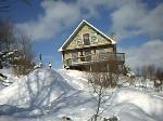
SaveEight seasons. Seven fells. Genuine Lappish villages. One national park with the world’s cleanest air. Explore and discover throughout the year in Ylläs, Lapland, Finland.
Links
Activities Click to view
- Mountain Bike
14 trails
- E-Bike
1 trails
- Adaptive Bike
0 trails
- Winter Fat Bike
0 trails
- Hike
0 trails
- Trail Running
0 trails
- Snowmobile
0 trails
- Snowshoe
0 trails
- Downhill Ski
0 trails
- Backcountry Ski
0 trails
- Nordic Ski
0 trails
Region Details
- 1
- 7
- 5
Region Status
Open as of Jun 16, 2025Stats
- Avg Trail Rating
- Trails (view details)
- 13
- Trails Mountain Bike
- 14
- Trails E-Bike
- 1
- Total Distance
- 9 miles
- Total Descent Distance
- 7 miles
- Total Descent
- 5,421 ft
- Total Vertical
- 1,516 ft
- Highest Trailhead
- 2,339 ft
- Reports
- 25
- Photos
- 3
- Ridden Counter
- 674
Sub Regions
-
Ylläs Bike Park
- 1
- 7
- 5
Popular Ylläs Mountain Biking Trails
• 80 ★ 4.0 • 1 mile • 0 ft • 85 •
Popular green difficulty singletrack. This mountain bike primary trail can be used downhill only. It features berm. Trail visibility is always easy to follow. On average it takes 5 minutes to complete this trail.
• 100 ★ 4.0 • 4,423 ft • 11 ft • 74 •
Popular blue difficulty gravel path. This mountain bike primary trail can be used downhill only. It features berm, bridge, drop, jump and ladder bridge. Trail visibility is always easy to follow. On average it takes 4 minutes to complete this trail.
• 15 ★ 4.0 • 4,478 ft • 0 ft • 74 •
Less popular green difficulty singletrack. This mountain bike primary trail can be used downhill only. On average it takes 2 minutes to complete this trail.
• 90 ★ 0.0 • 5,033 ft • 0 ft • 61 •
Popular blue difficulty singletrack. This mountain bike primary trail can be used downhill only. It features berm and jump. Trail visibility is always easy to follow. On average it takes 3 minutes to complete this trail.
• 60 ★ 2.0 • 1 mile • 16 ft • 60 •
Moderately popular blue difficulty gravel path. This mountain bike primary trail can be used downhill only. It features berm and jump. Trail visibility is always easy to follow. On average it takes 11 minutes to complete this trail.
• 40 ★ 3.0 • 2,661 ft • 4 ft • 58 •
Moderately popular green difficulty singletrack. This mountain bike primary trail can be used downhill only. Trail visibility is always easy to follow. On average it takes 2 minutes to complete this trail.
• 75 ★ 0.0 • 3,369 ft • 0 ft • 56 •
Popular green difficulty singletrack. This mountain bike primary trail can be used downhill only. Trail visibility is always easy to follow. On average it takes 2 minutes to complete this trail.
• 95 ★ 5.0 • 1 mile • 24 ft • 50 •
Popular blue difficulty machine groomed. This mountain bike primary trail can be used downhill only and has a easy overall physical rating. It features berm and jump. Trail visibility is always easy to follow.
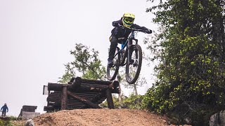
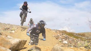
Videos of Ylläs Mountain Bike
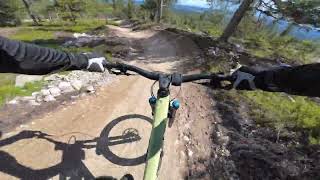
trail: Ylläs Flow
3:42 |
75 |
Jul 28, 2024 , Ylläs
0:28 |
216 |
Mar 19, 2021

trail: Top Red
0:13 |
260 |
Mar 17, 2021 , Ylläs
trail: Top Blue
0:13 |
263 |
Mar 15, 2021 , Ylläs
Recent Trail Reports
| status | trail | date | condition | info | user |
|---|---|---|---|---|---|
| Ylläs Flow | Jun 16, 2025 @ 11:11am Jun 16, 2025 | Very Dry | chriguc | ||
| Enduro Twist | Jun 16, 2025 @ 11:11am Jun 16, 2025 | Dry | chriguc | ||
| Reindeer Rally | Aug 31, 2024 @ 11:41am Aug 31, 2024 | Dry | mcharza | ||
| Top Blue | Aug 31, 2024 @ 11:41am Aug 31, 2024 | Dry | mcharza | ||
| 95980 Murica | Aug 31, 2024 @ 11:41am Aug 31, 2024 | Ideal | mcharza | ||
| Top Red | Aug 31, 2024 @ 11:41am Aug 31, 2024 | Ideal | mcharza | ||
| Appetizers | Jul 20, 2024 @ 7:01am Jul 20, 2024 | Dry | Winters3 | ||
| Full Enduro | Jul 9, 2024 @ 7:05am Jul 9, 2024 | Ideal | Thomas0 | ||
| Lower Twist | Jul 29, 2021 @ 12:28am Jul 29, 2021 | Ideal | PauliVart |
Activity Feed
| username | action | type | title | date |
|---|---|---|---|---|
| mikegolf | vote | trail | activity #81126196 | Sep 26, 2025 @ 6:24am Sep 26, 2025 |
| mikegolf | comment | trail | activity #81126160 | Sep 26, 2025 @ 6:24am Sep 26, 2025 |
| mikegolf | difficultyvote | trail | activity #81126117 | Sep 26, 2025 @ 6:23am Sep 26, 2025 |
| chriguc | add | report | activity #73905849 and 1 more | Jun 16, 2025 @ 7:09am Jun 16, 2025 |
| PiusgK5e6s | wishlist | region | activity #72152129 | May 22, 2025 @ 3:37am May 22, 2025 |
Recent Comments
| username | type | title | comment | date |
|---|---|---|---|---|
| trail | Marked on official trail map black color, with... | Sep 26, 2025 @ 6:24am Sep 26, 2025 | ||
| trail | Summer 2021: New blue trails will be built.... | Mar 15, 2021 @ 5:42am Mar 15, 2021 |
Local Badges
-

Epic Mountain Bike Climb 2k73 awarded -

Climbing 10k Badge5 awarded -

Mountain Biking 100k Badge1 awarded -

Epic Ride Descent 2k73 awarded -

Descent 10k Badge8 awarded -

Descent 100k Badge1 awarded
Bike & Skill Parks
| name | type | city | rating |
|---|---|---|---|
| Ylläs Bike Park | bike park | Ylläs |
Activity Type Stats
| activitytype | trails | distance | descent | descent distance | total vertical | rating | global rank | state rank | photos | reports | routes | ridelogs |
|---|---|---|---|---|---|---|---|---|---|---|---|---|
| Mountain Bike | 14 | 9 miles | 5,420 ft | 7 miles | 1,516 ft | #7,005 | #48 | 3 | 25 | 156 | ||
| E-Bike | 1 | #3,427 | #49 | 24 | 5 |
Frequently Asked Questions About Ylläs
▼
What are the best places to ride in Ylläs?
Ylläs has 1 areas to explore for mountain biking. The top rated areas are:
▼
What are the highest rated mountain biking trails in Ylläs?
The highest rated mountain biking trails in Ylläs are:
- Ylläs Flow (4.1/5)
- Top Red (4/5)
- Top Blue (4/5)
- Reindeer Rally (4/5)
- Enduro Twist (3.8/5)
▼
What is the best time of the year to ride in Ylläs?
Based on ride log data, the most popular months to ride in Ylläs are:
- July (3 activities)
- January (1 activities)
- March (1 activities)
▼
Where can I park to ride in Ylläs?
Check the Ylläs trail map for trailhead and parking information. Community members regularly update access and parking details for trails in the area.
Activities
Trails
Points of Interest
- By PWF & contributors
- Admins: apply
- #39609 - 1,801 views
- ylläs activity log | embed map of Ylläs mountain bike trails | ylläs mountain biking points of interest
Downloading of trail gps tracks in kml & gpx formats is enabled for Ylläs.
You must login to download files.