- Trail:
- Waldo Lake East (Waldo Lake Area and Wilderness)
- Status:
- Significant Issue / Amber
-
Issue status:
- Condition:
- Very Dry - watch those marbles, dusty
- Reporter Primary Activity:
- Mountain Bike
Description:
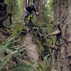
Heartbreaking report... Neither trail is marked closed by the FOREST CIRCUS. There is an excess of 400 trees blocking the trail with most down within the western burn area. I'm not exaggerating on the number of trees. As I started the ride from shadow bay road clockwise, I was excited to see the first 2 miles of the trail was cleared recently but only to the south shelter. A trail that normally take 3hrs on avg to ride, took me close to 5hrs due to hopping hundreds of trees and thousands of branches and debris in the trail. The trail is blocked at the N. campground, not accessible to continue. It's not worth attempting to ride the trail anytime soon, unless the USFS gets this place cleaned up. Such a beautiful iconic place that has been destroyed by fire the USFS management. Saddened to see this!
Local Weather During Report
- Summary
Clear - Temperature
15° (11°/27°) - Precip
0 mm/h - Wind
3.39 km/h - Cloud Cover
3% - Humidity
0.73
 lukey1
Jun 17, 2026 at 20:47
lukey1
Jun 17, 2026 at 20:47