

11.3 miles
Distance
917 ft
Climb
-916 ft
Descent
419 ft
High Point
2 ft
Altitude change
111 ft
Altitude min
213 ft
Altitude start
217 ft
Altitude end
-32.6%
Grade max
29%
Grade min
5 miles
Distance climb
5 miles
Distance down
1 mile
Distance flat

18km Loop without crossing over each other. Start at North side of car park.

Detailed Description
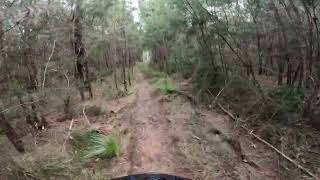
18km Lap is a 11 mile popular intermediate route located near Kempsey. This mountain bike only route can be used one direction. This route includes 18 trails. This route climbs 917 ft with a max elevation of 419 ft then descends -916 ft.
Tags

Trail Issues on Route

  • Minor Issue / Yellow: 4 trails (newest: Oct 8, 2025)

Local Trail Association

Local trail association
Macleay Valley Mountain Bikers (www.mvmb.org.au)
Please consider joining or donating to the local riding association to support trail development & maintenance.
Donate to earn trail karma!

Stats

  • Distance
    11 miles
  • Avg time
    1 hr 44 min
  • Altitude min
    111 ft
  • Altitude start
    213 ft
  • Altitude end
    217 ft
  • Climb
    917 ft
  • Descent
    -916 ft
  • Grade max
    -32.6%
  • Grade min
    29%
  • Distance climb
    5 miles
  • Distance down
    5 miles
  • Distance flat
    1 mile

3 Reviews & Comments


We hope you've been enjoying Trailforks!

Create a FREE account to view all route reviews and much more.

Trails in Route

Details

Directions

  1. Bike northeast on Grass Tree Rd.
  2. Continue for 600 meters.
  3. Bike west on Switchbacks.
  4. Continue for 1 kilometer.
  5. Bike south on To The Top.
  6. Continue for 50 meters.
  7. Bike north on To The Top.
  8. Continue for less than 10 meters.
  9. Bike west on Blue Bridges.
  10. Continue for 10 meters.
  11. Bike west on Blue Bridges.
  12. Continue for 80 meters.
  13. Bike northwest on Blue Bridges.
  14. Continue for 200 meters.
  15. Bike west on Blue Bridges.
  16. Continue for 100 meters.
  17. Bike south on Blue Bridges.
  18. Continue for 500 meters.
  19. Bike south on Firefly (Flow).
  20. Continue for 50 meters.
  21. Bike south on Firefly (Flow).
  22. Continue for 800 meters.
  23. Bike south on Firefly (Flow).
  24. Continue for 30 meters.
  25. Bike south on Grass Tree Rd.
  26. Continue for 500 meters.
  27. Bike northeast on Perrot's Road.
  28. Continue for 200 meters.
  29. Bike east on Perrot's Road.
  30. Continue for 300 meters.
  31. Bike northeast on Perrot's Road.
  32. Continue for 900 meters.
  33. Bike north on Robos Rd.
  34. Continue for 400 meters.
  35. Walk southwest on Billy Mav.
  36. Continue for 30 meters.
  37. Walk northeast on Billy Mav Climb.
  38. Continue for 200 meters.
  39. Walk northwest on Billy Mav Climb.
  40. Continue for 200 meters.
  41. Walk northeast on BGT Link.
  42. Continue for 200 meters.
  43. Walk east on Grass Tree.
  44. Continue for 50 meters.
  45. Walk north on Maze.
  46. Continue for 60 meters.
  47. Walk northwest on Maze.
  48. Continue for 200 meters.
  49. Walk southeast on Maze.
  50. Continue for 30 meters.
  51. Walk northwest on Grass Tree.
  52. Continue for 70 meters.
  53. Walk south on Grass Tree.
  54. Continue for 300 meters.
  55. Walk south on Billy Mav Access.
  56. Continue for 50 meters.
  57. Walk south on Sam's Extension.
  58. Continue for 30 meters.
  59. Walk southwest on Sam's Extension.
  60. Continue for 200 meters.
  61. Walk northwest on Sam's.
  62. Continue for 400 meters.
  63. Walk north on Sam's.
  64. Continue for 30 meters.
  65. Make a sharp right onto Grass Tree.
  66. Continue for 20 meters.
  67. Turn right to stay on Grass Tree.
  68. Continue for 200 meters.
  69. Walk northeast on Grass Tree.
  70. Continue for 40 meters.
  71. Walk northeast on Time Trial.
  72. Continue for 50 meters.
  73. Walk southeast on Time Trial.
  74. Continue for 80 meters.
  75. Walk south on Time Trial.
  76. Continue for 40 meters.
  77. Walk east on Time Trial.
  78. Continue for 30 meters.
  79. Walk northeast on Time Trial.
  80. Continue for 100 meters.
  81. Walk northeast on Time Trial.
  82. Continue for 600 meters.
  83. Walk northeast on Time Trial.
  84. Continue for 70 meters.
  85. Walk northeast on Rocky Ridge.
  86. Continue for 100 meters.
  87. Walk east on Rocky Ridge.
  88. Continue for 50 meters.
  89. Walk south on Rocky Ridge.
  90. Continue for 60 meters.
  91. Walk southeast on Rocky Ridge.
  92. Continue for 100 meters.
  93. Walk east on Rocky Ridge.
  94. Continue for 200 meters.
  95. Walk east on Sydney Harbour.
  96. Continue for 200 meters.
  97. Walk southeast on Sydney Harbour.
  98. Continue for 90 meters.
  99. Walk northeast on Sydney Harbour.
  100. Continue for 70 meters.
  101. Walk west on Boundary Rd Connector.
  102. Continue for 30 meters.
  103. Walk north on Sydney Harbour.
  104. Continue for 40 meters.
  105. Walk north on Sydney Harbour.
  106. Continue for 10 meters.
  107. Walk north on Sydney Harbour.
  108. Continue for 90 meters.
  109. Walk west on Sydney Harbour.
  110. Continue for 200 meters.
  111. Walk southeast on Sydney Harbour.
  112. Continue for 80 meters.
  113. Walk northwest on Sydney Harbour.
  114. Continue for 100 meters.
  115. Walk northeast on Sydney Harbour.
  116. Continue for 100 meters.
  117. Walk northeast on Sydney Harbour.
  118. Continue for 80 meters.
  119. Walk northeast on Sydney Harbour.
  120. Continue for 100 meters.
  121. Walk northeast on Sydney Harbour.
  122. Continue for 200 meters.
  123. Walk northwest on Sydney Harbour.
  124. Continue for 40 meters.
  125. Walk northeast on Tim's Carlton Dry.
  126. Continue for less than 10 meters.
  127. Keep straight to stay on Tim's Carlton Dry.
  128. Continue for less than 10 meters.
  129. Make a right U-turn to stay on Tim's Carlton Dry.
  130. Continue for less than 10 meters.
  131. Walk northeast on Tim's Carlton Dry.
  132. Continue for 20 meters.
  133. Walk east on Tim's Carlton Dry.
  134. Continue for 20 meters.
  135. Walk east on Tim's Carlton Dry.
  136. Continue for 20 meters.
  137. Walk southeast on Tim's Carlton Dry.
  138. Continue for 40 meters.
  139. Walk east on Tim's Carlton Dry.
  140. Continue for less than 10 meters.
  141. Keep straight to stay on Tim's Carlton Dry.
  142. Continue for 30 meters.
  143. Walk east on Tim's Carlton Dry.
  144. Continue for 10 meters.
  145. Walk northeast on Tim's Carlton Dry.
  146. Continue for 30 meters.
  147. Walk east on Tim's Carlton Dry.
  148. Continue for 30 meters.
  149. Walk north on Stary.
  150. Continue for 20 meters.
  151. Walk west on Stairway To Heaven.
  152. Continue for 200 meters.
  153. Walk west on Stairway To Heaven.
  154. Continue for 200 meters.
  155. Walk southwest on Stairway To Heaven.
  156. Continue for 300 meters.
  157. Walk southwest on Stairway To Heaven.
  158. Continue for 60 meters.
  159. Keep right to stay on Stairway To Heaven.
  160. Continue for 300 meters.
  161. Walk southwest on Stairway To Heaven.
  162. Continue for 200 meters.
  163. Walk southeast on Grass Tree Rd.
  164. Continue for 10 meters.
  165. Walk south on Grass Tree Rd.
  166. Continue for 20 meters.
  167. Walk north on Time Trial.
  168. Continue for less than 10 meters.
  169. Walk north on Time Trial.
  170. Continue for less than 10 meters.
  171. Walk west on Fatso's.
  172. Continue for 30 meters.
  173. Walk southwest on Fatso's.
  174. Continue for 100 meters.
  175. Walk southwest on Fatso's.
  176. Continue for 30 meters.
  177. Turn left to stay on Fatso's.
  178. Continue for 100 meters.
  179. Walk southwest on Fatso's.
  180. Continue for 300 meters.
  181. Walk southeast on Garry's.
  182. Continue for 200 meters.
  183. Walk northeast on Garry's.
  184. Continue for 200 meters.
  185. Walk southeast on Garry's.
  186. Continue for 10 meters.
  187. Turn right onto Crosscut.
  188. Continue for 100 meters.
  189. Walk west on Crosscut.
  190. Continue for 200 meters.
  191. Walk northwest on Crosscut.
  192. Continue for 100 meters.
  193. Walk south on Crosscut.
  194. Continue for 100 meters.
  195. Walk east on Crosscut.
  196. Continue for 200 meters.
  197. Walk northwest on Crosscut.
  198. Continue for 200 meters.
  199. Walk west on Crosscut.
  200. Continue for 20 meters.
  201. Turn left onto Rusty's.
  202. Continue for 200 meters.
  203. Walk southeast on Rusty's.
  204. Continue for 300 meters.
  205. Walk northwest on Rusty's.
  206. Continue for 400 meters.
  207. Walk west on Rusty's.
  208. Continue for 20 meters.
  209. Make a sharp right onto Bad Hare Day.
  210. Continue for 50 meters.
  211. Walk north on Bad Hare Day.
  212. Continue for 200 meters.
  213. Walk east on Bad Hare Day.
  214. Continue for 20 meters.
  215. Walk northeast on Bad Hare Day.
  216. Continue for 10 meters.
  217. Walk north on Bad Hare Day.
  218. Continue for 20 meters.
  219. Walk northeast on Bad Hare Day.
  220. Continue for less than 10 meters.
  221. Walk north on Bad Hare Day.
  222. Continue for 20 meters.
  223. Walk northwest on Bad Hare Day.
  224. Continue for 20 meters.
  225. Walk northwest on Bad Hare Day.
  226. Continue for 30 meters.
no votes yet
close
Trail transparency
  • Singletrack
  • Unpaved
mtb
223
mtb
214
mtb
357
mtb
271
Stairway To Heaven - Kalateenee MTB Park
mtb
Stairway To Heaven - Kalateenee MTB Park
8:36 | 559 | comments: 0 | favs:
Oct 6, 2022

Recent Trail Reports Along Route

statustraildateconditiondescription
Fatso's
Jul 31, 2026 @ 10:01am (Australia/Sydney)
Jul 30, 2026
very dry
Firefly (Flow)
Jul 31, 2026 @ 10:01am (Australia/Sydney)
Jul 30, 2026
fun as always
Stairway To Heaven
Jul 31, 2026 @ 10:01am (Australia/Sydney)
Jul 30, 2026
very dry
Maze
Dec 20, 2025 @ 2:39pm (Australia/Sydney)
Dec 19, 2025
Sam's Extension
Dec 20, 2025 @ 2:39pm (Australia/Sydney)
Dec 19, 2025
more reports »
  • By benwbTF Pro MVMB & contributors
  • #58018 - 418 views

Hit the Trail

Open in App

Get this route on your phone instantly.

Download Route

Save to wishlist, Garmin & download.
