
4.0 miles
Distance
627 ft
Climb
-637 ft
Descent
5,813 ft
High Point
-8 ft
Altitude change
5,248 ft
Altitude min
5,301 ft
Altitude start
5,292 ft
Altitude end
-0%
Grade
-30.6%
Grade max
27.1%
Grade min
2 miles
Distance climb
2 miles
Distance down
2,841 ft
Distance flat

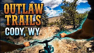
The easiest short loop from the trailhead, but still not easy. The Outlaw trails are all peppered with technicality. Mostly all new trail until you exit through the Red Neck Jungle. An aerobically challenging uphill followed by the largest vertical descent in the trail network.

Detailed Description
Blue Newness is a 4 mile popular intermediate route located near Cody Wyoming. This mountain bike primary route can be used one direction and has a moderate overall physical rating. This route includes 6 trails. This route climbs 627 ft with a max elevation of 5,813 ft then descends -637 ft.
Tags
Rock slabs

Local Trail Association

Local trail association
Park County Pedalers (parkcountypedalers.org)
Please consider joining or donating to the local riding association to support trail development & maintenance.
Donate to earn trail karma!

Stats

  • Distance
    4 miles
  • Avg time
    29 min 36 sec
  • Altitude min
    5,248 ft
  • Altitude start
    5,301 ft
  • Altitude end
    5,292 ft
  • Climb
    627 ft
  • Descent
    -637 ft
  • Grade
    -0%
  • Grade max
    -30.6%
  • Grade min
    27.1%
  • Distance climb
    2 miles
  • Distance down
    2 miles
  • Distance flat
    2,841 ft

1 Review & Comments


We hope you've been enjoying Trailforks!

Create a FREE account to view all route reviews and much more.

Details

  • Riding area
  • Primary Activity
    Mountain Bike
  • Other Activities
    • E-Bike
  • Difficulty rating
    Blue
  • Route Type
    Loop
  • eBike Allowed
  • Bike type
    AM, XC
  • Direction
    One Direction
  • Physical rating
    Moderate
  • Activity Logs
    3

Directions

  1. Walk southwest on Outlaw Start alt line.
  2. Continue for 300 meters.
  3. Turn left onto Outlaw.
  4. Continue for 200 meters.
  5. Keep right to take The Accomplice - Lower.
  6. Continue for 1.5 kilometers.
  7. Make a sharp left onto Outlaw.
  8. Continue for 60 meters.
  9. Keep right to take AG Trail.
  10. Continue for 300 meters.
  11. Turn right onto Beneath the Law.
  12. Continue for 400 meters.
  13. Walk north on Beneath the Law.
  14. Continue for 200 meters.
  15. Walk south on Beneath the Law.
  16. Continue for 200 meters.
  17. Walk west on Anarchy.
  18. Continue for 600 meters.
  19. Walk north on Outlaw.
  20. Continue for 60 meters.
  21. Walk south on Outlaw.
  22. Continue for 20 meters.
  23. Walk north on Outlaw.
  24. Continue for 50 meters.
  25. Walk southeast on Outlaw.
  26. Continue for 30 meters.
  27. Walk south on The Accomplice - Lower.
  28. Continue for less than 10 meters.
  29. Walk northeast on The Accomplice - Lower.
  30. Continue for 200 meters.
  31. Walk north on The Accomplice - Lower.
  32. Continue for less than 10 meters.
  33. Walk southeast on Redneck Jungle.
  34. Continue for 10 meters.
  35. Walk southeast on Redneck Jungle.
  36. Continue for 1 kilometer.
Avg: 5 (1 votes)
close
Trail transparency
  • Singletrack
mtb
trail: The Shiv
79
mtb
trail: The Shiv
75
mtb
trail: The Shiv
77
mtb
trail: The Shiv
117
Outlaw Trails In Cody, WY
mtb
Outlaw Trails In Cody, WY
trail: The Shiv
24:49 | 20 | comments: 0 | favs:
Sep 3, 2026
One of the many many rollovers on The Shiv
mtb
One of the many many rollovers on The Shiv
trail: The Shiv
0:06 | 37 | comments: 0 | favs:
Feb 7, 2026

Recent Trail Reports Along Route

statustraildateconditiondescription
Beneath the Law
Oct 24, 2026 @ 2:58pm (America/Boise)
Oct 24, 2026
The Accomplice - Lower
Oct 24, 2026 @ 2:58pm (America/Boise)
Oct 24, 2026
The Shiv
Oct 24, 2026 @ 2:58pm (America/Boise)
Oct 24, 2026
Outlaw Start alt line
Aug 19, 2026 @ 3:57pm (America/Boise)
Aug 19, 2026
Above The Law - Easier Alternate South
Aug 19, 2026 @ 3:57pm (America/Boise)
Aug 19, 2026
more reports »
  • By JohninCodyTF Pro PCP & contributors
  • #64469 - 604 views

Hit the Trail

Open in App

Get this route on your phone instantly.

Download Route

Save to wishlist, Garmin & download.