

9.1 miles
Distance
210 ft
Climb
-210 ft
Descent
100 ft
High Point
1 ft
Altitude change
55 ft
Altitude min
78 ft
Altitude start
79 ft
Altitude end
-8.7%
Grade max
11.2%
Grade min
2 miles
Distance climb
2 miles
Distance down
6 miles
Distance flat

Use trails at your own risk. Hidden hazards may exist.

This route includes all of Calverton Otis Pike Preserve.

Detailed Description
Calverton Complete is a 9 mile popular expert route located near Wading River New York. This mountain bike only route can be used one direction and has a hard overall physical rating. This route includes 8 trails. This route climbs 210 ft with a max elevation of 100 ft then descends -210 ft.
Tags

Local Trail Association

Local trail association
Concerned Long Island Mountain Bicyclists (climbonline.org)
Please consider joining or donating to the local riding association to support trail development & maintenance.
Donate to earn trail karma!

Stats

  • Distance
    9 miles
  • Avg time
    1 hr 16 min
  • Altitude min
    55 ft
  • Altitude start
    78 ft
  • Altitude end
    79 ft
  • Climb
    210 ft
  • Descent
    -210 ft
  • Grade max
    -8.7%
  • Grade min
    11.2%
  • Distance climb
    2 miles
  • Distance down
    2 miles
  • Distance flat
    6 miles

Comments


We hope you've been enjoying Trailforks!

Create a FREE account to view all route reviews and much more.

Trails in Route

Details

  • Featured
  • Riding area
  • Primary Activity
    Mountain Bike
  • Difficulty rating
    Black Diamond
  • Route Type
    Loop
  • Bike type
    AM, XC, Fat
  • Direction
    One Direction
  • Physical rating
    Hard
  • Activity Logs
    24

Directions

  1. Walk northeast on The Winding Way.
  2. Continue for 5 kilometers.
  3. Turn left onto Fox Hollow.
  4. Continue for 500 meters.
  5. Turn left onto Enchanted Forest.
  6. Continue for 900 meters.
  7. Turn left onto Roller Coaster.
  8. Continue for 30 meters.
  9. Keep left to stay on Roller Coaster.
  10. Continue for 900 meters.
  11. Bear left onto Enchanted Forest.
  12. Continue for 400 meters.
  13. Keep right to take Scuttle Hole.
  14. Continue for 1 kilometer.
  15. Keep straight to take Hillside Drive.
  16. Continue for 900 meters.
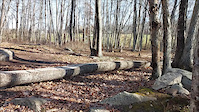
  17. Turn left onto Log Ride.
  18. Continue for 500 meters.
  19. Turn left onto The Oak Maze.
  20. Continue for 5 kilometers.
Avg: 5 (1 votes)
close
Trail transparency
  • Singletrack
Rock asualt log ride jam
mtb
Rock asualt log ride jam
trail: Log Ride
0:49 | 50 | comments: 0 | favs:
Nov 16, 2018
Few clips of some of the fun at Moween.
John P crashes on Log ride
mtb
John P crashes on Log ride
trail: Log Ride
0:08 | 109 | comments: 0 | favs:
Dec 6, 2021
#FridayFail , #logride #Crash

Recent Trail Reports Along Route

statustraildateconditiondescription
The Winding Way
Aug 29, 2026 @ 1:01pm (America/New_York)
Aug 29, 2026
Great trail, one big tree down where it’s a crossover near the back third. Can be a little confusing when going around it.
The Oak Maze
Nov 12, 2025 @ 10:06am (America/New_York)
Nov 12, 2025
was in great shape.. a few fallen small branches and leaves.. beautiful.. a bunch of deer also running around.
Fox Hollow
Jun 28, 2025 @ 7:27am
Jun 28, 2025
Scuttle Hole
Apr 27, 2025 @ 6:12am
Apr 27, 2025
big tree hanging qt the end of scuttle hole and main. no base on the tree
Log Ride
Nov 3, 2024 @ 8:30am
Nov 3, 2024
Lots of leaves...hard to see trail but still good
more reports »
  • By MTBMarcinTF Pro CLIMB & contributors
  • #35368 - 1,742 views

Hit the Trail

Open in App

Get this route on your phone instantly.

Download Route

Save to wishlist, Garmin & download.