



Open in App
Get this route on your phone instantly.
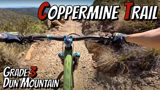
The Coppermine Trail is one of New Zealand’s most accessible alpine mountain bike rides, all the more memorable for its relatively easy up, exhilarating down, amazing rocky tops, sweet-smelling beech forest, and meandering river trail.
Starting amidst Nelson’s cafés and pubs, this stunning day ride should be ridden in one direction starting at Brook Street entrance and finishing at Maitai Dam. The trail heads directly into spectacular hill country via Codger’s Trails area and a long, consistent climb along the historic Dun Mountain Railway route. Broad panoramas of Tasman Bay and the rocky tops of Coppermine Saddle are just some of the rewards. Others are the brilliant 10 km downhill through rock gardens and bush, and the leisurely pedal back to Nelson via the pretty Maitai Valley.
The full loop is best suited to fit, experienced single-track riders with full-suspension mountain bikes. For those less confident, simply U-turn at Coppermine Saddle or Third House and enjoy a return-ride the way you came up.
From Nelson i-SITE the full loop is 43 km, shortened to 38 km if you start and finish at the Brook Street trailhead.
Although the ride time may only be 4-6 hours, we recommend you allow a full day to enjoy this unique environment.
You will be a long way from assistance in an alpine environment and mobile phone reception is patchy, so please ensure you have sufficient food, drink, spare tubes, first aid, and wet/cold weather gear to handle any problems you might encounter.

We hope you've been enjoying Trailforks!
Create a FREE account to view all route reviews and much more.

Service Road Atlas is a free to use, community-driven service for viewing and creating reports on the numerous back-country service roads around B.C. and Alberta.
Save the current map location and zoom level as your default home location whenever this page is loaded.
Save| status | trail | date | condition | description |
|---|---|---|---|---|
Oct 16, 2026 @ 9:40am (Pacific/Auckland) Oct 15, 2026 | Trail is in great condition |
 Trailforks Map Team & contributors