
This route is hidden from the public, you have special permissions to view hidden routes in this region. Please keep this route info private!
12.4 miles
Distance
3,358 ft
Climb
-6,546 ft
Descent
8,694 ft
High Point
-3,189 ft
Altitude change
3,917 ft
Altitude min
7,106 ft
Altitude start
3,917 ft
Altitude end
-4.9%
Grade
-92.5%
Grade max
83.7%
Grade min
5 miles
Distance climb
7 miles
Distance down
2,989 ft
Distance flat

No description for D1 Pano route has been added yet! Submit one here.

Detailed Description
D1 Pano is a 12 mile expert route located near Panorama British Columbia. This mountain bike only route. This route includes 8 trails. This route climbs 3,358 ft with a max elevation of 8,694 ft then descends -6,546 ft.
Tags
Summit

Stats

  • Distance
    12 miles
  • Avg time
    4 hr 54 min
  • Altitude change
    -3,189 ft
  • Altitude min
    3,917 ft
  • Altitude start
    7,106 ft
  • Altitude end
    3,917 ft
  • Climb
    3,358 ft
  • Descent
    -6,546 ft
  • Grade
    -4.9%
  • Grade max
    -92.5%
  • Grade min
    83.7%
  • Distance climb
    5 miles
  • Distance down
    7 miles
  • Distance flat
    2,989 ft

6 Reviews & Comments


We hope you've been enjoying Trailforks!

Create a FREE account to view all route reviews and much more.

Details

Directions

  1. Walk southeast on Summit Uptrack.
  2. Continue for 1.5 kilometers.
  3. Turn right onto Summit Access.
  4. Continue for 1 kilometer.
  5. Turn right onto Outback Ridge.
  6. Continue for 1.5 kilometers.
  7. Turn right onto Goldie Plateau.
  8. Continue for 400 meters.
  9. Keep left to take Mt. Goldie North Summit (Haiku-bike-u).
  10. Continue for 3 kilometers.
  11. Walk southeast on Hopeful.
  12. Continue for 200 meters.
  13. Turn right onto Hopeful towards ridge.
  14. Continue for 70 meters.
  15. Bear left onto Hopeful to south fork zone.
  16. Continue for 40 meters.
  17. Walk west on Hopeful to south fork zone.
  18. Continue for 800 meters.
  19. Bear left onto Hopeful Trail to South Fork Zone.
  20. Continue for 2.5 kilometers.
  21. Walk northeast on Hopeful Cabin down sled trail - upper.
  22. Continue for 40 meters.
  23. Turn right onto Hopeful Cabin down old trail - lower.
  24. Continue for 1 kilometer.
  25. Bear left onto Hopeful.
  26. Continue for 1 kilometer.
  27. Keep left to stay on Hopeful.
  28. Continue for 1.5 kilometers.
  29. Walk northeast on Mercy Me.
  30. Continue for 100 meters.
  31. Walk south on Summit Access.
  32. Continue for 200 meters.
  33. Walk north on Summit Access.
  34. Continue for 700 meters.
  35. Walk north on Top of Mile One Access.
  36. Continue for 600 meters.
  37. Make a right U-turn to stay on Top of Mile One Access.
  38. Continue for 20 meters.
  39. Turn left onto Champagne Express.
  40. Continue for 60 meters.
  41. Turn left onto Summit Trail.
  42. Continue for less than 10 meters.
  43. Keep left to stay on Summit Trail.
  44. Continue for 10 meters.
  45. Keep straight to stay on Summit Trail.
  46. Continue for 10 meters.
  47. Keep left to stay on Summit Trail.
  48. Continue for 30 meters.
  49. Turn left onto Lynx Hiking Trail.
  50. Continue for 20 meters.
  51. Keep left to take Summit Trail.
  52. Continue for less than 10 meters.
  53. Keep left to stay on Summit Trail.
  54. Continue for 20 meters.
  55. Keep right to stay on Summit Trail.
  56. Continue for 10 meters.
  57. Turn left onto Lynx Hiking Trail.
  58. Continue for 10 meters.
  59. Make a sharp right onto Rocking Horse.
  60. Continue for less than 10 meters.
  61. Turn right onto Summit Trail.
  62. Continue for less than 10 meters.
  63. Make a left U-turn to stay on Summit Trail.
  64. Continue for less than 10 meters.
  65. Make a sharp right onto Lynx Hiking Trail.
  66. Continue for 80 meters.
  67. Keep right to take Rocking Horse.
  68. Continue for 20 meters.
  69. Bear left to stay on Rocking Horse.
  70. Continue for 30 meters.
  71. Bear right onto Look Out.
  72. Continue for 70 meters.
  73. Keep right to take Moose Powder.
  74. Continue for 1 kilometer.
  75. Turn left onto Black Moose.
  76. Continue for 10 meters.
  77. Turn right onto Look Out.
  78. Continue for 300 meters.
  79. Bear left onto Black Moose.
  80. Continue for 300 meters.
  81. Bear left onto Rocking Horse.
  82. Continue for 50 meters.
  83. Keep straight to stay on Rocking Horse.
  84. Continue for 20 meters.
  85. Turn right to stay on Rocking Horse.
  86. Continue for less than 10 meters.
  87. Keep right to stay on Rocking Horse.
  88. Continue for 30 meters.
  89. Turn left to stay on Rocking Horse.
  90. Continue for 40 meters.
  91. Keep right to stay on Rocking Horse.
  92. Continue for 30 meters.
  93. Keep right to stay on Rocking Horse.
  94. Continue for 20 meters.
  95. Keep right to take Mile 1 Express.
  96. Continue for 50 meters.
  97. Turn right onto Insanity.
  98. Continue for less than 10 meters.
  99. Keep left to stay on Insanity.
  100. Continue for less than 10 meters.
  101. Keep left to stay on Insanity.
  102. Continue for 10 meters.
  103. Keep left to stay on Insanity.
  104. Continue for 10 meters.
  105. Keep straight to stay on Insanity.
  106. Continue for less than 10 meters.
  107. Make a right U-turn to stay on Insanity.
  108. Continue for less than 10 meters.
  109. Keep straight to stay on Insanity.
  110. Continue for 10 meters.
  111. Keep right to stay on Insanity.
  112. Continue for 10 meters.
  113. Keep right to stay on Insanity.
  114. Continue for less than 10 meters.
  115. Keep right to stay on Insanity.
  116. Continue for less than 10 meters.
  117. Turn right onto Rocking Horse.
  118. Continue for 30 meters.
  119. Keep right to stay on Rocking Horse.
  120. Continue for 30 meters.
no votes yet

The builders of this route have requested that its location be kept hidden.
Go out and explore!

Powder days!
mtb
Powder days!
0:05 | 12 | comments: 0 | favs:
Dec 13, 2024
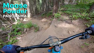
Riding a trail called moose powder on panorama with some fun lines.
youtuber Moose Powder | Panorama, BC
mtb
Moose Powder | Panorama, BC
5:40 | 315 | comments: 0 | favs:
Jul 25, 2024

Recent Trail Reports Along Route

statustraildateconditiondescription
Hopeful Direct
Aug 24, 2026 @ 9:16pm (America/Edmonton)
Aug 24, 2026
Moose Powder
Jul 26, 2026 @ 12:17pm (America/Edmonton)
Jul 26, 2026
Summit Uptrack
Jul 8, 2026 @ 10:06am (America/Creston)
Jul 8, 2026
Mt. Goldie Ridge
Jul 4, 2026 @ 9:27am (America/Edmonton)
Jul 4, 2026
reporter
Mt. Goldie North Summit (Haiku-bike-u)
Jul 4, 2026 @ 9:27am (America/Edmonton)
Jul 4, 2026
reporter
more reports »
  • By TransBCEnduroTF Pro & contributors
  • #63035 - 114 views
  • Flag

Hit the Trail

Open in App

Get this route on your phone instantly.

Download Route

Save to wishlist, Garmin & download.