


Open in App
Get this route on your phone instantly.
An easier version of D-Loop #3.
Start at the four way intersection by heading up Gold Camp Road. Take it all the way to the first tunnel, shortly after the end of Captain Jacks. On the left, Spring Creek trail will climb for a bit and then descend to Columbine Trail. Take the right onto Columbine as it climbs and descends, and climbs some more to the paved parking lot by the Gold Camp Rd. gate.
Continue through the gate onto the double track until you see Buckhorn Trail on your right. If you see markers for Seven Falls, you've gone to far. If you reach a collapsed tunnel, you've gone too far.
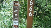
Climb up Buckhorn until it crosses over Captain Jacks. Look uphill to the left and you'll see Buckhorn continue towards 666. When it dead ends, you'll have a sharp right switchback onto 666. Follow it out back to High Drive.
Take High Drive back to the four way intersection that you started on

We hope you've been enjoying Trailforks!
Create a FREE account to view all route reviews and much more.
| 3,301 ft | |||||
| 1 mile | |||||
| 2,323 ft | |||||
| 1 mile |


Service Road Atlas is a free to use, community-driven service for viewing and creating reports on the numerous back-country service roads around B.C. and Alberta.
Save the current map location and zoom level as your default home location whenever this page is loaded.
Save