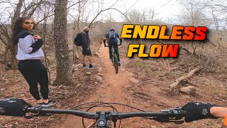
Two different kind of downhills. 4 miles starting at Midway through Goldmine and then loop around Fun Loops and finish dropping dead end no more with berms, banks, a couple of jumps, bridges and skinnies. If you start from Fun Loops side on 23 you'll need to do an out and back on dead end no more.
Note: The lowest fast part is an up and back. Please give way to downhill riders so that they can enjoy their ride.
Trail Issues on Route
- Significant Issue / Amber: 1 trail (newest: May 31, 2026)
Local Trail Association
Windham Area Recreation Foundation (windhamarf.org)Stats
-
Distance13 miles
-
Avg time2 hr 9 min
-
Altitude min1,771 ft
-
Altitude start1,970 ft
-
Altitude end2,142 ft
-
Climb1,526 ft
-
Descent-1,354 ft
-
Grade0.3%
-
Grade max-37.4%
-
Grade min48.6%
-
Distance climb5 miles
-
Distance down5 miles
-
Distance flat2 miles
11 Reviews & Comments
We hope you've been enjoying Trailforks!
Create a FREE account to view route comments and much more.
Trails in Route
| 1,138 ft | |||||
| 276 ft | |||||
| 614 ft | |||||
| 4,314 ft | |||||
| 823 ft | |||||
| 1 mile | |||||
| 1 mile | |||||
| 2,303 ft | |||||
| 1,132 ft | |||||
| 2 miles |
Details
-
Riding area
-
Primary ActivityMountain Bike
-
Difficulty ratingBlue
-
Route TypeLoop
-
Bike typeAM, XC
-
DirectionBoth Directions
-
Physical ratingModerate
-
Ridelogs
- Unknown
- Snow Groomed
- Snow Packed
- Snow Covered
- Snow Cover Partial
- Freeze/thaw Cycle
- Icy
- Prevalent Mud
- Wet
- Variable
- Ideal
- Dry
- Very Dry
The colour categories are based on what percentage of riders are riding a trail in its intended direction.
- > 96%
- > 90%
- > 80%
- > 70%
- > 50%
- < 50%
- bi-directional trail
- no data
- < 2 days
- < 1 week
- < 2 weeks
- < 1 month
- < 6 months
- > 6 months
- Downhill Only
- Downhill Primary
- Both Directions
- Uphill Primary
- Uphill Only
- One Direction
- Description
- Photos
- Description & Photos
- Videos
- most popular
- popular
- less popular
- not popular
Service Road Atlas is a free to use, community-driven service for viewing and creating reports on the numerous back-country service roads around B.C. and Alberta.
Save the current map location and zoom level as your default home location whenever this page is loaded.
Save- Singletrack
- Unpaved
Photos
Videos
Recent Trail Reports Along Route
- By Nootn
WARF & contributors - #8307 - 1,763 views

