7.3 miles
Distance
1,908 ft
Climb
-1,906 ft
Descent
2,389 ft
High Point
2 ft
Altitude change
1,345 ft
Altitude min
2,213 ft
Altitude start
2,215 ft
Altitude end
-59.1%
Grade max
71.6%
Grade min
3 miles
Distance climb
3 miles
Distance down
1 mile
Distance flat

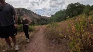
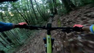
Fun route from parking lot, along Skyline, dipping into fast rollers and fun downhill turns. Climbs midway and to end, whole thing can be done in a bit over an hour.

Detailed Description
Down Up is a 7 mile moderately popular intermediate route located near Redwood City California. This mountain bike primary route can be used one direction and has a moderate overall physical rating. This route includes 9 trails. This route climbs 1,908 ft with a max elevation of 2,389 ft then descends -1,906 ft.

Trail Issues on Route

  • Minor Issue / Yellow: 3 trails (newest: Apr 8, 2026)
Local Trail Association
Local trail association
Midpeninsula Regional Open Space District (www.openspace.org)
Please consider joining or donating to the local riding association to support trail development & maintenance.
Donate to earn trail karma!

Stats

  • Distance
    7 miles
  • Avg time
    57 min 28 sec
  • Altitude min
    1,345 ft
  • Altitude start
    2,213 ft
  • Altitude end
    2,215 ft
  • Climb
    1,908 ft
  • Descent
    -1,906 ft
  • Grade max
    -59.1%
  • Grade min
    71.6%
  • Distance climb
    3 miles
  • Distance down
    3 miles
  • Distance flat
    1 mile

59 Reviews & Comments


We hope you've been enjoying Trailforks!

Create a FREE account to view route comments and much more.

Details

  • Riding area
  • Primary Activity
    Mountain Bike
  • Other Activities
    • E-Bike
    • Horse
    • Hike
  • Difficulty rating
    Blue
  • Route Type
    Loop
  • eBike Allowed
  • Bike type
    AM
  • Direction
    One Direction
  • Physical rating
    Moderate
  • Ridelogs
    184
no votes yet
close
3D
Trail Conditions
  • Unknown
  • Snow Groomed
  • Snow Packed
  • Snow Covered
  • Snow Cover Partial
  • Freeze/thaw Cycle
  • Icy
  • Prevalent Mud
  • Wet
  • Variable
  • Ideal
  • Dry
  • Very Dry
Trail Flow (Ridden Direction)
Trailforks scans users ridelogs to determine the most popular direction each trail is ridden. A good flowing trail network will have most trails flowing in a single direction according to their intension.
The colour categories are based on what percentage of riders are riding a trail in its intended direction.
  • > 96%
  • > 90%
  • > 80%
  • > 70%
  • > 50%
  • < 50%
  • bi-directional trail
  • no data
Trail Last Ridden
Trailforks scans ridelogs to determine the last time a trail was ridden.
  • < 2 days
  • < 1 week
  • < 2 weeks
  • < 1 month
  • < 6 months
  • > 6 months
Trail Ridden Direction
The intended direction a trail should be ridden.
  • Downhill Only
  • Downhill Primary
  • Both Directions
  • Uphill Primary
  • Uphill Only
  • One Direction
Contribute Details
Colors indicate trail is missing specified detail.
  • Description
  • Photos
  • Description & Photos
  • Videos
Trail Popularity ?
Trailforks scans ridelogs to determine which trails are ridden the most in the last 9 months. Trails are compared with nearby trails in the same city region with a possible 25 colour shades. Think of this as a heatmap, more rides = more kinetic energy = warmer colors.
  • most popular
  • popular
  • less popular
  • not popular
ATV/ORV/OHV Filter
Max Vehicle Width
inches
US Cell Coverage
Legend
cell carrier legend

Radar Time
Activity Recordings
Trailforks uses anonymized public activity data. ?
Activity Recordings
Trailforks uses anonymized public activity data. ?
Personal Heatmap
Activity Types
all / none
Options
2
Date range month
Winter Trails
Warning A routing network for winter maps does not exist. Selecting trails using the winter trails layer has been disabled.
Missing Trails
Most Popular
Least Popular
Trails are colored based on popularity. The more popular a trail is, the more red. Less popular trails trend towards green.
Jump Magnitude Heatmap
Heatmap of where riders jump on trails. Zoom in to see individual jumps, click circles to view jump details.
BC Backroad Status

Service Road Atlas is a free to use, community-driven service for viewing and creating reports on the numerous back-country service roads around B.C. and Alberta.

map legend
Slope Aspect
Direction the slope faces
Flat N NE E SE S SW W NW
Trails Deemphasized
Trails are shown in grey.
disable
Only show trails with no bike usage.
Enable
Suggested Layers
Based on selected activity type

    Save the current map location and zoom level as your default home location whenever this page is loaded.

    Save
    Trail transparency
    • Singletrack
    • Unpaved
    54
    69
    93
    99
    Deso Lake, Starting at the Spine
    Deso Lake, Starting at the Spine
    trail: Resolution
    10:01 | 67 | comments: 0 | favs:
    Sep 6, 2025
    Corte de Madera - North Leaf DH
    Corte de Madera - North Leaf DH
    trail: North Leaf
    0:14 | 247 | comments: 0 | favs:
    Oct 30, 2023

    Recent Trail Reports Along Route

    statustraildateconditiondescription
    Sierra Morena Trail
    Jun 3, 2026 @ 4:44pm (America/Los_Angeles)
    2 days
    All of the wet spots have dried up, go get'em!
    Manzanita
    May 22, 2026 @ 2:24pm (America/Los_Angeles)
    May 22, 2026
    Tree has been cleared
    North Leaf
    Apr 8, 2026 @ 11:19am (America/Los_Angeles)
    Apr 8, 2026
    Methuselah
    Apr 8, 2026 @ 11:19am (America/Los_Angeles)
    Apr 8, 2026
    Large tree blocking most of the trail
    Resolution
    Apr 8, 2026 @ 11:19am (America/Los_Angeles)
    Apr 8, 2026
    more reports »
    • By sheeleyTF Pro & contributors
    • #21002 - 812 views

    Hit the Trail

    Open in App

    Get this route on your phone instantly.

    Download Route

    Save to wishlist, Garmin & download.