
34.0 miles
Distance
6,537 ft
Climb
-6,555 ft
Descent
1,630 ft
High Point
-17 ft
Altitude change
377 ft
Altitude min
395 ft
Altitude start
377 ft
Altitude end
-142.4%
Grade max
164.3%
Grade min
17 miles
Distance climb
15 miles
Distance down
2 miles
Distance flat

Nice variation on the classic 'Beastie' route in the tweed valley by departing on the SUW and heading over to Yarrowford, Black Andrew and Bowhill before climbing back into Yair to complete the loop. Plenty of scope to adapt to suit DH preferences.

Detailed Description
Downstream Beastie is a 34 mile moderately popular black route located near Selkirk. This mountain bike only route can be used one direction and has a extreme overall physical rating. This route includes 14 trails. This route climbs 6,537 ft with a max elevation of 1,630 ft then descends -6,555 ft.
Tags

Trail Issues on Route

  • Significant Issue / Amber: 1 trail (newest: Oct 30, 2026)

Stats

  • Distance
    34 miles
  • Avg time
    5 hr 57 min
  • Altitude min
    377 ft
  • Altitude start
    395 ft
  • Altitude end
    377 ft
  • Climb
    6,537 ft
  • Descent
    -6,555 ft
  • Grade max
    -142.4%
  • Grade min
    164.3%
  • Distance climb
    17 miles
  • Distance down
    15 miles
  • Distance flat
    2 miles

11 Reviews & Comments


We hope you've been enjoying Trailforks!

Create a FREE account to view all route reviews and much more.

Trails in Route

Details

  • Riding area
  • Primary Activity
    Mountain Bike
  • Difficulty rating
    Black
  • Route Type
    Loop
  • Bike type
    AM, XC, Fat
  • Direction
    One Direction
  • Physical rating
    Extreme
  • Activity Logs
    3
no votes yet
close
Trail transparency
  • Singletrack
  • Unpaved
mtb
905
mtb
948
mtb
2,041 | 1 comments | 8 faves
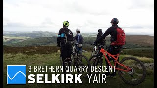
Selkirk - 3 Brethren Quarry Descent
mtb
Selkirk - 3 Brethren Quarry Descent
4:11 | 124 | comments: 0 | favs:
Mar 28, 2024
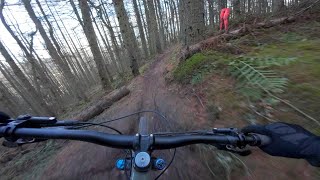
Prime conditions for Yair, Tweed Valley
mtb
Prime conditions for Yair, Tweed Valley
11:05 | 144 | comments: 0 | favs:
Jan 20, 2024

Recent Trail Reports Along Route

statustraildateconditiondescription
Switchbacks
Oct 30, 2026 @ 10:05am (Europe/London)
Oct 30, 2026
Still a few trees down at the top, but no worse than before, even with the recent storm.
Forest Road
Apr 5, 2025 @ 4:22pm
Apr 5, 2025
Path
Mar 27, 2021 @ 7:33am
Mar 27, 2021
more reports »
  • By paultheweathermanTF Pro & contributors
  • #20918 - 1,399 views

Hit the Trail

Open in App

Get this route on your phone instantly.

Download Route

Save to wishlist, Garmin & download.