5.4 miles
Distance
396 ft
Climb
-402 ft
Descent
1,602 ft
High Point
-6 ft
Altitude change
1,469 ft
Altitude min
1,495 ft
Altitude start
1,490 ft
Altitude end
-17%
Grade max
12.8%
Grade min
2 miles
Distance climb
2 miles
Distance down
2 miles
Distance flat

Working Course for event in 2024

Detailed Description
Endurance Course is a 5 mile intermediate race route located near Langham Saskatchewan. This mountain bike primary route. This route includes 17 trails. This route climbs 396 ft with a max elevation of 1,602 ft then descends -402 ft.
Tags

Trail Issues on Route

  • Significant Issue / Amber: 1 trail (newest: May 23, 2026)
  • Minor Issue / Yellow: 2 trails (newest: May 23, 2026)

Local Trail Association

Local trail association
River Ridge Trails Association (www.riverridgetrails.ca)
Please consider joining or donating to the local riding association to support trail development & maintenance.
Donate to earn trail karma!

Stats

  • Distance
    5 miles
  • Avg time
    26 min 38 sec
  • Altitude change
    -6 ft
  • Altitude min
    1,469 ft
  • Altitude start
    1,495 ft
  • Altitude end
    1,490 ft
  • Climb
    396 ft
  • Descent
    -402 ft
  • Grade max
    -17%
  • Grade min
    12.8%
  • Distance climb
    2 miles
  • Distance down
    2 miles
  • Distance flat
    2 miles

4 Reviews & Comments


We hope you've been enjoying Trailforks!

Create a FREE account to view all route reviews and much more.

Details

  • Race Course
  • Riding area
  • Primary Activity
    Mountain Bike
  • Other Activities
    • Gravel Bike
  • Difficulty rating
    Blue
  • eBike Allowed
  • Bike type
    AM, XC, Fat, Gravel
  • Activity Logs
    2

Directions

  1. Walk north on Start Hill.
  2. Continue for 70 meters.
  3. Walk north on Dis-Comfort.
  4. Continue for 100 meters.
  5. Walk south on Dis-Comfort.
  6. Continue for 100 meters.
  7. Walk southeast on Chasing Cows.
  8. Continue for 200 meters.
  9. Walk south on CC Sidelines Blue.
  10. Continue for less than 10 meters.
  11. Keep left to stay on CC Sidelines Blue.
  12. Continue for 60 meters.
  13. Bear left onto Chasing Cows.
  14. Continue for 100 meters.
  15. Walk south on Chasing Cows.
  16. Continue for 200 meters.
  17. Walk south on Chasing Cows.
  18. Continue for 10 meters.
  19. Keep right to stay on Chasing Cows.
  20. Continue for 20 meters.
  21. Keep right to stay on Chasing Cows.
  22. Continue for less than 10 meters.
  23. Turn left to stay on Chasing Cows.
  24. Continue for 20 meters.
  25. Turn right to stay on Chasing Cows.
  26. Continue for 10 meters.
  27. Make a sharp left to stay on Chasing Cows.
  28. Continue for 10 meters.
  29. Keep right to stay on Chasing Cows.
  30. Continue for 10 meters.
  31. Bear right to stay on Chasing Cows.
  32. Continue for 20 meters.
  33. Turn left to stay on Chasing Cows.
  34. Continue for less than 10 meters.
  35. Turn left to stay on Chasing Cows.
  36. Continue for 10 meters.
  37. Keep straight to stay on Chasing Cows.
  38. Continue for less than 10 meters.
  39. Keep left to stay on Chasing Cows.
  40. Continue for 10 meters.
  41. Keep right to stay on Chasing Cows.
  42. Continue for less than 10 meters.
  43. Keep right to stay on Chasing Cows.
  44. Continue for less than 10 meters.
  45. Make a sharp left to stay on Chasing Cows.
  46. Continue for 20 meters.
  47. Walk north on Chasing Cows.
  48. Continue for 20 meters.
  49. Turn right to stay on Chasing Cows.
  50. Continue for less than 10 meters.
  51. Keep left to stay on Chasing Cows.
  52. Continue for less than 10 meters.
  53. Keep right to stay on Chasing Cows.
  54. Continue for 10 meters.
  55. Keep right to stay on Chasing Cows.
  56. Continue for less than 10 meters.
  57. Keep straight to stay on Chasing Cows.
  58. Continue for 10 meters.
  59. Turn right to stay on Chasing Cows.
  60. Continue for less than 10 meters.
  61. Turn right to stay on Chasing Cows.
  62. Continue for 20 meters.
  63. Turn left to stay on Chasing Cows.
  64. Continue for 10 meters.
  65. Keep left to stay on Chasing Cows.
  66. Continue for 10 meters.
  67. Make a sharp right to stay on Chasing Cows.
  68. Continue for 10 meters.
  69. Make a sharp left to stay on Chasing Cows.
  70. Continue for 20 meters.
  71. Turn right to stay on Chasing Cows.
  72. Continue for less than 10 meters.
  73. Keep left to stay on Chasing Cows.
  74. Continue for 20 meters.
  75. Keep left to stay on Chasing Cows.
  76. Continue for 10 meters.
  77. Keep straight to stay on Chasing Cows.
  78. Continue for 30 meters.
  79. Keep left to stay on Chasing Cows.
  80. Continue for 10 meters.
  81. Keep left to stay on Chasing Cows.
  82. Continue for 10 meters.
  83. Turn right to stay on Chasing Cows.
  84. Continue for 10 meters.
  85. Make a sharp left onto I Hate Hills Bypass.
  86. Continue for 40 meters.
  87. Keep right to stay on I Hate Hills Bypass.
  88. Continue for 40 meters.
  89. Turn left onto Upper Climb & Punishment.
  90. Continue for 100 meters.
  91. Walk south on Grip-It 'n Rip-It.
  92. Continue for 100 meters.
  93. Walk west on Grip-It 'n Rip-It.
  94. Continue for 300 meters.
  95. Walk west on Grip-It 'n Rip-It.
  96. Continue for 100 meters.
  97. Walk west on Aspen for Trouble.
  98. Continue for 200 meters.
  99. Walk northwest on Aspen for Trouble.
  100. Continue for 100 meters.
  101. Walk north on Aspen for Trouble.
  102. Continue for 20 meters.
  103. Walk north on River Roller.
  104. Continue for 70 meters.
  105. Walk northeast on River Roller.
  106. Continue for 100 meters.
  107. Walk northeast on River Roller.
  108. Continue for 300 meters.
  109. Walk east on River Roller.
  110. Continue for 300 meters.
  111. Walk east on River Roller.
  112. Continue for 70 meters.
  113. Walk north on The River's Ridge.
  114. Continue for 100 meters.
  115. Walk south on The River's Ridge.
  116. Continue for 200 meters.
  117. Walk east on Hayleebird - River's Ridge Bypass.
  118. Continue for 50 meters.
  119. Walk north on Lower Hayleebird.
  120. Continue for 200 meters.
  121. Walk southeast on Lower Hayleebird.
  122. Continue for 50 meters.
  123. Walk north on Upper Hayleebird.
  124. Continue for 40 meters.
no votes yet
close
Trail transparency
  • Singletrack
  • Unpaved
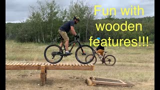
Fun with our new wooden features
mtb
Fun with our new wooden features
2:04 | 313 | comments: 0 | favs:
Apr 3, 2023
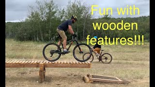
Fun with our new wooden features
mtb
Fun with our new wooden features
2:04 | 320 | comments: 0 | favs:
Apr 3, 2023

Recent Trail Reports Along Route

statustraildateconditiondescription
River Roller
May 23, 2026 @ 9:32am (America/Regina)
May 23, 2026
Lower Hayleebird
May 23, 2026 @ 9:32am (America/Regina)
May 23, 2026
South end unpalatable
Chasing Cows
May 23, 2026 @ 9:31am (America/Regina)
May 23, 2026
Wet patches near the top
Grip-It 'n Rip-It
May 23, 2026 @ 9:27am (America/Regina)
May 23, 2026
Upper Climb & Punishment
May 9, 2025 @ 8:52am
May 9, 2025
more reports »
  • By gearsccTF Pro RRT & contributors
  • #55831 - 575 views

Hit the Trail

Open in App

Get this route on your phone instantly.

Download Route

Save to wishlist, Garmin & download.